
NCBlizzard
-
Posts
706 -
Joined
-
Last visited
About NCBlizzard

Recent Profile Visitors


-
2025-2026 Fall/Winter Mountain Thread
NCBlizzard replied to Buckethead's topic in Southeastern States
Thanks for the insight. I'm pumped to get a spot and have a lot less frustration due to the lack of snow in the Piedmont haha. Cheers! -
2025-2026 Fall/Winter Mountain Thread
NCBlizzard replied to Buckethead's topic in Southeastern States
100% haha. My other half says that's too far from "things"... Alas, so ideally like within ~20-30 minutes of the general Boone/Blowing Rock or Asheville area. -
2025-2026 Fall/Winter Mountain Thread
NCBlizzard replied to Buckethead's topic in Southeastern States
If anyone has a moment, I’d love your thoughts on this “NW-flow snow favorability” map (especially whether it’s capturing the patterns you’d expect). Mobile is a bit rough unless you rotate to landscape. I’ve wanted mountain property for decades, so I’m doing as much pre-analysis as I can haha. http://44.197.87.201:3839 -
January 30th- Feb 1st ULL and coastal storm obs
NCBlizzard replied to JoshM's topic in Southeastern States
Ended the event with about 10.5" here in Belmont NC. Whopper of a storm. I'm glad to see Triangle folks were able to rake some in as well! -
January 30th- Feb 1st ULL and coastal storm obs
NCBlizzard replied to JoshM's topic in Southeastern States
https://forecast.weather.gov/product.php?site=NWS&issuedby=MHX&product=PNS&format=ci&version=1&glossary=1 -
January 30th- Feb 1st ULL and coastal storm obs
NCBlizzard replied to JoshM's topic in Southeastern States
We are right at 5.5" here in Belmont and still coming down steady! Temperature has dropped to 19° - despite solar noon having been ~1 hour ago. Incredible. -
January 30th- Feb 1st ULL and coastal storm obs
NCBlizzard replied to JoshM's topic in Southeastern States
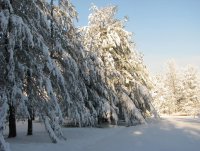
Truly pouring major flakes. It's like a snow globe outside. Right at 4" in Belmont. Averaging rates of about 0.8" hour since 8 AM. Temperature is down to 20°. -
January 30th- Feb 1st ULL and coastal storm obs
NCBlizzard replied to JoshM's topic in Southeastern States
Really hoping things work out at least to some degree up that way for y'all. Just moved to Belmont a few months ago from Durham, and now surprised I'm better off here than there re snow (nowadays, at least, since this area has missed out a lot over the past 10 years). -
January 30th- Feb 1st ULL and coastal storm obs
NCBlizzard replied to JoshM's topic in Southeastern States
Even with 3 snowboards out in various places, none seem to be fully exempt from the (sometimes massive) waves of blowing snow that are coming off trees/houses - trying to measure hourly at least to best gauge actual accumulation. -
January 30th- Feb 1st ULL and coastal storm obs
NCBlizzard replied to JoshM's topic in Southeastern States
Approaching 2" in Belmont. It is an absolute whiteout outside right now! It's 21.8° on my station here and still steadily dropping. CLT has been reporting visibility of 0.25" and "Heavy Snow" since 9:00. -
January 30th- Feb 1st ULL and coastal storm obs
NCBlizzard replied to JoshM's topic in Southeastern States
After a lull, light snow again in Belmont. Radar is looking good. -
January 30th- Feb 1st ULL and coastal storm obs
NCBlizzard replied to JoshM's topic in Southeastern States
Roughly 0.6-0.7" in Belmont at 6:00. Temperature is 26.4°F (right in line with latest HRRR for here). I-85 corridor GSP to Kannapolis about to really see thinks pick up over the next 1-2 hours it seems. -
January 30th- Feb 1st ULL and coastal storm obs
NCBlizzard replied to JoshM's topic in Southeastern States
Returns NE of Charlotte still hanging on as they continue moving towards Greensboro/Raleigh. HRRR doesn't have them making it all the way there quite yet (dries them up around Randolph County), but perhaps it will be wrong. -
January 30th- Feb 1st ULL and coastal storm obs
NCBlizzard replied to JoshM's topic in Southeastern States
Eclipsed 0.25" here about 10 minutes ago. It's really coming down out there, even under lighter returns now. Much bigger flakes. I think it's certainly safe to say the DGZ has already started deepening, and is certainly saturating! -
January 30th- Feb 1st ULL and coastal storm obs
NCBlizzard replied to JoshM's topic in Southeastern States
I'm feeling pretty good about your area up through CLT!


