

tuanis
-
Posts
763 -
Joined
-
Last visited
Content Type
Profiles
Blogs
Forums
American Weather
Media Demo
Store
Gallery
Everything posted by tuanis
-
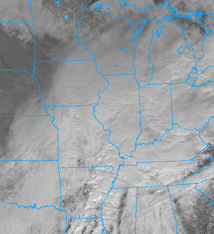
With this kind of satellite presentation in the Midwest you'd expect to see an expansive shield of precip in the cold sector. This season's trends continue to confound.
-
Could be wrong, but I think that's more a function of WAY less rain then previously forecast. Much of that falls as frozen.
-
Those plumes were consistently dumping 10”-18” on Waukegan even as the GHD storm was underway. We got maybe 2”.
-
I know the owner of the building so I reached out to make sure he was aware his building had collapsed and was burning to the ground. The tenant is a document storage company, not many employees on site. The owner said he hadn’t heard of any casualties or injuries.
-
Imagine the heat
-
That radar makes it look like something exploded in Bartlett. Looks like Brewster Creek Business Park. That's mostly warehouse/distribution/food users though. Edit: Edit: https://twitter.com/search?q=bartlett fire&src=typed_query&f=live
-
Meat of the band impacting Racine/Kenosha counties at the moment, but still doesn't look all that impressive. Getting steady snow globe action up here and it's blowing around a bit, but not amounting to much. Looks nice anyways.
-
Lake snows starting to accumulate on I-294 near Des Plaines
-
So ready for FlurryFest. I hope the flakes are really tiny. Good luck to those on the cusp of a dog. Hope everything works out and this thing delivers.
-
This thread is COOKIN’! Forgot what that is like. The trend is our friend in Chicagoland. This all feels so familiar, love this sh*t even if we don’t jackpot.
-
Winter 2021-22 Short/Medium Range Discussion
tuanis replied to Chicago Storm's topic in Lakes/Ohio Valley
Just got a notification for a winter storm warning. I wasn’t really paying attention to this. Maybe a surprise? Doubt it. -
Finished with about 5 fluffy drifty inches here. Not what could have been, but sure looks nice and should stick around.
-
Big flakes, solid rates. Thought this thing was moisture starved? Feels like a real deal snowstorm and will be if this keeps up.
-
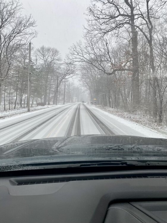
Stacking efficiently. Snowing at a good clip now. Bout a half inch so far.
-
It’s def in the cards, planning to get the whole fam out there. Snow is sticking straight away and blowing off the roof a bit. Not too wet.
-
Flakeage underway. The pessimism in here is palpable. At least it’s snowing.
-
Way too early to post this for Chicago but posting anyways. Watch this thing shrivel up now.
-
Glad we've put the boring futility talk behind us. Bring on the bigguns.
-
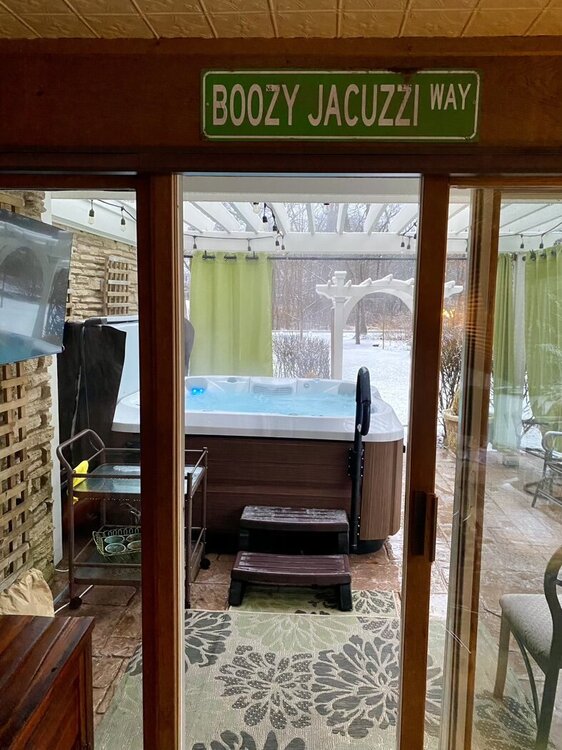
About an inch or so of glop out there that was melting about as quick as it was accumulating all afternoon. Got to put the new tub to use during the first snowfall of the season ✅
-
Juicy radar returns suggesting streets even into the city could get slushy. Nice to finally be on the board.
-
Most intense storm in years. Wind was violent and yard is a mess. Hail was minor but lasted awhile. Very loud storm that’s finally passing. Power is out and will likely be out for a few hours. We took this one on the chin.
-
Quite a noisy storm, blowin and boomin good. Woke up the whole house. It’s been a minute.
-
About 1.5" with still a bit to fall. Pretty much as expected. Impressive rates for a little while.
-
Willing to bet the back door will shut down those kinds of temps. We'll see. I'm just glad the melt looks to be gradual to avert flooding situations.
-
Feels glorious out there


