tuanis
-
Posts
763 -
Joined
-
Last visited
Content Type
Profiles
Blogs
Forums
American Weather
Media Demo
Store
Gallery
Everything posted by tuanis
-
Mixing a bit here, but still mostly flakes. Around an inch so far. We'll probably flip between precip types depending on rates until 5 or 6 PM, so not expecting much additional accumulation during the afternoon.
-
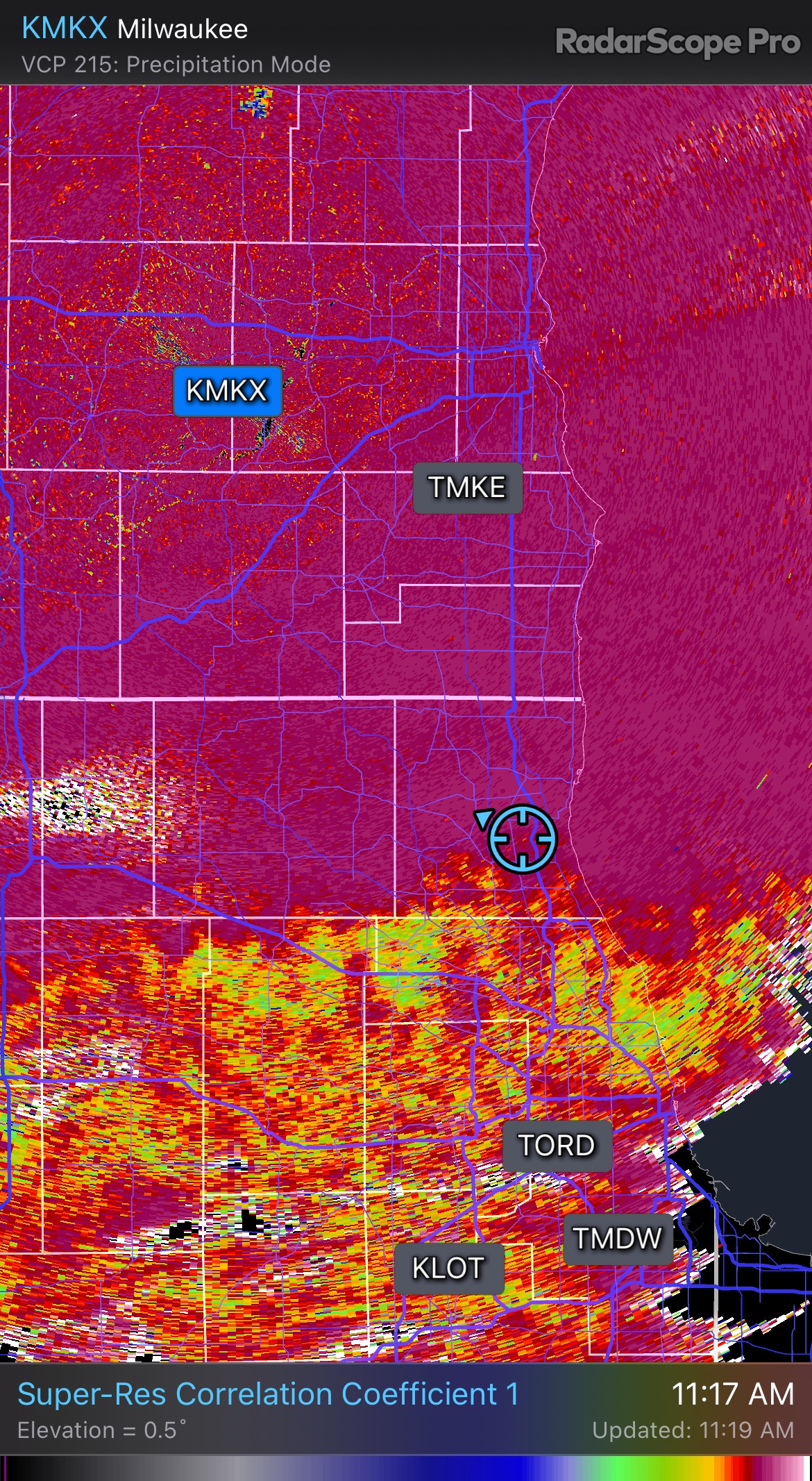
The banding to the north and south of Des Moines looks like a pretty sexy couple hours. Still SN here but CC radar says it’s on my doorstep…

-
Snowfall rate is pretty solid for the moment, stacking efficiently, low visibility, and it's actually sticking to pavement. No pinging yet but you know it's coming. Racine/Milwaukee look golden. Another narrow snow band.
-
Seems like a good bet. I'd imagine LOT will expand all the headlines south by a county or two if trends hold.
-
Warning issued, let's do this. I'll be happy with 5 inches.
-
February 8-9 Should There Be a Thread For This Storm
tuanis replied to Hoosier's topic in Lakes/Ohio Valley
Looks to be ripping in Madison per radar -
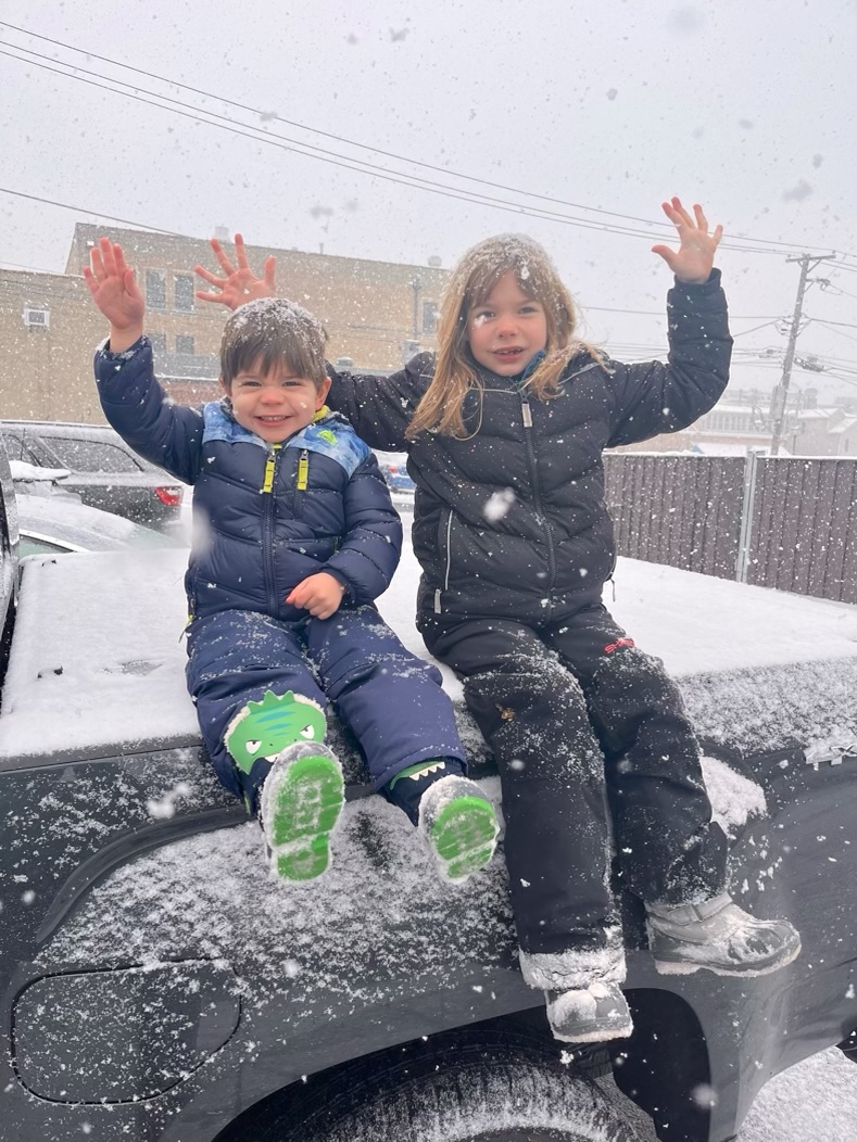
Eyeballin things looks to be 6 or so inches out there. Was out playing in it all night. Definitely delivered up here.

-
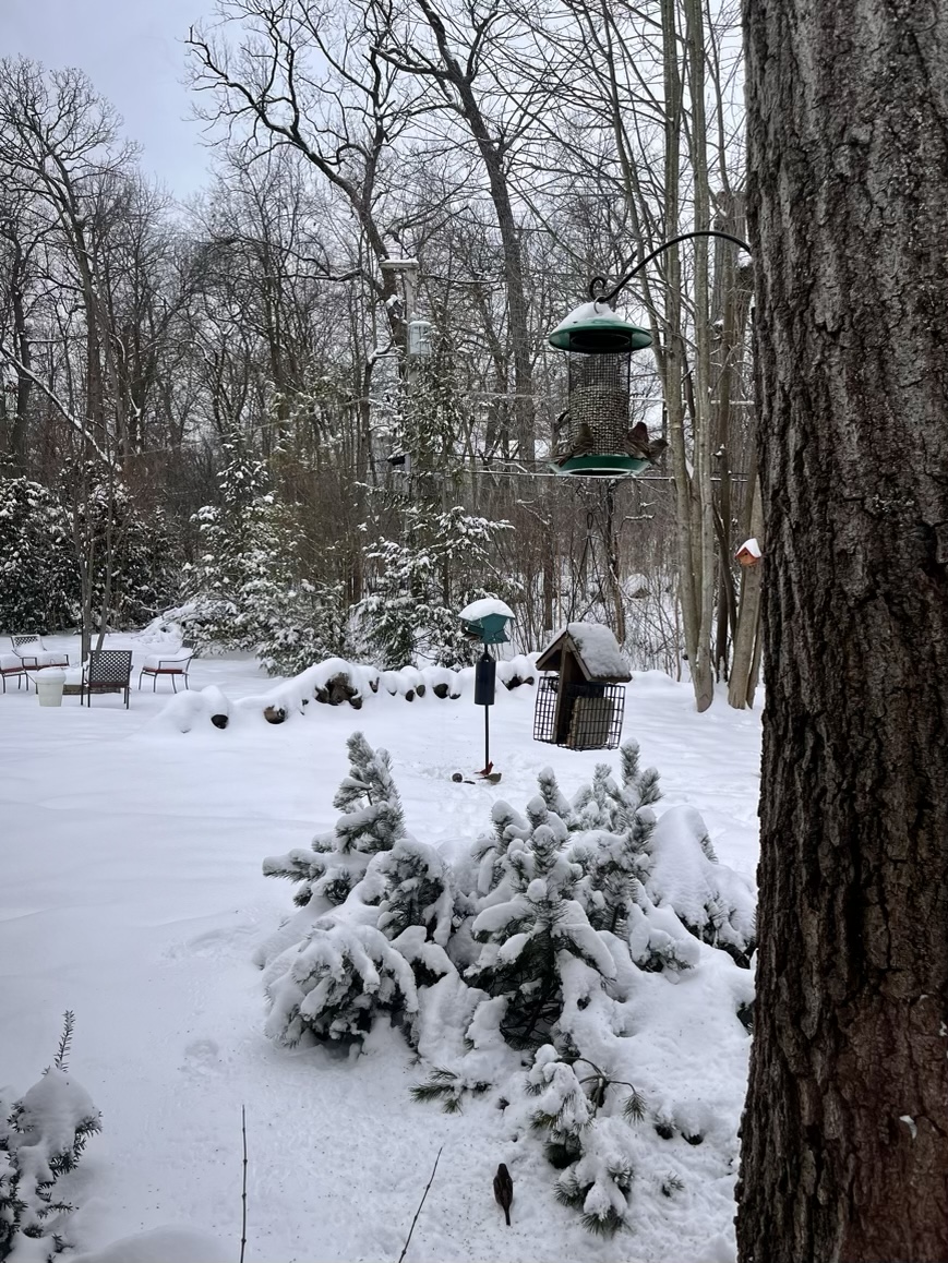
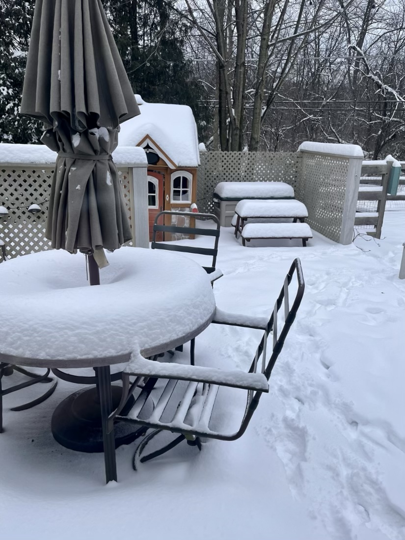
Today would’ve been fun weather for the Norge Ski Jump. Steady as she goes. Hard to say if we’ll get much a lull. Looks like about 2.5” new out there but I haven’t done a proper measurement as the kids have kept me busy with their excitement. Rates have been solid. Flakes have been fluffballs under the good returns. Keep it comin.

- 387 replies
-
- 11
-

-
Yeah, Iowa roads look to be moving well.
-
The heaviest accumulations WILL ride along hwy 20 and north in Iowa, but it’s like the NAM didn’t see this WAA wing cruising through the rest of Iowa and into the Quad Cities area/Peoria/Bloomington. Although it is lifting north pretty darn quick.
-
Yeah that north of hwy 20 business that the NAM was pushing for days was way off base.
-
5” storm total seems doable here with the fronto band lifting into WI this afternoon before things fill back in into the evening. Bring it. Best potential looks to be along the lake between here and Port Washington. Racine or MKE could hit double digits. Good luck all.
-
Winter 2022/23 Short/Medium Range Discussion
tuanis replied to Chicago Storm's topic in Lakes/Ohio Valley
The goods. Missed primo opportunity on the snow squall warning fo sho. https://imgur.com/a/j5EpJ4I -
Winter 2022/23 Short/Medium Range Discussion
tuanis replied to Chicago Storm's topic in Lakes/Ohio Valley
Hey neighbor. I’ll take 10+ hours of that please & thanks. -
This kind of system can be our bread & butter up here. Hope it delivers. The fronto band can really dump, but often seems to drift further north than anticipated instead of sitting overhead. Fingers crossed.

-
Midwest/Ohio Valley/Great Lakes Snow January 24-26
tuanis replied to Baum's topic in Lakes/Ohio Valley
Yeah, I was gonna say... we had about 6 hours with no grass tips today. They're baaaaack. Didn't have to do the driveway though, it just about melted off by 3 PM. So I got that goin' for me which is nice. -
Midwest/Ohio Valley/Great Lakes Snow January 24-26
tuanis replied to Baum's topic in Lakes/Ohio Valley
While the grass is (finally) covered for the first time this season, I'm debating if I should even clear my long-a$$ driveway. Between the relatively warm asphalt, a bit of solar energy, and melting it looks ma nature might just take care of it for me by the afternoon, leaving me just a few spots to clean up with a shovel. Perk of marginal temps & warm-ish ground temps. -
Midwest/Ohio Valley/Great Lakes Snow January 24-26
tuanis replied to Baum's topic in Lakes/Ohio Valley
Per radar FWA and LFT look like the spot to be for the next hour or two. Enjoy the goods! -
Midwest/Ohio Valley/Great Lakes Snow January 24-26
tuanis replied to Baum's topic in Lakes/Ohio Valley
Looks like the surface LP has crossed the Ohio River into southern IN. A lot of models had it riding south of the river through northern KY, so glad to see the system didn't crap the bed at the 11th hour. About 2" of wet stuff here so far... honestly it's more than I expected. Trees look nice with every branch caked in gloop. Hoping the upcoming pattern delivers some drier more mid-winter type snows. -
Midwest/Ohio Valley/Great Lakes Snow January 24-26
tuanis replied to Baum's topic in Lakes/Ohio Valley
These marginal temps are a buzzkill. This system for the most part looks like a drippy slopfest. This thing would deliver if we had some cold air involved (the weekend potential has the goods to tap into... here's to hoping it materializes). -
The Appetizer: Light Snow general 1-2 " event 1/22-1/23
tuanis replied to Baum's topic in Lakes/Ohio Valley
This would’ve stuck to a frozen ground. Temps held below freezing up here today which is why it never melted from the trees. I can dig a hole no problem anywhere in my yard. It’s late January. That ain’t right. Solar energy did play a role, obviously. Some sheltered spots still have a bit of cover. But again, it’s late January, not April. -
The Appetizer: Light Snow general 1-2 " event 1/22-1/23
tuanis replied to Baum's topic in Lakes/Ohio Valley
Trees and anything elevated are still caked yet the ground is so warm it melted about 90% of the snow. Not sure I’ve seen that before. -
The Appetizer: Light Snow general 1-2 " event 1/22-1/23
tuanis replied to Baum's topic in Lakes/Ohio Valley
Maxed out at about a half inch accumulation around 8 AM. It’s been a pretty snowfall since, but melting quicker than it can accumulate. -
Midwest/Ohio Valley/Great Lakes Snow January 24-26
tuanis replied to Baum's topic in Lakes/Ohio Valley
Ride the seasonal trend. Ready to call it up here… the “double duster”. A dusting tonight that melts tomorrow, and fringe flurry fest for the mid-week system. Can’t wait -
Midwest/Ohio Valley/Great Lakes Snow January 24-26
tuanis replied to Baum's topic in Lakes/Ohio Valley
Maybe next year when we get rid of the Niña. The last couple years have been rough. Late Jan-mid Feb 2021 was the last solid wintry period we had in the north/northwest burbs. Things got deep.