

TL97
-
Posts
311 -
Joined
Content Type
Profiles
Blogs
Forums
American Weather
Media Demo
Store
Gallery
Everything posted by TL97
-
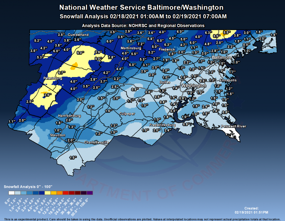
Just about 2" in downtown DC, was expecting less than an inch yesterday evening so very happy. Was SN+ for the last hour and a half or so.
-
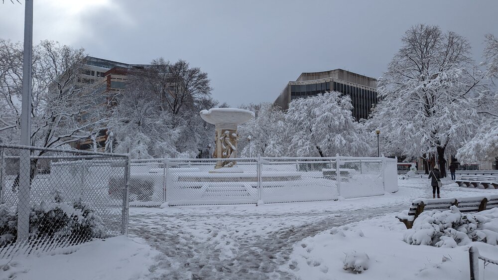
Ended at 7.5" in downtown DC. The sun peaked out earlier but the clouds are back and there are some light flurries (picture of Dupont Circle from earlier).
-
7.5" in downtown DC, the rate at which this has gone is incredible, it is winding down but we still got 1.5" in the last hour.
-
Seems we have maybe an hour or two left here in DC? We seem to be squeezing together two bands though, so should get some nice snows on the way out.
-
6" now in downtown DC, that band seems to be moving slowly away from us. Maybe we can hit 8"?
-
4.5" now in Downtown DC, maybe .75" in the last half hour? Lightened a little but looks like a heavy band is coming our way.
-
Just short of 4" in downtown DC, SN+ is continuing. Hope we can make 6".
-
2.75" just north of downtown DC, very heavy snow right now.
-
The crab claw got us here in DC
-
11-12 pm hour is money, DC to Baltimore gets 2" in that hour on the HRRR
-
HRRR also has southern NJ getting .5 QPF of sleet in an hour, that would be quite the sight to behold
-
Both NAMs put down .5" of QPF between 10 am and 1 pm in DC, the big question seems to be what the precip type is but that's a crazy 3 hours either way.
-
HRRR also gives DC like .15" of QPF in an hour after the flip when it's really close to snow.
-
Jan 31st - 33rd Storm Obs and Disco like it's 1979
TL97 replied to Bob Chill's topic in Mid Atlantic
Seems to me most of the short term models say the moment starts coming north and so we avoid the WV dryslot. Anyway, 1.5" here and think 4" is a good target for DC area. -
Jan 31st - 33rd Storm Obs and Disco like it's 1979
TL97 replied to Bob Chill's topic in Mid Atlantic
Just about at an inch in downtown DC. -
Jan 31st - 33rd Storm Obs and Disco like it's 1979
TL97 replied to Bob Chill's topic in Mid Atlantic
GFS is going to be better I think, hour 42 radar came out on Tropical and there is a CBB band right about where 18Z RGEM had it -
Issued at: 9:59 AM EST 2/4/10, expires at: 6:00 PM EST 2/4/10Winter storm warning in effect from 10 am Friday to 10 pm est saturday, The NWS in sterling Virginia has issued a winter storm warning for heavy snow with near-blizzard conditions, which is in effect from 10 am Friday to 10 pm est saturday. The winter storm watch is no longer in effect. Precipitation type, heavy snow. Accumulations, storm total accumulations of 16 to 24 inches. Timing, snow will begin mid-morning Friday, and will continue through Saturday evening. Conditions will deteriorate rapidly Friday afternoon, with heaviest snowfall occurring between sunset Friday to sunrise Saturday. The most hazardous winter weather conditions will occur Friday night, when the combination of heavy snow and strong winds will reduce visibilities to below one-quarter mile, producing near-blizzard conditions. Temperatures, highs in the lower 30s Friday. Friday night and Saturday, temperatures will be in the mid 20s. Winds, becoming northeast 10 to 20 mph Friday with gusts to 30 mph Friday night and Saturday. Precautionary/preparedness actions, This storm has the potential to be similar to the 19 December storm. Plan for substantial disruptions to travel Friday afternoon through the weekend. A winter storm warning means significant amounts of snow are expected or occurring. Strong winds are also possible. This will make travel very hazardous or nearly impossible Friday night.
-
Winter storm watch in effect from Friday morning through saturday evening, The NWS in sterling Virginia has issued a winter storm watch, which is in effect from Friday morning through Saturday evening. Precipitation type, snow. Accumulations, this storm is likely to produce 12 or more inches of snow in the watch area, with a good chance for localized amounts over 20 inches. Timing, snow is expected to begin late morning Friday, continuing through Saturday evening. Temperatures, highs in the lower to mid 30s Friday. Friday night and Saturday, temperatures will be 25 to 30 degrees. Winds, east 5 to 10 mph Friday and Friday night, becoming north 10 to 20 mph Saturday. Precautionary/preparedness actions, This storm has the potential to be similar to the December 19th storm. Plan for substantial disruptions to travel Friday afternoon through the weekend.