qg_omega
-
Posts
3,843 -
Joined
-
Last visited
Content Type
Profiles
Blogs
Forums
American Weather
Media Demo
Store
Gallery
Everything posted by qg_omega
-
Lots of rain, no drought just mud
-
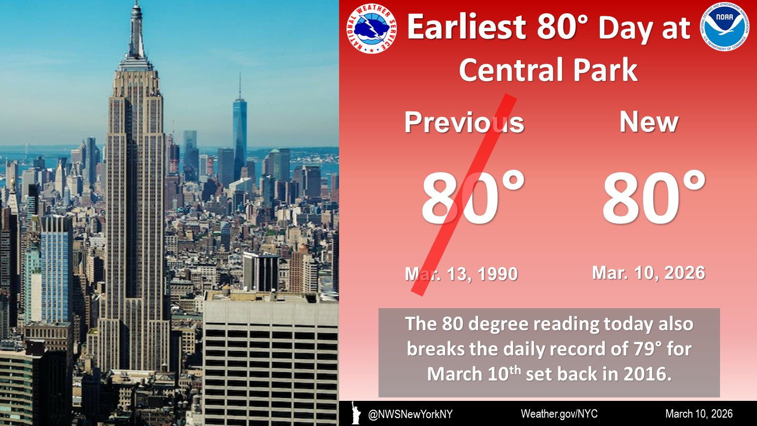
Warm Today ?
-
Extremely windy
-
Many are under a tornado watch and we don’t even have a thread
-
March is not winter, has no bearing on the grade which is obviously an A
-
Did Boston get the 10 inches or not?
-
Why are schools closing, it’s snow to rain
-
2/24 - 2/25 Clipper Obs (1 - 2" for many on forum)
qg_omega replied to Northof78's topic in New York City Metro
About 2 inches -
2/24 - 2/25 Clipper Obs (1 - 2" for many on forum)
qg_omega replied to Northof78's topic in New York City Metro
Pounding heavy snow -
What? Where? New snow???
-
Almost no model support, will go down as an amazing forecast or the opposite
-
Crazy to see Euro locked in for days with 8 to 12 for NYC and then you have upton going for 20 inches. Make it make sense
-
Again I’ve never seen such a disconnect, weather underground app still showing 12 and been consistent for days while NWS is 16 to 24 inches. Unprecedented.
-
Crazy to see when the non US models have a 8 to 14 inch storm, someone is going to have an epic bust come tomorrow afternoon
-
It’s very rare for the NWS to be forecasting much more snow than the model consensus. We will see how this shakes out but this looks across the board high by 6 inches plus. My weather underground app has me at 14 inches and they usually are always high while the NWS warning has me at 16 to 24 inches. I’m expecting around a foot.
-
Euro is locked in for 8 to 12
-
6 to 12 is a good call for NYC
-
Euro is a solid 6 to 12
-
Euro still no GFS it hits the cap and SE NE the hardest
-
Ai EPS not looking good
-
Nice
-
Very unlikely Euro will be this wrong vs the GFS
-
If you are looking to be banned this is good content
-
Ai has crushed the OPs actually