msg112469
-
Posts
106 -
Joined
-
Last visited
About msg112469

-
“Cory’s in NYC! Let’s HECS!” Feb. 22-24 Disco
msg112469 replied to TheSnowman's topic in New England
Walt Drag had a real passion for what he did! The write ups since that time for storms of this magnitude have been meh. -
Out like a lamb.
-
Friday February 6 FROPA / WINDEX small event
msg112469 replied to HoarfrostHubb's topic in New England
The Marblehead Mauler! -
Possible coastal storm centered on Feb 1 2026.
msg112469 replied to Typhoon Tip's topic in New England
If I recall there was a bit of waffling with the models (especially the EURO) for the last storm. Maybe there's still room for this one to come back West a bit as we get closer to the actual event. We'll know a lot more tomorrow and should be able lock in whatever's expected on Friday. -
Possible coastal storm centered on Feb 1 2026.
msg112469 replied to Typhoon Tip's topic in New England
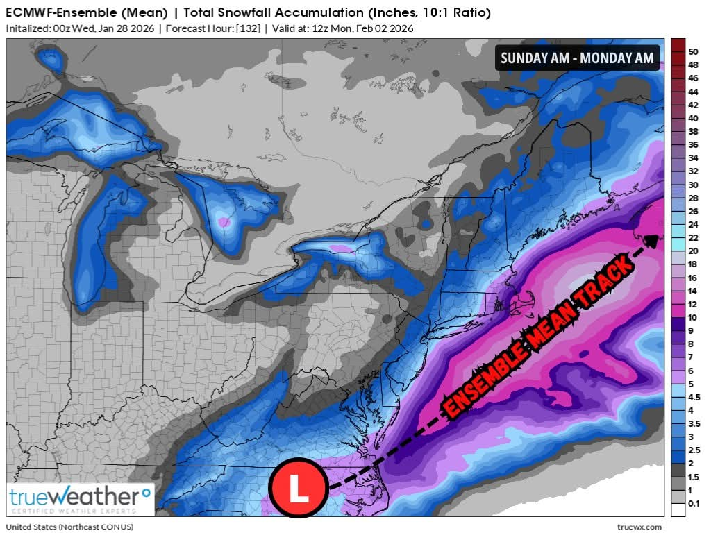
trueWeather posted this on Facebook. I do realize that every storm is different, but given the potential track that they are depicting it seems as though if the storm were to take this track the QPF would be further inland. No?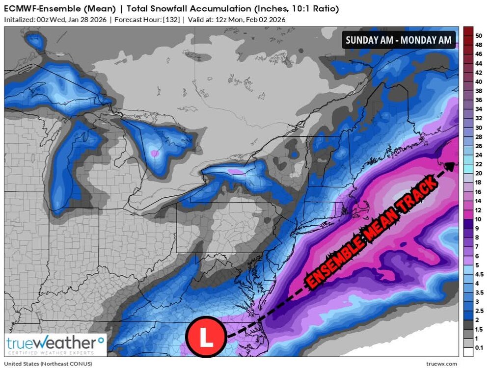
-
Does the 3-5" that fell last night in E Mass not count toward the full storm totals? I do not see any change from yesterday's totals at the NOAA.gov website.
-
This is absolutely the right idea! The CF between 128 and 495 and another front hanging back a bit in western Mass.
-
January 2026 regional war/obs/disco thread
msg112469 replied to Baroclinic Zone's topic in New England
Impressive 12Z! The next 12-24 should be interesting. https://photos.app.goo.gl/XXamJpX7J6Pn8UxbA -
First Legit Storm Potential of the Season Upon Us
msg112469 replied to 40/70 Benchmark's topic in New England
Lol! -
Agreed. These people saying that it's cold are crazy! They are likely just used to the string of extremely warm Decembers that we've had.
-
100%. Just thinking the exact same thing. These storms are a nuisance as far as I'm concerned. I'm sitting here pissed that I actually need to get outside and fire up the snow blower for another mediocre 4" storm.
-
Yup
-
It is quite common, historically. Just not common in the last 10 years or so. Lol!
-
March 12 Rain to…more rain? Maybe some snow
msg112469 replied to HoarfrostHubb's topic in New England
Yeah. Junk. -
It's an anomaly. That area usually cleans up BIG!