paulythegun
-
Posts
976 -
Joined
-
Last visited
Content Type
Profiles
Blogs
Forums
American Weather
Media Demo
Store
Gallery
Everything posted by paulythegun
-

Jan Medium/Long Range Disco 2: Total Obliteration is Coming
paulythegun replied to Jebman's topic in Mid Atlantic
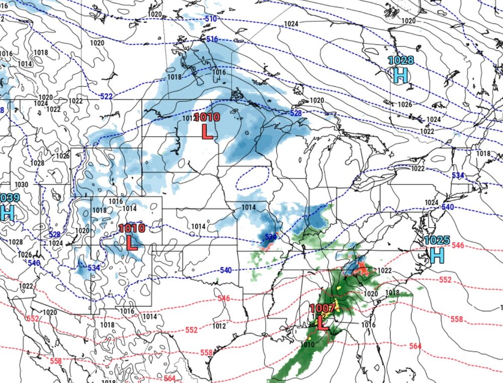
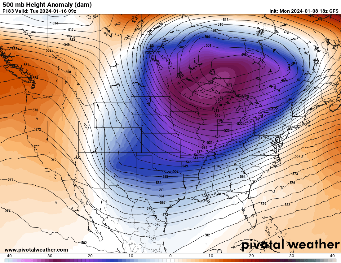
The TPV lobe is way further north on this run (compared to the bad 12z euro run). Good! -
Jan Medium/Long Range Disco 2: Total Obliteration is Coming
paulythegun replied to Jebman's topic in Mid Atlantic
Generally speaking, you don't want to see the confluence setup OVER WASHINGTON DC -
Jan Medium/Long Range Disco 2: Total Obliteration is Coming
paulythegun replied to Jebman's topic in Mid Atlantic
Haha I hope this trends toward the tpv phasing with the trailing energy -
Jan Medium/Long Range Disco 2: Total Obliteration is Coming
paulythegun replied to Jebman's topic in Mid Atlantic
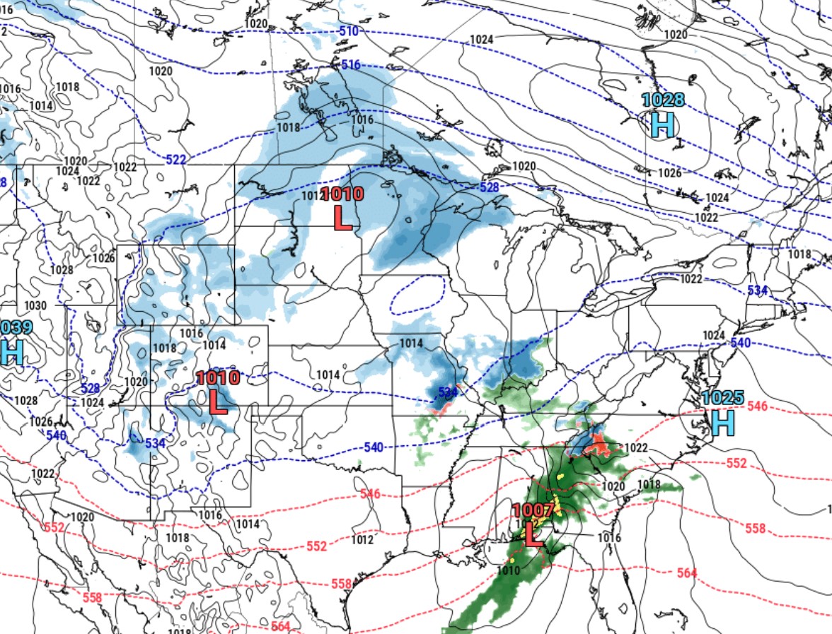
wow, even the SPIRE model is moving our way. 00z: 12z.thumb.png.48265c4fe9276af7f79c60b65ff25fd6.png)

-
reverse jinxed it
-
Jan Medium/Long Range Disco 2: Total Obliteration is Coming
paulythegun replied to Jebman's topic in Mid Atlantic
I remember these well! before I knew to look at the 500mb stuff (and just stared at surface pressure and precip depictions) these were insanely frustrating. precip would build near the gulf with a low approaching from what appears to be the right angle. then the precip would suddenly disappear at the mountains, leaving DC high and dry....before it EXPLODED back onto the scene when the low bombed off the NJ coast. to a snow weenie with no clue why precip goes where it goes, this is one of the most painful events to witness. please be kind to surface map watchers. -
RE: January 16th:
-
uh oh!

-
Jan Medium/Long Range Disco 2: Total Obliteration is Coming
paulythegun replied to Jebman's topic in Mid Atlantic
great points all. i just wrote all those wobbles off as "different cows being hit by rain or snow" but now i remember that there are cities in the midwest -
Jan Medium/Long Range Disco 2: Total Obliteration is Coming
paulythegun replied to Jebman's topic in Mid Atlantic
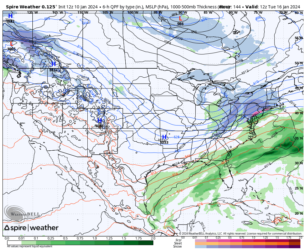
Next weekend's cutter has been well modeled for a while. GFS remarkably consistent. I wonder if it's just easier to model inland storm systems? No messy coastal transfer/redevelopment? Or if there's something else about this setup that's easier for models to resolve? I suppose this just doesn't seem very complex. Just a vort orbiting around a well defined trough. -
Jan Medium/Long Range Disco: Winter is coming
paulythegun replied to stormtracker's topic in Mid Atlantic
They have maybe 0.5% more skill than throwing darts. Mostly printing out old El Niño analogs from what I’ve seen -
Jan Medium/Long Range Disco: Winter is coming
paulythegun replied to stormtracker's topic in Mid Atlantic
This seems extreme
-
January is ROCKIN'!!!
-
38F and light sleet and rain at the base of dc’s mighty Mount Hamilton
-
The 925mb hole setting up over Roanoke
-
YES. radar hallucinations have started!
-
Jan Medium/Long Range Disco: Winter is coming
paulythegun replied to stormtracker's topic in Mid Atlantic
For those who didn't get what "convection over the MC" is (me until 60 seconds ago) here's a neat little study where i figured it out: https://agupubs.onlinelibrary.wiley.com/doi/full/10.1029/2022MS003503 Summary: Large-scale convection associated with the Madden-Julian Oscillation (MJO) initiates over the Indian Ocean and propagates eastward across the Maritime Continent (MC). Over the MC, MJO events are generally weakened due to complex interactions between the large-scale MJO and the MC landmass. -
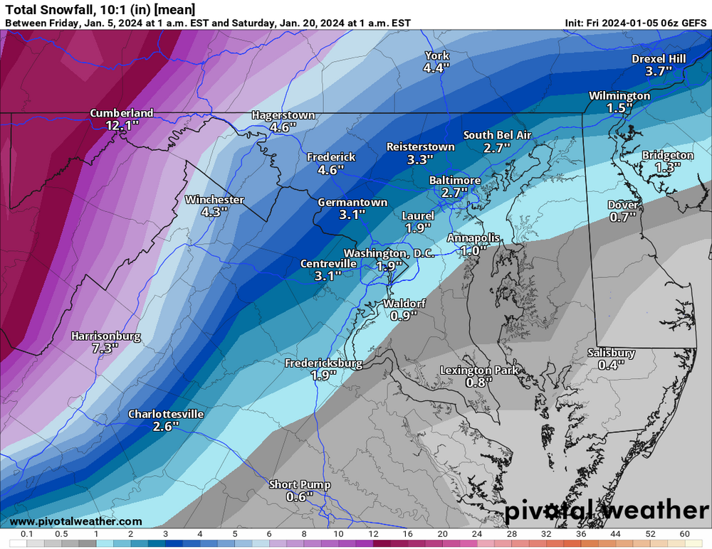
10 to 1! and half of this is from "tomorrow" (!!!)
-
Really stinks for Virginia ski resorts if they can't get a nice clean snow to drizzle event. Seems reasonable. Not your focus, but the euro (and to a lesser extent, GFS) had some interaction with that trailing low that provided some hope for NYC/Boston.
-
-
ok this is just funny now.
.thumb.png.ad7d6055012f6e73c5f780e213d006fb.png)
-
CLASSIC surface level setup for an HECS on NAM. Got your three low pressure systems (triangle defense) chasing two weak highs off the continent
-
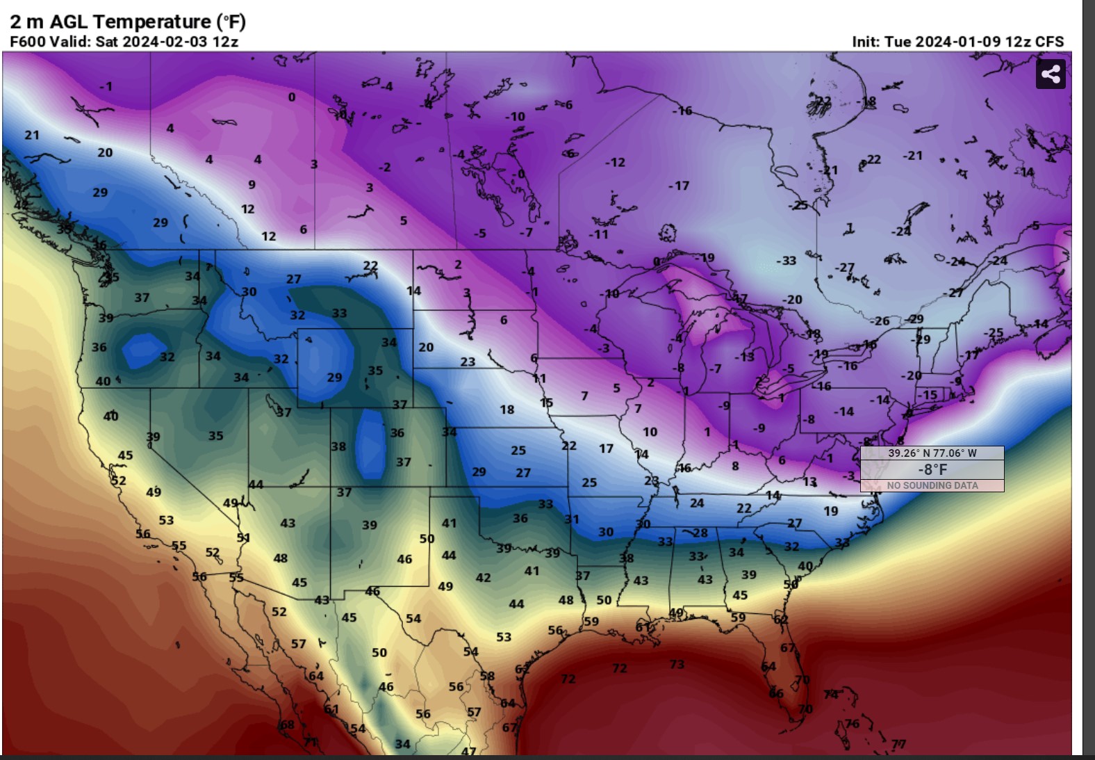
you beat me to this. whenever someone complains about a long range map, gotta up the ante with some CFS
-
Model trend momentum is accelerating toward some extreme snowmap colors Models were accelerating in another direction earlier today. But - as we all learned in meteorology class - model trend momentum is moving toward snow now.


.png.a2958a0dfa2c9f64e209770dcffe682f.png)


.png.d6a2ef979ca4da3e99b4085cc90f2536.png)