ariof
-
Posts
664 -
Joined
-
Last visited
Content Type
Profiles
Blogs
Forums
American Weather
Media Demo
Store
Gallery
Everything posted by ariof
-
What is this from? xmACIS shows 1936-7 at 9.0, 2011-2 at 9.3 for all-time lows.
-
We should probably start a glossary of terms used in this thread so n00bs can read a sentence like "it looked like a SWFE but then we got Leoned" and make some sense of it. (This might already exist.)
-
A few ticks south and it looks something like the mid-Dec 2020 storm that dropped 44" over some CNE folks. Of course, a week later was the mega-grinch …
-
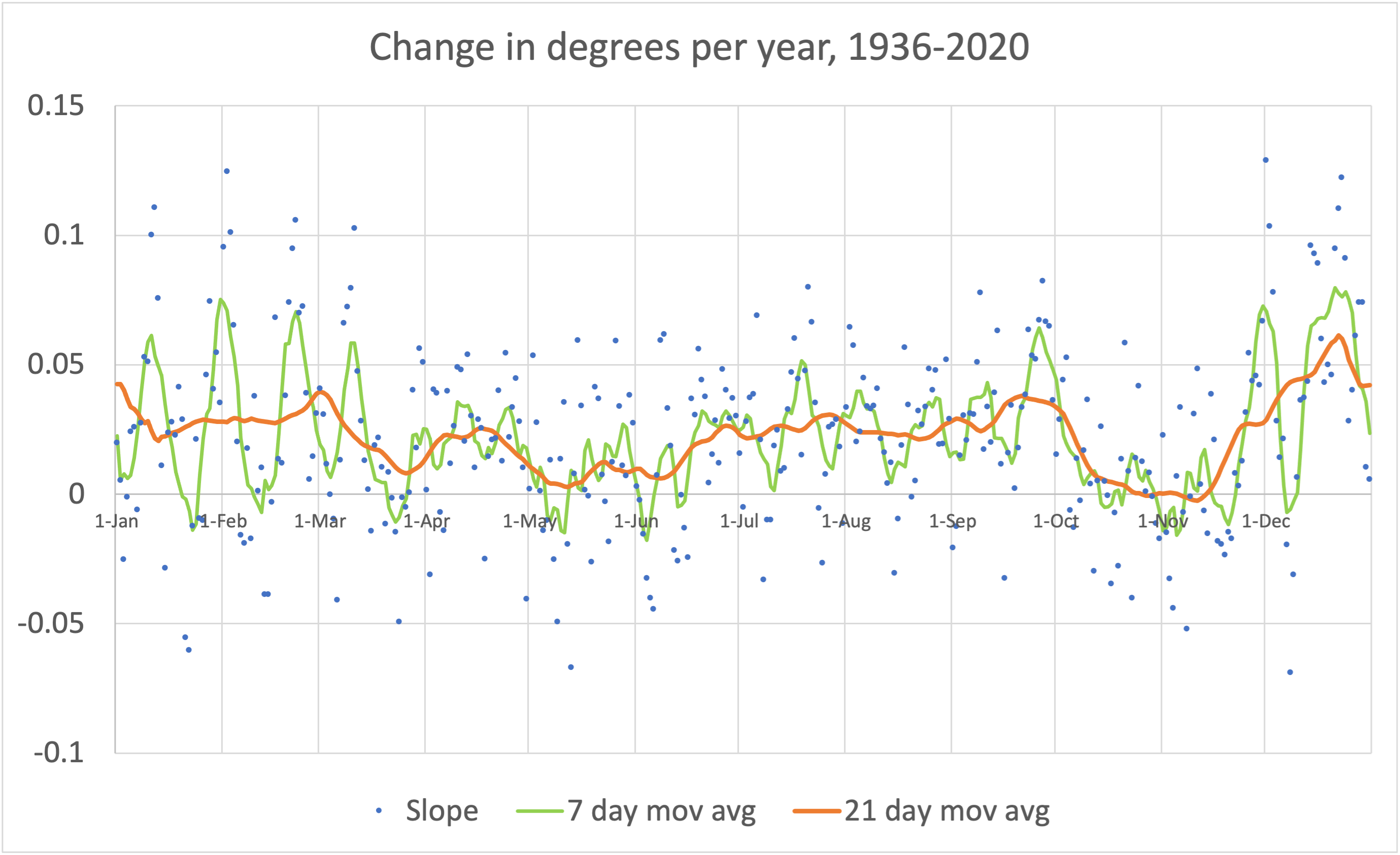
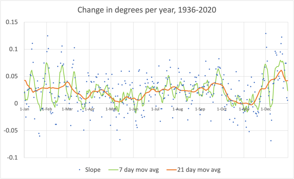
So based on some Twitter threads I got to looking at how climate data at KBOS anyway (1936-2021) has not been changing over the years at the same rate at different times of year. After abusing Excel (as usual, I got to the point where I should have stuck this into R or py or something, but had too much invested) I came out with the attached chart. What this is showing is the change in temperature, per year, for each calendar day of the year (excluding February 29). There's some weird stuff going on that I can not begin to explain. Warming is not taking place at all evenly over the course of the year. It varies by quite a bit, but if you look at the orange line (21 day moving average; longer periods don't really change things) it's clear that there are several local minima and maxima to the rate of warming. Specifically: Late fall—from basically Columbus Day to Veterans Day—is not warming at all. Same for early May to Mid June, although there is a slight upward trend here (<1˚/100 years), and a period in late Morch Jul-Sep is warming at a rate of about 2˚/100 years, with late September slightly faster. Met winter is warming at a rate closer to 3˚/100 years, with lots of variability Late December is warming at a rate of 6˚ per 100 years, which is by far the fastest warming of the year. Looking at the variability, there seems to be a ~21-day period from late Nov to early Mar between rapidly warming cycles (7˚/100 years) and periods really without any perceptible warming. The cycles peak on 29-Nov, 22-Dec, 11-Jan, 1-Feb, 22-Feb, 9-Mar. The 7-day average's highest five days, warming at a rate of 7.5˚ per century, are December 20 to December 25. December 22 and 23 are two of the five highest days in the year. (The others: 12-Jan, 2-Feb and 1-Dec.) So basically the Grinch is very real and has been getting worse over time. The seasonal variation probably has something to do with the ocean+sun, given that the two minima are about 6 months apart when the sine curve of the sun flattens. But the local minima (3-ish week period) during the winter probably has to do with something else entirely? Anyway, IANAMeteorologist and IANAClimatologist and I may have buggered up these data completely. But if not, a) it's interesting and b) the Grinch is real!
-
I should have made the drive up to rip the GBA glades and the Sherbie. This should set up a nice base at least (finally).
-
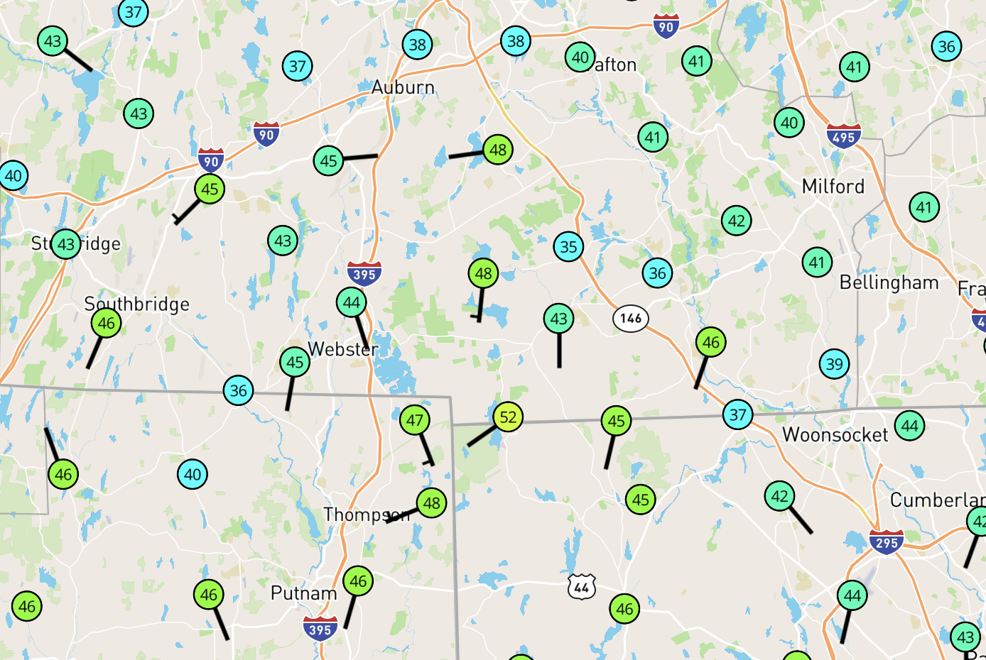
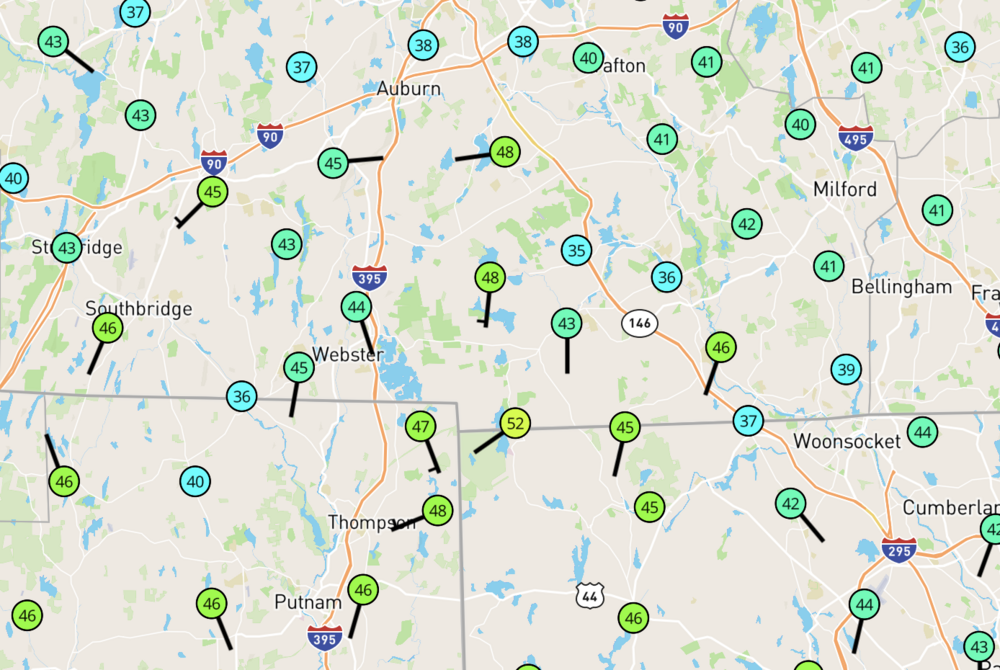
Some interesting things going on with temps on Wundermap stations. 16˚ differentials over quite short distances, and the colder spots in the 36˚ range.
-
43 days in KBOS in 2015 was particularly impressive.
-
*spectacular
-
2015 redux, but without a Super Bowl parade. If this were to verify there would be very little melting and lord knows where the snow would go.
-
Yeah that would be a much better solution up on the hill!
-
To quote Lewis Black on thundersnow:
-
Come on, you left this just sitting there …

-
It's only about a 450 mile jump. Like when we see a low go from ACK to BUF …
-
~133 miles, which is just about the GFS 12" gradient (BGR-BOS) versus the NAM (PHL-HPN-???)
-
NAM vs GFS are only two degrees apart at 84h.
-
Just going to point out that this thread is now at 121 pages and we are only getting into the meso range. And the local stores aren't yet out of two-prong toasters (yet).
-
Feb 06 2013 12Z NAM had 50-70" in BOS-BED-BVY, and showed 30-45 right up until the start of the event. Not even a huge bust; GFS was 15-20 and the final tally in Boston was 25.
-
SOP at BOS is that if there's something along the lines of this, BOS closes. The state issues a travel ban, they don't want people on the roads, and BOS wants the ramps empty so they can clear snow. It works exceedingly well, and the airport can get back to full ops the next day, as opposed to JFK, which usually takes a week to dig out. So unless this goes well inland or ots, I wouldn't be surprised if this flight is proactively canceled on Friday.
-
GON-PSM is only Western Mass if you're in Boston. That would be a track which would make anyone west of Worcester pretty happy.
-
Looks about right. Hard to complain though living on Randolph Hill.
-
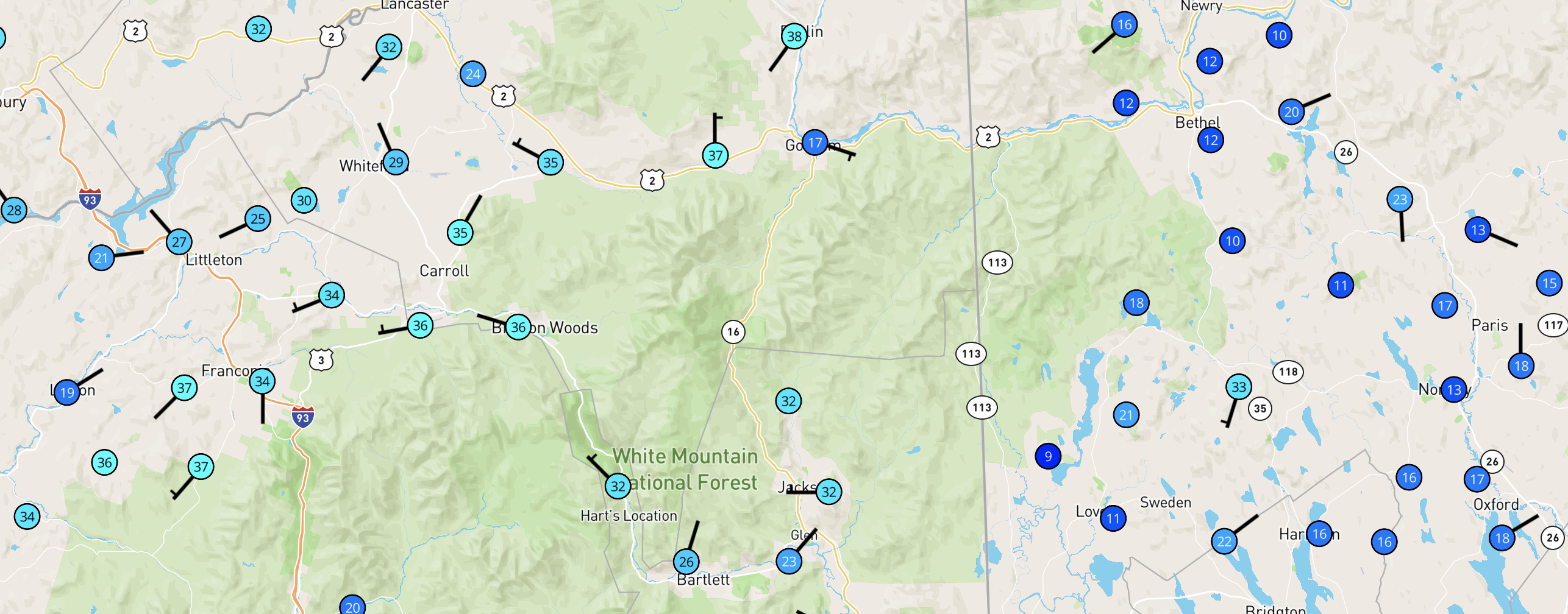
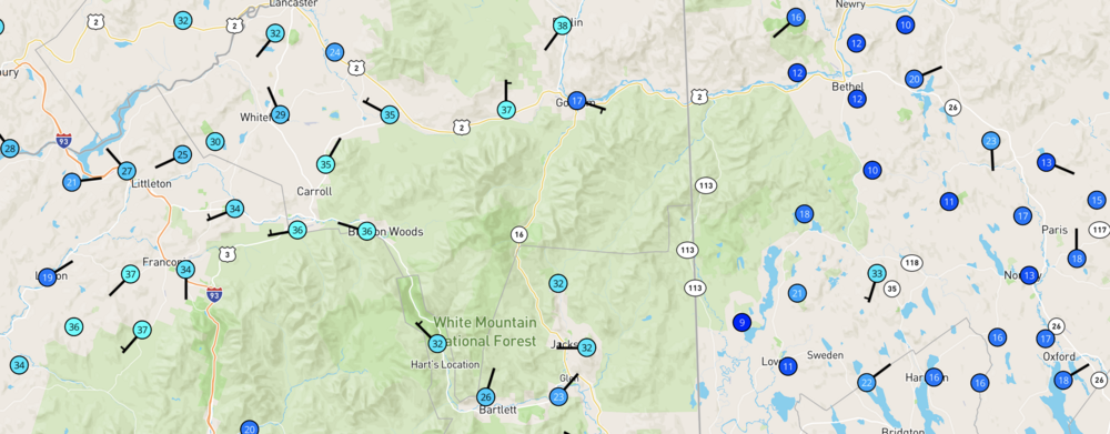
Some wild inversion temperature differentials in NNE right now. A station at Appalachia is reporting 37˚ and it's 17˚ in Gorham. Berlin is reporting 38˚ while KBML in the valley up the road is at 11˚ with a daily high of 15˚ (so far). Nowhere in interior Maine north of PWM made it past 20 with the CAD in place, everything NW of the notches is nearly 40. Models had Maine up in the 30s today FWIW.
-
And right back to -15 it seems.
-
It's all about timing and not being on the ball with any treatment. My favorite was 2/8/17. Not a flash freeze but CAD which I think was discussed but didn't even show up on the mesos. And then it would have been fine except a light rain shower passed through (aircraft were reporting 25 at KBOS and 56 a few thousand feet up) and put down 0.1" of ice on everything right before morning rush hour and the results were about as expected up to and including a 55-car pileup on 128. Basically this + this = chaos, when the first this was 5 or 10 degrees colder than modeled. Just an epic, epic bust. And worse, ZR the morning before had been forecast but benign, not that this was forecast until this forum (your's truly included) went out and tried to run in the morning.