Chinook
-
Posts
10,602 -
Joined
-
Last visited
Content Type
Profiles
Blogs
Forums
American Weather
Media Demo
Store
Gallery
Everything posted by Chinook
-

Alaska/Western Canada obs and discussion
Chinook replied to patrick7032's topic in Central/Western States
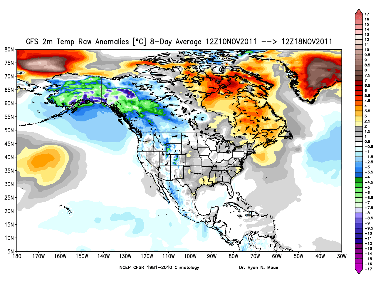
20-48 degrees F below normal in 7 days! Watch out! 8-day average temperature anomaly in southern Alaska: 5-12 Celsius.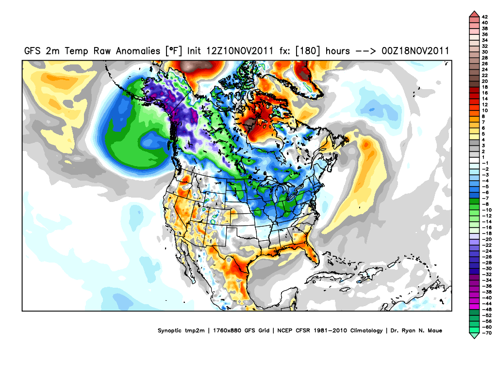
-
Historic Tornado Outbreak April 27, 2011
Chinook replied to CUmet's topic in Weather Forecasting and Discussion
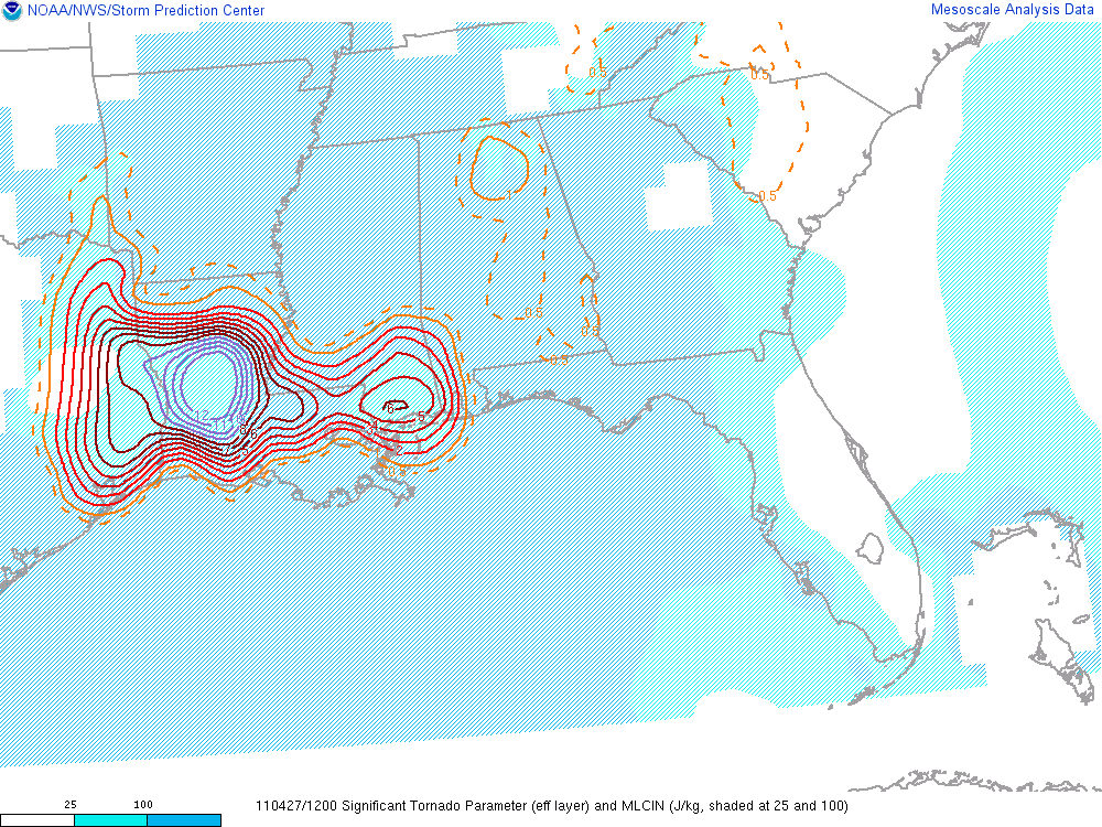
I woke up a little early this morning. Supercell composite of 50 and an effective-layer significant tornado parameter of 12. I think the highest I've seen is 44 and 11.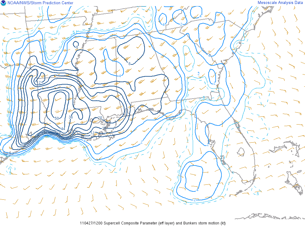
-
Historic Tornado Outbreak April 27, 2011
Chinook replied to CUmet's topic in Weather Forecasting and Discussion
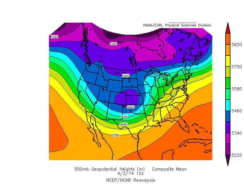
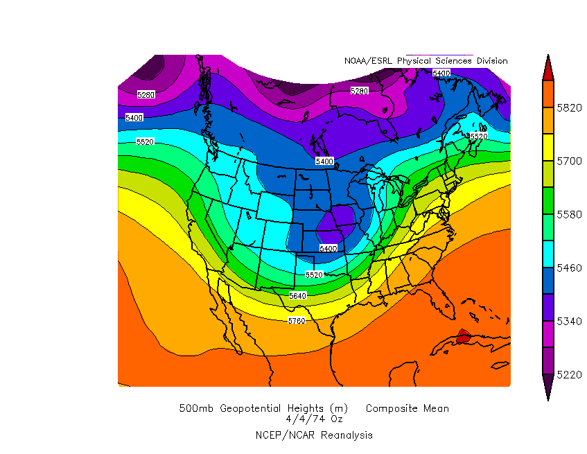
Synoptically it has some similarities. Tomorrow, two low pressures (surface) will exist. In 1974, there was one main low pressure. Check the 500mb chart of the morning and evening of April 3, 1974. There are some similarities to tomorrow's 500mb chart. Nobody can know for certain what type of tornado destruction will happen, but no outbreak brought about more destruction than the Super Outbreak. It's unlikely that April 27, 2011 will go down as the worst of the worst tornado outbreaks.