

Maestrobjwa
-
Posts
10,335 -
Joined
-
Last visited
Content Type
Profiles
Blogs
Forums
American Weather
Media Demo
Store
Gallery
Posts posted by Maestrobjwa
-
-
2 minutes ago, WVclimo said:
OK, cool. Guess I should read more carefully when I am supposed to be working, lol.
Nah wasn't your fault, I wasn't specific, lol
-
3 minutes ago, HighStakes said:
He must be talking about the January storm alone. No way 4.8 was the seasonal total.
Yeah I was
-
2 minutes ago, WVclimo said:
Holy smoke ! Did the city really get screwed that badly last winter ? I see BWI reported 18.3". I had 37" here which might be the biggest discrepancy I can recall between here and Baltimore, if your total was really that low.
Ah, my apologies: I meant to say we only got 4.8 from that January system that gave DC a foot. 18.3" for the year is correct.
-
12 minutes ago, psuhoffman said:
I suggest you reset expectations. Your using a numerical anomaly to convince yourself we won’t fail. That very short term trend of storm frequency is just a random anomaly within a larger set of random chaos. Trust me I’ve done the actual statistical analysts and yes at the start of any given stretch the longer you go the less likely you don’t get snow...because at any given time there is a chance of snow, but once you are years into a snow drought the odds of breaking it are no better each year over the long term. We have had 4 years in a row above normal. We have had 8 years in a row with little to no snow.
Besides...if it snows it will melt and be gone and so by spring so what we should be over it. Maybe we get a big snow next December. It will snow again. Sucks to have to wait but since we don’t have any control I suggest you relax and just roll with it. Or move somewhere it snows more regularly.
I'm not trying to "convince" myself of anything...stop accusing me of denying reality. I've said over and over again that the trend could break anytime. Yes I'm hoping it doesn't...sure I guess we've been fortunate to be able to time it with a watch the last 27 years. But I am NOT trying to deny reality. And no, I cannot move somewhere else...that option isn't possible or feasible at this juncture.
I was just making a general wish that we find a way to make it work...not because of numerics or reality denial, but because 4 years in a row would just be awful. (And I'm dreading the drought going longer. We've gotten away from la nina, but still ain't been able to get things right or get a mod nino (mercy how rare are those anyway? Once a decade???)
-
Just now, WinterWxLuvr said:
Last year wasn’t a bad winter. I’m speaking of course here. Not for me to pass judgement on any other locale.
Up here we only got 4.8 inches...that was basically a dc/nova jackpot. I mean, we had some nice "scenery" snow...but the fact remains for all of us that we've only gotten to pull out a shovel one time since 2016 (so far)
-
35 minutes ago, Bob Chill said:
Seeing good tracks with no cold during prime climo is a giant billboard highlighting what our consistent problem has been the last 5-6 weeks. It's just one of those years where we can't buy a real winter airmass. 2-3 day cold shot in a progressive pattern carries low probabilities of frozen precip. I'd like to think the busy flow off the Pac creates an opportunity to combine enough cold with enough precip. Still very possible but ops are highlighting the constant risk we've been dealing with for quite a while now.
And yet when we had cold air masses during the two dreadful la nina years....suppression and snowhole, smh Mercy...I'm telling ya, if we cannot overcome this this year (or get lucky with a perfect track coastal bomb) and score at least once, this will go down as the worst 4-year stretch of winter we've had since that period between 1988 and 1992, smh We don't have to snow every year...but in a 4 year span we always manage to score at least once or twice among all the chaos. We have got to find a way this year...
-
19 minutes ago, psuhoffman said:
If the gfs slows down anymore this could become a white Christmas threat
You're on a roll today!
-
26 minutes ago, pasnownut said:
Dude, that't the best phrase I've read on this board all year.
By far, lolol
-
Just now, psuhoffman said:
That look can be suppressive if the ridge in Canada is too far south and or nothing amplifies enough yes. One fail would be all the waves compete and fail to amplify. Then they all slide east under the blocking ridge.
How many waves are we lookin' at here?
-
Just now, stormtracker said:
I thought about it. I'm going to give it at least until February.
I'd wait to see what happens the next 10-12 days. If we still manage to whiff even after all that activity...then bring out the teardrop, lol (so let's hope ya keep it on the shelf!)
-
3 minutes ago, MD Snow said:
uh...it's Ji...are you new to the board? haha!
Not sure if it was mentioned, but the 12z CMC was kind of a strung out/suppressed system.
I'm not, but...I just don't understand that dude, lol
Anyway...it seems like we haven't had to deal with "strung out" since the awful la Nina's a couple years ago. And this year everything has been kinda juiced...but cutters. If we now finally have a chance at a southern system...and cold in place before it...ya never know! Just glad to see us back in the game again!
-
22 minutes ago, losetoa6 said:
I dont buy the suppression either.
I'm not so sure it's the complicated factor so much as it's the "Busy " factor ...with numerous ns vorts flying around the next 10 days models will be challenged to see or hone in on a single one in the mid range imo.
Yeah we ain't had suppression all winter...if it were to suddenly be an issue that would just be a case of MAI (mid-atlantic-itis)
-
5 minutes ago, Ji said:
We cant ever have nice things.
Why are you living model run to model run this far out? Thus is madness, brother....I'd suggest stepping away for a day. Emotional (I'm contemplating the same thing...temptation will be hard to resist, lol) Emotional model watching in the LR=bad!
-
 3
3
-
-
4 minutes ago, ryanconway63 said:
Well the Euro likes the idea of a storm off the NC Coast Jan 31/Feb 1 also.....this kills me to see the lack of cold air around.....perhaps this will change.
Man I hope so...otherwise that's gonna be a real knife in the heart after what we've been through with snow the last few years (especially to happen right at the end of what's supposed to be the coldest part of the year!)... C'mon...we oughta be due, lol
-
9 minutes ago, Scraff said:
Let’s roll with “The Reaper Storm”.

Nooooooo buddy...besides, Bob had this one first, lol
-
 1
1
-
-
3 minutes ago, stormtracker said:
It's most definitely going to be rain along I-95...the cold air is moving out. But it's vastly different solution than the GFS for this period.
ETA: Yup, goes to rain, but close. I guess it's something to keep in mind. But I'm like the man who the storm is named for...unless something sig changes, time to go dormant
Of all the things that we haven't been able to get to trend our way in the medium range...I'd take my chances for a trend to a colder solution (and only needing small shifts for such). Here's hoping it's still there next Tuesday!

-
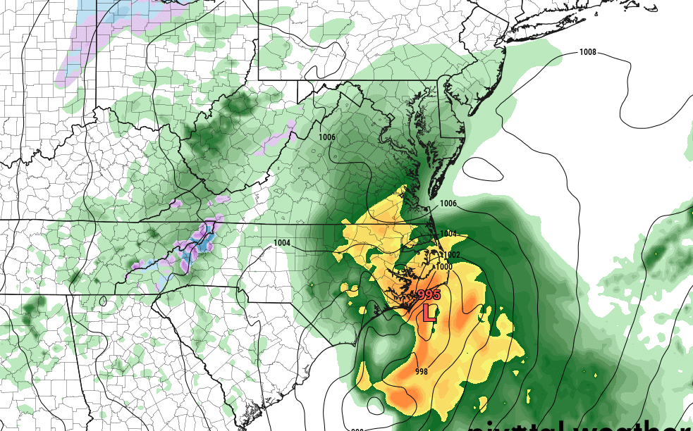
52 minutes ago, Ji said:53 minutes ago, MD Snow said:12z chill storm update - GFS is a cutter to the lakes and the CMC a strung out/southern slider with enough cold for all snow for our area. ICON appears to be headed somewhere in the middle.
Yes that is the chill storm...the feb 1 bomb is still unnamed
Wondering if the first cuts...could it serve as a 50/50 for the second?...
-
20 minutes ago, psuhoffman said:
The EPS is already kicking the can again...compared to the weeklies from Monday.
This was the weeklies run for what is now day 15 on last nights EPS...it was leading to that better pattern mid February there by already obviously moving the NAM state towards neutral and a developing EPO ridge...

but as usual as we get a day closer look what is happening...the NAM state is still strongly positive now for the same time and the EPO ridge is being shunted south of the EPO domain by the strong Vortex. This has happened again and again.

Yeah I'm starting to think long range looks are getting pointless to look at, lol It's becoming increasingly clear that we are gonna have to pray for a bit of fortune in perfect timing during a very transient window...obviously the looks up top ain't wanting to change anytime soon, smh
-
21 minutes ago, Fozz said:
Yeah it was a miserable stretch, especially with that triple phaser barely scraping us but burying the same places as the Boxing Day storm.
And see that's what makes the last two winters more depressing...that close miss! Had we gotten that one...or even the one in December 2018 that just missed...we wouldn't be in such a snow drought right now, smh
-
1 hour ago, WxWatcher007 said:
Man, I hate to cut this Reaper Retreat short, but it sounds like I’m needed here. I was really enjoying the tea.

But unfortunately for you it goes right through ya!
-
Man I hope we don't go 4 years in a row without a footer....that would be somewhat historic by itself--seeing as it hasn't happened for over 27 years...yikes. That would make this winter one of the absolute worst on record because of that alone. (Even worse if we didn't see another flake and stayed at 1.8", lol)
It would make you wonder if we would be setting up for a longer drought like 1970-1977, smh But our region has always has gone: a few bad years in a row, one or two good...then 2 or 3 bad...then good, etc. 20 inches is the magic point for me...and usually we can hit that every 3-4 years (historically)
-
28 minutes ago, WinterWxLuvr said:
Too many quitters lol. To me this isn’t some simple low that forms in one place and travels to another. This thing is bouncing around all over the place in relation to that upper low. Might be a dupe but I think I can stay interested in a few more runs.
Yeah I think we may be the only ones still with the ship, bro lol Like I said, I'll riiiiiide till I can't no mo!
-
Just now, nj2va said:
Duh, sorry just realized its only 5:30 so the 18z Euro isn’t out yet.

Yeah I thought it was the 18z EURO too at first (precip map had the same graphics, lol)
-
6 minutes ago, Solution Man said:
Still holding out hope. I like your resiliency
Yeah I can't bring myself to give up on this one either for whatever reason, lol I think I'm gonna riiiiiide till' I can't no mo....
-
1
-


Mid January/Mid February Medium/Long Range Discussion
in Mid Atlantic
Posted
Exactly (same up here! At least DC was thrown a bone last year with the January snow, lol)