

ShawnEastTN
-
Posts
1,722 -
Joined
-
Last visited
Content Type
Profiles
Blogs
Forums
American Weather
Media Demo
Store
Gallery
Posts posted by ShawnEastTN
-
-
Absolutely! I think there will be a long band that over performs by potentially several inches.Anyone else feel like there’s an opportunity for someone in the valley to over perform?
.-
 4
4
-
-
In the past I would watch that sort of slosh of cool and warm blobs either from CAA or Downsloping & WAA depending on the situation on Wunderground PWS map full screen to see as much of the valley as possible at once. Very fun thing to see those pools slosh back and forth before mixing.
-
3
-
-
This makes sense! I've always noticed in storms with strong downsloping along the mountains, before mixing occurs the warm air against the mountains pushes a cool pocket in the valley up against the eastern escarpment of the plateau. Almost like a bathtub sloshing. What you are describing is similar but in the other direction cold coming off the plateau displacing and pushing the relative warm pool toward the mountains. All of this before it all mixes and normalizes.Looking at the RGEM soundings, the wind direction this doesn't appear to be a downsloping issue. More like what is seen on every front rolling off the plateau, it slowed the front just a smidge more. Doing so causes less time for the Arctic air to wash the warmer air out of the valley, as it gets pushed against the Smokies. It's like a quasi warm nose in a way...rates, speed, and several other factors can quickly erase this problem, but won't be ironed out until closer to the event.-
1
-
-
Yeah I read that as literally the Georgia border area as their only thermal concerns since they specifically say southernmost counties.
I’m I reading this correctly that MRX isn’t really all that concerned with PType issues outside of the lowest elevations of the southern valley?
.
-
1
-
-
I just don't buy the thermals of NAM and end of HRRR. The mechanisms for that just isn't there unless this is going to become a major Gulf storm. The only thing in East that might affect Thermals would be downsloping, but even that I just can't see being supercharged. The flow just isn't that great over the mountains to push temps way up. East should sink deep into the 20's and Teens Monday morning clouds socked in before daybreak. Without a strong Gulf storm, without strong flow over the mountains it just doesn't make sense to me that thermals go into torch mode as the end of the short-range models are suggesting. Not wish casting just don't see the fundamentals for an Eastern torch.
Sent from my Pixel 7 using Tapatalk-
4
-
-
This is why a lot of Mets ride the NMB. It's the safer route than picking a single winning model.
I don’t blame her at all. However one thing I believe that would help the local weather people in these situations is to show the viewers more than one solution and explain the difference. At this range they could show more than one accumulation map.
.
Sent from my Pixel 7 using Tapatalk
-
2
-
-
Wonder if it has ingested the 0Z GFS, I would assume so.01z NBM
Sent from my Pixel 7 using Tapatalk
-
Agree 100%. Remembering back to similar overrunning events the precip shield was often greatly under-modeled.I honestly don’t think there’s any trends at this point going on. Feels like mods are just bouncing back and forth 50ish miles or so every run. The issue is the margin of error is pretty thin considering we are looking at 150-200 mile swath at the most for a significant amount. I’d say the big swings are over with at this point. Feels like the southern plateau up to Crossville is probably a safe spot to be in. I won’t be surprised if the bouncing around continues up until kickoff. If I had to give an opinion, I’d say the best thing for a forum wide event is for the mods to come in a little SE and hope the mods are underestimating the NW precip shield which they have been known to do.
.
Sent from my Pixel 7 using Tapatalk
-
1
-
-
Chatty a sweet spot this run
Sent from my Pixel 7 using Tapatalk-
3
-
-
GFS just isn't giving up.
Edit: maybe losing QPF a tick faster.
Sent from my Pixel 7 using Tapatalk-
 1
1
-
-
Yeah I think that is a serious problem. Though I wasn't really referring to the plateau sections vs city but that also, most modeling has shown a huge difference from state line, which close to 40 miles from Birchwood in northern Hamilton on Meigs border. Similar for Meigs itself large differences across the roughly 40 miles from Birchwood on the Hamilton county line to Ten Mile on the Roane line. I've always hated that generally only tornado warnings and flood advisories seem to be the only products issued granularly with the exception of splitting the mountain counties by elevation which they do. 40 miles from one side to the other of a county can be very different in terms of weather conditions.Historically, MRX considers Hamilton county to mean Chattanooga. They won't issue advisories or warnings if the event only affects Lookout and Signal mountains for example. I don't see them doing anything differently this time.
Sent from my Pixel 7 using Tapatalk
-
1
-
-
Agree especially considering portions of Hamilton county is consistently 3" or higher even if chatty isn't.With the new criteria, I think everyone probably gets the Winter Storm Watch, ironically, I've got less chance as of now than other areas because criteria is different here it looks like
Sent from my Pixel 7 using Tapatalk
-
Quite possibly they were my first as well in that same timeframe, came over here in 2014.Ha, those were my first weather forums, we probably interacted at some point! I met John there around 2008-2009 I think.
Sent from my Pixel 7 using Tapatalk
-
1
-
-
Many many years ago so much it makes me feel really old, before I knew AmericanWX had forums those old DGEX outputs would set the old SouthEast forum on AccuWeather on fire! I swear sometimes it was a combination zoo & MMA sprinkled with a little weather.Not the DGEX but I've been fiddling with Earl Barker's page today trying to render some of his classic graphics. Sadly no luck on my end yet. If anybody can conjure an Earl NAMing please post it.
https://www.wxcaster.com/models_main.htm
Sent from my Pixel 7 using Tapatalk
-
2
-
 3
3
-
-
Someone got the DGEX for old time sake? I really miss it so much. I guarantee it would show the storm of the century right about now.
Sent from my Pixel 7 using Tapatalk-
1
-
-
I understand this fear really really well. How many times over the years have we watch it take ages for cold air to filter over the plateau only to arrive when precip was ending. However I feel this is different primarily because of the initial cold front coming in now, and start time of precip especially for west and Middle as it will be at night likely, though even in Mid East Tennessee my forecast low Monday morning before precip start is 24 degrees. As sun comes up it will already be overcast and with dry air in place will likely start as virga which will help keep temperatures down through evaporative cooling. I don't really hold this as a great fear in this setup as I would if there weren't already seasonal cold in place. Many times we are above seasonal and then depending on the Arctic front to overcome above seasonal temps which just isn't the case this time with good cold air already entrenched. If I have a fear it's actually the dry air and not really over coming it quick enough. But with good Gulf connection that doesn't really spook me too much either. Just my thoughts.While this may be my own forecasting “anti-bias” / cautious & pessimistic forecasting attitude taking hold, but I don’t like the look of the end of today’s 18z Nam for eastern areas if one wants snow. We haven’t had the actual arctic air yet arrive from behind the current system and it remains to be seen just how robust this arctic air is when it moves in Sunday. I feel pretty confident western and middle tn folks are on board to see some decent accumulation, but the potential is there for this swath of snow to shift 50-100 miles north of the current forecasted area for East Tennessee if deep cold thickness lines end up not being as far south and shift sw to ne like the end of the latest nam 12km is indicating. This is exactly what happened on January 5th, 2022 with the snow expected to hit pretty much all of East Tennessee with 3”-5” anticipated, however, in reality, all of East Tennessee barely received a trace or even 1/2” with most of the moderate to heavy snow going to our north and west with milder and drier air over all of East Tennessee. I’m not saying this is what will happen with this upcoming system because I’m sure different dynamics are at play and the Nam isn’t necessarily spot on at hr 84, but I did get a small dose of PTSD when I saw the end of the NAM and connected that to Jan 5th 2022.
Sent from my Pixel 7 using Tapatalk
-
4
-
 1
1
-
-
Yeah if it pans out it'll be the longest duration snowfall for me in many many years. As modeled with 18z GFS, IMBY and Knoxville proper it's just shy of a 24 hour continuous event in totality.I love that this is looking to be a longish duration event. Not just a quick 3 or 4 hour hit. My exuberance is growing!
Sent from my Pixel 7 using Tapatalk
-
2
-
-
Cove Mtn MRX just reported a 105 Mph gust with sustained winds of 62 Mph.
Sent from my Pixel 7 using Tapatalk-
6
-
1
-
-
Starting to see Morristown releasing graphics with higher totals now. Even Chatty bump to 30% of 2" or more.
Just posted on their FB feed:
Sent from my Pixel 7 using Tapatalk-
8
-
-
Like you mentioned a few days ago the Euro on the last storm system vastly under modeled QPF. In many instances the verified QPF was under modeled by the Euro by 3:1. It may do so again with this storm. If we get the Euro on board with similar placement and tracking as others then I personally am not that concerned about it's QPF forecast.Strengthening low near the Outer Banks that isn't producing any precip on it's west/nw side for some reason by 102.
I
Sent from my Pixel 7 using Tapatalk
-
1
-
-
Yeah I was kind of worried about the same thing. Didn't have time this morning to really check in until now and pleasantly surprised. Not only is GFS doubling down, but looks like Euro might be trending in the right direction. Not a bad place to be this morning.I’ll be honest… I almost didn’t open this after I got up because I expected everything had caved to the Euro.
.
Sent from my Pixel 7 using Tapatalk
-
2
-
-
By the 0z GFS having low sitting about 50 miles from Hatteras its another shift westward. Today the GFS has shifted the low track about 200 miles total westward. If we can get this thing running inside Hatteras like through Albemarle Sound that back far western precip shield will include Nashville. For GFS that is a trend westward with the low track on the operational through the day today. Also even as modeled the precip shield both north and west extent is under modeled likely as we see in these storms pretty much every year for as far as I can remember.
Sent from my Pixel 7 using Tapatalk-
5
-
-
Hey anything sub 70 hours it's gospel!Don't forget posting some long range hi-res precip output to get hopes up: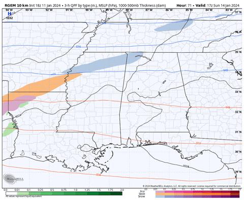

Sent from my Pixel 7 using Tapatalk
-
2
-
-
Looks to me at hour 120 12Z GFS, the low is centered about 100 miles west of 6z GFS for the same point in time. If we can get that to continue until that sucker is nearer to the coast... At 120 that low though is 100 miles closer to Hatteras than it was at 6Z.
Sent from my Pixel 7 using Tapatalk-
1
-
January 15th-17th 2024 Arctic Blast/Snow Event
in Tennessee Valley
Posted