Jump to content

jbenedet

Meteorologist
  • Posts

    7,163
  • Joined

  • Last visited

Everything posted by jbenedet

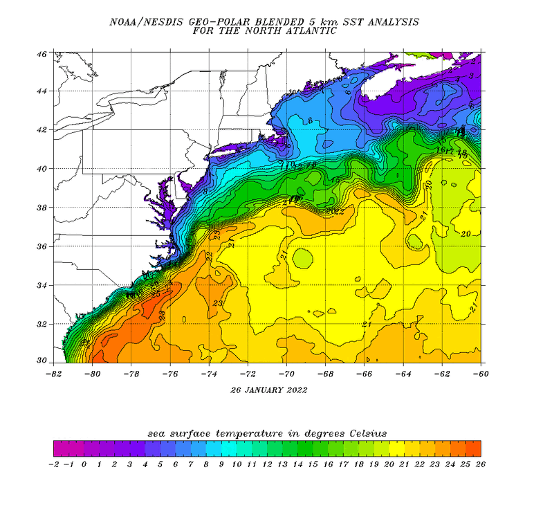
  1. 12z GEM is likely the high end of solutions for Monday/Tuesday in terms of how wrapped up this can get... I am favoring something sub 990 at our latitude given guidance consensus showing this being moisture rich off the SE coast in mid November. Expecting moisture fluxes to play a more important role in deepening this than our garden variety Nor Easter...
  2. Must be another Pope around here...
  3. Buy day 3/4 storm sell everything else.
  4. Agree on this, and it’s also why I strongly favor the first (day 3/4) wave. This wave appears to have tropical characteristics while off the SE coast. This is key. The quasi-tropical nature of this disturbance early on, means minimal long wave interference to UL ridge amplification induced by the second wave, allowing the coastal disturbance to track up the coast and phase near the BM as it becomes extra-tropical
  5. Hmm can you elaborate on this? Or any good references on it? My personal reference range for this is roughly the period from a month after the autumnal equinox to a month before the vernal equinox. (Approx late October to late February)
  6. Monday Tuesday potential looks like crap. Meh all around. Maybe it’s just a recency bias but these big -EPO patterns (especially when coupled with +NAO) tend to disappoint us far more often than not—big storm enthusiasts and snow lovers alike. We see a big long wave trough overhead and tappable arctic but the big picture with these serves as a trap that reels in interest and rarely delivers favorably. I suspect the primary reason is we often lack strong perturbations in the flow with these patterns. Why? Who knows for sure but I suspect having short wave propagation out of western Canada vs the Colorado Rockies is one strong reason behind it. Western Canada is typically the breeding ground for Alberta clippers whereas our big Miller A’s and B’s have origins much further south and begin maturing in the development cycle long before reaching our region, unlike the former...Maybe I won’t be disappointed if, going forward, I look at these patterns more correctly as Alberta clipper patterns....That has meh written all over it...
  7. I know you’re being facetious here but I think many are confused...And this point is important enough to elaborate on...Forecasting is an art and an independent skill that can be developed. Some are much better at it than others. Dare I say there are many “professional meteorologists” out there who are terrible forecasters. A major contributor to this is atmospheric sci programs and the NWS are not filtering candidates based on forecasting skills/ability, but I digress.... Models are built based on scientific theory, but the inherent uncertainties within the models —chaos and complexity—require the art of forecasting to produce accurate —or at least better than consensus— forecasts.
  8. I’m not even talking wet or white at this point. Looks like a big storm nearby, that’s all. Full moon on the 12th so that makes it more interesting to watch for the coast as well.
  9. FWIW as a general rule of thumb for the warmer 2/3 of the subforum, I’ve noticed that when the deepest cold dumps into the Upper Midwest while the storm is on its closest approach to us—as it does in this case—its typically not a situation that bodes well for snow. Hedge in favor of a warmer/wetter outcome.
  10. Jeeze I said that about an hr ago and already being taken out of context? Never said rain for everyone, especially not you. This euro run only strengthened my case, further reflecting the trend west/north. How many more runs before euro 850 mb track is over Pittsfield MA? 8?
  11. You can do that. Fine. I think about what a given outcome will look like (independent of models), and see if that starts to show up in the guidance. That’s what this 12z GFS run was for me.
  12. I’m not pointing out the GFS as having superior skill. I specified this run is much closer to what will verify imo.
  13. I’m going to call an EPS FAIL on this one. 12z GFS much closer to what this is shaping up to be. Looks like a yawner for 99% of us. Thinking you’ll want to be in northern greens,, the whites and northern Maine to see snow from this one. Everyone else, enjoy the rain and Fropa.
  14. Which surface low? Heh. The synoptically driven one that develops near the Delaware bay? Sure. But even the 6z GFS is developing a meso low/weak TC that traverses the Carolina coast. Maybe it doesn’t happen, but that’s the other area to watch for surface pressure falls, especially judging by the convection collocated there right now.
  15. Think the specific area to watch is the blob of convection south of Wilmington NC. Difficult to tell by radar but appears there may already be a very weak LLC embedded within that.
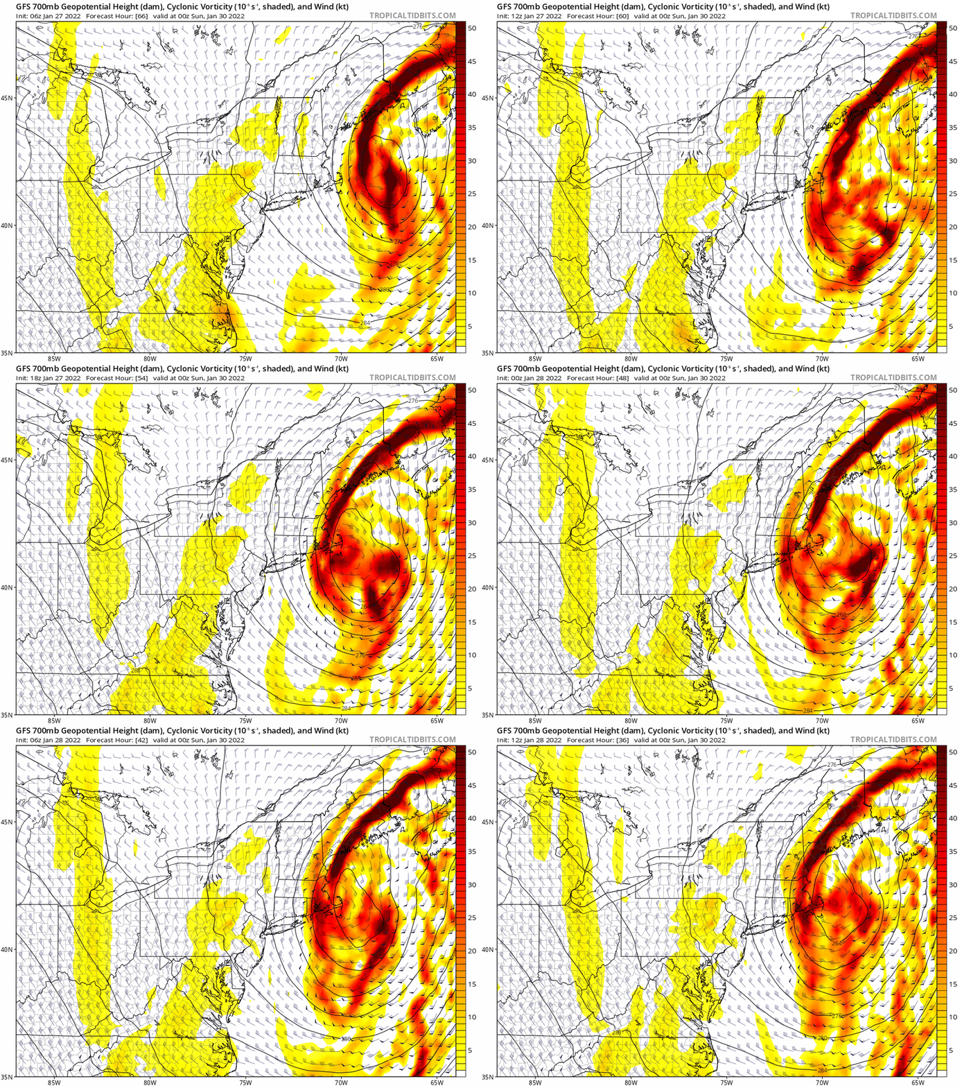
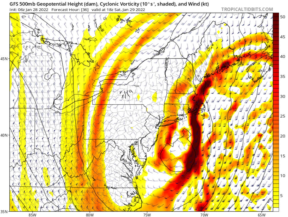
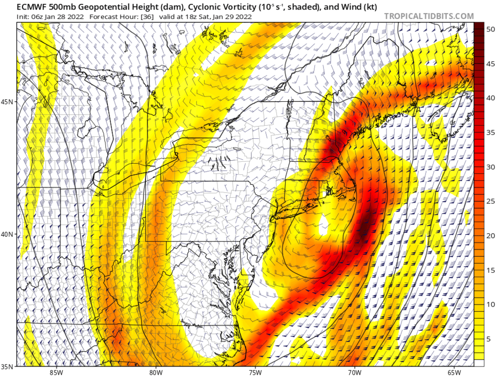
  16. Wrt last night’s 0z runs, hedge bets in favor of a correction slightly west as guidance tends to underestimate downstream UL ridge amplification due to LHR. The deep tropical nature of this system means the correction inside 12-24 hr could be larger than usual...
  17. It seems that this shouldn’t remain a mystery for long. The mesolow—if it develops—is currently developing off the Carolina coast. That much is consistent across the guidance which has it. We watch.
  18. Just being facetious. Seems like splitting hairs in this case, bc where it may not verify in the front end has a decent probability of verifying on the back end.
  19. Heh south coast of RI, is RI. I’d go south shore MA over CT.
  20. Whatever the case is, the mini cane that heads into Coastal RI, has been remarkably consistent across guidance since early yesterday...
×
×
  • Create New...