jbenedet
-
Posts
7,815 -
Joined
-
Last visited
Content Type
Profiles
Blogs
Forums
American Weather
Media Demo
Store
Gallery
Everything posted by jbenedet
-
70/58
-
Already feeling like shorts.
-
Lost 1 day to the rain considering the late start yesterday. looking forward to 70 and sun. With 8pm sunset can maximize the opportunity.
-
This spring has been excellent for young plants establishing and seed starting.
-
3/4 days are nice. 65-75 Monday will surprise to the upside. The one day with rain (Sunday) will treat the gardens so I can avoid watering. winning.
-
Gorgeous morning.
-
Yea you’re good. Im thinking of the 4 days Fri-Monday I lose one to rain. Will lose either Sunday or Monday to rain—trending to Sunday but it’s in and out quickly. Expecting that trend to continue. On the days with sun it will be near 70. Nothing to complain about up here. It’s a shit setup though for the CT, RI, southeast MA.
-
Nice four day weekend incoming.
-
It’s not crappy everywhere. Not even close. It’s def not summer vibes but really comfortable for outdoor activities.
-
Just give us a faint sw flow and it’s Florida. Gotta love how fossil fuel emissions all the focus meanwhile… All those data centers popping up
-
This is just a feature now. Careful what you wish for. 60’s for highs looking great. Can’t wait for the return.
-
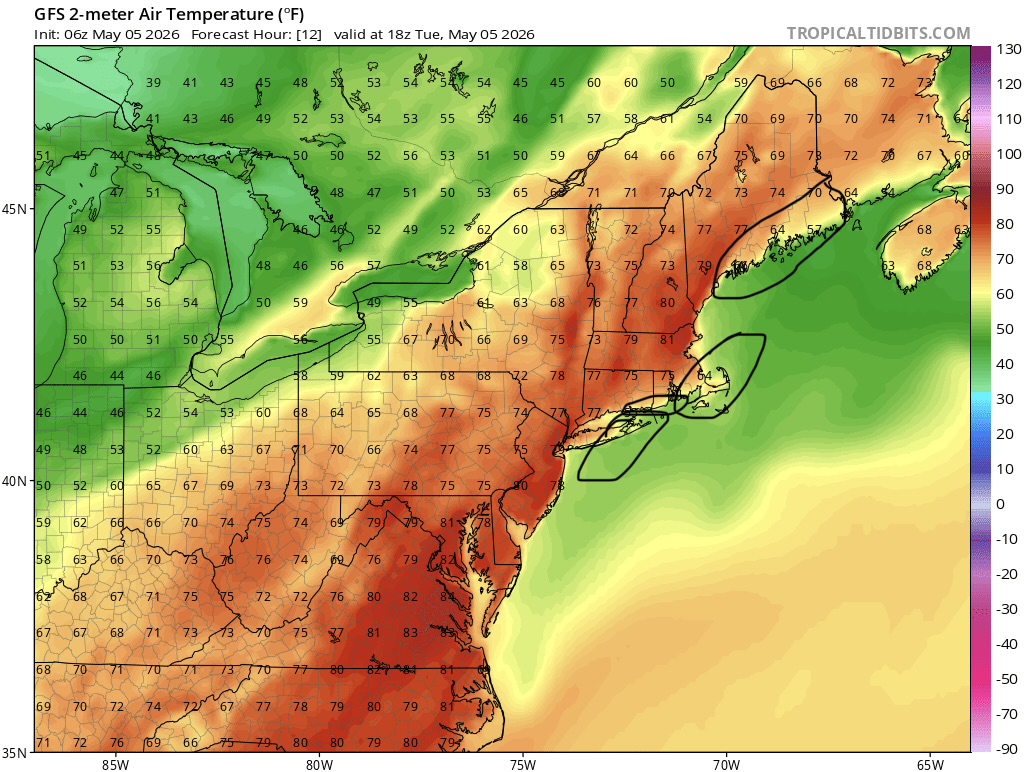
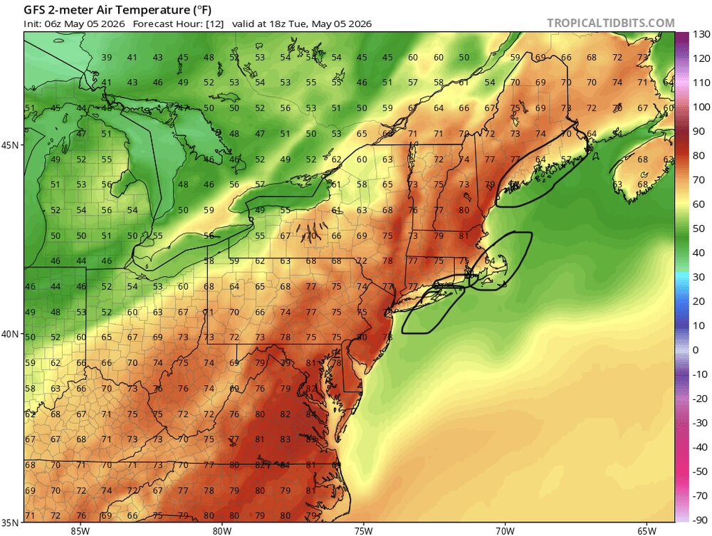
The persistence continues with often world’s apart differences in sensible weather between here and eastern Long Island. Jet still meandering overhead. Memorial Day weekend gonna be a lot of GWDLT…
-
54/50 Dews up — landscape flowered up and plenty of deep greens. Noice.
-
Beautiful mid spring morning walk with the dog—even some sun in the eastern sky
-
@Ginx snewx

-
Another nice day 70 in view
-
Drought?
-
Gonna be cutting the lawn twice this week. Been a helluva run for the lawns and gardens.
-
The breeze is wonderful. Would be hot otherwise. Bring it 80/51
-
Another factor to your local forecast. UHI + DCHI I do believe this already impacts locations downwind…à la imby
-
Sub 70 temps through June 1 on SSW/SW winds low level WAD would piss me off to no end in these pahts. Couldnt live here. Portland is often in that zone, as much as I love that city.
-
If you’re in the sun it’s a +10 real feel. T-shirt and jeans perfect in the sun.
-
Amazing people knocking this weather. Awesome out.
-
Nova Scotia wet snow bomb incoming