

jbenedet
-
Posts
6,555 -
Joined
-
Last visited
Content Type
Profiles
Blogs
Forums
American Weather
Media Demo
Store
Gallery
Posts posted by jbenedet
-
-
Odd split in the guidance for lows tonight. GFS and all mesos except the RGEM showing we stay way above freezing while euro and rgem showing we go below. And it’s even stranger with the former group having seasonal cold biases….
-
Man. Gardener’s nightmare with a hard freeze on April 26. We do it one more time tomorrow….
The trees always know….
The landscape was brown with much anticipation of this shit…
-
 1
1
-
 1
1
-
-
Our AN weather in winter hasn’t translated to early spring. It’s like 6 months of mid to late March.
Seeing how easily we freeze at night is a real spectacle on April 22 + after mid January taking an alignment of the stars to see a low below 35.
April just reminds us all of how bad our climo is for outdoor activities, generally…
But people are paying up to live here…Less snow but not less shit…
I’m finding my ticket out. Fentanyl weather is for the birds. Life is short.
-
5
-
 1
1
-
 1
1
-
-
Bad forecasts need bad measurements.
-
2
-
-
15 minutes ago, CoastalWx said:
6-8” there on PNS.
I guess they measure in the plow piles on the sidewalks in Dover.
-
6 minutes ago, Chrisrotary12 said:
Funny. My trees added a coating of white overnight after losing it late yesterday afternoon.
Melting now!
We’re going to get a good melt today despite the BN temps and clouds, given that the ground never froze up. Makes a big difference.
Can’t melt fast enough for me though. April 5th man. I need spring.
-
Don’t know how anyone has been adding to totals MHT points south/east unless you have elevation.
34/35 throughout the area for lows last night.
I’ve had probably had 30” of falling snow, but no more than 3” at any point to show for it.
The trees even lost their thick white coats overnight, despite the persistent light snow falling throughout.
We are now capping this event off with a flip to rain/drizzle.
-
 1
1
-
-
Car doesn’t even need a clean off after parking at 9 a.m.
Seeing ASH at 35/35.
We never fell below 33 so the spring plants are still springing.
A true April snow event.
-
2
-
-
What + 1.5F does to clown maps.
-
Even DAW didn’t drop below 34
-
20 minutes ago, DomNH said:
Guess my eyes are wrong! Either way about what I expected.
1:1 ratios with snow
snow atm profile; sleet ratios
-
1
-
-
On 4/2/2024 at 8:03 AM, jbenedet said:
The precip rates will be impressive with the initial push Wednesday evening. But radar echoes will progressively weaken after 0-6z Thursday. Lots of “holes” developing in the echoes.
For the big totals you’ll need to be stacking Wednesday, and that’s when temps are most marginal in eastern sections.
Yup.
-
2 minutes ago, dendrite said:
CON to Pope should be snowing

Snow.
So wet.
So much white rain….
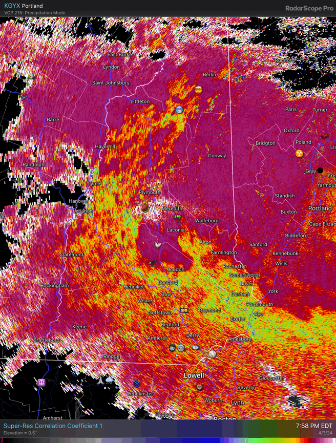
In other news, the radar looks like poopy
-
1
-
4
-
-
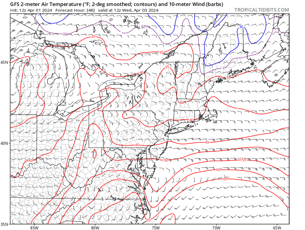
The GFS cold bias is going to make a crescendo with this event to wrap up a season of BS
42 at PSM right now.
GFS: past 8 runs; check out 40 isotherm from SE MA to Seabrook NH, and still too cold!
-
3
-
-
13 minutes ago, 40/70 Benchmark said:

Good baseline. Now from this reference point add 1-2F to surface temps throughout.
That's why I'm in much better agreement with NWS maps vs this output.
-
1
-
-
The precip rates will be impressive with the initial push Wednesday evening. But radar echoes will progressively weaken after 0-6z Thursday. Lots of “holes” developing in the echoes.
For the big totals you’ll need to be stacking Wednesday, and that’s when temps are most marginal in eastern sections.
-
1
-
-
The depth of the ULL peaks 6z Thursday near *Indiana*. It’s weakening from there on out.
I think what we’re missing more than anything with this is another UL vort to phase in as it makes closest approach to us.
Decaying low isn’t gonna get us the consistent mod+ rates to stack in the marginal areas in SNE and SE NH.
-
2 minutes ago, DomNH said:
Problem with those GFS clown maps in this area is that most of what falls after 12z Thursday, if it’s even snow, probably isn’t accumulating much, especially on pavement. Heaviest rates are Wednesday night into Thursday which could bring a few sloppy inches but anything after that I’m skeptical. The snow depth maps aren’t all that impressive outside of the elevated areas.
East winds are ripping in eastern SNE up to PWM. SST’s are low 40’s in gulf of Maine. It’s not until after 12z Thurs that those areas gain a more northerly component and by then our ULL has really filled in and dynamics therefore significantly weaker.
-
2
-
-
Just now, HIPPYVALLEY said:
Maybe with that saturated ground you get some gusts that rip a few trees down.
6 trees and 6” of rain. The new persistence forecast.
-
2
-
-
Another early H5 occlusion….

-
Evolved into a look that favors West more than north (ex interior Maine). I like Scranton PA area and a big chunk of upstate NY from Binghamton up to Albany NY —much more than southern NH.
-
1
-
-
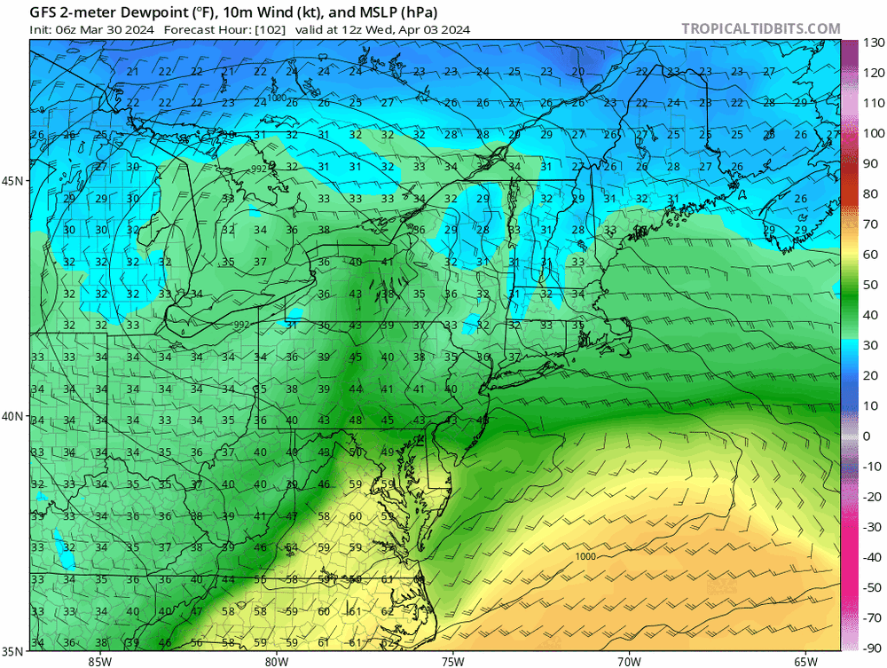
42 minutes ago, dryslot said:
Quite bullish on the 06z GEFS

That’s a white rain goose egg in SE NH. PF has it right with the depth change maps. Much better baseline with that.
GFS gonna burn us on the coast up until go time with these looks.
I mean, it’s outputting 32-34 DP throughout, with 34 surface temps over same time frame. Assuming that’s correct you’d have melting exceeding rates with the qpf output. And if it’s 3 degrees too cold (as the GFS has been all season at these leads) it’s wet surfaces except for the coldest with those transitory dustings that melt whenever rates lighten.
Seeing that 34 DP 18z Thurs on the backside of this <980 low is red flag we don’t have the cold conveyor hook up needed to positively offset “marginal”.
-
2
-
-
Rain in Portsmouth NH
34/31
-
1
-
-
100% sleet. Maybe had 3” before change.
-
1
-


April 2024 Disco- SNE’s favorite month
in New England
Posted
Persistent -NAO conditions during what is now mid spring, causing model chaos with fronts always near by. Good time to not be a forecaster, and grab the popcorn. Short/immediate term forecast errors for “fair weather days” must be through the roof.
Weather here is much better this morning than what was modeled 6-12 hrs before….Very warm morning compensating for a lame high…But mid 50’s I’ll take with what could have been…
The misery mist and low overcast is at bay—-for now….