Chris78
-
Posts
5,226 -
Joined
-
Last visited
Content Type
Profiles
Blogs
Forums
American Weather
Media Demo
Store
Gallery
Everything posted by Chris78
-
I'm hugging it. Rgem is a good model right?
-
He'll im not even talking about big dogs lol. Snow in general is hard in these parts. Altesst the last 8 to 10 years...
-
Only took 300 hours but it finally gets us. Although overall the run is colder and there's some close calls prior to this. This combined with the ensembles in this time frame I think should give some optimism. It's never easy for snow in these parts lol.

-
The dgex model would be showing a Blizzard from Birmingham to Maine.
-
Really nice bump west on the GEFS.
.thumb.png.e043ca51e6700d5b101256d313c83f80.png)
-
Yes. It's a very technical term.
-
The I -81 corridor has been the snow anus of the mid Atlantic for the last several years now.
-
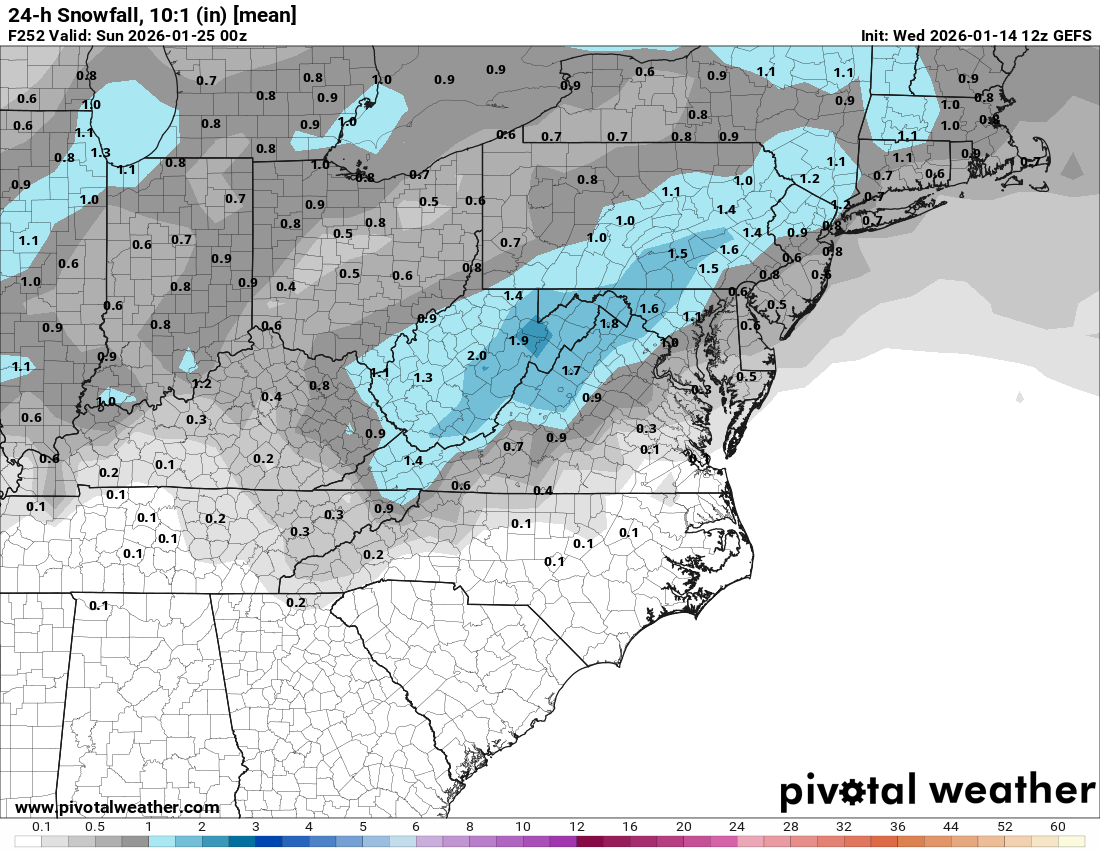
The 12z GEFS looks really good for later in the month. Really honking for next weekend. Majority of the snow mean is from day 9 onward.

.thumb.png.b0bb4782e0940e3171e6cc4f05a2d787.png)
-
Ugh. Suarez to the redsox
-
And getting a weenie from a certain someone for stating what ensembles show If it ain't unicorns and rainbows some people can't take it.
-
Looking at the GEFS overnight runs we might have to wait till after the 25th for any region wide snow chances. The 23rd-25th looks more cutterish unfortunately. Long way out and things can change but definitely trended warmer in that time frame.
-
I think it's settled. You need to sell your place.
-
I'm in Smithsburg just on the west side of the Catoctins. It's really hard to beleive how bad it's been since the start of the 21-22 season.
-
HGR is in its worst 4 year period for snowfall since records have been kept there. (1899) It's been really really bad.
-
The shortwave gets stuck in the SW
-
I'd gladly take what the cmc is showing for Saturday. A nice region wide 1 to 3
-
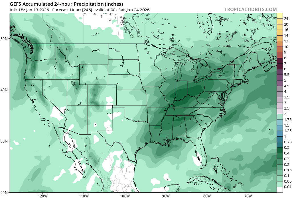
With this moisture during the time frame shown above.
-
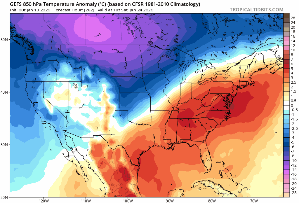
I like the trends for temps for next weekend.

-
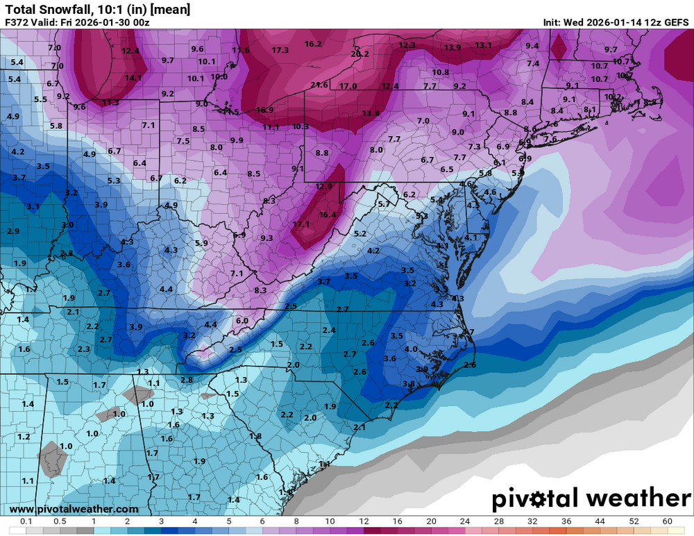
This forum would have to shut down if that map actually verified. It would be unbearable in here lol. 2ft+ to next to nothing further south
-
100% Agree. Bone chilling cold with no snow sucks.
-
How's February/March looking?
-
Maybe February will deliver.
-
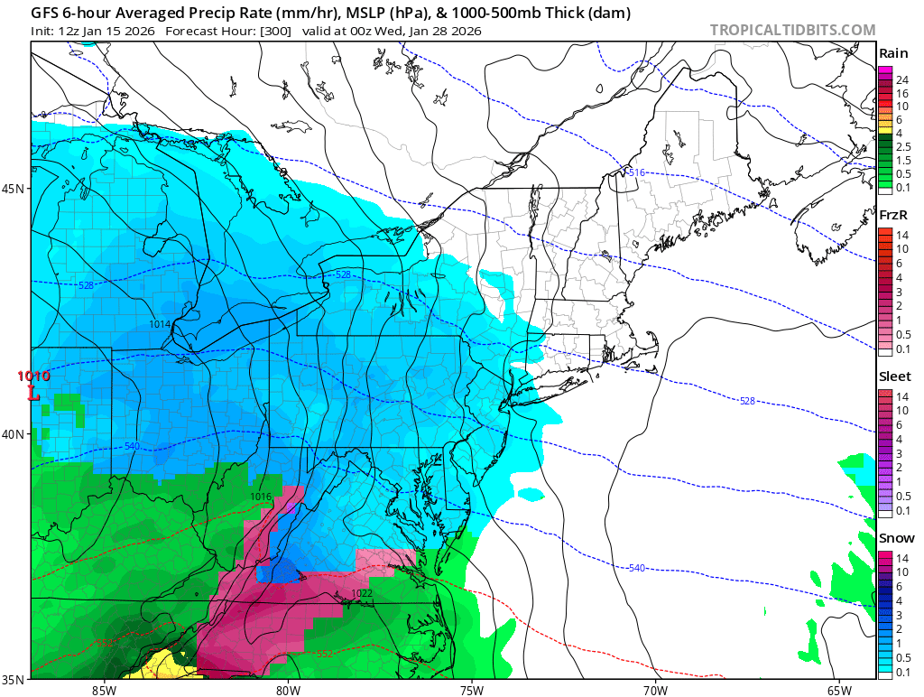
My fear is if we do finally get SS moisture we end up on the wrong side of the boundary. Ala 00z gfs
-
Pretty crappy gfs run overall. I hope the Esembles show some hope....
-
I'm at 3.5". Haven't hit 20" for a season since 2020-21. I average high 20s up here northern Washington county


.png.86491599000b8353ce4a6b06bb1df023.png)


.png.5b31de5aef3ab8adb3535f34c0cf502c.png)