

winterwx21
-
Posts
6,198 -
Joined
-
Last visited
Content Type
Profiles
Blogs
Forums
American Weather
Media Demo
Store
Gallery
Posts posted by winterwx21
-
-
1 hour ago, Allsnow said:
We need rain
Yep, and very little rain in sight unfortunately. Scattered t-storms with the front late tuesday is looking like our only chance. Very dry pattern the next couple weeks. Hot too. After a brief minor cooldown late week, it looks as if we're gonna start another heat wave next weekend. Labor Day looks hot.
-
 1
1
-
-
Beautiful summer day. The 90 degrees here right now feels good with the dewpoint down at 55.
-
2 minutes ago, Allsnow said:
Literally just missing me to my west ugh
Wow that's terrible. On radar it looks so close to you now. Hopefully you're about to get something. Up here it was a really nice downpour that lasted for awhile. Dropped a little over an inch of rain and I'm up to 1.28 for the day now. Ended up being pretty good up here, but it's a shame that the scattered nature of the convection leaves out many places.
-
2 minutes ago, Stormlover74 said:
getting crushed now
It has been coming down in buckets. This cell saved the day for us.
-
1
-
-
Another cell popped up and is giving me a heavy downpour right now, thankfully.
-
7 minutes ago, Stormlover74 said:
dark and thundering now....hopefully it clips me
I just barely got clipped by the southern edge of it. It rained for 1 minute.
-
0.23 here so far. Had a couple very brief heavy downpours.
-
3 minutes ago, Stormlover74 said:
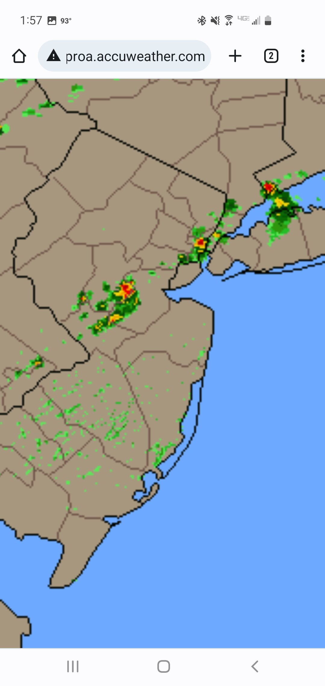
Look at the radar. That area of somerset got blasted and nearby got next to nothing
Yep, just a little light rain here. The heavy rain this morning was very isolated, just in parts of Hunterdon and Somerset counties.
-
2 hours ago, Allsnow said:
Bust?
Looks as if the heavy rain that was supposed to hit us early in the morning never materialized. That was supposed to be the most widespread part of this event. Just terrible, but it figures that our bad luck continues. Of course there will still be some heavy downpours around the rest of the day, but they will be scattered in nature so we have to hope for good luck. HRRR doesn't look that great. Gonna be horrible if this event ends up a bust.
-
1 hour ago, Stormlover74 said:
Can only laugh at this point
.thumb.png.a025c52578f6fc571256db58b93c60bf.png)
Hopefully this won't be a start of a trend of the models taking away our potential significant rain event. I see RGEM cut back on the 12z run too, now showing the bigger rain amounts staying to the southwest. Knowing that every potential event has fallen apart during this horrible drought, it certainly wouldn't be surprising if it happens again.
-
6 minutes ago, SnoSki14 said:
Very easy to do in this SW desert type of climate
The low humidity makes it much more tolerable though
Yeah the 93 here right now doesn't feel bad at all with the dewpoint of 50. Very nice outside.
But I'm hoping the higher dewpoints that will will be coming in sunday will help us finally see some widespread downpours sunday night and monday.
-
Up to 93 here now.
-
Models are showing a good amount of rain for monday. Every threat always falls apart so I know to not get hopes up too high, but you'd think one of these threats would have to pan out eventually. I doubt it the way things have been going, but maybe monday will finally give the area more widespead heavy downpours.
-
84 with a dewpoint of 50 here right now. A spectacular day, and this has been a great stretch the last several days with the very low dewpoints.
-
99 here with a dewpoint of 70.
-
1
-
-
10 hours ago, SnoSki14 said:
The near normal weather late this week and weekend will feel cold compared to the sauna we have now.
It's going to feel especially great with the very low humidity. Dewpoints could fall to the upper 40s next weekend.
-
2
-
-
15 minutes ago, Stormlover74 said:
Yeah 2nd round coming through now just mod rain
Yep it was good to add a little more rain. I picked up 0.72" here. Much needed rain.
-
2 minutes ago, Allsnow said:
Just light rain and thunder here meh. Not even enough yet to get under the trees
Sorry, that's lousy. Frustrating when a nice storm like this just barely misses you. You were just a few miles too far south. I got lucky here.
-
1
-
 1
1
-
-
Just now, Stormlover74 said:
Short lived but I'll take it
I see another little cell popped up behind it. We might get another brief downpour.
-
2 minutes ago, Stormlover74 said:
Getting blasted
It was a very good storm. So glad we FINALLY got hit with a nice cell.
-
1 minute ago, Allsnow said:
Odd…not getting much rain when the radar shows differently
I know you're a little south of me. The dark red on radar went right over me here in the extreme northern part of the county. It came down buckets here. A half inch of rain in a very short period of time. We had some close lightning strikes and 40mph wind gusts. Best storm in a long time here. Glad I finally can take a break from watering the vegetable garden for a couple days.
-
Pouring here now. Windy too with gusts 30 to 40mph. Decent storm.
-
3
-
-
2 minutes ago, Stormlover74 said:
Come on Schwartz
Dark clouds and I can hear the thunder.
-
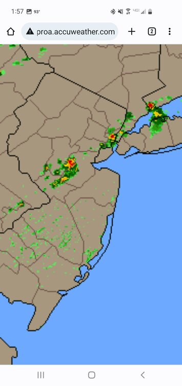
Looks as if the downpour in Somerset county is on track to hit here shortly. Keeping my fingers crossed .... I'm desperate for the rain.
.png.58c8c778e04dfbc058798bb889f8b760.png)
August 2022
in New York City Metro
Posted
Dewpoints will be falling to the 40s for thursday and friday, but temps will still be nice and warm in the 80s. It's going to be spectacular late summer weather ... a couple of the nicest days of the year.
Models now showing a wrinkle with a possible backdoor front for late in the holiday weekend, but way too early to worry about rain. Seems pretty unlikely as Brian just said. It's so difficult to get any rain around here.