backedgeapproaching
-
Posts
3,819 -
Joined
-
Last visited
Content Type
Profiles
Blogs
Forums
American Weather
Media Demo
Store
Gallery
Everything posted by backedgeapproaching
-

New England Overrunning Event 02/03-02/04/22
backedgeapproaching replied to dryslot's topic in New England
Strangely, no. Not even a flicker. Might have not accreted totally uniform on everything because of how hard it was raining and maybe the slightest little bit of IP mixed in at times? Not sure why really, but glad to have it. -
New England Overrunning Event 02/03-02/04/22
backedgeapproaching replied to dryslot's topic in New England
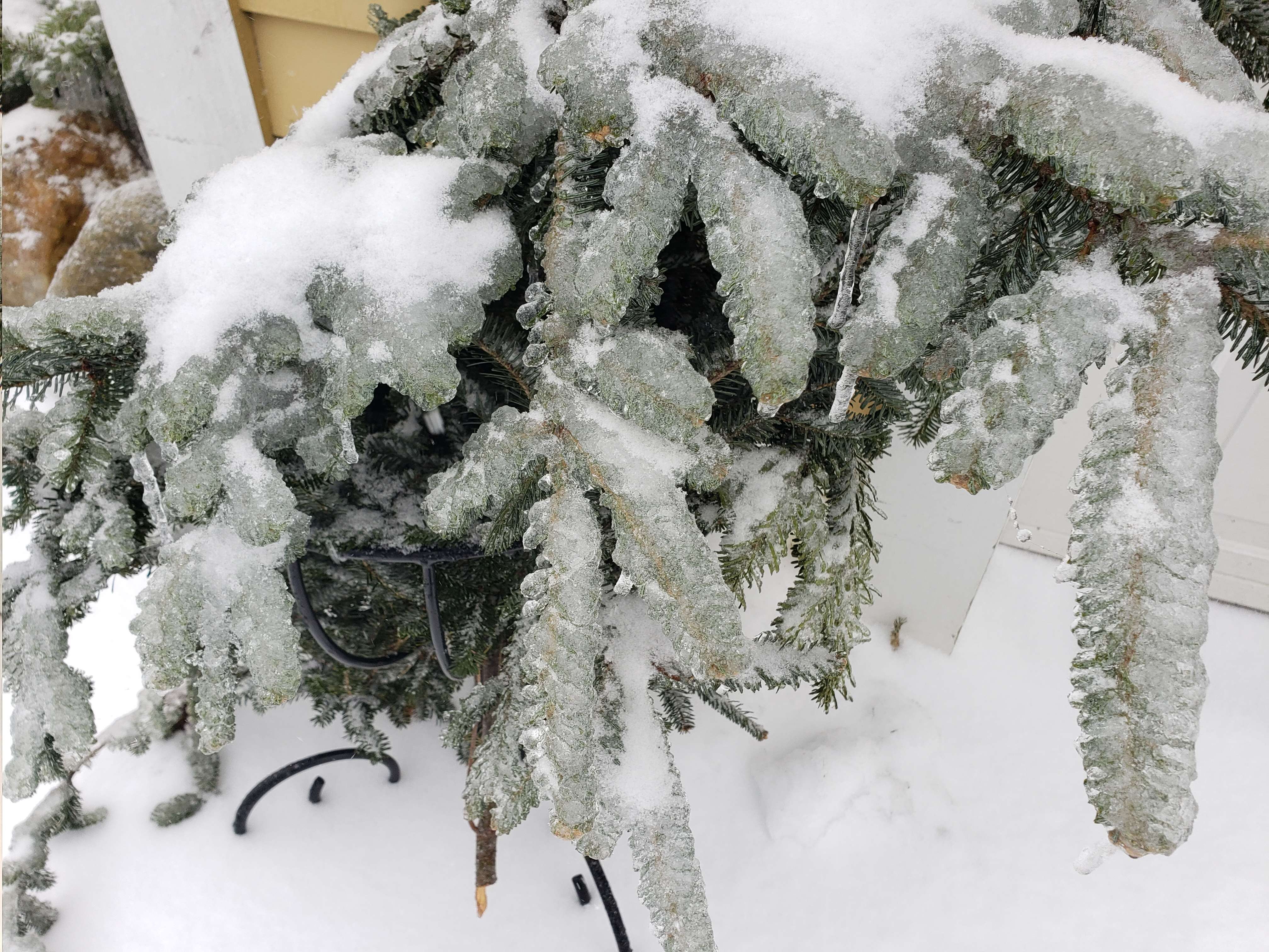
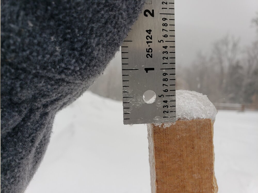
Had 2-3 hours last night of pouring ZR, then about 8 hours of scalping and then the last 3 hours or so of mostly snow with some IP mixed at times. About .4-.5" glaze and 2-2.5" sleet and we'll see how much snow..prob not much..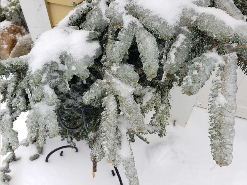
-
New England Overrunning Event 02/03-02/04/22
backedgeapproaching replied to dryslot's topic in New England
Yea, that's my hope..never thought I would praying for sleet. -
New England Overrunning Event 02/03-02/04/22
backedgeapproaching replied to dryslot's topic in New England
Turning into a full blown ice storm here..what a disaster. Pouring ZR and 26F, water just pouring off the roof. Maybe a tiny bit of IP in there, but mostly ZR. Lots of sagging going on. -
New England Overrunning Event 02/03-02/04/22
backedgeapproaching replied to dryslot's topic in New England
No chance its snowing there -
New England Overrunning Event 02/03-02/04/22
backedgeapproaching replied to dryslot's topic in New England
I'm trying to not look at CC.......its too painful Went from mod SN to -ZR. -
Yea, he's even more screwed than me being 25 miles south.
-
Feel like this literally happens with every event with some warm nose involved, every model run ticks warmer and warmer and warmer, and then still ends up even warmer than guidance at go time and during the event Some of these mesos have like 2-3" here of precip with alot of sleet. I officially hate this event..lol
-
There is a definitely a threshold where the lines get blurred on pack depth and just the optics of it. Like when you get to 24-26" I feel like it doesn't look "that" different from 3ft just from an overall perspective kind of like you were mentioning. Like even last year after the grinch wiped out 30", got back to 28-29" in FEB I think with little freshers all the time and felt like more OTG.
-
OBS/DISCO - The Historic James Blizzard of 2022
backedgeapproaching replied to TalcottWx's topic in New England
The Woodford measurements are not totally accurate IMO. Little bit inflated I've noticed at times, even with it being a total weenie spot and probably the best in SVT. We talked about this I think in the ski thread last year or maybe the NNE thread, the spotter is a woman around 90 yrs old or older and who took over from her husband who passed away some time ago. Amazing dedication to be doing that at that age, but seem to be a few discrepancies that I have noticed and even Mitch too I think. -
OBS/DISCO - The Historic James Blizzard of 2022
backedgeapproaching replied to TalcottWx's topic in New England
He had 1.7". I had 1.1" I wouldn't say epic bust by any means, as we were always on the fringe, but things definitely didn't break right to grab a little more than expected. -
Highest gust I had today was 12mph on Davis..still damn cold though.
-
Going to be some SNE peeps flying up the snow table standings blowing into top spots, well outside of the top 3 that are locked every year of course.
-
Up to a balmy 1.8F....Maybe like 1" give or take. I know Dendrite said forcing wasn't there, whether forcing, dry arctic air seeping in ,subsidence or whatever--most models nailed it here with little to nothing accum wise.
-
Yea, that would be nice. Has 2.5" QPF of snow/IP down here.
-
OBS/DISCO - The Historic James Blizzard of 2022
backedgeapproaching replied to TalcottWx's topic in New England
Yea, even under some halfway decent radar returns there is nothing at all coming down right now. Stratton summit cam has like miles and miles of VIS..lol. I was always out of it really even here, but, not sure even places east of me in VT got much? -
OBS/DISCO - The Historic James Blizzard of 2022
backedgeapproaching replied to TalcottWx's topic in New England
There is certainly some cold air nearby for you guys to tap into. I'm currently at 0.6F with some very light artic dust falling in SVT. -
Yep, love those..covers up the "tired" snowpack look.
-
Virga
-
Nice, always loved the eyewall drone shots.
-
-7.3F
-
Little further south? I guess I'm Im kind of faux NNE anyway down here..lol..
-
If your going to downslope, prob the best direction to do it..cant think of many blockbuster snow events on a south wind. Only issue is a strong cutter making a dent in the pack. Interestingly, south wind here is one of the few directions that is a non event..even tonight is weird, every station in the valley here is 35-37F while its 31.1F here almost calm.
-
This map sums up this storm pretty well. Terrain influence heavily in play.
-
Just give up. Its death by a thousand 2.7" upslope's.