

Fozz
-
Posts
38,073 -
Joined
-
Last visited
Content Type
Profiles
Blogs
Forums
American Weather
Media Demo
Store
Gallery
Everything posted by Fozz
-
Time to bump this up http://www.washingtonpost.com/blogs/capital-weather-gang/wp/2014/12/17/looking-back-on-winter-2009-10-snowpocalypse-strikes-smashes-december-snow-records/
-
You all need to stop getting so depressed from remembering great storms
-
Time to be
-
Awesome storm. In the days leading up to it I literally couldn't believe what I was seeing, even though the upper air setup was fantastic. I didn't think a HECS in December was possible until this storm.
-
I couldn't even keep up with all the thrill and excitement......all seemed way too good to be true. Got my last final canceled and enjoyed my 19" of snow
-
I miss my hourly ventures outside up until 2 or 3 am.
-
25"
-
Damn..........I had at least 20" at this time exactly 2 years ago. Good times.
-
Actually, crappy winters are the best time to reminisce about the great storms of the past.
-
-
Definitely 1.
-
I had a Jebman moment.......lolz http://www.easternus...ost__p__4332793
-
It was right after midnight two years ago when Don S compared this to the Knickerbocker storm. It was a huge turning point for me towards getting on board (at first I was extremely skeptical). http://www.easternuswx.com/bb/index.php?/topic/215377-historic-lower-mid-atlantic-snowstorm-increasingly-likely/
-
Bump. It's time to bring back this thread. Luckily the eastern archives are back.
-
Me neither.
-
Based on that scale, I'd call it moderate.
-
http://news.yahoo.com/5-8-earthquake-virginia-felt-washington-york-city-175830266.html
-
About 7 minutes ago I felt some pretty loud rumbles and our chandelier near the entrance was swinging a bit. It lasted 30 seconds or so. I was almost ready to run outside. This was pretty scary.
-
Shut up weenie.
-
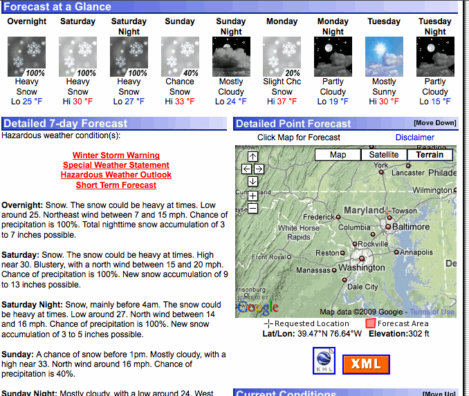
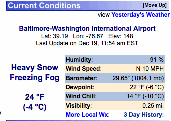
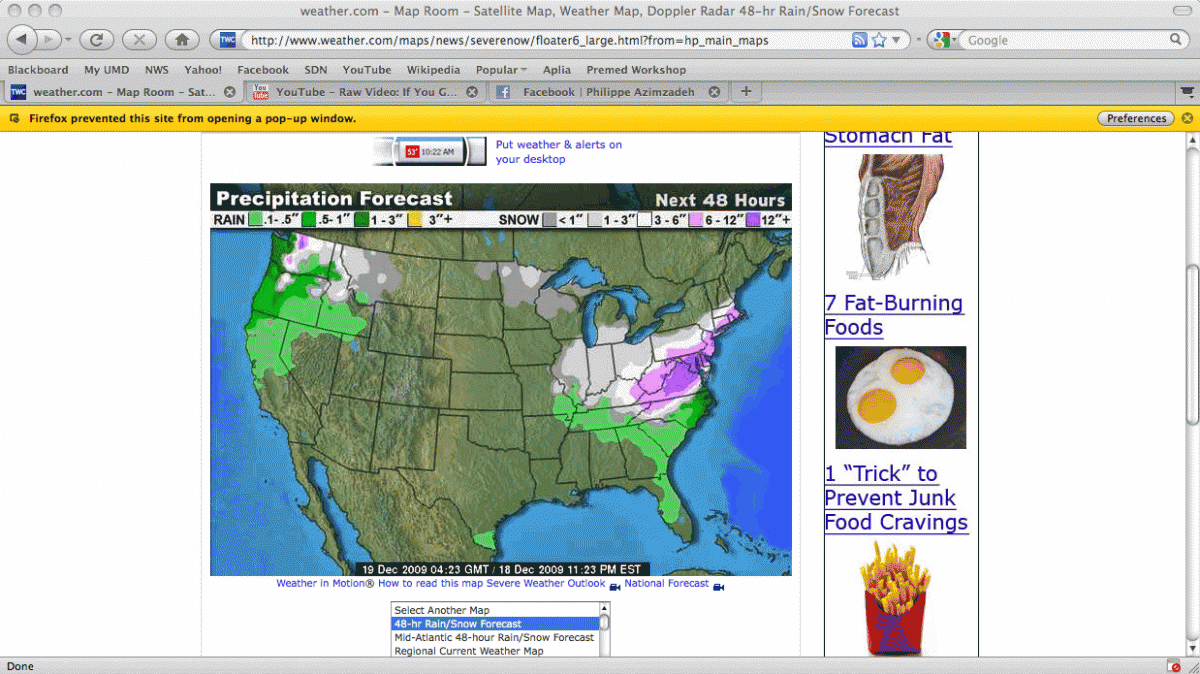
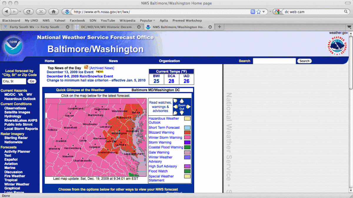
The snow was really picking up around this time.
-
What was the strongest pressure from that north Atlantic storm? I recall it being a monster.
-
It was exactly a year ago that the snow really got going.......I dropped my siblings off at their martial arts lesson Friday evening, and then decided to drive north just as the snow started to stick on the roads. There was probably 1-2" of snow at that point. It was a very wintry scene, slowly getting darker, and I kept driving north on York Road until I was up around Sparks, MD at Ensor Mill Road. Then I turned back, picked them up and got back home.
-
Thanks WVclimo, those radars are beautiful.
-
No, actually NYC was totally shafted, as badly as we were on 12/26.
-
Ian, do you have any total QPF maps for those runs? As a weenie, I want some pink and purple!
