T. August
-
Posts
4,612 -
Joined
-
Last visited
Content Type
Profiles
Blogs
Forums
American Weather
Media Demo
Store
Gallery
Everything posted by T. August
-
6.0-6.5” depth on the snow board/other areas around the property. Only lost about 2.5-3” of depth since the event. 31.4° after a high of 35.3° in Havre de Grace.
-
Awesome shot
-
40° today? I think so
-
We are going over the forecast high today 100%. Probably crack freezing in the cities.
-
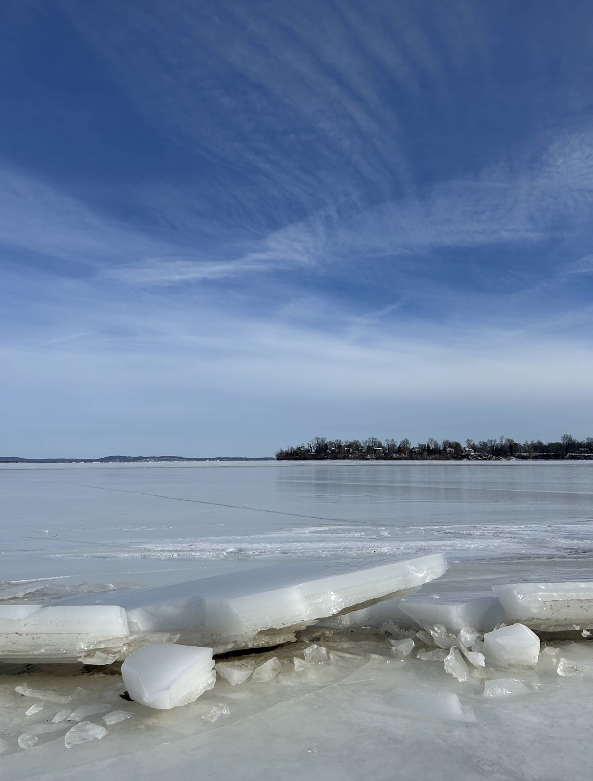
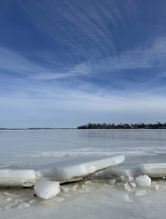
Walked 2 miles on the inlet/Bay today. Never seen anything like it in my lifetime. Ice was about 6” thick in most places. Aberdeen Proving Ground on the right, Battery Island barely visible on the left.
- 46 replies
-
- 11
-

-
 Seems short-lived on most OPs and ens guidance, with cold air waiting near by. Not to mention the seasonal trend of warmups being muted as we get closer in.
 -
I did but it confused him greatly
-
OP Euro juiced up a little too. Still waiting on maps but could be 1-2”. edit: an inch, but better than 12z
-
DC gets close to 4” on Kuchera. Smoked (relatively)
-
@WxUSAF @mappy a random normal non-weather person was talking about the past storm and mentioned how some parts of Harford County got 16”. I hit the fastest “well actuallyyyy” in my entire life.
-
Agreed… too much smoothing. Almost ensemble-esque
-
It precipitates for like 48 hours with no panel getting over .1” lol. Yeah technically it is indeed half an inch of liquid.
-
it’s not as pretty
-
Need that in Quebec
-
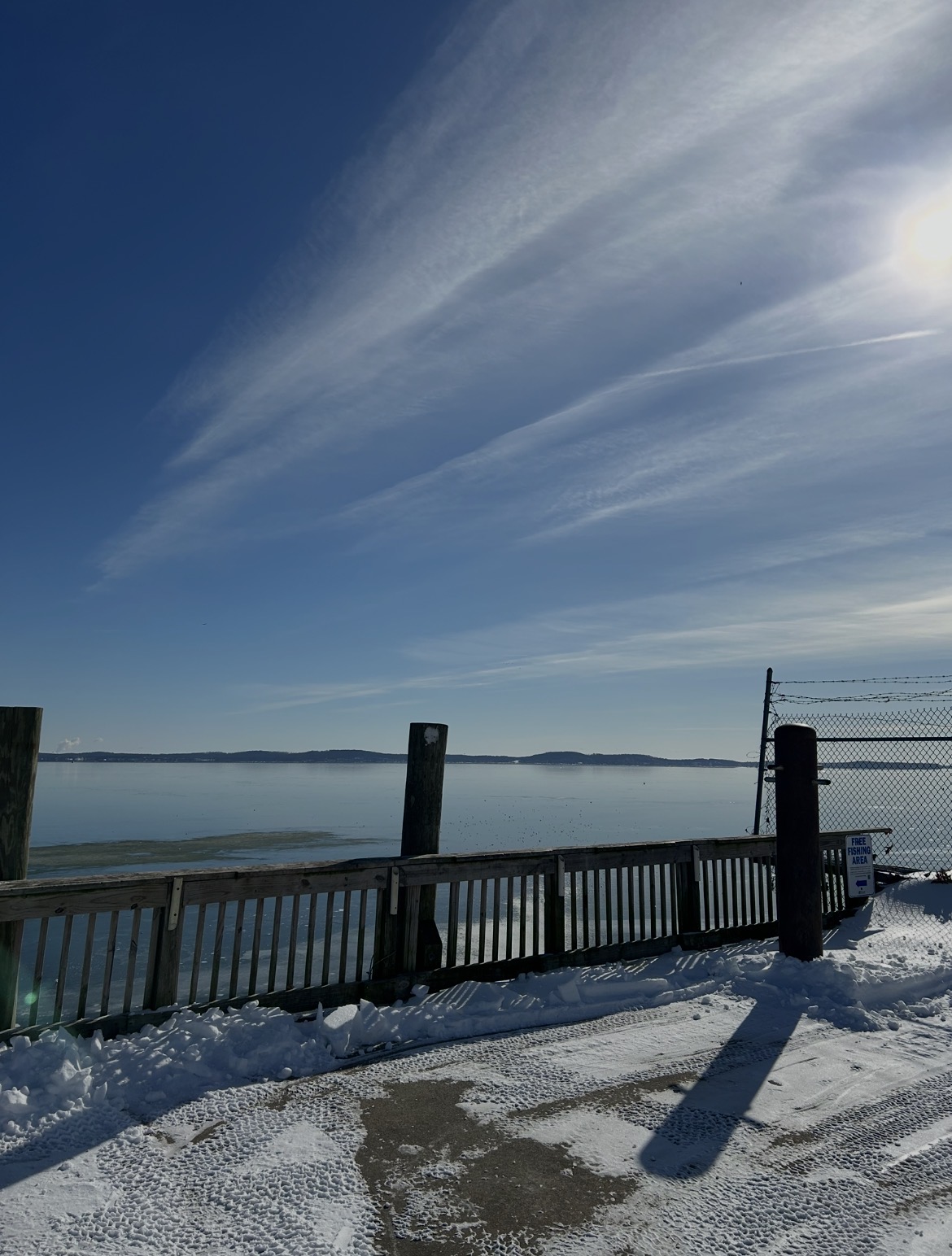
Looking SE from Havre de Grace. The hills are Turkey Point in Cecil. The Bay is about 95% covered.

-
I’m still interested but the one red flag I saw last night and this morning was such little support on the EPS and euro AI. Not a good look.
-
Insane. The gfs has us hitting 34-35 MAYBE a day or 2 the whole run. I would say it’s off-base, but the 12z euro showed the same thing.
-
15.1” in Havre de Grace. Winter average is probably 18-19” total.
-
For me personally, if we get a 1-3” event before the pack fully melts, then a bigger 4-8” storm to usher in the next cold shot, this winter would be an A+.
-
Temps since Saturday imby. What a stretch. Sat: 18.1/9.0 Sun: 21.7/13.5 Mon: 28.3/16.8 Tue: 26.3/8.5 Wed: 22.7/9.1 Thu: 23.3/5.2
-
Funny enough, 3k NAM from last night was too warm for a lot of the area on this AM’s temps. Split the difference and it could be a pretty accurate forecast. -2° up by psu/mappy over to Leesburg and 2-3° towards 95.
-
Euro says we don’t get above freezing until 2/7. Probably overdone but damn.
-
Not getting snow on snow does suck but I don’t get the negative attitude about the remainder of winter. All of the op runs are showing threats/chances over the next 2 weeks.
-
5°. Station in Darlington hit -1°