

stadiumwave
-
Posts
1,168 -
Joined
-
Last visited
Content Type
Profiles
Blogs
Forums
American Weather
Media Demo
Store
Gallery
Posts posted by stadiumwave
-
-
On 11/5/2020 at 12:25 PM, 40/70 Benchmark said:
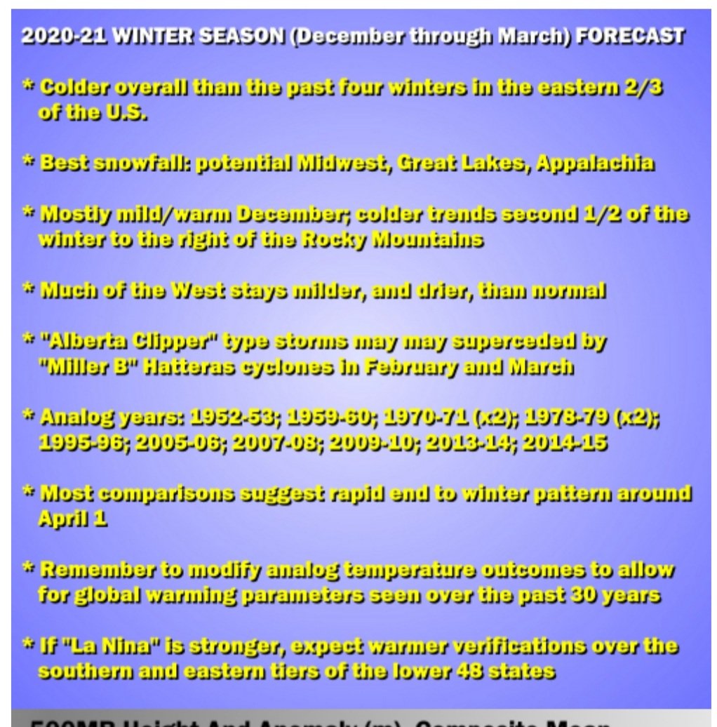
https://easternmassweather.blogspot.com/2020/11/winter-outlook-2020-2021-mixed-type-la.html
Here is my winter outlook, if you are looking for something to pass the time, while a team of molasses molecules counts the NV ballots.
The abridged version is linked....there are also options for more technical discussion of the telconnections if so desired.
Most wintery period looks to be December, and potentially another bout in March, but it may very well just result in a cold spring...as last season did.Great job!!
-
 1
1
-
-
46 minutes ago, michsnowfreak said:
Does anyone know what the other 4 winters were besides 2016-17?
1988-89 was one & it's also a strong analog for this winter for various reasons. If you look at that winter I encourage you look at it in 10 day increments. DEC had a good cold stretch & so did FEB/MAR. But JAN had a really strong warm stretch that kind of skews the 3 month mean.
-
 1
1
-
-
21 minutes ago, Damage In Tolland said:
Deal with it
- Cosgrove
He has not had a good winter forecast ever. Whatever his forecast is , if you go completely opposite , you will win every single time . And his very last point “if stronger Niña” tells you all you need to know . That’s his out
He did talk of warmth last year & was not popular. Larry is objective...not a "cold every year" wishcaster. He may be wrong but not for that reason.
Kind of refreshing to see someone not simply driven by nuances & status quo Climatology & make a cookie cutter La Nina forecast. That's lazy! And that is a lot of what I see every year nationally.
It's evident from his analog years he put a lot of thought & considered many factors.
-
2
-
-
Larry Cosgrove
-
1
-
 2
2
-
-
So is this temporary? I know @ORH_wxman had mentioned he thought easterlies would keep this east. Right now...clearly coldest anomalies chugging west.
-
Is @Isotherm not posting a winter outlook this year?
-
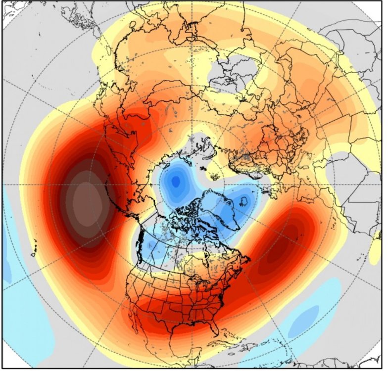
2 hours ago, 40/70 Benchmark said:
Looks like some west-based NAO love in that forecast. 2010-11 like.
Where the warmth is located around & north of Hudson it would appear so.
-
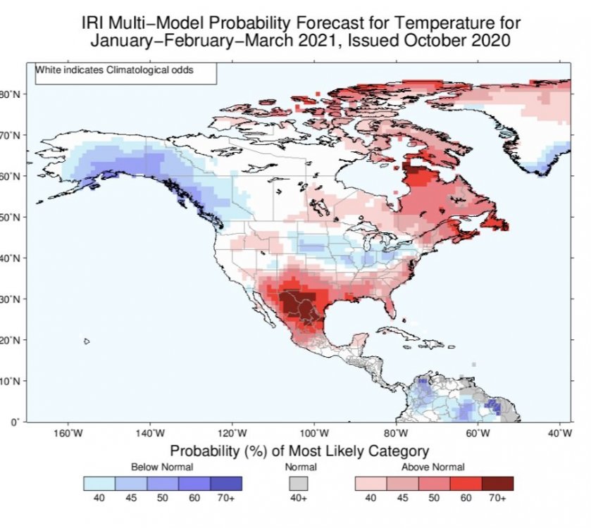
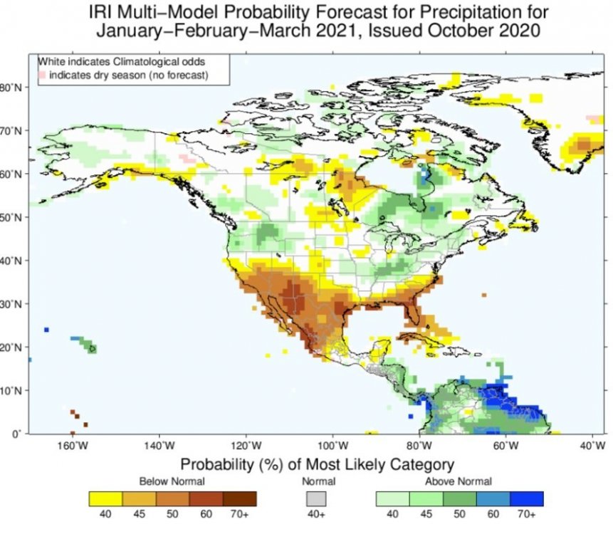
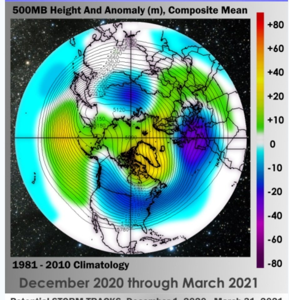
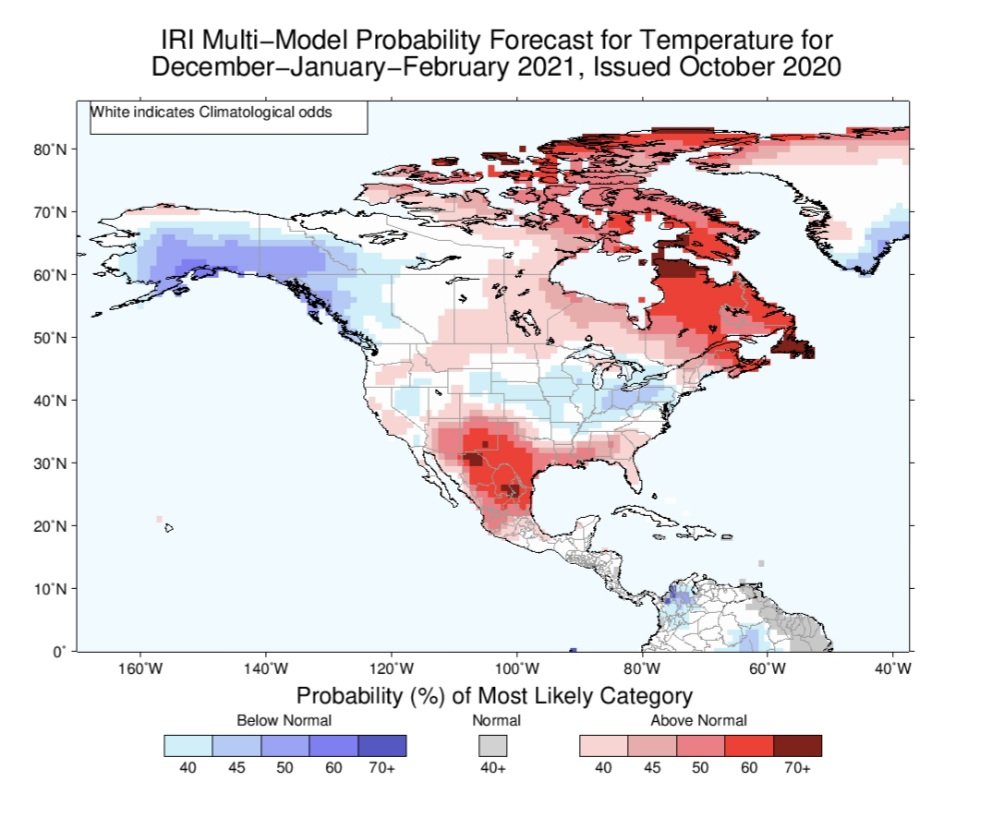
IRI Model updated
DJF

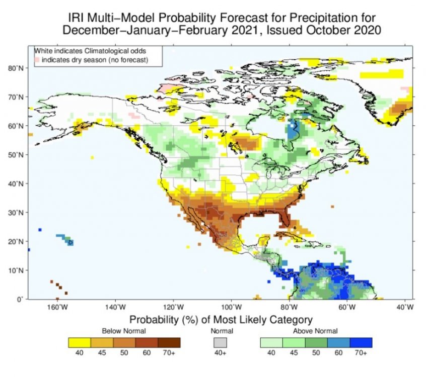
JFM
-
On 10/1/2020 at 4:34 PM, RogueWaves said:
This is a 2020 Nina. No point in comparing with the 00's. Thx anyways
I'm hoping this is sarcasm?
-
 2
2
-
-
14 minutes ago, CoastalWx said:
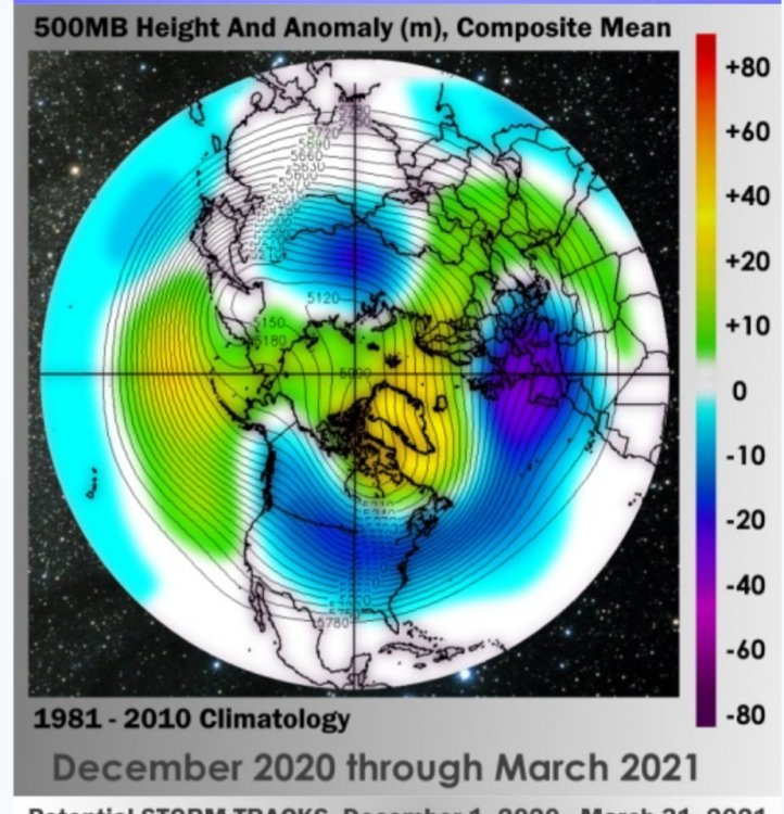
I'd like to see the H5 look.
Trust me...you don't want to see...lol. There are no positives to glean.
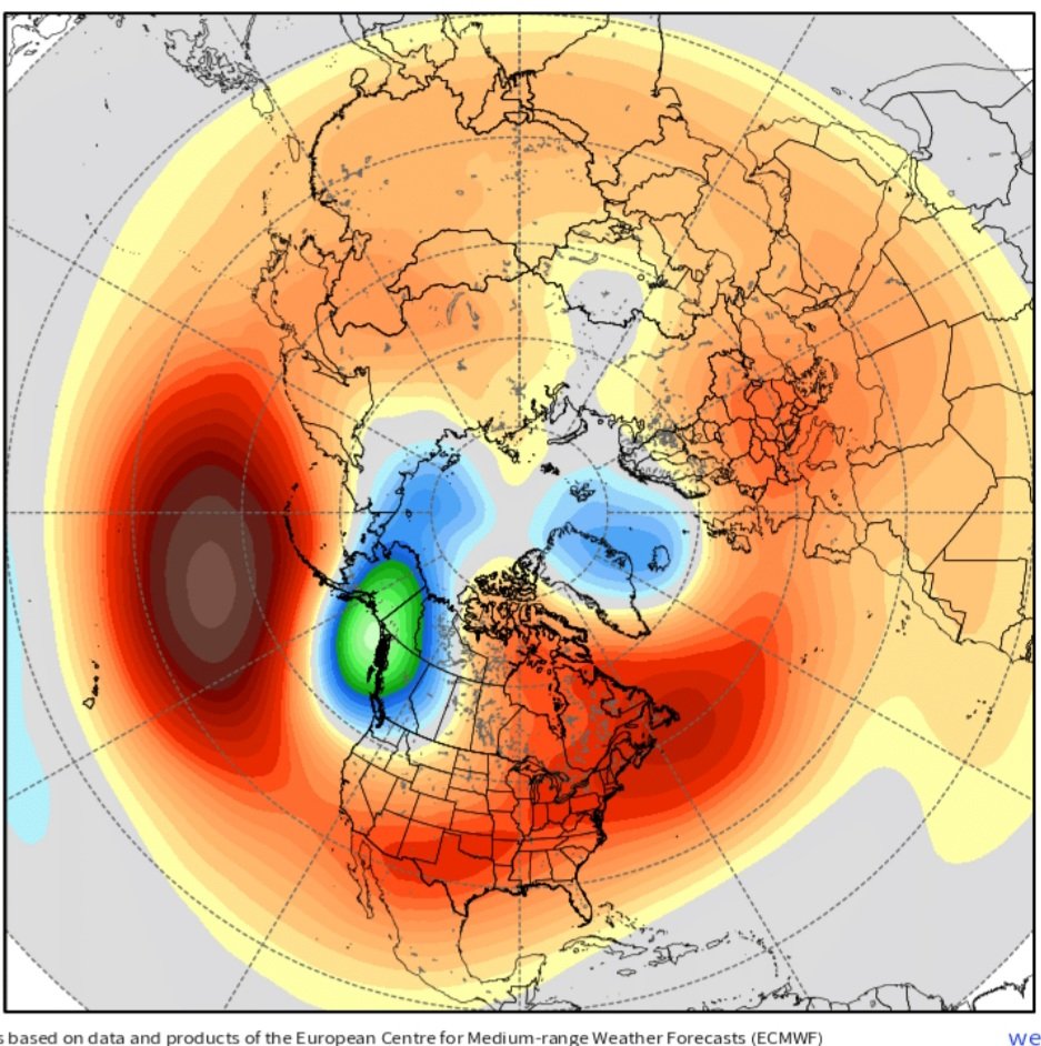
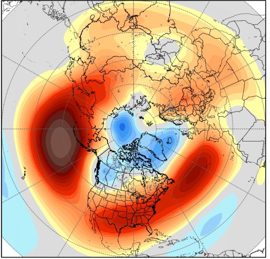
DEC...has a -NAO & might possibly squeeze a good storm or slop...if there is a temporary improvement out west not discernable in the means.
JAN

FEB
-
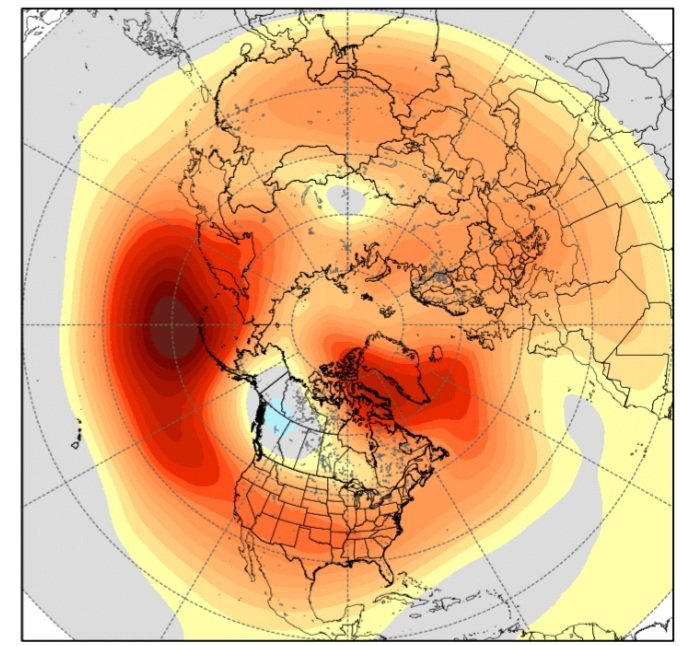
The culprit at this point is that most of the seasonal models keep indicating a very strong +AO/+NAO/+EPO & a -PNA. So if the models are wrong at this point just a little it will lead to a big bust. If they are correct it's going to mean a long and depressing Winter for Winter weather lovers.
Has the look of a very strong stratosphere ploar vortex. I'll be honest this would surprise me. It seems that most stratosphere experts believe that the record strong +IOD last winter was the lead culprit. IOD is negative for now & I dunno.
-
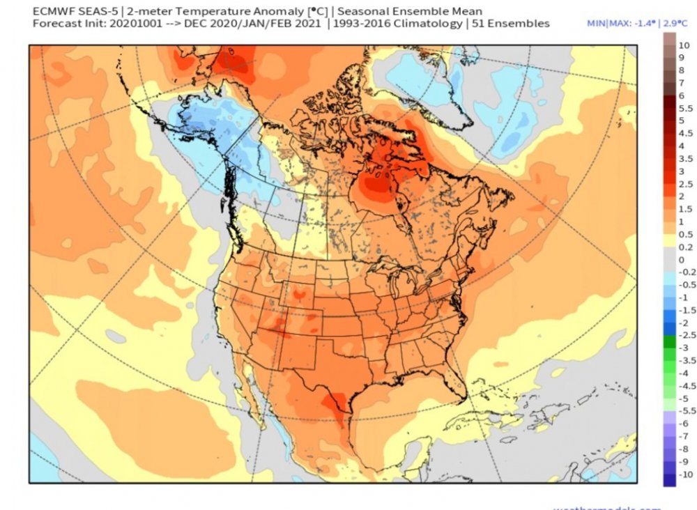
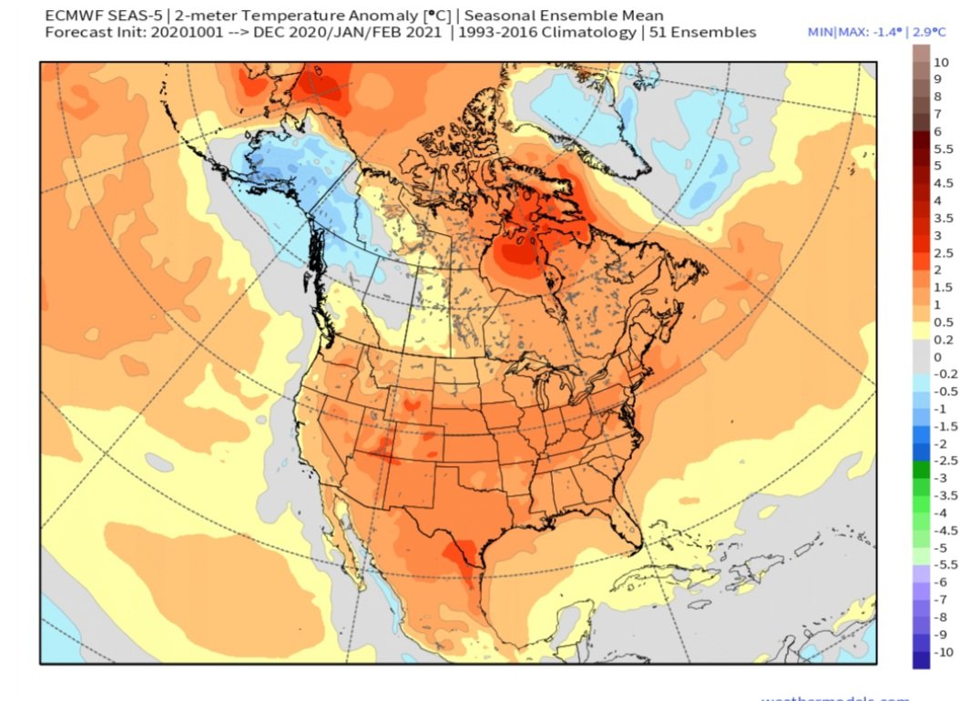
FWIW...European Seasonal model updated & its a complete blowtorch for the entire CONUS for the entire winter. Alaska & Grrenland is the only winter in all of N. America.
-
1
-
-
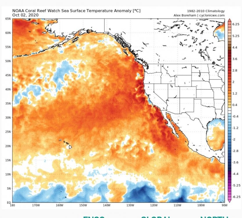
33 minutes ago, ORH_wxman said:
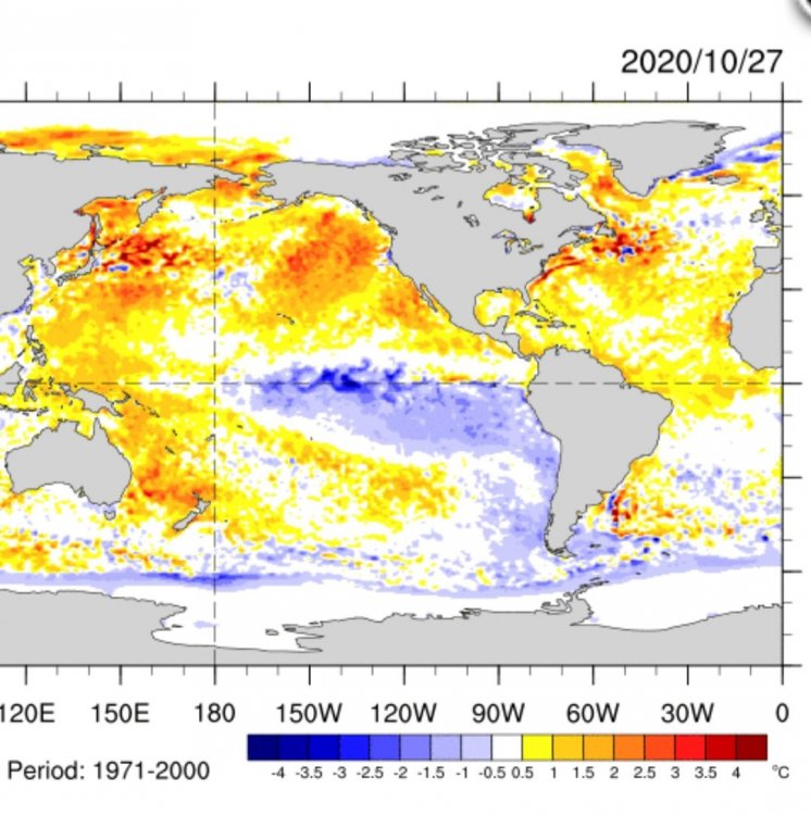
Yeah and Sept might still be neg too...but the last week or two has def trended strongly toward positive....I had posted the SSTA map yesterday or the day before. We'll see if it reverses again...I'd expect it to, but no guarantees.
Current SST anomalies...certainly +PDO.
Last 15 days...increasing +PDO.
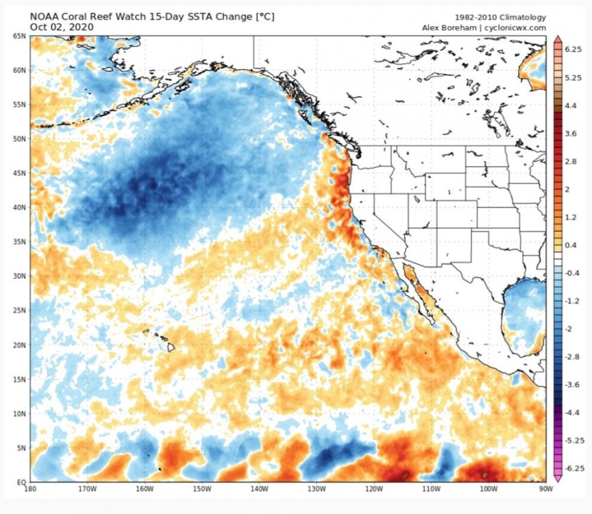
Although I 100% agree with your statement hat it can quickly change & especially during fall seasons. So, thinking winter by looking at PDO in fall "can" certainly backfire.
-
39 minutes ago, ORH_wxman said:
I’ve always thought there was pretty compelling evidence that the 134F wasn’t real.
Its a much tougher case to say for sure it was under 130F, but I don’t think questioning the 134F is that nefarious.
So, let's say it was 132. Who knows maybe it was 135. I still think the driving force is just to think "that just can't happen", so let's investigate a reason to show how bad they missed it. Lets do away with the record.
So, let's question the 100 degree temp in Alaska in 1915 also.
-
On 8/19/2020 at 2:39 PM, bdgwx said:
Probably. Yes. There is an incredibly detailed and lengthy write up by William Reid and Christopher Burt regarding the matter. The investigation is still on-going, but unless something has changed it is my understanding that this will eventually be presented to the WMO for official review.
The following is a lengthy 8-part series summarizing the state of the investigation through March 2020 from William Reid.
http://stormbruiser.com/chase/2013/08/29/death-valleys-134f-record-temperature-study-part-one/
You can review a considerably more consolidated summary on Christopher Burt's blog.
Count me unimpressed. Revisionist history. Maybe they will figure out a clever way to say 100 years from how stupid we were & our temperature data was way off....lol. I mean...come on. This is about setting the stage for new records.
Climate change is real but I'm sorry I'm bothered by this.
-
On 8/17/2020 at 8:28 AM, LibertyBell said:
Chris, Death Valley recorded the first 130 degree temp in the shade in modern history......and if verified, it will be the first verified 130 degree temp ever recorded (all the ones before are being challenged because no other nearby location was nearly as hot.) While, at the same time, there was a unique severe thunderstorm and heavy rain going on in SF.......
Of course there's just no way they observed the correct record of 134 in 1913. Just has to be wrong...right?
-
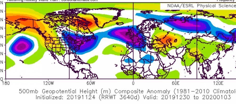
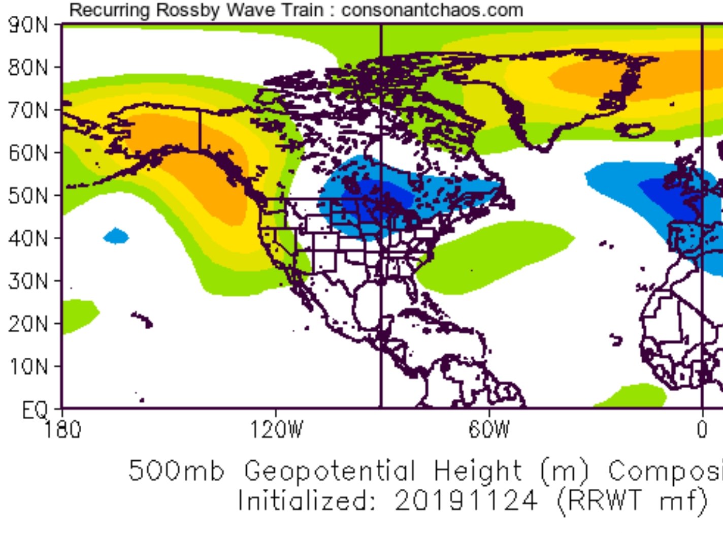
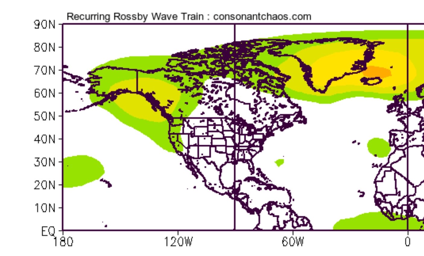
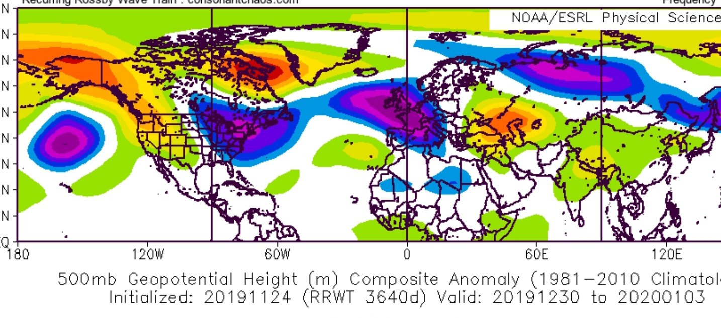
FWIW...something else to look at. Josh Herman initialized his RRWT model yesterday, which is based on reoccurring rosby wave train. It did well early last year until SSW shakeup, struggled after that.
30 days NOV 24-DEC24

90 days NOV 24-FEB22
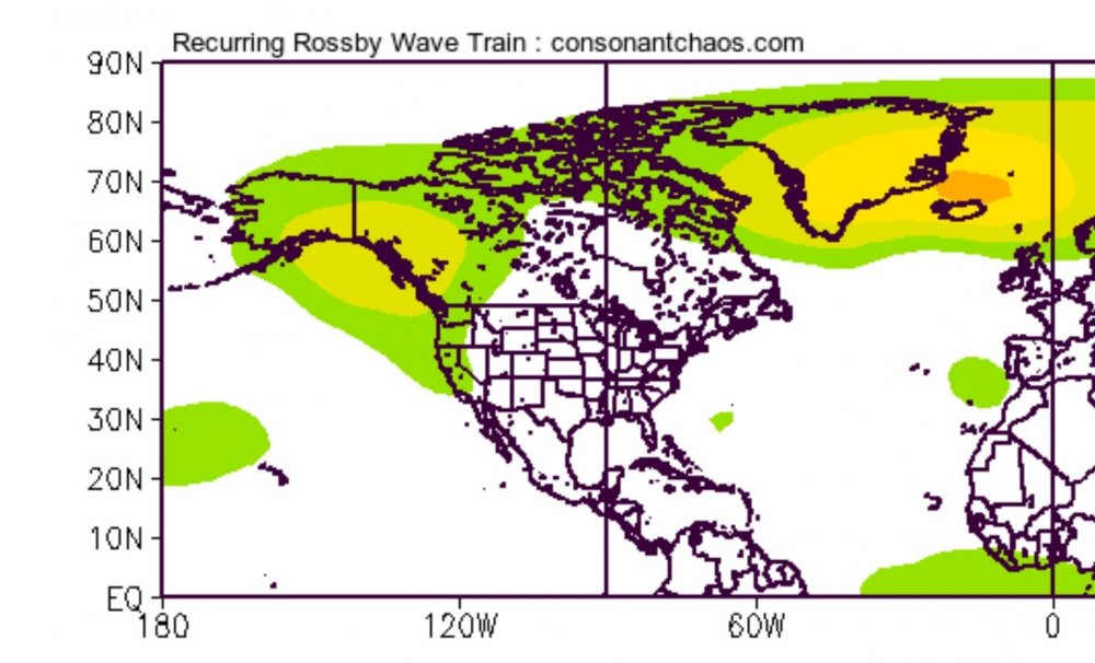
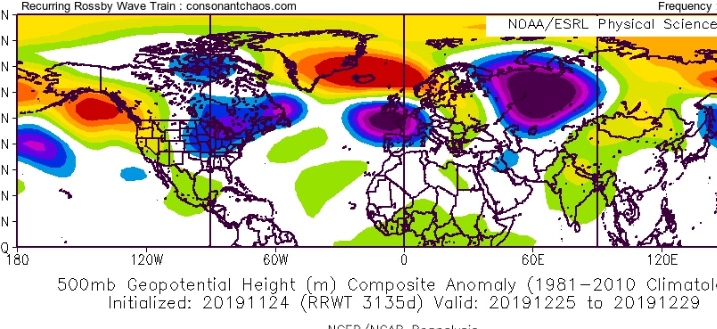
You East Coast folks will like the look 9f last week of DEC & beginning of JAN
DEC 25-29
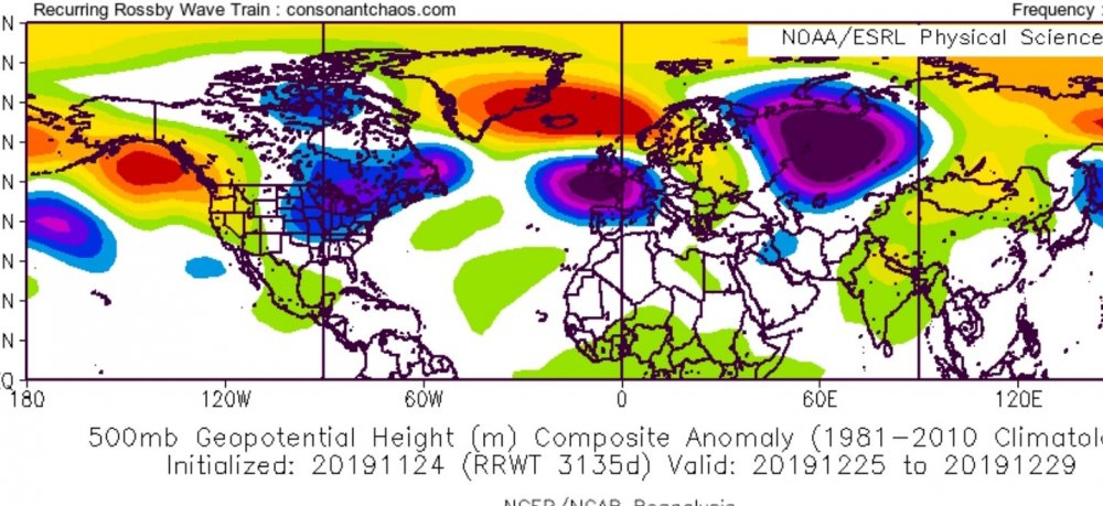
DEC 30-JAN 3
-
-
Great forecast & method!
-
1
-
-
On 9/30/2019 at 7:09 AM, donsutherland1 said:
At least some research shows that at least parts of the Arctic today are the warmest in at least the last 44,000 years.
https://agupubs.onlinelibrary.wiley.com/doi/full/10.1002/2013GL057188
I do not have a dog in this fight. Firm believer in AGW...however, the history of Arctic temps is a moving target.
-
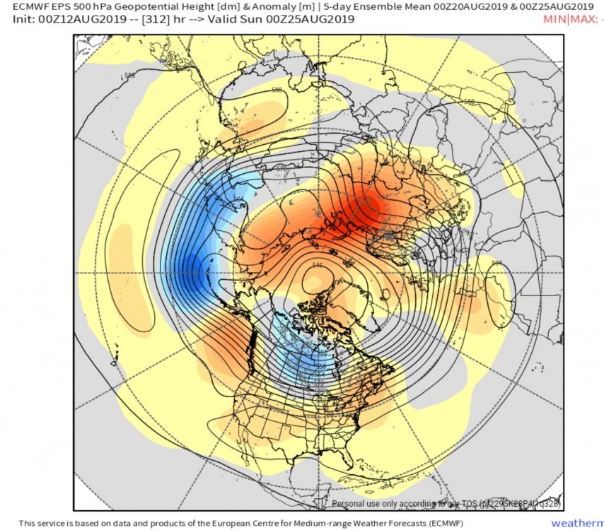
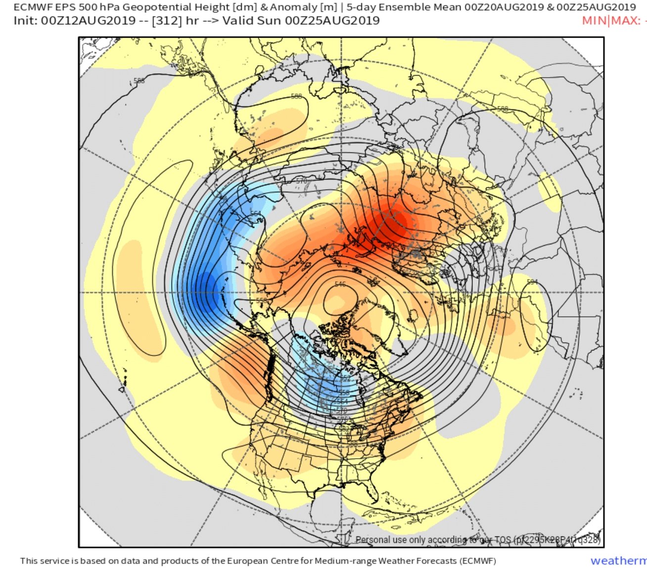
If the Euro Weeklies are correct a new minimum is inevitable. Big signal for dipole pattern continuing throughout August
This is day 8-13, 5 day average. That's a strong signal for 8-13 day, 5-day average
-
1 hour ago, ORH_wxman said:
He's prob talking about the southern route. The deeper main channel northern route never opened this year.
In his defense...that is not how the media reported it. Big headlines & the words unprecedented used. I looked at the satellite data & thought "What the heck?", it's not open.
-
1 hour ago, Sundog said:
I would be more impressed with early minimums decades ago when the ice was much more widespread and therefore had more vulnerable ice to give back.
Getting an early minimum when all the easy ice is already melted and all we have is a compact core left is not as impressive, it's almost expected.
What is impressive is how we continue to shed ice most years despite losing all the vulnerable ice well before the end of the season. Shows you how pathetic the cryosphere has been over the last 15 years.
Lol...ok
-
On 6/26/2017 at 2:29 PM, forkyfork said:
it says a lot about the state of the ice that mundane melt weather could still bring a top 5 low finish
Actually...to me it's pretty remarkable we don't beat 2012 considering where we started.


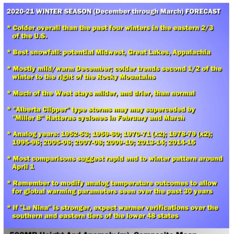
Winter 2020-2021
in New England
Posted
Thanks for sharing Tom. Good luck but I hope you're off your game this year. It is 2020 after all.