hawkeye_wx
-
Posts
6,582 -
Joined
-
Last visited
1 Follower

About hawkeye_wx

- Birthday 10/10/1974
Recent Profile Visitors
10,031 profile views


-
The temp has soared way past the NWS forecast. Last night DVN said 55º, then this morning 60º, then at midday 63º. It is now 68º and still rising.
-
I took ~90 measurements in a grid across my backyard and came up with 3.0", which seems about right considering the drifts and scoured areas. The gauge caught 0.40", which means the ratio is terrible, as it always is when the wind is strong. The kuchera map predicted a ratio well above 10. This stuff was a major pain to clean up. It's dense, with a layer of either wet snow or ice on the bottom.
-
My NWS forecast says 3-7", but as the models have continued to inch eastward, I am only expecting 2-3 inches now.
-
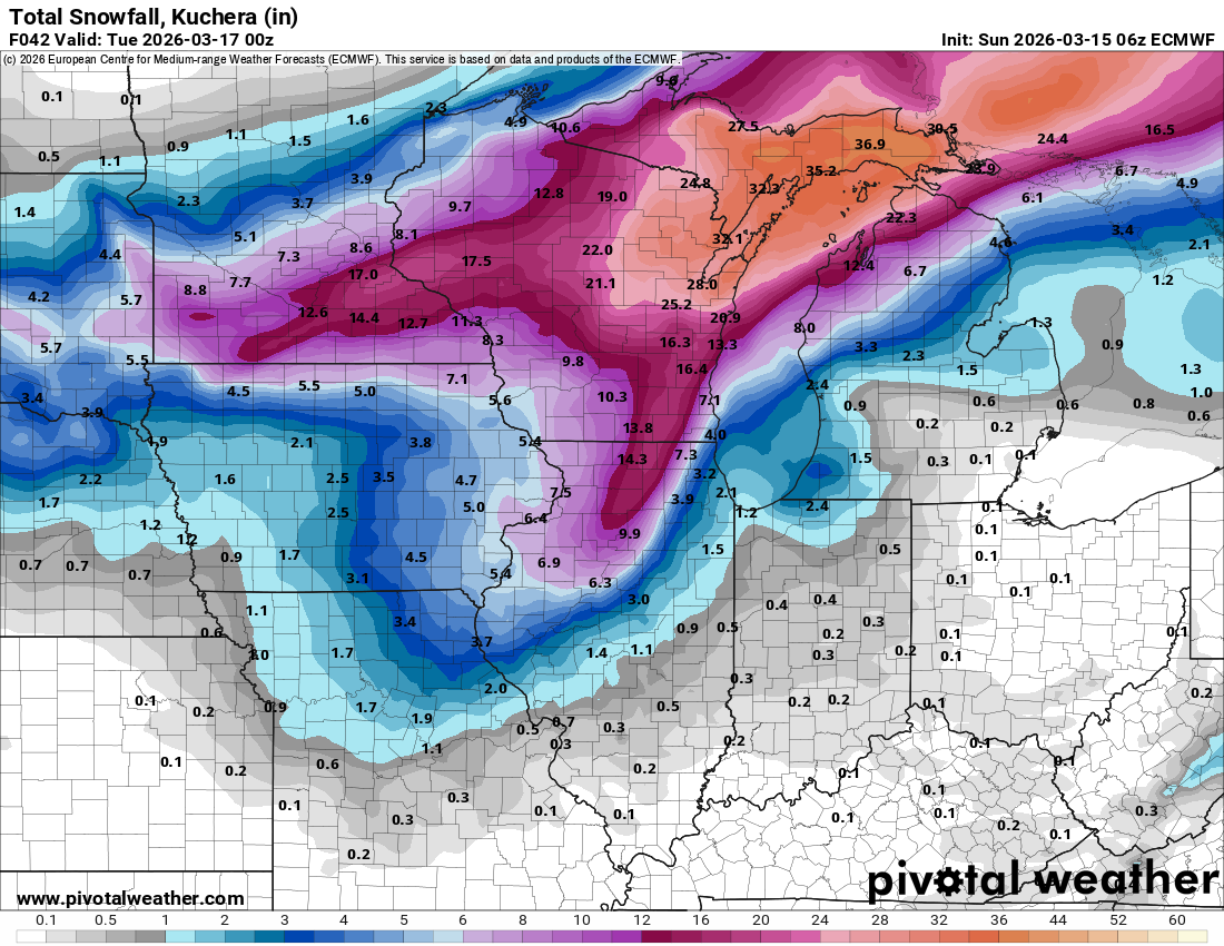
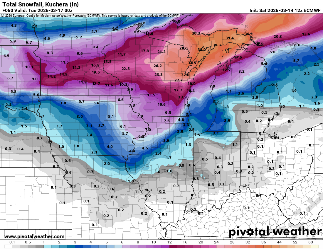
06z Euro is southeast with the heavy secondary defo band
-
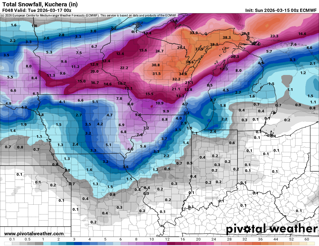
00z Euro - ratio will probably be lower due to wind
-
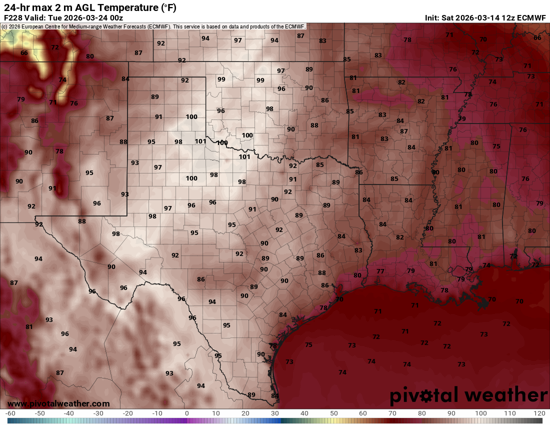
March 23rd on the Euro
-
DVN issued a blizzard warning for their entire area. The snow forecast is 4-8", which seems a bit high, plus wind up to 60 mph.
-
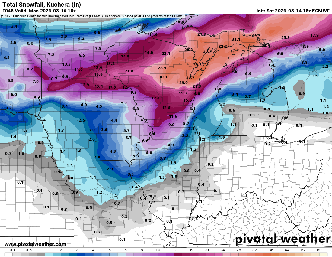
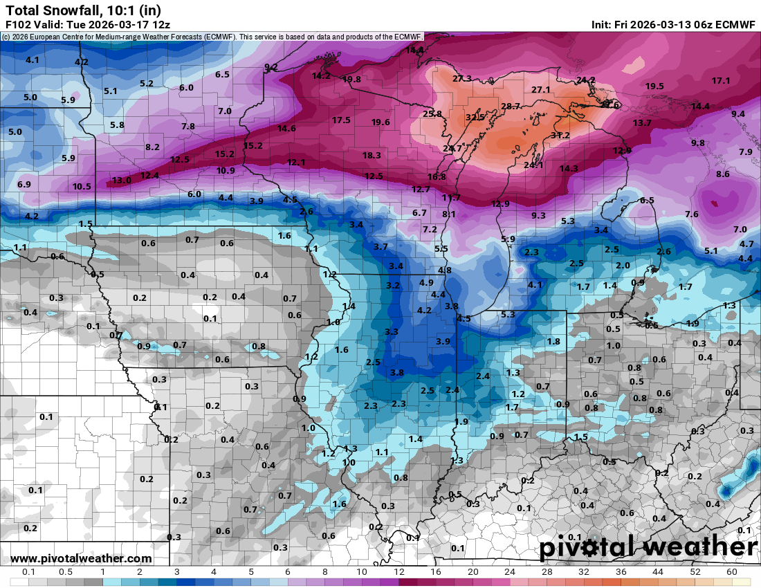
The 12z Euro bumped up the defo zone and is the most robust of the models.

-

Winter 2025-26 Medium/Long Range Discussion
hawkeye_wx replied to michsnowfreak's topic in Lakes/Ohio Valley
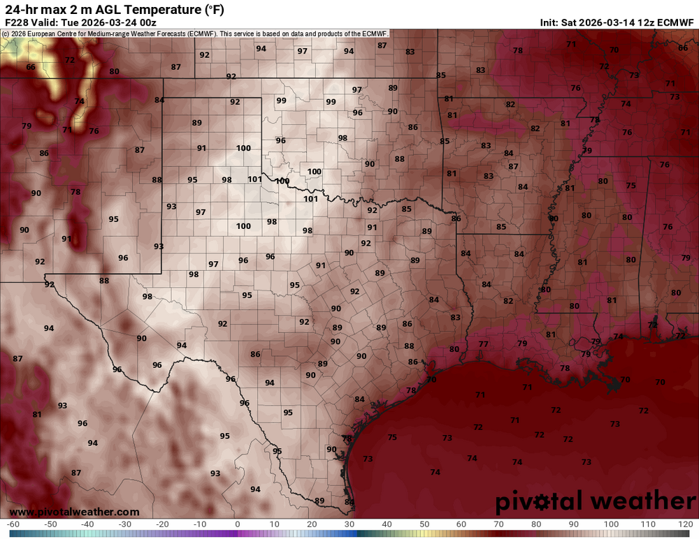
The Euro has low teens across Iowa Monday afternoon, then 70s by Thursday and 80s Friday. -
The 12z Euro is a big shift back west with the secondary defo band. The previous two runs had almost nothing in eastern Iowa.

-
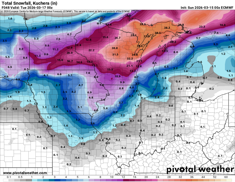
Oddly, I just read the DVN discussion and it talks about a winter storm watch for heavy deformation zone snow, with zero mention of the bone-dry Euro. Other non-GFS models are also trending toward the Euro, so I think DVN will have to start walking back the snow talk.
-
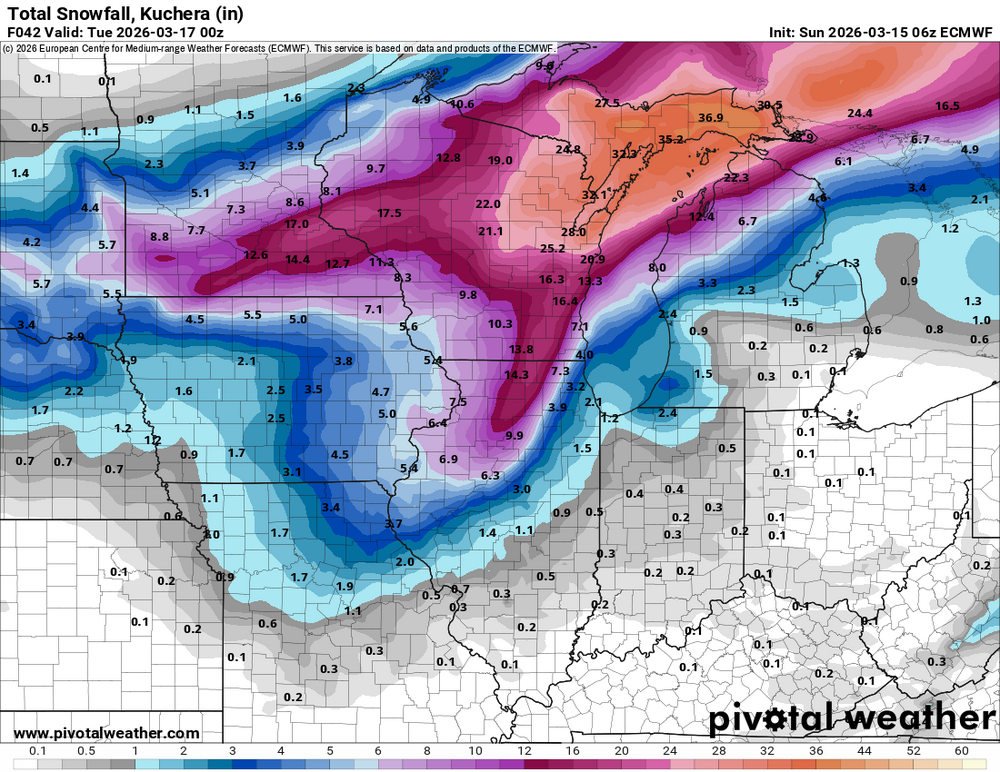
The Euro continues to trend in the wrong direction for Iowa. At this point it's non-event except for wind. It barely has a flake of snow falling anywhere in the state. I'm expecting the GFS to cave soon.
-
The Euro is the most progressive of the models. It doesn't have much of anything for Iowa, rain or snow.