TellicoWx
-
Posts
2,632 -
Joined
-
Last visited
Content Type
Profiles
Blogs
Forums
American Weather
Media Demo
Store
Gallery
Everything posted by TellicoWx
-
Jan 30th-February 1st 2026 Arctic Blast/ULL Snow OBS Thread.
TellicoWx replied to John1122's topic in Tennessee Valley
Dont bother submitting your reports to MRX. They have 3" as the official report for Tellico. -
Jan 30th-February 1st 2026 Arctic Blast/ULL Snow OBS Thread.
TellicoWx replied to John1122's topic in Tennessee Valley
Western side around Indian Boundary/Rattlesnake Rock has to be getting blasted right now -
Jan 30th-February 1st 2026 Arctic Blast/ULL Snow OBS Thread.
TellicoWx replied to John1122's topic in Tennessee Valley
Talking to one of the older county plow drivers who just came off Coker Creek. Last time he remembers it snowing that hard up there was '93. -
Jan 30th-February 1st 2026 Arctic Blast/ULL Snow OBS Thread.
TellicoWx replied to John1122's topic in Tennessee Valley
Definitely a snowband feeding off Tellico Lake/River...rates will back off a few mins, but pick right back up. Still heavy snow falling. -
Jan 30th-February 1st 2026 Arctic Blast/ULL Snow OBS Thread.
TellicoWx replied to John1122's topic in Tennessee Valley
Starting to see posts/videos from Coker Creek area of near whiteout conditions. Almost all of them are saying they got 2-3" in last 30 mins. -
Jan 30th-February 1st 2026 Arctic Blast/ULL Snow OBS Thread.
TellicoWx replied to John1122's topic in Tennessee Valley
Looking at the radar (hard to tell), can almost see what looks like a faint streamer coming off the river close to Lenior City, feeding toward Tellico area. -
Jan 30th-February 1st 2026 Arctic Blast/ULL Snow OBS Thread.
TellicoWx replied to John1122's topic in Tennessee Valley
You got sunshine there? -
Jan 30th-February 1st 2026 Arctic Blast/ULL Snow OBS Thread.
TellicoWx replied to John1122's topic in Tennessee Valley
That's way whole event had been here, was like someone flipped a switch -
Jan 30th-February 1st 2026 Arctic Blast/ULL Snow OBS Thread.
TellicoWx replied to John1122's topic in Tennessee Valley
8"...added 2" in last hour, and its still pouring. Just saw measurement from Madisonville 9" -
Jan 30th-February 1st 2026 Arctic Blast/ULL Snow OBS Thread.
TellicoWx replied to John1122's topic in Tennessee Valley
Easily 2-3" per hr snow rates right now -
Jan 30th-February 1st 2026 Arctic Blast/ULL Snow OBS Thread.
TellicoWx replied to John1122's topic in Tennessee Valley
There's a hill there somewhere..radar has nothing on it here. All the tire tracks on the road are now covered back up.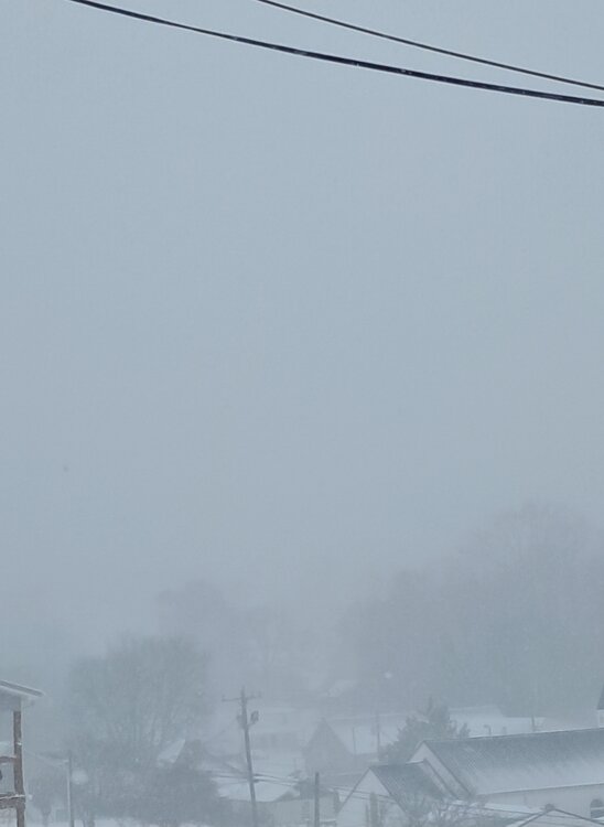
-
Jan 30th-February 1st 2026 Arctic Blast/ULL Snow OBS Thread.
TellicoWx replied to John1122's topic in Tennessee Valley
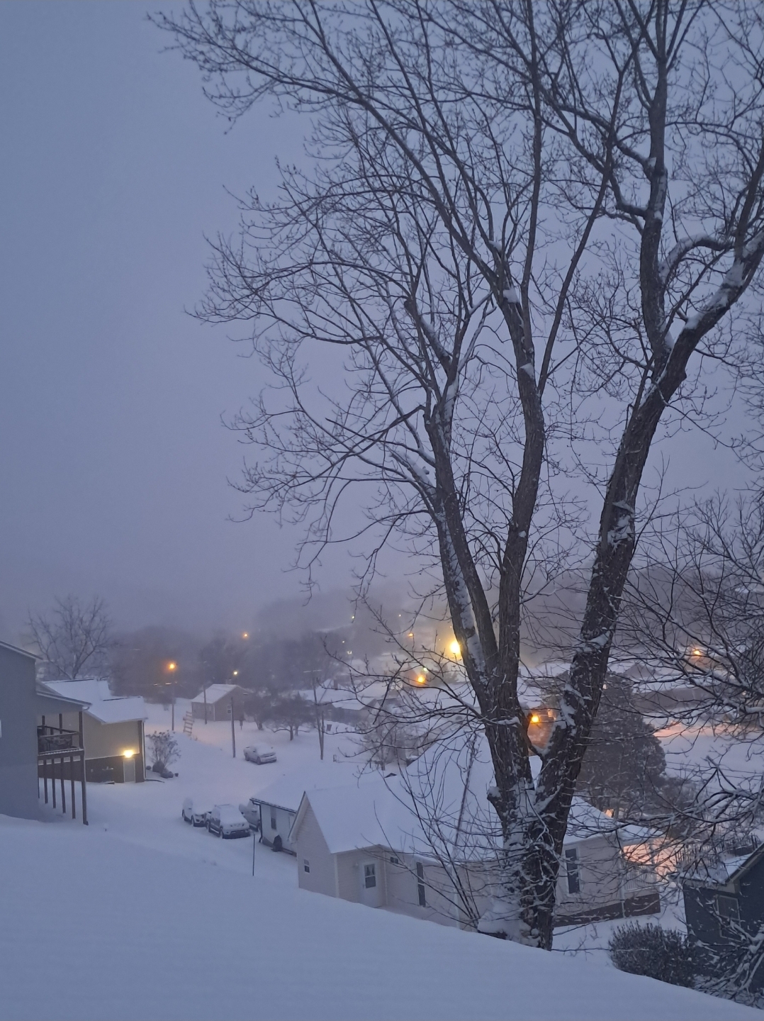
Hard to get on camera and it doesn't do justice to how dark it has got here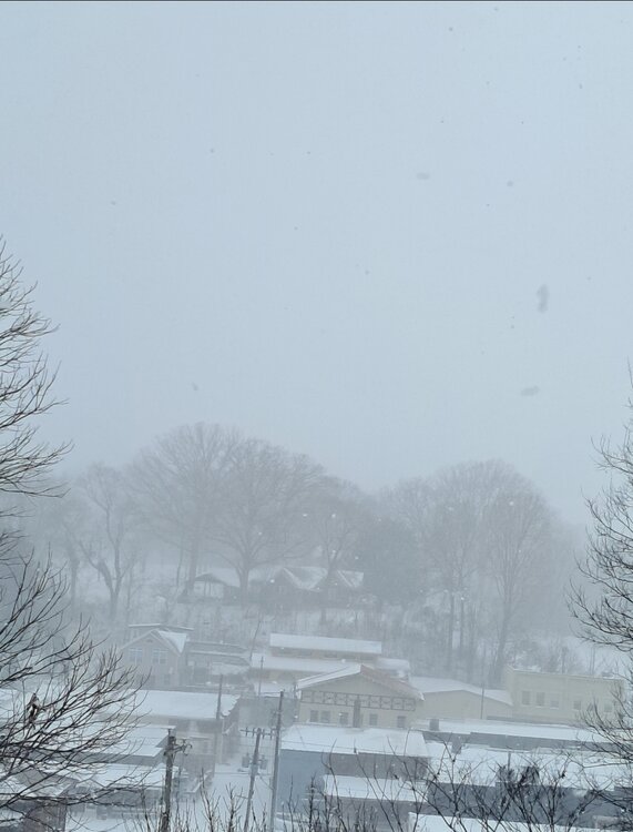
-
Jan 30th-February 1st 2026 Arctic Blast/ULL Snow OBS Thread.
TellicoWx replied to John1122's topic in Tennessee Valley
I'm actually at a loss for words...the smallest flakes are size of goose feathers. Never seen snowflakes this large in my life. -
Jan 30th-February 1st 2026 Arctic Blast/ULL Snow OBS Thread.
TellicoWx replied to John1122's topic in Tennessee Valley
My sister had drove her boys up to go sledding..they just made it back home. Said they barely made it back in 4x4 and snow drifing from the heavy rates and wind, was about 6-12" in parts of the road. She lives on one of the ridgelines outside town about 3 miles. -
Jan 30th-February 1st 2026 Arctic Blast/ULL Snow OBS Thread.
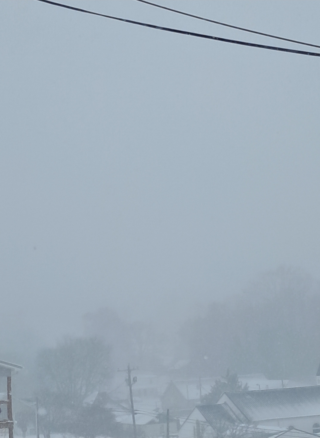
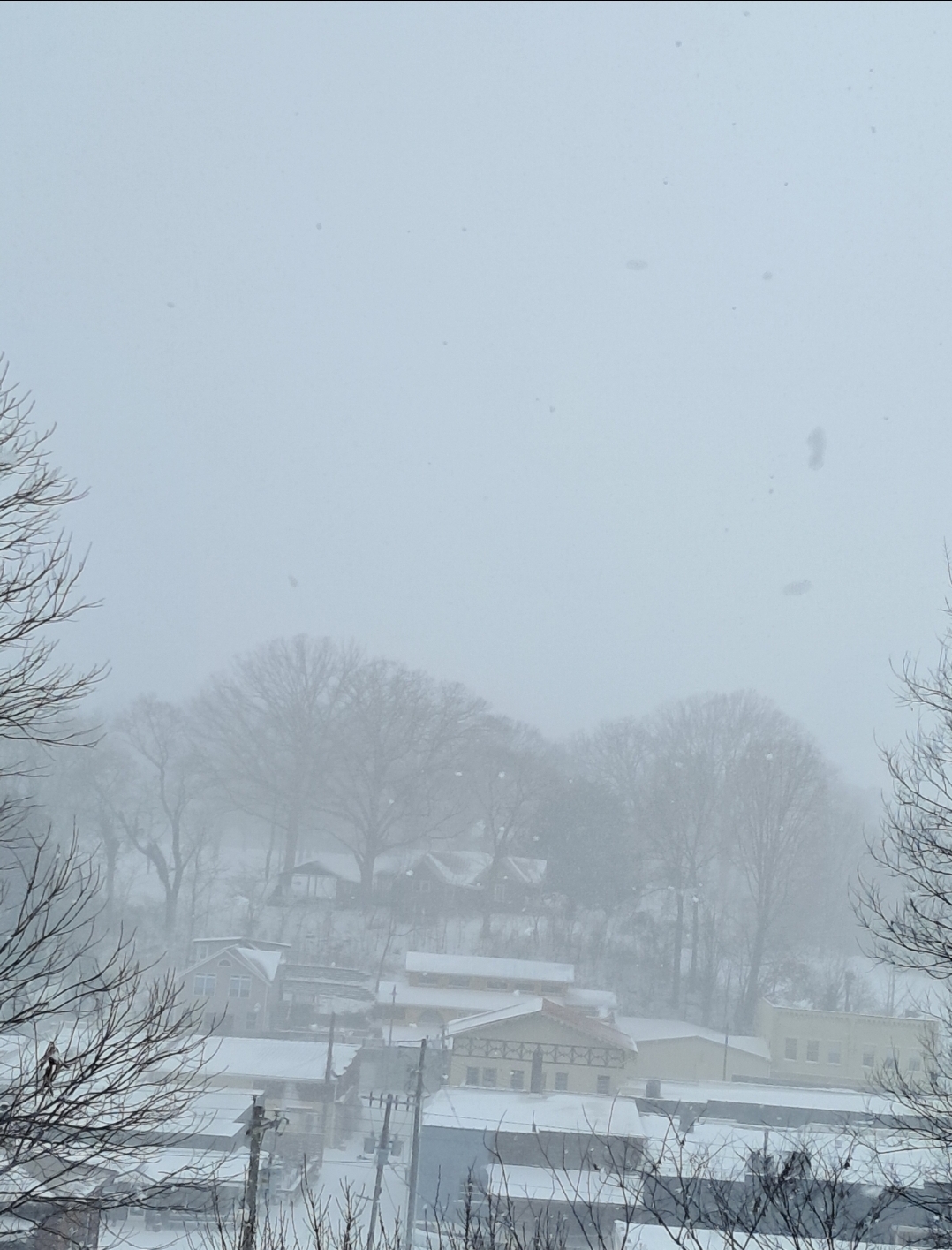
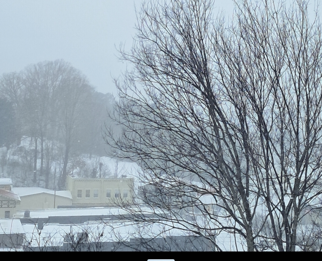
TellicoWx replied to John1122's topic in Tennessee Valley
Camera sees a little better...that's hill to hill in town square ( about 250 yards or so)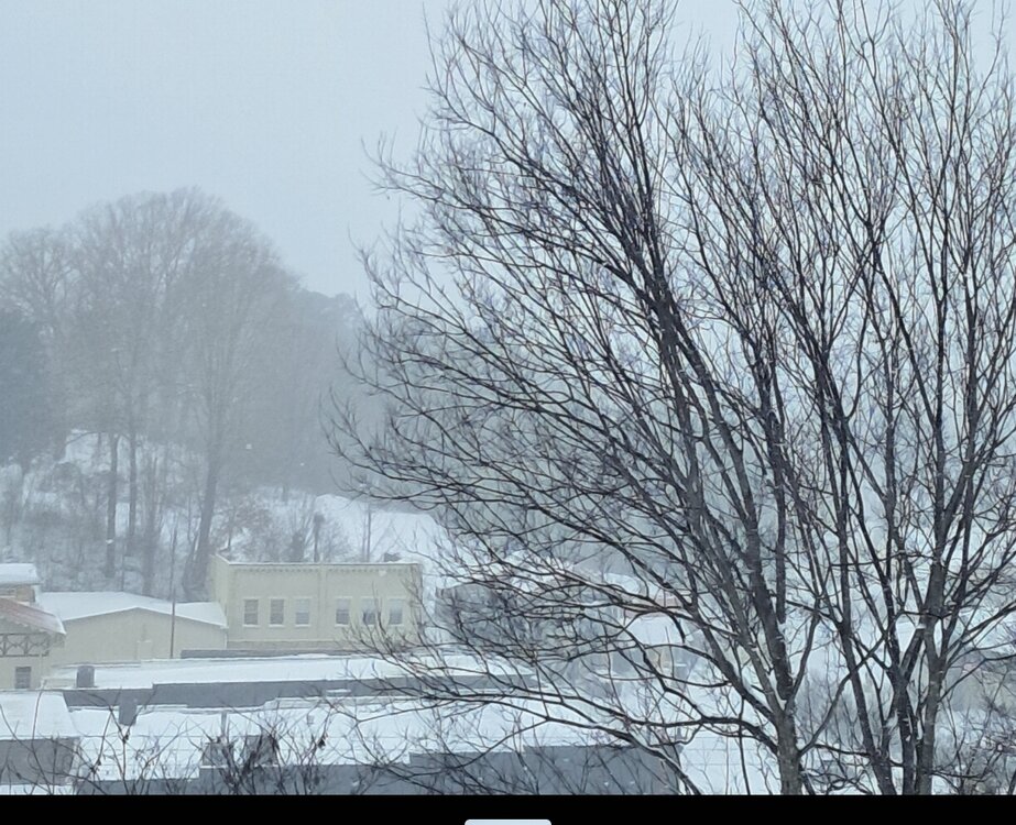
-
Jan 30th-February 1st 2026 Arctic Blast/ULL Snow OBS Thread.
TellicoWx replied to John1122's topic in Tennessee Valley
Near whiteout conditions here now...visibility less than 500 yards -
Jan 30th-February 1st 2026 Arctic Blast/ULL Snow OBS Thread.
TellicoWx replied to John1122's topic in Tennessee Valley
Soundings showed the possibility of this going on thru the night, but models didn't have any lift to put anything down on snow maps (that was when i was looking pre event). Haven't checked them since event started. -
Jan 30th-February 1st 2026 Arctic Blast/ULL Snow OBS Thread.
TellicoWx replied to John1122's topic in Tennessee Valley
Biggest flakes of the day starting to fall here -
Jan 30th-February 1st 2026 Arctic Blast/ULL Snow OBS Thread.
TellicoWx replied to John1122's topic in Tennessee Valley
Starting to pick back up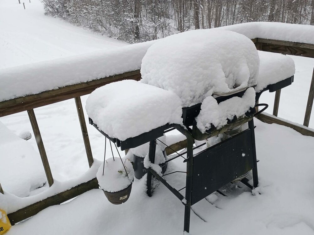
-
Jan 30th-February 1st 2026 Arctic Blast/ULL Snow OBS Thread.
TellicoWx replied to John1122's topic in Tennessee Valley
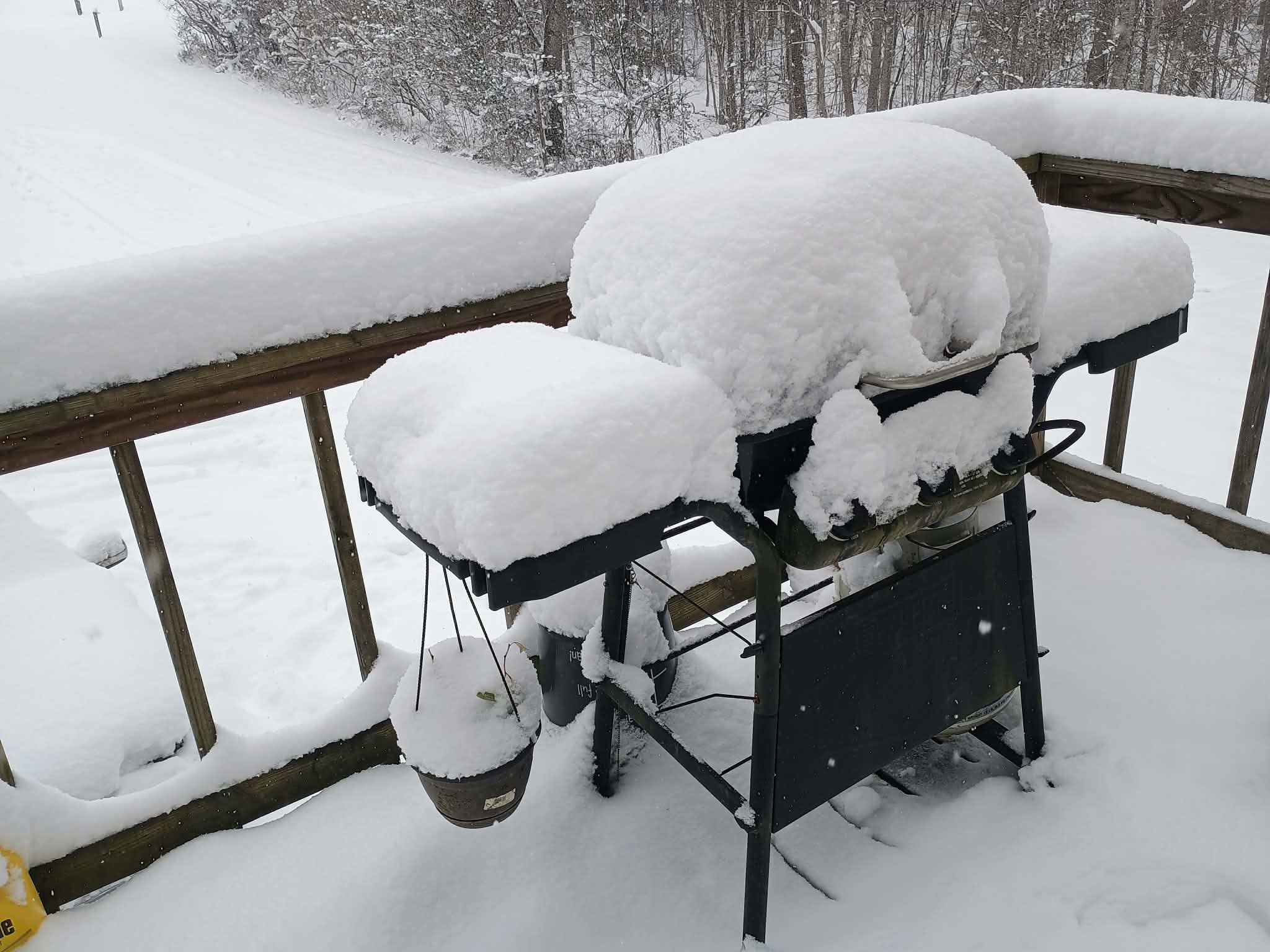
Went around town to get some different measurements..6-7", but Mt. Vernon area between Tellico and Madisonville alot of reports 8-10" (slightly more elevated there vs town). Still have light/moderate snow falling. -
Jan 30th-February 1st 2026 Arctic Blast/ULL Snow OBS Thread.
TellicoWx replied to John1122's topic in Tennessee Valley
Same here with the drifting..still got moderate snow falling. My best guess is 5-6" here. -
Jan 30th-February 1st 2026 Arctic Blast/ULL Snow OBS Thread.
TellicoWx replied to John1122's topic in Tennessee Valley
Visibility down to about 1/4 mile and HRRR/RAP still showing another 4-6" to go...havent went out yet.
-
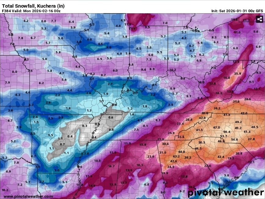
0% chance of happening but that 0z GFS full OP run was insane. If cold is in place, looks to be a very active southern jet in place. Pic for insanity purposes lol
-
Jan 30th-February 1st 2026 Arctic Blast/ULL Snow OBS Thread.
TellicoWx replied to John1122's topic in Tennessee Valley
Hopefully, it will improve here (have a bad feeling it won't tho), stopped for awhile now, dusting blowed off, and bare ground. -
Jan 30th-February 1st 2026 Arctic Blast/ULL Snow OBS Thread.
TellicoWx replied to John1122's topic in Tennessee Valley
Yeah the gradient is gonna be rough according to the models (and what has me nervous about this system) any wobbling can have big impacts here