

FXWX
-
Posts
838 -
Joined
-
Last visited
Content Type
Profiles
Blogs
Forums
American Weather
Media Demo
Store
Gallery
Posts posted by FXWX
-
-
19 minutes ago, tunafish said:
Just got an email from our super - they will not be cancelling school. Discussed with surrounding superintendents and all are not cancelling. South Portland & Portland have a ton of walkers, so I can understand it for the more suburban communities, but for PWM that makes no sense.
Agree
-
 1
1
-
-
5 minutes ago, ORH_wxman said:
If you don't cancel for this type of cold, then you will never cancel for any type of cold. It really doesn't get much worse than this from a historical perspective. But yeah, the morning not being as bad as afternoon/early evening might fool administrators into thinking it's not that bad.
Down here, the timing is late enough I could see them having school...but anyone north into CNE/NNE, it gets bad pretty quickly on Friday.
I deal with lots of CT districts and the morning numbers Friday are driving the decision not to cancel. I think across northern New England it should be an easy cancelation call. As for the afternoon period, unless they have lots of walkers the concern is not high. But there are some large city districts that are contemplating it given the number of walkers. The afternoon bus deal is a drop off and quick short walk into your house or a waiting car. Mornings that feature kids standing around for a bus to arrive is are different story. If Saturday was a school day, lots of delays and closures would be in play for CT.
-
2
-
-
1 hour ago, 40/70 Benchmark said:
Tough to wrap your mind around just how insane the positive temp anomaly was for January.
It has been stated a few times already, but it was just a constant mild day after mild day setup. Nothing excessively warm, but always above normal. Many Januarys feature a thaw period with max temps that beat anything we saw this past January. BDL has a top January 2023 temp of 56... Most good old fashioned January thaws would beat that...
-
3
-
-
8 minutes ago, STILL N OF PIKE said:
Looking forward to the mass schools canceling Friday - I’m guessing it’ll happen
At least in CT, my advice has been no need for cancelling or delaying. Friday will start out a a pretty "normal" bitter cold morning with temps in the teens so there is no need delay. In a normal winter we would usually experience quite a few mornings like Friday. There should be no concern for buses not starting. Also the vast majority of students do not walk so the potential for any widespread issues after school during the afternoon as the temps fall and wind chills ramp is limited. Email Notices always go out about proper clothing for families with walkers. If Saturday was a school day there would likely be consideration for delays. Unless we are dealing with a true Wind Chill Warning with chill numbers minus 20 or lower cancellations are hard to sell...
-
3
-
-
59 minutes ago, Ginx snewx said:
2 years ago today. We need another one of these

Here's my street after that storm...

-
6
-
-
3 minutes ago, The 4 Seasons said:
Any final snow totals for CT, big or small, a couple or nothing, trace or a tenth, ill take em TIA
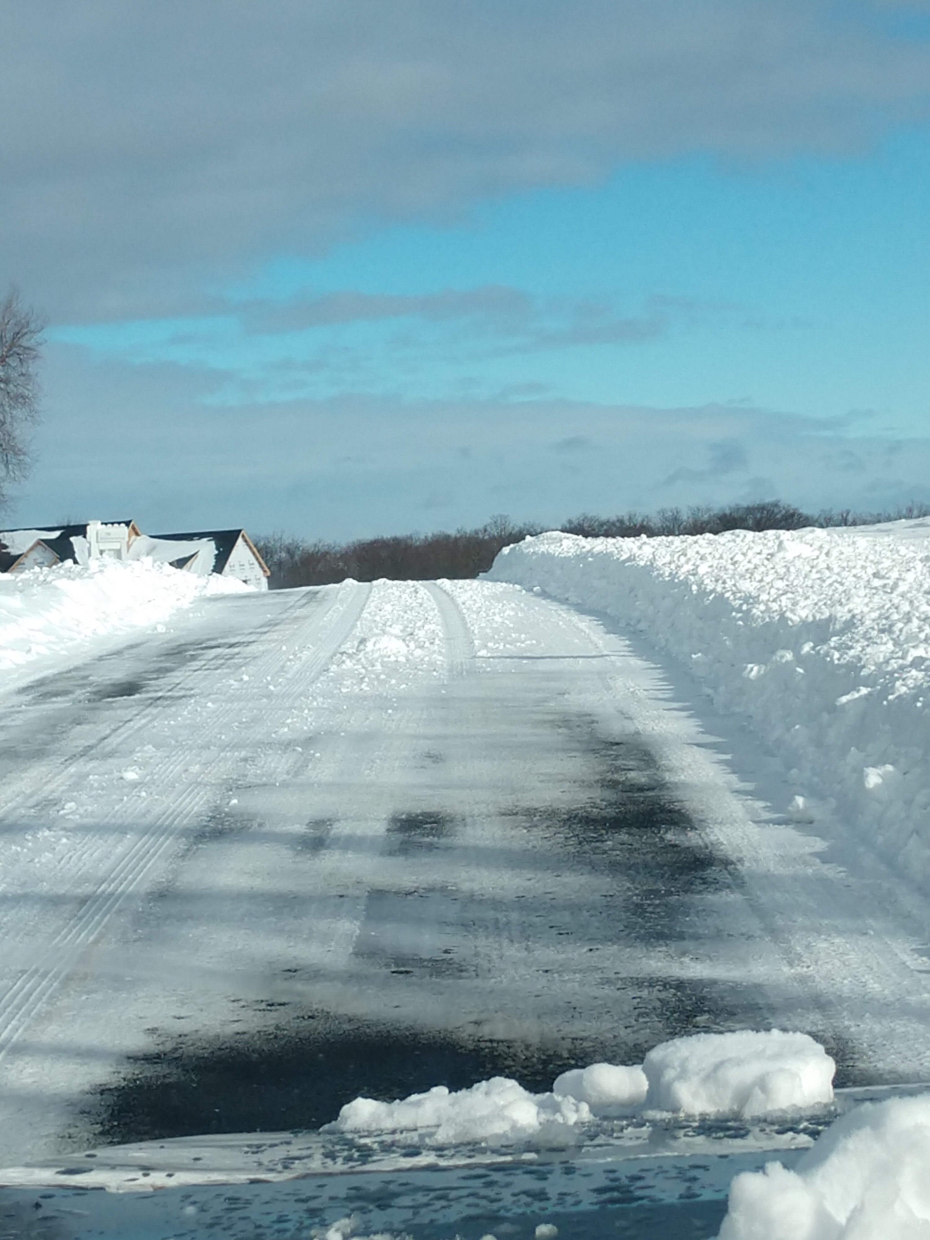
3.0 here in Burlington at ~1,100 ft
-
 1
1
-
-
33 here at 1100 ft in Burlington; roads covered...
-
3
-
-
25 minutes ago, TalcottWx said:
This wasn't issued until early this morning:
URGENT - WINTER WEATHER MESSAGE
National Weather Service Boston/Norton MA
337 AM EST Mon Jan 23 2023CTZ002-232145-
/O.EXB.KBOX.WW.Y.0005.000000T0000Z-230123T2200Z/
Hartford CT-
Including the cities of Hartford and Windsor Locks
337 AM EST Mon Jan 23 2023...WINTER WEATHER ADVISORY IN EFFECT UNTIL 5 PM EST THIS
AFTERNOON...* WHAT...Rain changing to snow late this morning and continuing
into the afternoon, with accumulations of 1 to 4 inches, highest
totals across northwest Hartford county, in the hilly terrain.* WHERE...Hartford County.
* WHEN...Until 5 PM EST this afternoon.
* IMPACTS...Plan on slippery road conditions. The hazardous
conditions could impact the morning or evening commute.PRECAUTIONARY/PREPAREDNESS ACTIONS...
Slow down and use caution while traveling.
Some Litchfield County districts have decided to close given uncertainty about trying to have early dismissals during the transition period, as well as the most active snow period. Local DPW crews want no part of trying to work around bus routes during late morning to mid-afternoon period. Many times it is not about how much is going to fall; almost always about timing.
-
1
-
-
10 minutes ago, Damage In Tolland said:
The Blue could certainly be an issue lol.
I think all your points are correct and throw in there was zero mention of freezing rain in any local, media , or NWS outlet last night that no one had any idea. Even me the weenie had no idea until I stepped outside to run. This was a recipe for disaster .Variety of items are allowing or allowed this to occur; moist / damp near surface air layer; no meaningful drying late yesterday or overnight; apparent condensation frost / dew on some roads; hard to detect drizzle / light rain producing processes and borderline cold road surfaces? Tremendous variations in road surfaces across relatively short distances which gave many drivers a false sense of security... Last night's RGEM did suggest some possible troubles, but had literally no other model support...
-
1
-
-
5 hours ago, ORH_wxman said:
Yeah I’m just going to start aggressively moving the whining posts to the panic room thread.
There’s actually some events to track now and even though many don’t care about an inland icing threat or marginal snow threat, some still do so the whiners/don’t carers can exit this thread or we will do it for them.
A positive move... as I stated earlier, I'm a very minor poster and not trying to tell anybody how to run a forum. But there is often wonderful insight from some posters, both mets and hobbyists, that can and often does get lost in overwhelming number of meaningless posts. If folks want to moan and whine that is fine with me, but it should stay out of the main threads, at least not to the degree it currently is... I'm not a kill joy either and there is room for some snarky back and forth, but it appears to be dominating what I consider the main threads...
-
3
-
1
-
-
2 hours ago, ORH_wxman said:
I’m not sure I’ve ever seen the whining reach this level. Not in 2013, not in 2015 and not in the horrific Jan/Feb/Mar 2020 stretch.
It’s gotten embarrassing.
Agree Will... I'm in no way a significant poster on here, so maybe I shouldn't comment, but it is becoming unreadable. The # of constructive post v the # of whinning, non meteorology post has become stunning. Maybe each thread should have 2 sections; a serious section and non serious / bullshit section. Scrolling through a threat looking for serious posts has gotten tedious...
-
6
-
5
-
-
Just now, FXWX said:
While many, if most, on here try to make SNE winter climate something it never or rarely was/is, your post is spot on!!! So many live in a fancy SNE winterland... When one of those relatively rare long pack winters come along, it skews some brains into thinking they should be or ever were common.
"Fantasy"
-
31 minutes ago, ORH_wxman said:
You need to be in CAD land to have a realistic shot at a “wire to wire” winter for snow pack (I’ll define wire to wire as continuous pack or at least nearly continuous.) Only a small part of SNE really gets into that zone…I’d call it N ORH county mainly near and N of rt 2. My old stomping grounds on winter hill was on the edge of that zone but definitely not quite as good. The other area that is in that zone is the east slope of Berkshires and maybe including down into Hippy’s area. East slope above like 1600 feet is prob in a separate category themselves.
The rest of interior SNE can sort of fake it for 3-4 week stretches outside of those truly special winters. Places like BOS maybe get something semi-close to wire to wire once per 15 years or something.
While many, if most, on here try to make SNE winter climate something it never or rarely was/is, your post is spot on!!! So many live in a fancy SNE winterland... When one of those relatively rare long pack winters come along, it skews some brains into thinking they should be or ever were common.
-
19 minutes ago, HoarfrostHubb said:
3F here. I think my high was 54. Not bad
0.5 degrees here
-
1
-
-
4 minutes ago, Damage In Tolland said:
Now absolutely nothing to look forward to or track thru mid January. That to me is just depressing
I'll give through Jan 7... After that I expect a slow but steady transition into near normal conditions and becoming active heading into Jan 10-15 period.
-
3 minutes ago, ineedsnow said:
flash freeze will be a disaster I think with everyone out last minute shopping
Always stumps me why this has to be the case. The DOT / DPW crews have been alerted to this potential for days. The DPW crews I deal with are already to go with a treatment just prior to the temp collapse... Not too tough to time and be ahead of the situation... Just a lack of coordination with lots of town and state crews...
-
1
-
-
3 minutes ago, TalcottWx said:
The no flash freeze because it's windy idea seems comical now.
That would have been fine, but the rain and shower activity is lingering much longer than first anticipated. It appeared earlier that there would be several hours of mostly dry weather leading up to the cold surge. That is not going to be the case...
-
2 minutes ago, Damage In Tolland said:
Once the warm surge rushed in and convective rain showers developed, it was ball game over across CT...
-
1
-
-
Multiple trees down on Milford Rd, Burlington; Tree on house in New Hartford...
-
48 mph gusts in Burlington, CT; multiple power surges
-
5 minutes ago, UnitedWx said:
I just came down from north Canton/Granby and there's still 100 percent cover... for now
What a little elevation can do!
-
1
-
-
1 hour ago, Modfan2 said:
Grab it off twitter
Thx... Trying to find it on BOX home page... So far have no hit right tab...
-
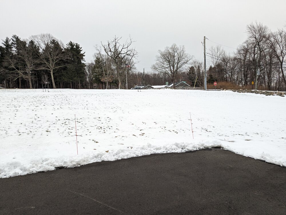
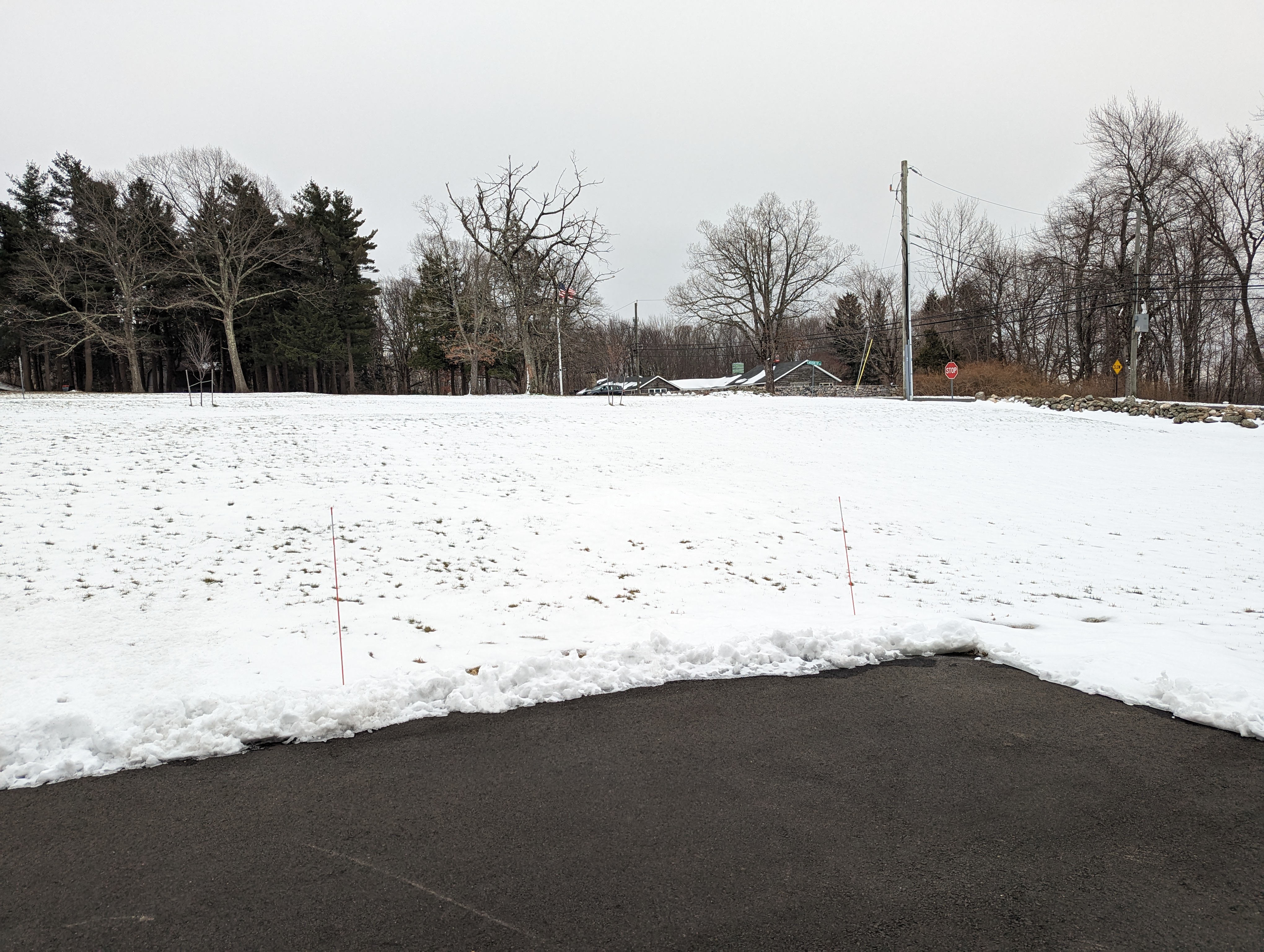
Snow cover hanging tough on Mountain Top Pass, Burlington, CT
-
2
-
-
15 minutes ago, CT Rain said:
Yeah could be impressive. Wave action on a southerly wind always creates more issues than you’d expect with a given tide level.
There are a couple of Fairfield County coastal school districts that have to alter some bus routes during events like this one...
-
1
-

The event of the season - 2 days of hell!
in New England
Posted
Agree... I would be recommending cancelations up north...