

mimillman
-
Posts
3,333 -
Joined
-
Last visited
Content Type
Profiles
Blogs
Forums
American Weather
Media Demo
Store
Gallery
Posts posted by mimillman
-
-
4 minutes ago, zinski1990 said:
They look better than last night. I get The mid range gfs op gaffes that always happens. The NAM in long range lol we all know it was comical. EURO and Canadian I think have been most consistent models.
The Euro took a huge move south at 00z and the GGEM has been all over the place. I wouldn’t call that consistent.
I would argue actually that the GFS OP has been more consistent.
-
5 minutes ago, HillsdaleMIWeather said:
Welp, GEFS is south
I wouldn’t call it south, rather just weak and progressive
-
I would caution that the GGEM tends to be the most amped of all the globals.
-
1 minute ago, Stebo said:
I am trying to figure out why the GFS handled things the way it did because it wasn't like it started off differently at all.
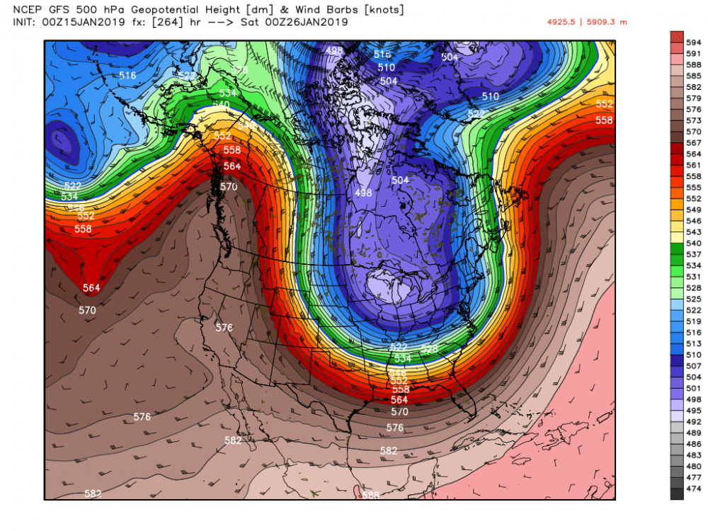
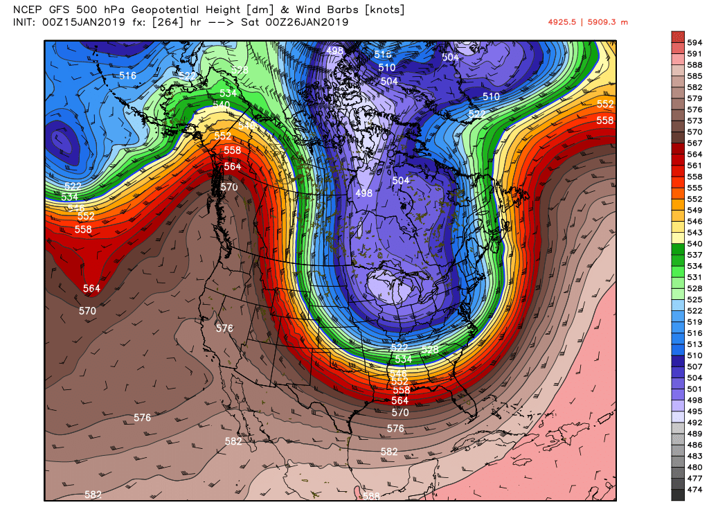
I think it has to do with that upper level low in the Gulf of Alaska honestly. It shunts the ridge out west pretty significantly and prevents the southern wave from digging enough.
-
Just now, cyclone77 said:
Since it was horrific with the last storm hopefully it's out to lunch with this run. Will be interesting to see what the GEFS do.
This.
But a somber start to the 00z suite. I still think all the ingredients are there, but expectations are definitely tempering.
-
 1
1
-
-
Just now, Chicago Storm said:
0z GFS going to be terrible everywhere.
Center of low pressure has to be a solid 200 miles south from the 18z
-
GFS south and weaker from 18z
At 500mb the set up is a lot more similar to the 12z with the upper level ridge out west shunted east and the PV oriented more towards the east.
The effect looks to make everything more progressive.
-
 1
1
-
-
Just now, metallica470 said:
I'm from Chicago myself! South suburb to be exact. Long time lurker here just never posted lol. Just wanted to say it's pretty cool to see all you posting from this area!
Welcome, and may we both do well in our great city.
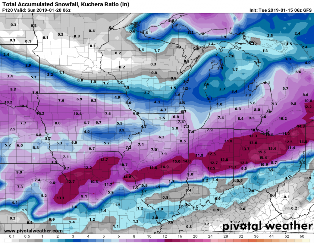
Nothing like a good 84 hour NAM map to kick off the 00z suite.
-
Pretty close look to the 6z
-
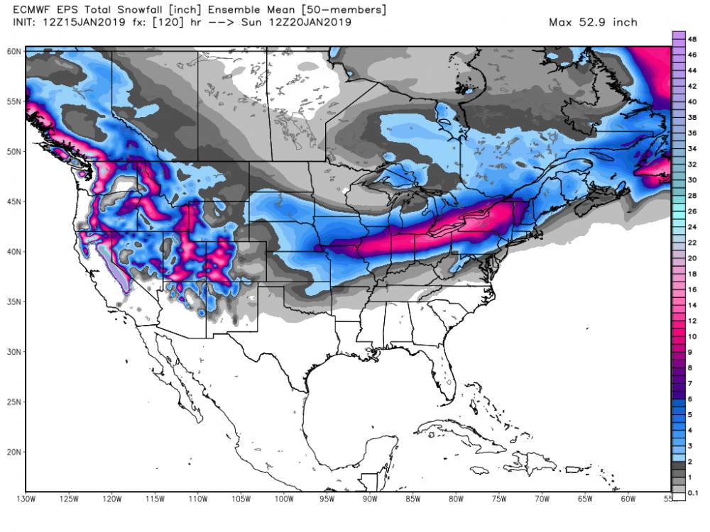
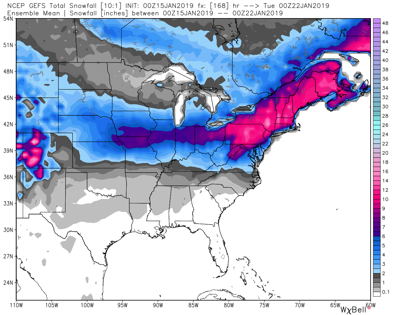
Euro ensembles more amped. Widespread 10”+. There must be some nutso members
-
 2
2
-
1
-
-
Still a very solid hit for most of the sub forum, especially eastern areas.
Just not as widespread as 00z. Would take and run
-
Also that vorticity in the Gulf of Alaska is shunting the upper level ridge on the west coast. Grrrr
A number of issues on this run I think will cause the SLP to be southeast of the 00z.
Maybe models ingested some new info?
-
3
-
1
-
-
One thing I’ve noticed is that the trend today has been to bring the leading wave further south, which may be the issue here.
Euro showing the same signs.
-
4 minutes ago, AppsRunner said:
When should I post the JMA and NAVGEM? I should probably dig up my old links to the Brazilian and KMA too.
Fv3 did quite well with the previous system
-
9 minutes ago, janetjanet998 said:
FVS-GFS dry for N IL..screw hole WWA goes north..other precip later south
Yea that’s pretty awful
-
1 minute ago, Malacka11 said:
Sorry, what's MSN?
")
Madison
-
1
-
-
Watch the Euro come in as a MSN special :p
-
1
-
 2
2
-
-
5 minutes ago, RCNYILWX said:
I like to think of operational model solutions at this lead time as being like individual ensemble members. They fall into the range of possible outcomes like the ensembles themselves. It's a good way to assess what you need to see happen to get the event you want or what could go wrong. We're still at a point where the shifts you see in the model suites may or may not be meaningful to the eventual outcome.
Sent from my SM-G965U using Tapatalk
If the ensembles shift south, I think we can safely say the trend is not our friend.
-
Round 3 early next week on the GFS lol
-
1
-
-
Pretty interesting differences at H5 on the 12z GFS. Higher heights out ahead but low is further south at 500, causing the surface low pressure to be further south.
-
1 hour ago, Jim Martin said:
06z GFS not missing a beat. This is along with 20-30 MPH sustained winds too.
Anyone noticing the axis of snowfall tilting more and more SW to NE?

-
4
-
-
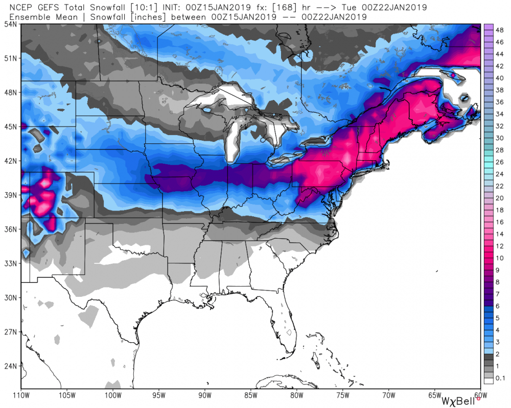
00z GFS ensembles more amped again
-
2
-
-
Well hello there
-
3 minutes ago, Hoosier said:
This is up there with the most ridiculous death band signatures I've seen off of Lake Michigan. There will be good inland penetration in this setup, but it might be overdoing those heavier rates so far inland.

Absurd.
Also GEM cave to the rest of guidance. That was quick.


Winter Storm? Jan 18-19th, 2019
in Lakes/Ohio Valley
Posted
It’s been an abysmal winter up to this point. Take it.