

mimillman
-
Posts
3,468 -
Joined
-
Last visited
Content Type
Profiles
Blogs
Forums
American Weather
Media Demo
Store
Gallery
Posts posted by mimillman
-
-
I think we’re on track for lowest seasonal snowfall total in at least 35 years?
And if nothing much changes from here, Chicago will have a 3-year average annual snowfall of below 20”.
-
 1
1
-
 1
1
-
-
48 minutes ago, OrdIowPitMsp said:
The high in Minneapolis was a brisk -2F today.
I’m here for work and can confirm it is cold
-
 1
1
-
-
3 minutes ago, buckeye said:
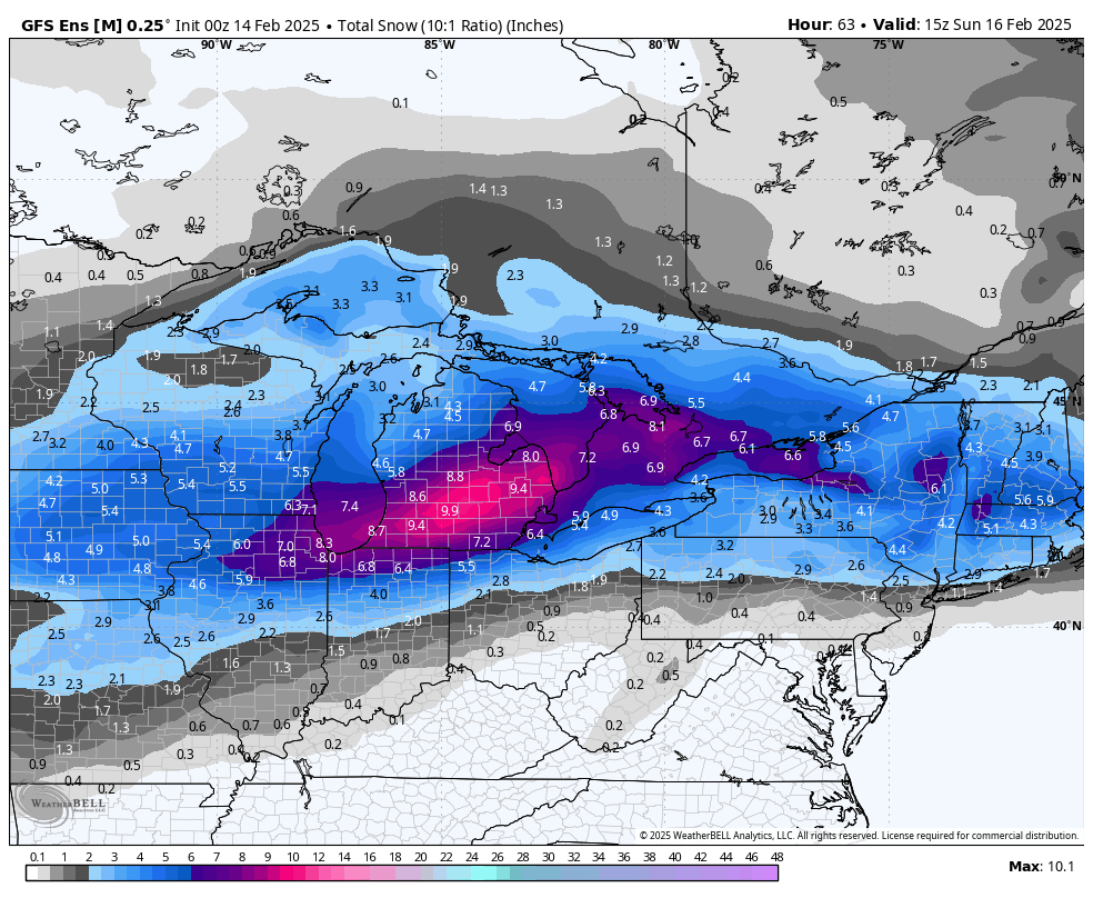
36 hours ago several models were big dog’n Chicago thru Detroit. Now it looks like Chicago won’t see crap and Detroit will get a run of the mill advisory snow. If you can’t trust models 2 days out, wtf is the point? Crazy
Maybe we shouldn’t defund the NWS?
-
2
-
 8
8
-
-
I haven’t really been paying attention but this still seems like a solid 3-5” event for DTX
-
19 minutes ago, Radtechwxman said:
Well this system was an epic bust and one next week misses way south. So over winter. Bring on spring.
Next week New Orleans special, calling it.

-
 1
1
-
-
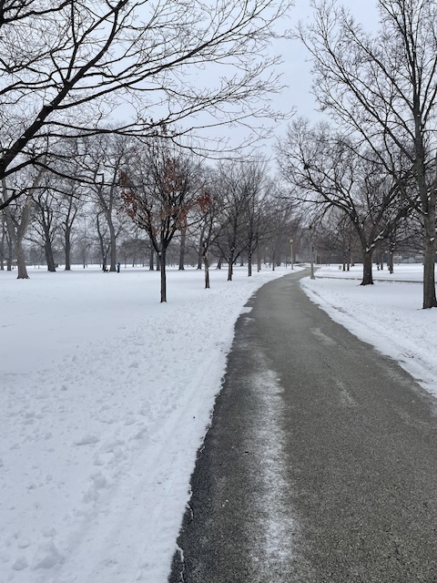
Up in Irving Park getting my car serviced. About 3-4” on the ground depending on where you are. It’s the deepest of the season
-
6
-
-
-
7 minutes ago, Powerball said:
I know you're joking, but it's really been a mediocre winter for most of you in the subforum snowfall-wise.
There's no point in making it a "tallest midget" competition.
I think with this DTX will be on target for normal snowfall or within a few inches departure?
-
2 minutes ago, Lightning said:
I don't know where you are getting this from?? Winter is one of the themes of Michigan!!

Certain residents on this board. I do love Michigan in general. If only Chicago were there
-
1
-
 1
1
-
-
1 hour ago, Lightning said:
Marquette is ~85" as of 2/14/25. A bad year there but most everyone in the MW (of side of LES belts) would be shattering records if that was your current year to date snow.
Bo's location likely has a bit more than 100" but still well below normal. The Keweenaw is doing better as the winds have been favoring them more so with LES. Marquette does better when there are more storms which have been lacking.
Bulk of the good LE this year has been closer to Munising / Pictured Rocks area
-
20 minutes ago, nwohweather said:
What a turn of events. Congrats to the snow lovers in NW Ohio and SE Michigan if this holds. Looks like Detroit beats Chicago in yet another thing
Can’t wait for the “it never snows in Michigan” to start next December
-
1
-
-
Visibility very quickly deteriorated. Looks like 1/4 mile vis
-
1
-
-
Light snow commencing here
-
Anyone in eastern Iowa who can comment on the quality of this WAA? Looks decent on radar
-
1
-
-
At this point you can tell even the LOT forecasters are jaded
-
2
-
-
It’s basically looking like 1-2” with the WAA and then probably another inch of mood flakes + lake influence on Saturday. Fine
-
1
-
-
It’ll become more clear in a few hours with radar sig, but I think the floor is safely 1-2” for those north of I-80 as consensus has grown for a 2-3 hour period of heavy WAA this afternoon.
-
2
-
-
-
GFS says game time
-
1
-
-
13 minutes ago, A-L-E-K said:
Extrapolate at your own risk

Plumes are all over the place. The ARW cores are clustered clunkers while the NMB are more significant
-
3 minutes ago, Stebo said:
I would pay every dollar I have for a Ukmet win here.
That seems a tad extreme
-
2 minutes ago, Chicago Storm said:
Final even snowfall total of 2.9" at ORD.
The seasonal snowfall total is up to 13.0".
Mega
-
4 minutes ago, A-L-E-K said:
could still pull off the ultra rare b2b miss north/south combo
At least the burbs also get screwed. I hate when ORD records 7” and the city rains
-
GFS is rinse and repeat of yday. Eastern Iowa and south Wisconsin for the win. N IL lose
-
1
-
1
-

Fall/Winter '24 Banter and Complaints Go Here
in Lakes/Ohio Valley
Posted
Down to shatter 75 year futility over here