

mimillman
-
Posts
3,333 -
Joined
-
Last visited
Content Type
Profiles
Blogs
Forums
American Weather
Media Demo
Store
Gallery
Posts posted by mimillman
-
-
Michigan City 25.0 in 0400 PM 01/19 41.71N/86.88W
-
 5
5
-
-
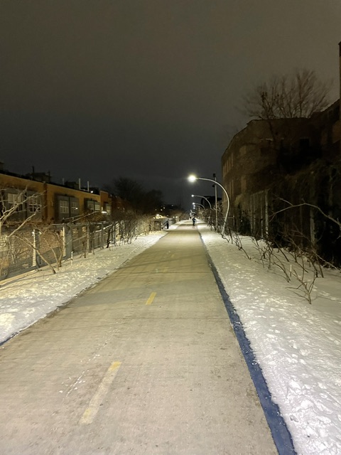
Driving out 8am tomorrow taking the dog to the dunes by Michigan City
-
Warmest night till Monday so gotta get the run in on the 606
-
1
-
 1
1
-
-
1 hour ago, cyclone77 said:
Some 15DBZ returns overhead now and flake size much improved.
QC = new Minneapolis
-
1
-
-
3 hours ago, OrdIowPitMsp said:
Flurries here. Clipper is sliding south. Story of this winter for central Minnesota.
Would still trade climos any day, just ask
-
Unsurprising. Still looks like 2-3” is achievable but anything more than that is less likely
-
31 minutes ago, mimillman said:
I was literally just talking about this on the desk at work. I think I’m gonna do it, though tomorrow night is earliest I could go
Think I’m gonna do early Saturday AM. Take the dog, find a park, and drive back around noon. Might catch the end of snow showers but will be able to enjoy proper depth at least
-
1
-
-
25 minutes ago, RCNYILWX said:
For those who have wanted to chase a Lake Ontario or Erie LES event, I think tonight-tomorrow's event for northeast Porter, especially LaPorte, and nearby is worth considering heading out. The high res guidance is in really good agreement in 1.5"+ QPF, so it's not just the HRRR putting out huge amounts of QPF. This could be one of the better southeast Lake Michigan LES events in a while.
Sent from my SM-G998U using Tapatalk
I was literally just talking about this on the desk at work. I think I’m gonna do it, though tomorrow night is earliest I could go
-
2
-
-
Had about 0.5” overnight. Tonight’s system looks promising for widespread 2-4”
-
Riding the RGEM
-
1
-
-
Pulling for Memphis to get more snow than Minneapolis this year. They are annoying
-
2
-
6
-
-
Just now, A-L-E-K said:
Call was $$
I really don’t think you could say that but if you really love technicalities then ok
-
53 minutes ago, OrdIowPitMsp said:
Minneapolis finished with 0.8”
We have about that on the ground but apparently we got 6”
-
It’s the type of pattern that can surprise to the upside on high ratio events, which I like
-
2
-
-
First snowflakes I’ve seen since 8am. Road is wet and temperature is 34 degrees still
-
1
-
-
It’s still 37 degrees. Wild
-
Just to echo what’s already been said about lake influence, this had nothing to do with the lake and everything to do with the secondary low not taking over as early as previously progged. You had a primary low bomb out and track directly over Cook county into a stale antecedent airmass. Even if the lake were frozen over, that would still be a rainstorm outside of the preliminary WAA, which is exactly what happened.
-
1
-
-
There is no remaining accumulation from this morning. Moderate to heavy rain continues
-
28 minutes ago, hawkeye_wx said:
This storm has been a snow dud for a large chunk of east-central Iowa. Models really struggled with the placement of the heavy band. A couple days ago it was expected to be sw through northern Iowa, but instead it tracked through southern Iowa and turned north around the Quad Cites. We didn't get much from the WAA band overnight and accumulation from the defo zone has been iffy today. A couple hours ago I only measured 3.3" and I probably still have <4". The HRRR continues to show snow over us through late evening, but radar shows a big dry hole forming and moving into Cedar Rapids, so we may not get much more snow. Oh well. We got the brunt of the early week storm and now we get the other end of that. That's life.
Update: There is a new 6" report from a few miles north of me. It's so frustrating watching everyone around me report significantly higher totals when there is wind. Where are these people measuring?!? I swear, we could get two feet of snow and my snow board will have 6" on it.

Happy to switch with you if you’d like.
-
1
-
-
RN+
-
1
-
-
I think the worst part of having 8” of snow recorded at ORD and MDW this week is having 0 on the ground to show for it
-
1
-
1
-
 2
2
-
-
Those early April snow squalls will be rockin
-
7 minutes ago, Chicago Storm said:
One big difference in the evolution of this storm system that we are seeing is how the double-barrel SLP/inverted trough feature has played out.
Most guidance, as recently as the 0z runs last evening, had the southern SLP becoming dominated as things transitioned across Illinois and Indiana. Instead, we have seen the northern SLP be the dominant one, thus leading to everything having been shifted a bit north so far out this way.
As we continue on, it does look like the transition to a most eastern dominant SLP will occur as things continue up into Michigan.
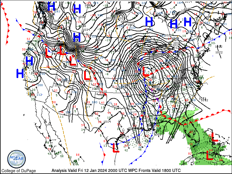
Very true. HRRR was catching onto this early this AM and so did the Euro eventually but pretty poor performance from globals on timing of secondary taking over.
-
These heavier returns are 100% pouring rain
-
1
-
4
-
Did Someone Say Clipper(Hybrid)!?! 1/18-1/19
in Lakes/Ohio Valley
Posted
Wow. They have another 3-5” Coming