
Hoth
-
Posts
9,903 -
Joined
-
Last visited
Content Type
Profiles
Blogs
Forums
American Weather
Media Demo
Store
Gallery
Posts posted by Hoth
-
-
1 minute ago, JC-CT said:
herpes with a big jump nw, maybe not the model to be looking at
Don't think it's that different than the GFS. Not that one should look at that one either.
-
That was a fairly significant tick NW on the GFS.
-
1 minute ago, ORH_wxman said:
No it could still slow. This partial phase between the two streams is a trainwreck on guidance. If it happens quicker then we could have this storm overstay it's welcome somewhat.
It's welcome to stay as long as it wants.
-
Ryan mentioned a "fluffy foot" in banding in w/c CT. We humbly would accept!
-
4 minutes ago, Chrisrotary12 said:
The northern stream vort has essentially caught the southern stream one......feel like I need one of Tip's head spinning posts about what this means.
Does it not look like it's just pouring in the backside of the southern stream? Doesn't look like a kicker to me.
-
Liking the fluff factor possibility back here. Pile that on top of whatever cement is left.
-
One more last minute tick west at 0z and it's go time.
-
Northern stream looks a little more southwest initially.
-
4 minutes ago, kdxken said:
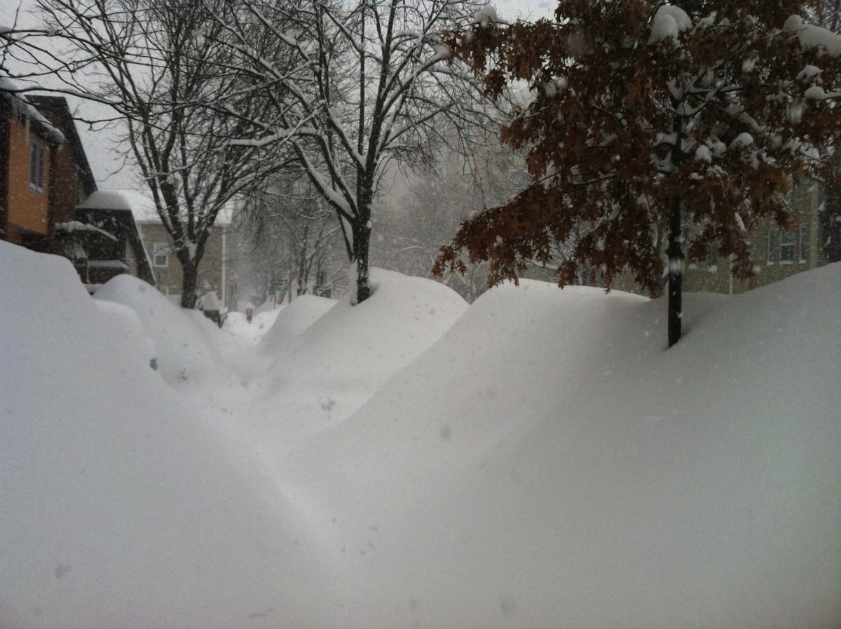
Probably the only nor'easter to put up a 50" spot in CT.
-
4 minutes ago, Chrisrotary12 said:
Is it just me or is the northern stream vort a lot further southwest of where it's modeled to be?
.thumb.gif.7c8f9af733819191940fb6423cd41c3b.gif)
I have been saying this since last night, but figured it was just my weenie hallucination.
-
 1
1
-
-
1 minute ago, RUNNAWAYICEBERG said:
It’s been really nice watching this from the outside, never invested. Stress free. Now I know what PF felt like from 2010-2016.
The deform band looks pretty good for CCT though, on most guidance, with the slight nw ticks. Near the CF, however, should see many 20 spots. Congrats Taunton to Weymouth,
It's a much easier pill to swallow when you've just put up a double digit snow.
-
1 minute ago, sbos_wx said:
I have no idea I'm stuffing my face at castle island
Sullivan's?
-
4 minutes ago, sbos_wx said:
Guess what model still sucks? The gfs
I really thought it was gonna tuck in more for a second there. Oh well. We wait until 1:45.
-
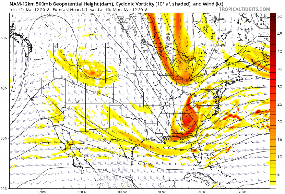
Some pretty nice FGEN in central-western CT there. Perhaps the confluence between the PV anomalies lending an assist?
-
8 minutes ago, STILL N OF PIKE said:
Can anyone load a nice w.v. loop
http://weather.cod.edu/satrad/exper/?parms=global-northernhemi-08-48-0-100-1&checked=map
-
 1
1
-
-
2 minutes ago, JC-CT said:
Hey, I was considering posting about it but then I thought it was so low probability that it wasn't worth it to weenie over. But if there are any tricks left up this one's sleeve, it is with the northern stream. A lot of it hasn't been raob sampled yet, including the energy that creates that late diving shortwave, which could affect the trough orientation ever so slightly one way or the other.
We'll just set our expectations low and hope for a surprise. I mean, that PNA is pumped, the block is holding steady and the trajectory on the n/s energy seems more north/south to me.
-
1 minute ago, weathafella said:
James should rent a room in Diane’s house. I think he may have some problems as far east on the cape he is.
Really? I hadn't looked too closely. I thought 850s were plenty cold even there.
-
Well, first off, congrats to NoPoles and Jimmy for finally catching a break. Second, my visual hallucinations continue. Looks to me like the n/s is already starting to slip down the backside of the s/s. I just keep thinking, "how is this not coming more west?"
-
If I had no access to model data and could only see the northern hemisphere water vapor loop, I'd think we were all in for a trouncing. But alas...
-
1 minute ago, STILL N OF PIKE said:
Nexrad Radar would pick up a pocket of deep yellow Coinsiding W splooge Over harwich
Yes, that's a very conditionally unstable atmosphere there.
-
7 minutes ago, Ginx snewx said:
I like Arugulas at the Mohegun Sun
My brain totally replaced Arugulas with an anatomical feature. I was thinking, "I didn't know Electric Blue had opened a branch there."
-
 1
1
-
-
1 minute ago, RUNNAWAYICEBERG said:
Some of us are. But Unfortunately it doesn’t work that way.
Hey man, we'll always have the magic of the 2011 norlun and blizzard to warm the cockles of a heart. That was a magic week.
-
Maybe Sipperel will let our budding author in Harwich, MA, USA write a guest discussion for the next update? I would pay good money to read that.
-
1
-
-
4 minutes ago, codfishsnowman said:
plenty of time to send it east another 100 miles
Haha I can feel the schadenfreude. Like you're standing in your back yard trying to blow it out to Bermuda.
.gif.48992025d847de9f5b550396ac9ab212.gif)

March 13th ... west Atlantic bombogenesis type low clipping SE New England, more certain ...may be expanding inland
in New England
Posted
Correction.