
David-LI
-
Posts
1,248 -
Joined
-
Last visited
Content Type
Profiles
Blogs
Forums
American Weather
Media Demo
Store
Gallery
Everything posted by David-LI
-
Yes I updated to mention Long Island, some precipitation in the city. Although someone commented that HRRR shouldn’t be looked at atm
-
HRRR is warm. Almost no front snow for Long Island
-
No, it won't rain that much, maybe an inch.
-
NAM 3k seems to be the coldest of all models.
-
NMM is the name of the model. Nonhydrostatic Mesoscale Model (NMM) core of the Weather Research and Forecasting (WRF).
-
How are the SREF's looking?
-
Is this a reverse storm of the century forecast?
-
Any word on Ukie? I hear it’s south again
-
Yes it can
-
GFS has that low jumping south from Long Island to south of BM. It's NJ to LI to BM, in a triangle
-
I posted too early. It’s not all frozen you’re right.
-
ICON keeps NYC all frozen. FWIW
-
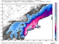
NAM clown map shows a foot in the city, but probably half is sleet
-
-
We are in the game
-
NAM colder and south
-
Don't you love a weather pattern like this? Brutal cold followed by cold rain followed by another shot of cold weather, rinse and repeat...
-
The pattern does not look bad going forward. Plenty of winter to go still.
-
According to GFS, city should be changing over to snow around 1 PM Sunday and end by 6 PM as the storm pulls away.
-
According to GFS any rain will fall overnight with a changeover Sunday afternoon. We might get a few inches after the changeover.
-
986 low but no back precipitation?
-
Surface temps??
-
How are surface temps?
-
I live in Long Island and I was wondering why the asphalt outside turned white so quickly. I guess cars bringing that stuff from the city on their tires?
-
Is there a precipitation map for the ukie?


