

Typhoon Tip
-
Posts
44,568 -
Joined
-
Last visited
Content Type
Profiles
Blogs
Forums
American Weather
Media Demo
Store
Gallery
Everything posted by Typhoon Tip
-
Wow... it's a uniquely warm. I mean... when arriving into a paradigm where all machine interpretive guidance is completely and utterly rendered meaningless. Odd-ball warmth may happen upon occasion for short stints ... but, this is going to be stretching believe-ability ... if that hasn't already occurred to civility. Actually 'civility' is zombied by other bs these days so they'll be blithe to it ...but that's a cynical rage for another debate... Anyway, the extent/ protracted aspect of days on end of it - oookay ...I recall some impressively warm temperatures in Nov and Dec's once in a while... but, ephemeral. They are typically short lived. It was 72 F one evening, Dec 2nd, 2003... and a sharp cold front heralded in winter by the end of the same night... That was prior to the impressive snow event over eastern zones just 3 or 4 days later ( digression..) Lots of those... xmas day 2014... I think it was near 70 in lagged CAA ... we did short sleeve family stroll in cargo shorts, not realizing that look was no longer ala mode - heh... but we get those warm intrusions just enough Oct-Dec/Jan. But this? Nah...something's entirely different here. 70 to 82 F spanning days ... and the lows are not trivially above normal. ORH being 59F for a low last night is not being handled by the MEX/MAV either...
-
Two different things ... -EPO vs the 'folding hypothesis' But they mimic one another... Folding is just high velocity flow over the Pac encountering the back-logging of the continent and that exaggerates the perennial N/A pattern response and makes the ridge in western Canada burgeon more frequently... The EPO is basically the whole region from the N-central Pac to Alaska and N BC.... And heights can and do rise into blocking in that region from other reasons... related to everything from PDO to west Pac TC recurvatures... to R-waves. Hard to say ...but the GEFs have an AO dive still after the 16 and the NAO too... and those aren't really related to 'folding hypothesis' if you will.. So with the AO going down, and a few members of both the EPS and GFS ensembles buckin for the strong MJO phase 8... - it's thin but not zero chance for that signal to return in earnest. we'll see... For the record? I don't see November going down 74 F as the mean high -
-
Course the original signal is fighting back... heh -
-
Just an observation ... but it seems the gradient weakened a little ( overall ..orbital perspective ) bit less than a week ago, and this ridge seemed to immediately balloon. Meanwhile, prior...we had a cold pattern and early tantalizing notions of winter and of course the significant realization/event came of that ...and while that was happening, heights between Florida and Bermuda ...never really deflated... I used to refer to the "Miami Rule" ... it was basically: if the heights over MIA were greater than 582 dm, and the balanced geostrophic winds were above 30 kts at 500 mb ...that means that S/W are entering a destructive interference pattern ... when ejecting E of 110 W/ along ~ mid latitudes. This strikes me as related... The snow event we experienced was along a narrow latitude - which is consistent with fast flow neggie interference ... stretching in the longitude. The event's specific morphology fit - Also, as soon as the flow 'relaxed' in a large eddy sense of it...the ridge immediately ...almost reflexively bounces back - ... Interesting... The autman has two distinct complexions ... and this also fits with the observation that there is a tendency for huge temperature variances - even relative to transition season typology - setting up along 45 N in the means... We are going into late summer vs early winter across 300 naut mi over the Continent, which is ...6 hours of advection at any given region near-by from excessively flipping between the two. But, what's intriguing is to see that without substantive cyclogenesis... Usually, big baroclinic variance results in deeper/larger system behavior. I think the speedy nature of the flow is inhibitory...leaving big gradients sort of 'unrealizing' in the means. Just a hypothesis -
-
Interesting ... we’re tickling 70 in this sounding and synoptic layout we’re doing low 80s on Sat ( haven’t seen the 12z Euro just based on previous)
-
seriously though ... is this possible - in 2011 ... my forsythias took off around 2nd week of November ...and I can't recall if flowers popped but those, and other shrubbery types too, did swell and split and half mutilated young leafs sort of half committed - the sun was week so I don't know what the bio-molecular response is between temperature vs sun angle/irradiance triggering... Anyway, it was sort of 'meme' ed as a second green up back then and others noted this around the landscape... after the early cold and snows of Halloween .... That I think was a more profoundly cold span of time ... This deal the other day ... seems it was like that day ...then this CAA windy jive that's already pulling out... Tomorrow still has the look of an impressive diurnal but I don't know how much decoupling tonight. Pretty striking warm frontal translation on the charts during the morning afternoon tomorrow so...
-
Eventually ... humanity will be forced to admit that all we have achieved in our current state of technologically -advantaged awareness ...is awareness - nothing else. 10, 50 ... 100, 300 years from how, historians will draw this up as an expose on dangers evinced to a mass of population that did not have proportional compensatory measures for dealing with the revelations of those perils. Seems that way...
-
I should be more clear ... I mean for November - but... I was being tongue in cheeky about the DJF being cold - who woulda thunk... heh.. But, about 2 weeks back there was a better -EPO/ La Nina folder over look to the pattern and that's all but completely vanished - interesting... Actually I was looking at the Euro, it almost seems it's mid month circulation overall is like a "west-based -EPO" ...which is drawing the trough digging trajector through the eastern Gulf of Alaska ... while ridging over the Alue chain - that's kind of weird... It's setting up a reloading Great Basin early winter out there... and unfortunately ... coupling/mass conservation requires a 1998-2000 SE ridge reloading at least excuse imaginable ... Maybe that's the correction key - I mean...if that all bumps E by ... half a R-wave length than we get split and cold bleeds along the 45 N further E.
-
Depends on what one means by 'torch' ha but, yeah ... superlatives may be understandable at least over this weekend - eesh. +20 F and more over climo ... I'll tell you, as an aside ... it interests me that France and Great Britain, ... over to the lower lands beneath the Urals and Australia ..they seem to put up their +20 exotic GW freakshow heata like ... IN their warm seasons... We seem stuck having to do it during winters - Anyway, I'm looking at the 00z GGEM and Euro, and their blend ...and it will be 81 F at typical warm achieving locales/sites on Saturday, Sunday ...and probably Monday too in those operational 00z cycles. Now..obviously, a typical locale/site isn't 1000 K high ORH/elevations... I mean BDL ... BED... ASH ... Why? Here's the thing ... the 12z/sun-up temperature at 850 mb on both those guidances for Saturday and Sunday is about 2 to 3 C cooler than the sun-down temperatures those succeeding late afternoons. That only happens if the boundary layer heights breaths...expands and exceeds the 850 mb sigma level...which means, the mixing depth 'got that high' So, what is the temperature at that level say...4 to 7 pm? It's 14 to 15C !!!!! The standard adiabat from 850 mb using those temperatures is about 28 C at the surface just eye-ballin' the blank skew-T diagram. And that's not taking into consideration the 2-meter. I'm actually willing to toss a major 2-meter slope correction owing to the sloped sun and well mixing ...actually makes the tree-top temperature more likely what we feel at the surface at this time of year... But, having the 850 mb temperature rise at max heating means you aren't going below that temperature either - ... The GFS is not as warm ... but appears to be below it's own ens mean so - heh.
-
Well ..I'm pulling the plug at this point. The telecon's are all abandoning that signal like a bat outta Pandemia at this point, and relying on 'sometimes these signals return' - heh, ... not lending confidence considering the 'synergistic' hemisphere - for lack of better word. I almost wonder if this redux' 2011-2012 after all - Oh, the counter argument ( of course ...) is ENSO this and that... and comparatively nill - but ... If ENSO matters less - that effects that juggling arithmetic.. I really have no compunctions about keeping my mind open to the notion that all La Nina this and El Nina that are almost irrelevant ... because of HC stuff having expanded so vastly ... may very well be engulfing and shutting down the trigger latitudes of the SST anomaly in the coupling .... That may be why/related to why ( anyway...) the MJO is collapsing on the left side - because it's there...but it's detection is getting lost trying to propagate deeper across the Pacific where it is lost inside the HC. It just all seems suspiciously related to me... So some hypothetical points there ...sure. But there isn't anything very La Nina looking about a Pac NW jet that's trying to careen off the Pacific S of the 55th parallel like that... That in fact looks more El Nino ish... and may - in essence - really just be a f'n coincidence either way... I said this over the summer half in sarcasm ...that the flow may 'look' La Nina at times, but just because the meandering happened to migrate the jet through a traditional La Nina construct but is really just an ephemerality that isn't indicative - Could just be a warm winter - deal with it. Because frankly, I don't see how the HC that is real and measured and fact ( ) can merely be overcome because we 'think' it's supposed to be cold in DJF... That's guiding seasonal outlooks and the HC stuff is also evading either attention or will to try and understand the changing Global paradigm - probably because of the implications of what they may mean.
-
I still wouldn't give up on a -EPO look evolving after the 15th of the month ...or hybrid therein. But sometimes these long lead deals slip into obscurity and then return.
-
The Euro would topple those records with that synoptic evolution... It's stowing warmth diurnally... each successive day that fails to clean out that look sets stage for the next day to get closer to maximizing that thickness potential. 13.5 C in mid February, three years ago sent temperatures to 83 F in interior eastern Mass... We'll be in early Feb sun/on the threshold of dimming into the 90 day nadir ... but I've seen in 73F at Bedford in the 2nd week of December in a look not too dismilar to this ... It'll be 82 on Saturday ... if not, likely Sunday *IF* the Euro parametric layout verifies ...and in fact, there's no cooling down on that run next Monday either.
-
looks like it's evolving the dreaded pin-prick eye
-
heh...wouldn't shock me if ETA bursts to 185 mph with gusts to 220 ... hPa of 888 mb ... stalled E of Honduras
-
I keep waiting for another shoe to fall but it just doesn’t do it. The 850mb temps and overriding ridge get more impressive every run. I mean the GGEM had temperatures approaching 16 Celsius at 850! Is that an 850 record ..or maybe that was the Euro I don’t know one of those two
-
Does anyone remember the 2nd green up? 2011
-
That ridge setting up week’s end is astounding ... It’s like pressing the ceiling of geophysics Wed could see a rare diurnal range if the region should decouple leading ..If early afternoon. intense warm frontal passage in dry adiabatic profiling/ active return flow gradient mixing you could approach 50 F spread 5am to 4pm
-
You know .. actual scale/degree of extremes, notwithstanding, isn't this warm up actually kinda sorta like 'normal' ? It's probably a verboten to use this terminology given recent 'ethotic' changes ... but "Indian Summer" has very pronounced and almost legit anticipated historical precedence - we just have been in a climate mix--up for so long we've lost sight of that kind of normal procession of events. The definition of Indian Summer even has an entry in the AMS glossary: " Indian summer A period, in mid- or late autumn, of abnormally warm weather, generally clear skies, sunny but hazy days, and cool nights. In New England, at least one killing frost and preferably a substantial period of normally cool weather must precede this warm spell in order for it to be considered a true "Indian summer. " Granted ... having Logan break it's October snow record ... perhaps exceeds the 'normal cool weather' aspect that's tucked into that definition, but negating the extremeness of it, it's really a fitting warm-up... Also - ... the warm up extreme may match the (SD of this cold snap + the climate signal) ... I frankly don't have a problem seeing it be 77 F at the apex of this thing ...whether there's arithmetic justice or not. The Autumn of 1999 and 2006 ...both had a week with 60s and at least one 73-75F at BED Hanscom into the first week(s) of December ... Having said that, we've had trouble getting the verified ridges east of 110 W over the continent to actually swell to the extent of mid/extended range guidance since last March...not sure this ridge has to succeed necessarily... Waiting for the other shoe to fall on some confluence impulse to send weightier undercutting PP
-
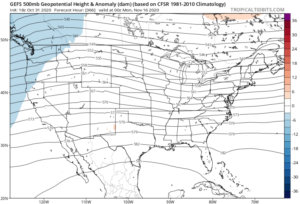
Here’s the GEFs ensemble mean ... showing it’s uncanny support
-
wow was that a warm Euro run - ...I mean, as a singular complexion not considering much else, that's an impressive warm signal for that calendar range - gee, about equal and opposite SD as just what occurred ?
-
Looks like this Invest is ahead of the popular global model's development curve ... Not sure what the tropical specific ensembles look like but TPC has 'near 100%' and have all but already declared it. Thing is, it's got 'that look' of having no interest in holding back - it's curling over pretty coherently at multiple levels, and given to low shear and high OHC ...it's seems it's a candidate for exceeding intensity expectations - we'll see on that. Looks a bit like a Wilma analog for slowing as it near Honduras ...possible meandering over the hottest waters in the solar system outside of deep penetration Jupiter, then being pulled out..
-
I don't think it's going to last ... not that you asked ( I realize you're just leveling the comment - ) But, I do still believe that warm pattern R-wave folds over ... possibly dramatically... mid month. I wonder about corrective storminess closer to the 20th too - but it's exotically far out there..admittedly. The problems I have with sustaining warmth are: N/stream expressive hemisphere makes any sustained subtropical ridging both plausible, but also susceptible along the N rims for transitory pattern behavior. If we add to that the a progressive/velocity surplus hemisphere, that lends to non-fixate R-wave constructs. I just don't see us situating a ridge and have it be unperturbed to "sustain" anything for that matter. Being realistic: this snow wasn't gonna last - you/we know that...of course. But, we need to 'unjazz' from yesterday and think of this for what it is... But what is it: that's an interesting question... Comparing this to the 300 year climate observation, this is rare... Comparing this to the local climate spanning 20 years, I argue it is not rare - no way... We've had half ... ( at least ) of all Octobers featuring either synoptic snow, or... patterns certainly favorable of supporting synoptic snow - but merely happened to dodge the timing in this latter essence... But less than even synoptic ... these packing pellet bouncer showers way waay more frequently than the previous paradigm before the turn of the Century. And, it has also coincide with the two things that I find increasingly more difficult to believe is just random chance: The hockey-stick climate acceleration; The velocity surplus and hemispheric wind flux anomalies sendong commercial airline traffic on sonic speed trajectories across the N Pac and Atl Basins... ( I took the liberty adding this statement but you get my meaning...) Nah, the former lends to the latter ...due to HC expanding N and "compressing" the hypsometry of the hemisphere in the means... and this then causes the flow to 'pile up' so to speak and 'fold over' western Canada at transition seasons. Octobers and Aprils are more winter at times the January now... "at times" - not all the times...
-
Random shit ... I was musing this morning about 1995 ... That was a phenomenal entrance into winter that year, the likes of which I have not experienced since. There have been fast starts since... but none enduring. 1995 was like a winter wall creeping S - once your region succeeded that invisible boundary ... you didn't go back. Latitude Rt 2, .. ~ 9th of November.. We did not see bare ground until late January. I wonder if this year will compete ... I won't even score this year badly if we do in fact see a 70 late next week, particularly if by the 10th we are seeing -EPO ( quasi therein) and +PNAP structured flow, and subsequent rolling into another deeper winter expression again - . Last night ... as I was driving around town after dark ( in the late afternoon at this time of year ...), the streets were steaming. Some enough that the steam was pooling into ground fog under the clearing sky, calm wind decoupling that was already underway. The region was swept over by a jolt cooling event - yesterday's system was a distant weaker example of a Woolly Mammoth legendary frozen-instantly, while still working cud in craw. As the theory has it ... from some kind of sudden cold climatic shock that zapped at hemispheric scales across Siberia and N Canada.. Not sure if that is true, but..., that observation of steaming really is an homage to us having just witnessed something pretty rare, nonetheless. It's okay to steam streets - but not when it is because of 4-6" of snow prior to Halloween - This morning there is a combination of cold air - related still leaf fall taking place along with dislodging clumps of snow that sparkle in the steeply sloped morning sun... I'm not sure I have ever seen that concurrent effect before. Usually it's leaf, then snow... several weeks later.
-
Man if that all just got a little bit deeper quicker and verified we’d have one of those 4 to 6 hour dim orbing of the street lamps … And then 24 hours later we get poofed by a Windex series of squalls… And then it’s 70° next Friday heh .. negotiable
-
You gotta be f’ing kidding me


