

Typhoon Tip
-
Posts
43,394 -
Joined
-
Last visited
Content Type
Profiles
Blogs
Forums
American Weather
Media Demo
Store
Gallery
Everything posted by Typhoon Tip
-
You wonder what's going on in the think tanks/Pentagon - I was entertaining the notion that Yevgeny might be sort of secretly a Ukrain sympathizer or even switched sides. But my buddy brings up the obviously over-arcing oligarchy role in probably not agreeing with Putin's tact at this point - that's sort of been there all along... forgot about that. But suppose for a second the oligarchy got to the Wagner chief ... this could still be a preamble? testing Moscow's flinch response. That doesn't work either. The problem I'm having with any of this is that the element of surprise has been removed from any future attempt. So I'm curious what the motivation was for "staging" a move on Moscow in the first place - and what changed to draw the Wagner forces to now stand down. What a f'n morass
-
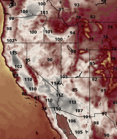
Kinda interesting... get a load a California at the end of this Euro run. Considering the snow pack in the Sierra and all that water apparently in the valleys
-
I suspect ASH's DP is too high. Just as FIT's seems too low. More so in the latter suspicion, I've noticed FIT is always last. Today's no different - I realize other Mets disagree, but KEEN, KASH ... everywhere around just finished a morning of saturating air, light rain, and are reporting a sultry 70 DP ... FIT is stuck at 66. I mean they are surrounding by readings that make more sense synoptically. Interesting...
-
mmm, perhaps a little 'too great'
-
Holy shitness Bat Man! CNN's headline page banners, "Apparent Insurrection Underway In Russia" uhh... Yeah, I guess it's a specter that's been looming. This Wagner chief, ...railing on as a recent antagonist against his own government was a sort of wake up call. Why CNN also reports that U.S. officials were caught of guard might just be CNN invent-a-click news reporting but we'll see... And we'll see if any of the above is true. But wow - historic if so...
-
Last two runs of the operational GFS backdoors - end thread necessity.
-
I just ran over to W-bell ... the graphic is what it was.. I didn't look very deep
-
Oh absolutely ( bold ^) ... That's what drives the return user-ship, and what at times even seems a bit like obsessive wait-on the model cycles. It's really just about the excitement. For all the wrong-way-rub of one infamous Forky poster, he's been spot on in the past when his usual proclivity for zero restraint ( haha ...) uttered, " I think you people care less about the storm and more about the modeling of it " It's really more about perpetuity of the stimulus among us. It's our particular chosen genre for "doom scrolling" We use the weather cinema provided by models, for and no differently than the general dystopian problem in tech cultural societies of the globe, that are in a kind of 'mass-psychotrophic' ... if not addiction, affliction and reliance - one that creates a faux reality about the world. But that's wildly digressing at that point... I mean right - I'm not a PHD sociologist or psychologist or whatever, but when you generate your own hypothesis, based on real observations about the world around you, and then credible, unaffiliated agencies start publishing papers and airing documentaries ( 60 Minutes ... be it "The Social Dilemma" ...etc, etc..), parroting those hypothesis, one tends to believe they are right. And I do - It's not really complicated to prove anyway. If the power goes out and there's no access to the ongoing model cinema, all the yo-yoing joy to disappointment of model-cycle consternation, be it want of heat and DP in the summer, or blizzards and ice storms in the winter, it all evaporates. That's the proof. Sorry - I'm reading Noah Harari's book, "Sapiens: A Brief History Of Humankind" ( a parody title borrowed from Hawking's "A Brief History Of Time," no doubt). So it has me sort of gaslighted and turned onto these facets and particularly enraged right now. hahaha. His book does a brilliant job of using real history to expose how just about everything related to human history and ongoing practice of behavior, is based on illusions of reality.. it's so deliciously dystopian, without even being dystopic in turn of phrase. ho man -
-
It's still got it but it's been slowly coming down. Instead of 10" over the friction deformation, as of 06z it was down 4" just south of Tolland CT
-
Really - All 4 majors in the SNE region are running -.8 to -2." for June. We need more water. It's funny when this kind of divorce between sensible/impressionable weather experience, vs the scalar empirical circumstance (reality) happens. It's like losing in multiple dimensions haha
-
Days are long ... I mean, if it is 'any' sun at all, best bet might be 4- 7pm? We can see on satellite loops that there's a westerly wind burst above the surface down near NYC occurring along the under-belly of this negative ( albeit weak ) tilted trough and associated low pressure/stationary front mangled mess. This feature actually collapsed the warm front east such that it has no chance of coming through here as a warm front like modeled. This whole ordeal hasn't been modeled very well for these idiosyncrasies, which probably makes sense with a nebular entropic piece of shit flow circumstance... anyway, as this thing gets up toward Brian to ruin the afternoon even more than it's already ruined-looking now, that may offer some skylights late in the day for us down here. First in CT obviously... but when we end up in that under belly region. I dunno and/or best timing if so
-
From a purely Meteorological perspective ... ( which is impossible for any human sentience to compartmentalize, just sayn' -) there is value in the science and math of the thing. No one asked me but sitting in it and saying it's "nice" ? that requires either lying, or ... washing one's self into believing their own narrative (muah haha gaslighting )
-
ahhh... first post I read this morning. LOL
-
NAM won't back down on Sunday ... The profile off the FOUS would support about 89 at BDL... probably that warm at ASH/BED up my way, too. MET's 85-87 DPs are all 66-68 but given that we're already 69 and 70 at these sites and Will and Brian think that FIT is spot on some how...I guess we won't expect to be 70 DP on Sunday LOL just kiddin guys. Yeah I don't know... I've been by FIT many times because I live here. It's not nearly enough of a topographic nadir there to create the consummate -4 to -6 that it always carries. But hell ... maybe it just is what it is. This may not be the best time to exempfify, as we're differentiating the DP in association with a shallow warm boundary that probably mixing down unevenly ...blah blah.
-
I guess it beat the overnight .. .I was impressed at how noticeable it kept getting down here. Meanwhile, WPC is still analyzing the warm/stationary front down around the lat of S NJ.
-
KFIT bangin' away with a 64 DP again when BDL/HFD/ASH/BED are all 70 ... I'll give them the benefit of the doubt because MHT and BOS are in the mid 60s but the doubt is still there... 81/70 here and I'm 7 miles from that ob
-
It did that 6 years ago ...though I don't know if it was as much this last winter... Many res filled and water flowed but within 5 years they were right back in a f'ed desiccated state. We'll see if this has any longer term benefit. The problem with irrigating California as I've read hydro science is that their topography is such that they these hefty single season deals tends to run out before the deep geology is reached. They need not be blitzed but have nominal impact over multiple seasons. Interesting...
-
Weird Euro run.. Keeps the wind from VA Beach to Boston for 8 straight days. No big heat ... but vacillating the hydrostats between 570 and 576 that whole way is quite sultry
-
Meant to Lear' obviously a Harrier is a military plane
-
It may be getting in there soon ...if not later today, overnight? It was 54 DP here this morning, now most home stations within a mile or two of my location are all 66 to 70 dps, which are the garden dewpoint effect. Sure, but NWS has 64 to 66's now down here.
-
also the sky's broken open and the cu fractals have begun moving SW-NE ... at noon there was more of a bacon strata deck moving from the due S. Maybe the sun just destroyed the pre wfrontal environment, I dunno -
-
It seems pretty clear we had some sort of boundary come through here mid day, because we've surged to 81/67 ... and you can feel it KFIT is 80/63 and getting that particular site's DP to admit it's over 60 is herculean
-
Dude ... unrelated but do you remember that story you told about the harrier jet back in 1999 with the golfers? It depressurized catastrophically at like 22K feet ... pretty much instantly knocking everyone onboard unconscious, which was a group of wealthy and golfers including pilot. So the plane bobbed around blithely on the wind while millitary jets desperately couldn't do damn thing but watch the doomed dance. ... finally running out of fuel it drove its self half way to Hades impacting a cornfield at something like 9 times the force of gravity. I mean ... it's not funny but it's like the hapless crew's luck wasn't bad enough for god already? - just to make sure, you know. I wasn't paying attention to the news but apparently that happened again. This thing with the submarine to Titanic that's been mentioned reminds me of this...
-
Global warming
-
Not to be a total dick ( ...I'll go with 'just the tip' hahaha) but that location is nearly 8,000' ... I don't think it's that amazing.


