Jump to content

Lettucesnow

Members
  • Posts

    41
  • Joined

  • Last visited

About Lettucesnow

  • Birthday 04/09/1989

Profile Information

  • Four Letter Airport Code For Weather Obs (Such as KDCA)
    KGSO
  • Gender
    Male
  • Location:
    Northwest Greensboro

Recent Profile Visitors

677 profile views
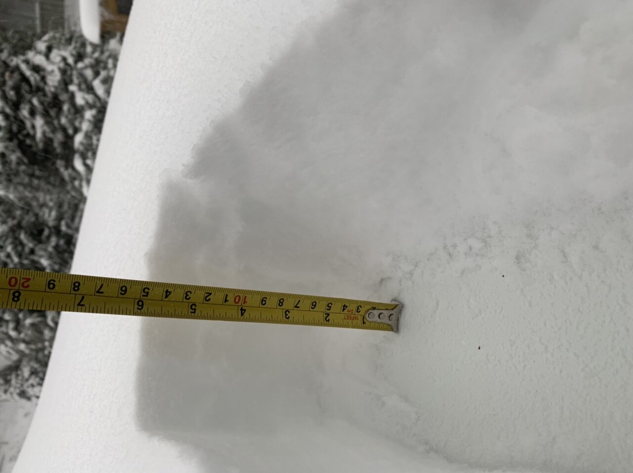
  1. 6” on Sugar Mountain! (P.S. anyone know why my picture is sideways and how to change that?)
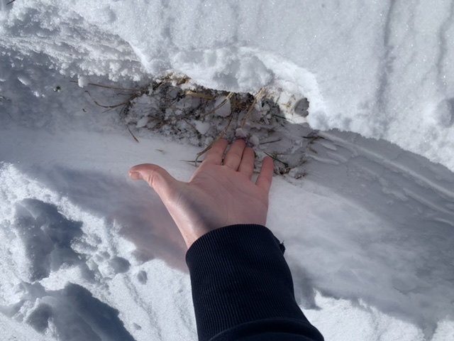
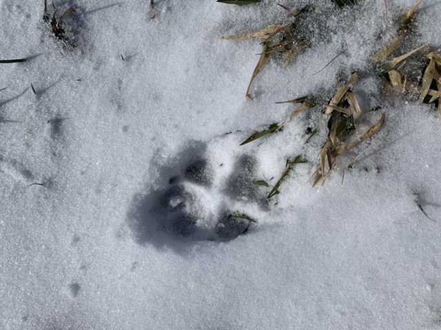
  2. IMG_3025.MOV It was a beautiful and rather fun drive on the Blue Ridge Parkway through Avery County Sunday morning! I believe this was a coyote print! It was off the road on the Blue Ridge Parkway and headed straight into the woods. Too big to be a fox and there weren't any houses around for a dog to be roaming. I took this picture of a snow drift at about 11am not far off the road on the Blue Ridge in Avery county. It appeared to be ~5-6" and the wind was absolutely WHIPPIN!! (I wanted to rotate these pictures but couldn't figure out how ... Anyone?)
  3. 35/34 in Northwest Greensboro close to Lake Brandt. Snow is finally beginning to become the dominate precip. type, although rain is still mixing in.
  4. Wow!! Seriously, a 28 degree temperature difference in about 130 miles or so! From 43 degrees in Winston-Salem to 71 degrees just across the SC border northwest of Florence.
  5. I woke up this morning extremely unimpressed by the small amount of ice here in Greensboro... everything has melted off of the lower surfaces and there isn't too much on the trees, although they look pretty. However, after checking Duke Power's Outage map, I was very surprised to see how many customers are without power in this area. As a matter of fact all around me there are thousands of outages in Greensboro alone. Forsyth county has more than 42,000 individual customers affected with power out and Guilford county has over 22,000 customers without power!! Overall there are more than 140,000 customers without power, which is rather surprising to me based on the small amount of ice that I see on the trees currently. Looking at their history outage data it looks as if the power outages began surging sometime between 4AM and 10AM. I guess many of us got lucky... not to say that I don't love a good ice storm; but I certainly wouldn't be on the computer currently and I would be quite a bit colder here in my house Edit: 10 minutes after this post the power just flickered.. Yikes!! LOL Might have spoke too soon! The wind is picking up a bit out there!
  6. 34 officially at KGSO currently, but many of the weather stations on wundeground just north of Greensboro have gotten down to 32 degrees... The wetbulb temperature is at about 31, so we will see how the next few hours play out...
  7. Decent moderate sleet moved through in Northwest Greensboro. Lightened up a bit now, but still coming down. Probably won't last too much longer, but will hopefully bring the temperatures down a bit
  8. Latest RAH discussion states that the GFS has been verifying much better than the NAM in regards to temperatures as the NAM was too cold, and the GFS was closer with the strength of the 700mb cyclone over the southern plains.. Which doesn't really bode well for the NAM's colder forecast here in the Carolinas..
  9. Thank you soooo much!!! They are so meaningless!
  10. In addition to the relative model agreement, which I'm sure will be all over the place between now and then, it's optimistic to see both GSP and RAH have at least some mention of frozen precip. in the mid-range forecast (i.e. Thursday-Friday and Sunday/Monday).
×
×
  • Create New...