

Kevin Reilly
-
Posts
2,154 -
Joined
-
Last visited
Content Type
Profiles
Blogs
Forums
American Weather
Media Demo
Store
Gallery
Posts posted by Kevin Reilly
-
-
Storm total here in Media, Delaware County 3.00" on the button!
Breezy now maybe winds gusting to 30 mph.
Crum Creek just over its banks still rising a bit though.
-
Moderate to Heavy Rain 44f humidity 99% Dewpoint 44f pressure 29.63 steady wind east 2 mph.
Total rainfall 2.57"
-
 1
1
-
-
Getting ridiculous is an understatement. High here today was 78f normal high here today is 52f low last night was 46f so yea well above normal.
Normal High here 52f normal low 31f
So, between the normal highs and lows were above by 41 degrees.
Up here in southeastern PA we have all daffodils, saucer magnolias, southern magnolias, and brad ford pear trees, apple trees, and cherry trees in full bloom.
Crocus are done as they bloomed in and around January 21st. We have had our daffodils in full bloom since Valentine's Day so there is that.
Also, we had snow squalls and 50 mph winds last Saturday so yea it is changeable too.
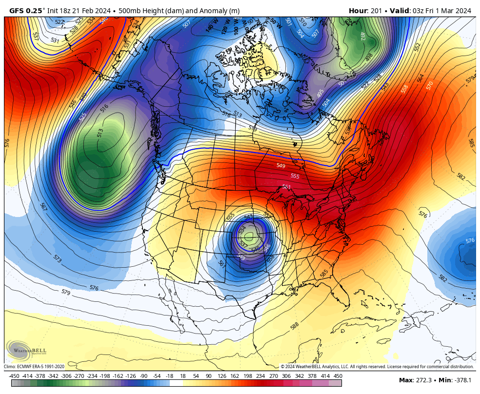
Anyone buying highs in the 30's next week on the GFS? That's a close call for snow on March 23rd up here in Southern PA. lol right.
-
 1
1
-
-
10 minutes ago, Terpeast said:
We’ll probably have to chase next year. I will be keeping an eye on where the best places are going to be.
I would think the safe bet would be Lake Tahoe LOL..... I would pick that area.
-
 1
1
-
-
Moderate Rain 47f humidity 99% dewpoint 47f wind east 14 mph pressure 30.13 steady
Total rainfall: 1.20" and courting
-
I suppose we need to watch this timeframe. I think this is Ralph's miracle storm from the other day.
We Track!
-
6 hours ago, Birds~69 said:
Largest fire in Texas history still roaring rather impressive as well...
Alll normal everyday stuff no worries:
12 feet + of snow in Sierra Nevada after 5 Years of no snow
Raging fires and 90 degrees + in Late February all normal stuff.
Being Sarcastic obviously there is an obvious problem in climate in my opinion and most of it is fueled by warm ocean water temps and air temps especially the Pacific Ocean.
-
 1
1
-
-
When you know you know!
You know it is over when you see this!
.BLIZZARD WARNING REMAINS IN EFFECT UNTIL 10 AM PST SUNDAY...

* WHAT...Blizzard conditions likely, particularly through Saturday
  morning. There is a 10-20% chance of thunderstorms along the crest
  through this evening with snowfall rates of 4 to 6 inches per hour
  at times. Snow accumulations between 3 and 6 feet for Lake Tahoe
  communities, with 6 to 10 feet above 7000 feet. Winds gusting to
  70 mph in lower elevations and above 115 mph over Sierra ridges
  with significant drifting of snow.

* WHERE...Greater Lake Tahoe Area.

* WHEN...Until 10 AM PST Sunday.

* IMPACTS...Whiteout conditions with near zero visibility at times
  due to blowing snow. The strong winds and weight of snow on tree
  limbs may down power lines and could cause sporadic power outages.
  Travel will be treacherous and potentially life-threatening.

PRECAUTIONARY/PREPAREDNESS ACTIONS...

A Blizzard Warning means severe winter weather conditions are
expected or occurring. Falling and blowing snow with strong winds
are likely. This will lead to whiteout conditions, making travel
extremely dangerous. Do not travel. If you must travel, have a
winter survival kit with you. If you get stranded, stay in your
vehicle.

Downtown Truckee, CA Live Webcam | HDOnTap.com
Take a trip anyone! LOL
-
When you know you know!
You know it is over when you see this!
.BLIZZARD WARNING REMAINS IN EFFECT UNTIL 10 AM PST SUNDAY...

* WHAT...Blizzard conditions likely, particularly through Saturday
  morning. There is a 10-20% chance of thunderstorms along the crest
  through this evening with snowfall rates of 4 to 6 inches per hour
  at times. Snow accumulations between 3 and 6 feet for Lake Tahoe
  communities, with 6 to 10 feet above 7000 feet. Winds gusting to
  70 mph in lower elevations and above 115 mph over Sierra ridges
  with significant drifting of snow.

* WHERE...Greater Lake Tahoe Area.

* WHEN...Until 10 AM PST Sunday.

* IMPACTS...Whiteout conditions with near zero visibility at times
  due to blowing snow. The strong winds and weight of snow on tree
  limbs may down power lines and could cause sporadic power outages.
  Travel will be treacherous and potentially life-threatening.

PRECAUTIONARY/PREPAREDNESS ACTIONS...

A Blizzard Warning means severe winter weather conditions are
expected or occurring. Falling and blowing snow with strong winds
are likely. This will lead to whiteout conditions, making travel
extremely dangerous. Do not travel. If you must travel, have a
winter survival kit with you. If you get stranded, stay in your
vehicle.

Downtown Truckee, CA Live Webcam | HDOnTap.com
-
11 hours ago, Ralph Wiggum said:
Best digital tease of the season. 1% chance I give this one
I give it a 1% chance of being on the next model run.
-
34 minutes ago, RedSky said:
EPS starting to sniff out something in that GFS period, we not done yet
Bring it!! March 1993!!
-
2
-
-
6 minutes ago, RedSky said:
Thinking of a move up near Bradford to stay ahead of global torching
Not sure it is much better there either they are way below normal snowfall and way above normal temps too and are adjacent to another warm body of water Lake Erie.
-
1 hour ago, RedSky said:
Far too generous. Did nothing Dec-holidays-mid January, and it's a top 5 warmest winter.
C+ Here only because of normal snow, crazy deathband, 2 high end SECS in a week, 5" snow in an hour and a real 1" squall with warning.
Oh yeah a decent maybe 10 days of snow cover in February.
February snow came in sun angle season with non impressive cold deduct a few points.
Pretty Lucky with your death band the models did all they could to find the needle in the haystack! That event though has got to be your most memorable event over the past few years. I will say it was fun tracking that until 3 am and then hearing the results as I looked at bare grounds until 1 am.
-
1
-
-
Above you're right Winter is Over with that look! Here come the 60's, 70's possibly 80's.
I fear for NYC to Boston Drought pending!
-
1
-
-
2 hours ago, Birds~69 said:
It never really started so no big deal/loss...basically 2 weeks of cold (if?) and a couple minor/mod events. The rest of winter felt like Fall.
Grade C-
42F
Yea pretty much snow wise better than last year, but we got lucky. The results are pretty much the same just a slightly different way to get there. Temps will wind up above normal again and below normal snowfall most areas except the snow capitol of the east Allentown.
-
1 hour ago, ChescoWx said:
Still a solid 4" snow cover here in East Nantmeal. This is our 7th consecutive day with snow cover our longest such stretch since the 7 days between January 28, 2022 and February 3, 2022. Tomorrow will mark the longest stretch (8) since the 32 days with consecutive snow cover from January 31, 2021 through March 3, 2021
Outside of shaded areas we are back to zero. However, the shaded areas look like a solid 3" still.
-
19 hours ago, RedSky said:
Erie is the biggest red flag on the list indicating the lack of cold air flow from Canada.
And it shows how warm the Great Lakes are.
-
15 hours ago, MJO812 said:

So wow every single reporting station is below normal snowfall for the year with the exception of Allentown neat. Now NYC to Southern New England is WAY below normal. Also, you have Raleigh NC at 1,000 plus days without 1" of snow.
-
1
-
-
57 minutes ago, ChescoWx said:
Chilliest morning since January 20th across most of Chester County this AM. With the solid snow cover across most of the County lows were in the teens in most areas (see attached). A little below normal temperatures for today through mid-week then some warming before our next chance of rain by Thursday night.
Records for today: High 72 Phoenixville (2011) / Low Phoenixville 11 below (1979) / Precipitation 1.59" KMQS Airport (2008) / Snow 10" Coatesville (1979)Same here our low was 18 down here at the foot of the fall line. We had 3" on the ground now we lost 80% of that at this point.
-
3 hours ago, MGorse said:
4 inches at my place.
Wow regarding that intense band that occurred. The look of it on radar looked like a fire hose of snow that Buffalo gets off Lake Erie. Insane!
I have a Question?... it almost had an appearance of an elongated norlun trough?
-
11 minutes ago, sibbley said:
Holy crap. I can't believe some of these totals.
...UPDATED SNOWFALL REPORTS AS OF 8 AM FOR FEBRUARY 17TH...
...Pennsylvania...
...Berks County...
Lyons 12.0 in 0328 AM 02/17 Public
Fleetwood 9.0 in 0602 AM 02/17 Trained Spotter
Huffs Church 8.4 in 0723 AM 02/17 Trained Spotter
Blandon 7.3 in 0215 AM 02/17 Trained Spotter
Bern Twp 5.7 in 0145 AM 02/17 Trained Spotter
Spring Twp 3.0 in 0625 AM 02/17 Public
Reading Regional Airport 2.5 in 0700 AM 02/17 ASOS
Union Twp 2.0 in 0706 AM 02/17 Trained Spotter
1 N Union Twp 1.8 in 0446 AM 02/17 Public
...Bucks County...
1 ESE Kintnersville 13.0 in 0630 AM 02/17 Public
Kintnersville 8.0 in 0212 AM 02/17 Public
East Rockhill Twp 5.2 in 0645 AM 02/17 Trained Spotter
Newtown 3.4 in 0719 AM 02/17 Public
Jamison 3.0 in 0710 AM 02/17 Public
1 SSE Northampton Twp 2.8 in 0724 AM 02/17 NWS Employee
1 W Levittown 1.0 in 0227 AM 02/17 Trained Spotter
...Carbon County...
Jim Thorpe 3.0 in 0645 AM 02/17 Trained Spotter
...Chester County...
Berwyn 4.8 in 0720 AM 02/17 Public
Oxford 3.5 in 0700 AM 02/17 Public
Jennersville 3.4 in 0640 AM 02/17 Public
West Caln Twp 3.1 in 0700 AM 02/17 Trained Spotter
2 WSW West Sadsbury Twp 3.0 in 0650 AM 02/17 Trained Spotter
East Nantmeal Twp 2.5 in 0400 AM 02/17 Trained Spotter
...Delaware County...
Morton 3.4 in 0520 AM 02/17 Trained Spotter
Boothwyn 3.2 in 0429 AM 02/17 Trained Spotter
Aston Twp. 3.1 in 0530 AM 02/17 Public
...Lehigh County...
Center Valley 13.8 in 0419 AM 02/17 Trained Spotter
Macungie 13.7 in 0357 AM 02/17 Trained Spotter
1 S Allentown 12.1 in 0720 AM 02/17 Public
2 ENE Ancient Oaks 12.0 in 0410 AM 02/17 Cocorahs
Upper Saucon Twp 8.0 in 0156 AM 02/17 Public
1 WSW Vera Cruz 8.0 in 0600 AM 02/17 Public
Allentown 7.8 in 0653 AM 02/17 Trained Spotter
Lehigh Valley International 5.7 in 0700 AM 02/17 ASOS
Whitehall Twp 4.5 in 0700 AM 02/17 Trained Spotter
...Montgomery County...
Pennsburg 5.0 in 0454 AM 02/17 Public
New Hanover Twp 3.0 in 0645 AM 02/17 Trained Spotter
1 E Willow Grove 2.3 in 0541 AM 02/17 Trained Spotter
Norristown 1.0 in 0200 AM 02/17 Trained Spotter
...Northampton County...
Hellertown 11.8 in 0406 AM 02/17 Trained Spotter
North Catasauqua 4.8 in 0530 AM 02/17 Trained Spotter
...Philadelphia County...
Northeast Philadelphia 3.5 in 0700 AM 02/17 Trained Spotter
Somerton 3.1 in 0545 AM 02/17 Trained Spotter
Belmont 3.0 in 0445 AM 02/17 Public
Philadelphia Intl Airport 2.3 in 0700 AM 02/17 ASOS !Just wow the differences just within a county like Bucks and Berks like basically 1" to 13" over a what 25–35-mile area is just astounding! I knew there would be a lucky soul that picked up 6" but this is like hitting the jackpot and you're in it up there LOL.
That band that dropped all that snow last night was literally like 10 miles wide north to south and stretched along just south of I-78 straight out off the coast of New Jersey south of Long Island pretty amazing feature a training band of snow.
-
Cloudy a few snow flurries blowing through 32.9f humidity 88% dewpoint 29f pressure 29.73 steady wind west northwest 6 mph.
Total snowfall here in Media 3.5" all surfaces except only 2.1" on paved surfaces.
Looks like we made up from some lost time with a band that came up from the SW and set up just northeast of the Mason Dixon Line.
Considering RedSky Country picked up 5.5' in like an hour and a half before the first flake even fell here and my 2.3" under over I would say victory here lol.
The Trees and wires are loaded definitely not the powder that some say we would get it's once again a wet gloppy snow straight out to the Pacific Ocean thank you Pacific Ocean for
Some that were under WWA got 13" of snow while others in WSW got Advisory level snows this guy! 3.5" so the 2-4" I was looking for worked out.
Snowfall total on the year here: 15.7"
-
moderate to heavy snow here 31.8f humidity 91% dewpoint 29f half inch of snow on the cars are other surfaces a coating now... paved surfaces have finally caved. about a half inch and all grassy surfaces roof tops trees covered.
-
1 minute ago, jhotdog said:
This storm is awful. I’m 5 minutes from Red. Streets r still wet. Radar looks horrible. Redsky I’m 6 minutes from u. Where is the good bands?
Truly like pencil thin lake effect bands almost Norlun trough stuff.
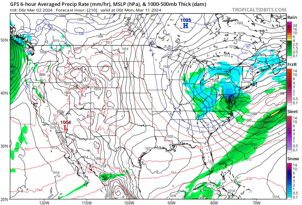


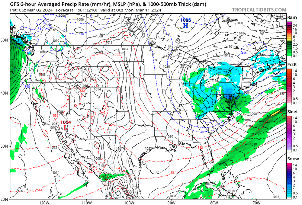
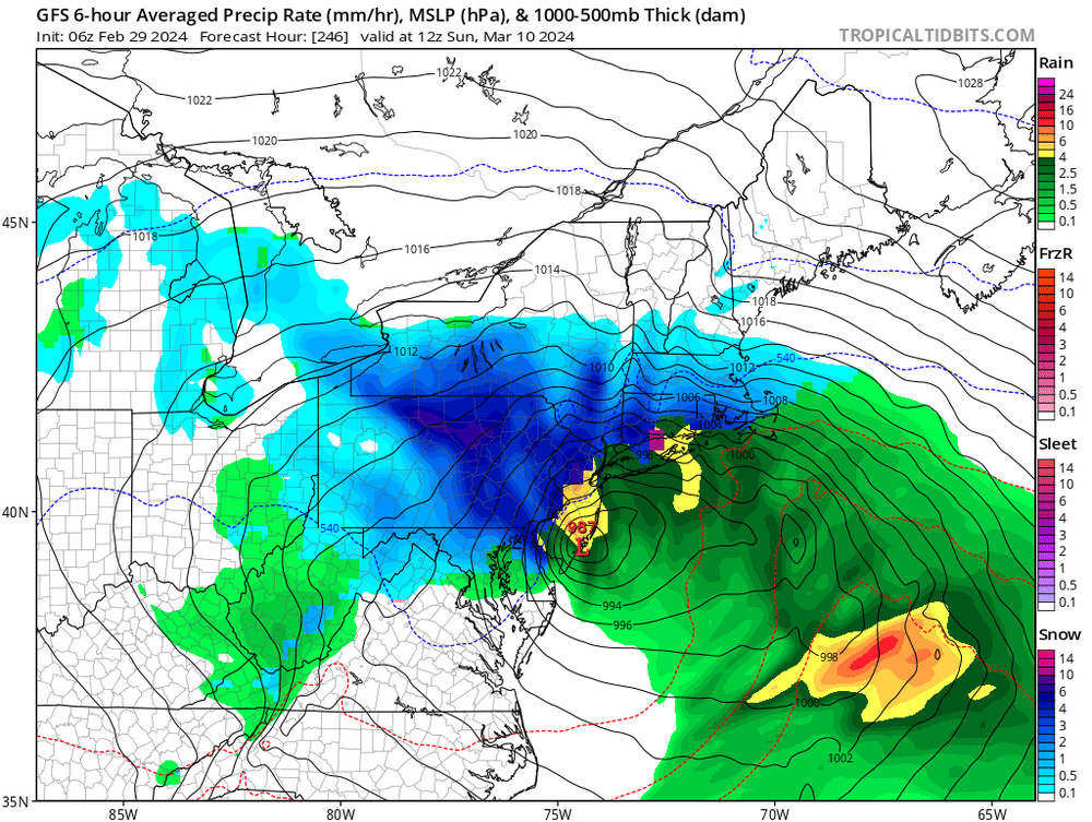
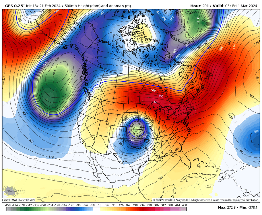
Late Feb/March Medium/Long Range Discussion
in Mid Atlantic
Posted
That looks exactly like the 12z GGEM