

wasnow215
-
Posts
875 -
Joined
-
Last visited
Content Type
Profiles
Blogs
Forums
American Weather
Media Demo
Store
Gallery
Posts posted by wasnow215
-
-
1 minute ago, RIC Airport said:
The CMC is the closest to what the Euro showed at 12z.

Exactly-different models and different runs of the same models are all over the place still. In 5-6 days it’ll become more clear.
-
 1
1
-
-
It’s funny though when the gfs shows snow every third model run or so we don’t believe it which is fine. But it’s too early for 2/18-19 to automatically think too warm or too suppressed will happen either. Everything is still on the table 9 days out.
-
1
-
-
6 minutes ago, Scarlet Pimpernel said:
OK, I'm not @psuhoffman and don't play him on TV...and yeah my previous comment was meant as snarky humor. But in all seriousness, just giving a cursory glance at the 500-mb flow around that time, it seems to me that the GFS just lifts everything more. The PV seems to get shunted north or elongated a bit, with little confluent flow; rather than forming a 50/50 type low it sits way up there in northeast Canada. We end up with flow coming right off the Pacific. At least according to the GFS ops. Here's one snapshot:

Ty! Seems like if things are still this volatile from run to run things can still pan out.
-
Just now, Scarlet Pimpernel said:
Change the physical properties of water so that it freezes at like 45 degrees???
Haha see above. @psuhoffmanor someone knowledgeable like to weigh in?
-
1 minute ago, IronTy said:
Volcanic eruption or meteor.
Haha so you done know either
-
7 minutes ago, Ji said:
It jumped north 600 milesYes and still warm. With that track from 18z GFS I don’t understand why there isn’t more cold air. What has to happen?
-
Oh where oh where could all the cold air be????!!!!!
-
 Nice look for sure
-
1
-
-
32 minutes ago, JB Fins said:
Right where you want it this far out. We know what happens when we are in the bullseye this far out, DC gets jackpotted, applying the same non-scientific weenie logic to this, as we want NC in that zone before the inevitable jogging trend to the north.
Exactly what I was thinking
-
 1
1
-
-
Super busy day but ..let’s go!
-
1
-
-
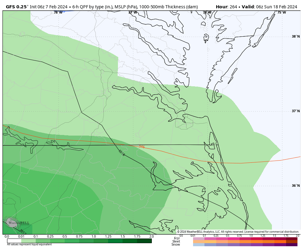
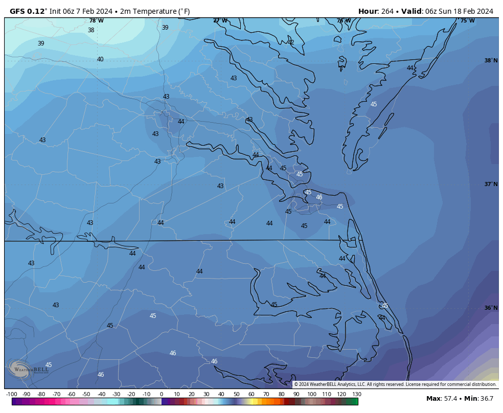
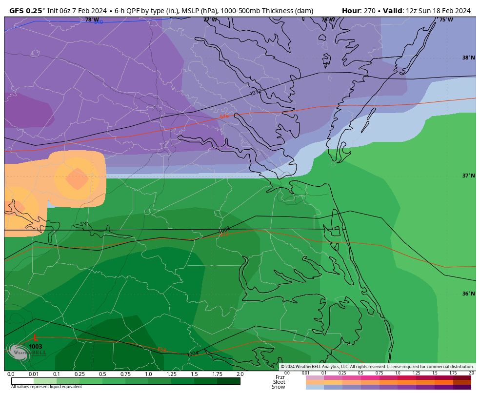
6z GFS somewhat more south for both 2/13 and 2/18-19.
-
1
-
-
@RIC Airportdidn’t the Dec 9 2018 big snow come after some pretty warm early Dec temps or no? I thought it was.
-
4 minutes ago, RVAman said:
Better than absolutely nothing.
Also, with the pattern change, conditions will be much more ripe for possible snowstorms in our area than they have been for a very long time. So this adds to the confidence of swing at least a SECS or MECS.
-
2
-
-
2 hours ago, RIC Airport said:
Yup, verbatim we are in the low-mid 50s the day before. By 1am, as the precip is moving, we are raining with temperatures still in the mid-40s and waiting for colder air.

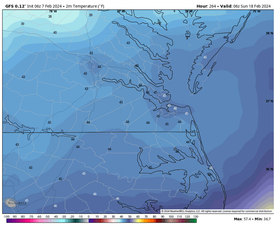
6 hours later, temperatures are at freezing from about Williamsburg north and west with snow falling. Ideally, we'd be cold enough from the start.
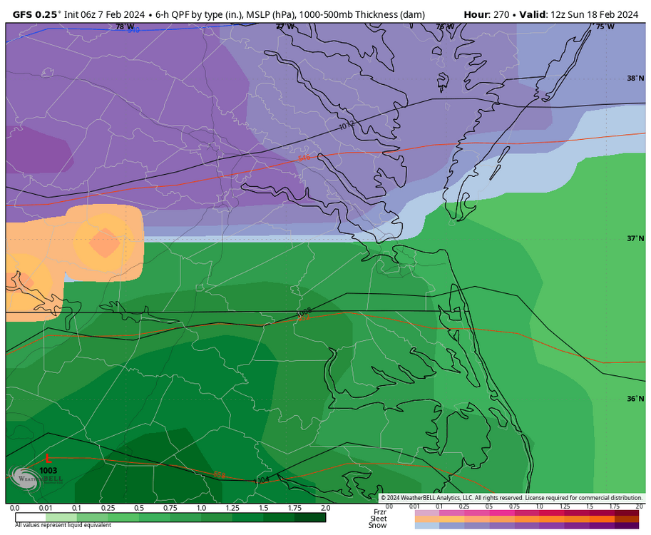

Good news is many of us have seen this multiple times in different places, where it’s in the 50s and even lower 60s one day, and a big snowstorm the next day.
-
1
-
-
This thread about to get awfully quiet soon except for these Dr Phil sessions (I would put “LOL” here but you know)
-
1
-
 1
1
-
-
9 minutes ago, mdhokie said:
My "negativity" is based in reality. The past two weeks have been above normal, and the upcoming week continues that stretch. I'm not rooting for warmth. I love snow. I love skiing. Can't do one without the other. Like I said, go back and re-read the previous LR thread. I'm not knocking on the posters. They provide great insight from the data available. That said, I think we need to step back and look at all of the data available and review what actually happened vs what guidance was showing.
I'm hoping we turn around and get a good back loaded winter, otherwise I'll be driving farther to do my skiing!
Lol-that’s cool and fair enough. Wasn’t talking about you in particular. But I had been disinterested for a month but hearing about the -Nao/ridge/blocking pattern upcoming gave me renewed interest. And only heard it would be in the 2/15 to 3/15 window. I really thought the next couple weeks were supposed to be tranquil. That’s why I don’t think it’s can kicking.
-
 1
1
-
-
40 minutes ago, mdhokie said:
Uh, go back and read the previous long range thread. It gets harder the farther you go back because people delete old images, but there was hype around the Feb 5/6 period, then there was hype around the Feb 14 period. Now its hype around the Feb 20 period.
All I know is the warm up period has been longer than anticipated. Local ski resorts have had one or two short night time snowmaking opportunities in the last two weeks. It’s supposedly middle of winter! Look at the 7 day forecast for Western MD! Depressing. Those lows are deceiving too, it takes forever to cool down and theres a short amount of time early in the AM where it’s actually cold enough to make snow before the sun comes. I don't need wall to wall winter but 3 weeks of spring in the middle of our best climo sucks.
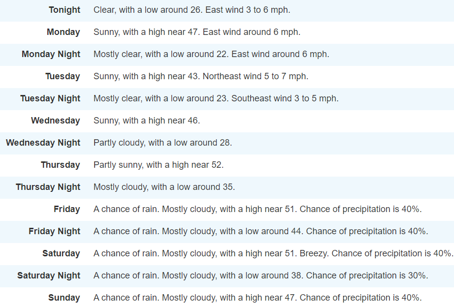
This forecast only goes to 2/11. Pattern change isn’t supposed to happen until 2/15. I think impatience is the bigger issue and negativity not “can kicking”.
-
1
-
-
4 minutes ago, Maestrobjwa said:
Why? He said it seemed like a can-kick in the LR...and to me it isn't. Feels like a perception as folks are understandably antsy. I just never saw the 14th as a big window but after based on the discussion.
Exactly-No can kick. People who root for a bad football team do this same thing. Because their team stinks they only get joy by rooting against other teams. Just arrogance and negativity and little more.
-
42 minutes ago, RIC Airport said:
People are floating around PD III because we had a KU on Presidents Day in 1979 and again in 2003. RIC recorded 10.9" from PD I, one of the coldest snowstorms in the period of record, rivaling the February 1899 Blizzard. Temperatures in Richmond during that snowstorm were only around 10°F. I would've loved to have been alive to experience it.
Here are some photos I found of it. Does anyone recognize these areas?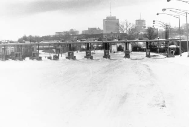
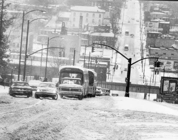
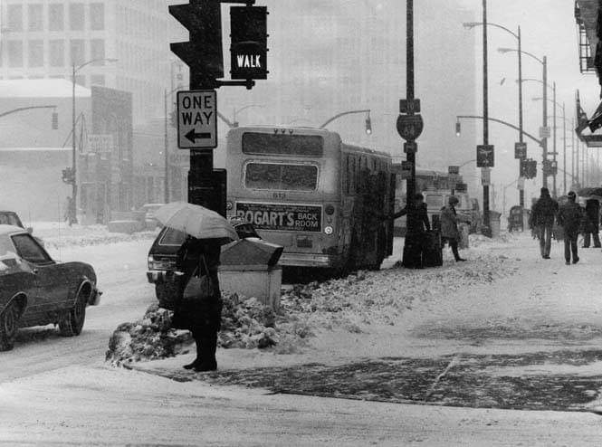
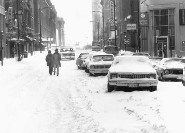
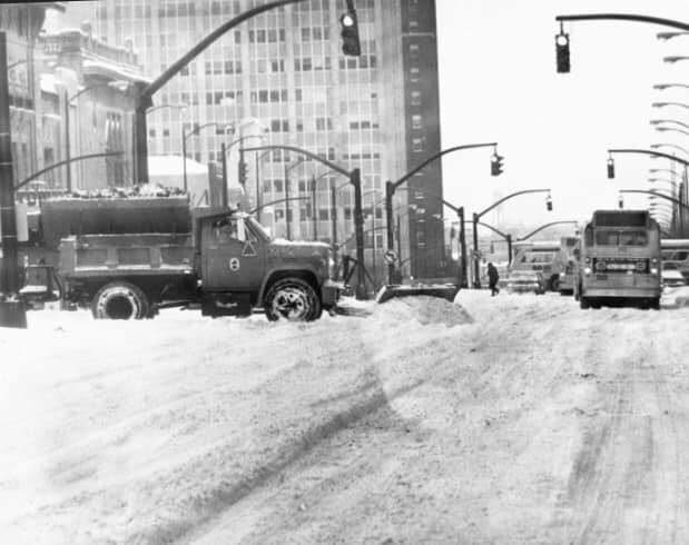
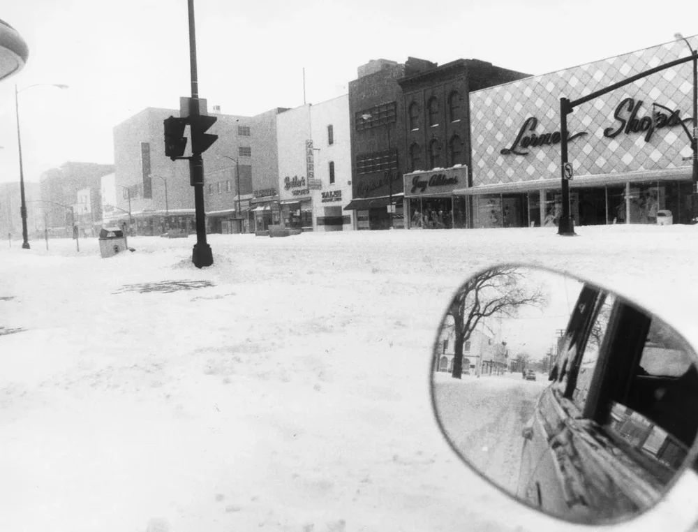
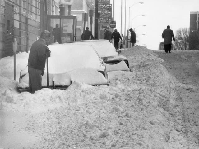
Unfortunately, the 2003 storm (PD II) did not meet expectations for areas south of Fredericksburg, but it was still a very impactful event. I had the AKQ graphic saved for many years until an old hard drive crashed. The graphic had 14.2" for RIC. However, there was only about 3-5" across the RIC area because even though the surface temperatures were only around 20°F during the height of the event, precip was mainly in the form of IP. The storm came in 3 pieces over several days. It started as rain, then it was forecasted to turn to ZR/IP, and then +SN once the coastal got going. Instead, we got the IP/ZR as the colder air filtered in, then got dry slotted. Then, the coastal cranked too far north of us to reap the benefits, something that thankfully didn't happen in the 2016 storm. Perhaps, if and when there is a PD III, it'll be on par with PD I.
Lived in Atlantic Co, NJ. Far enough inland it stayed all snow and had a foot and a half in 1979. Was in 5th grade and no school for a week.
in 2003 was living in Cape May Co, NJ. Over 20”! Both storms amazing!!
-
1
-
-
2 hours ago, Jebman said:
You guys are gonna get demolished. I can feel it in my bones. It may happen several times, too. You are DUE. It's coming.
Do NOT forget the Scraff Beer Fridge Index. Bolster it by stockin up on 7700 IPAs. Get five fridges and stock up but good.
Let's bring these snowstorms home and put the Reaper out of business for good. We've got this!
What I love about Jeb’s consistent positivity is it’s JUST AS REAL and appropriate as anyone consistently writing “I’m not sure” (anyone can say that lol) or “this is gonna bust!!”. Keep it up Jeb -thank God you’re not a DEB!! Hahahaha!!
-
1 hour ago, Conway7305 said:
LR models look dry for the most part, hoping that will change in time. Would hate to waste a good pattern change with no precip.
Shows some snow around the 16th ish. It’s gonna snow/ice. Conditions will be to ripe for it not to.
-
18 minutes ago, RIC Airport said:
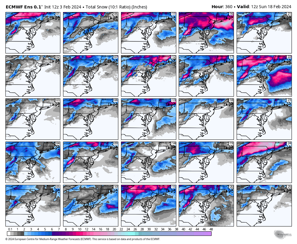
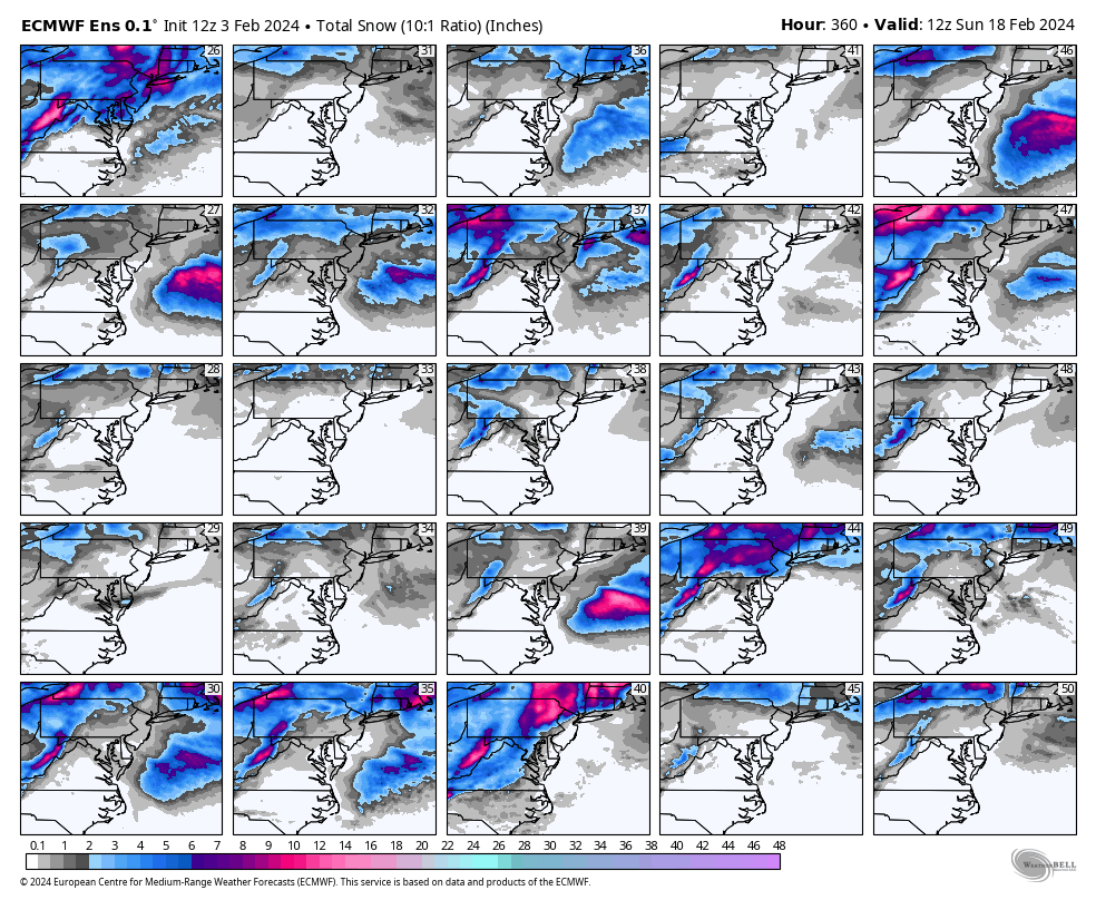
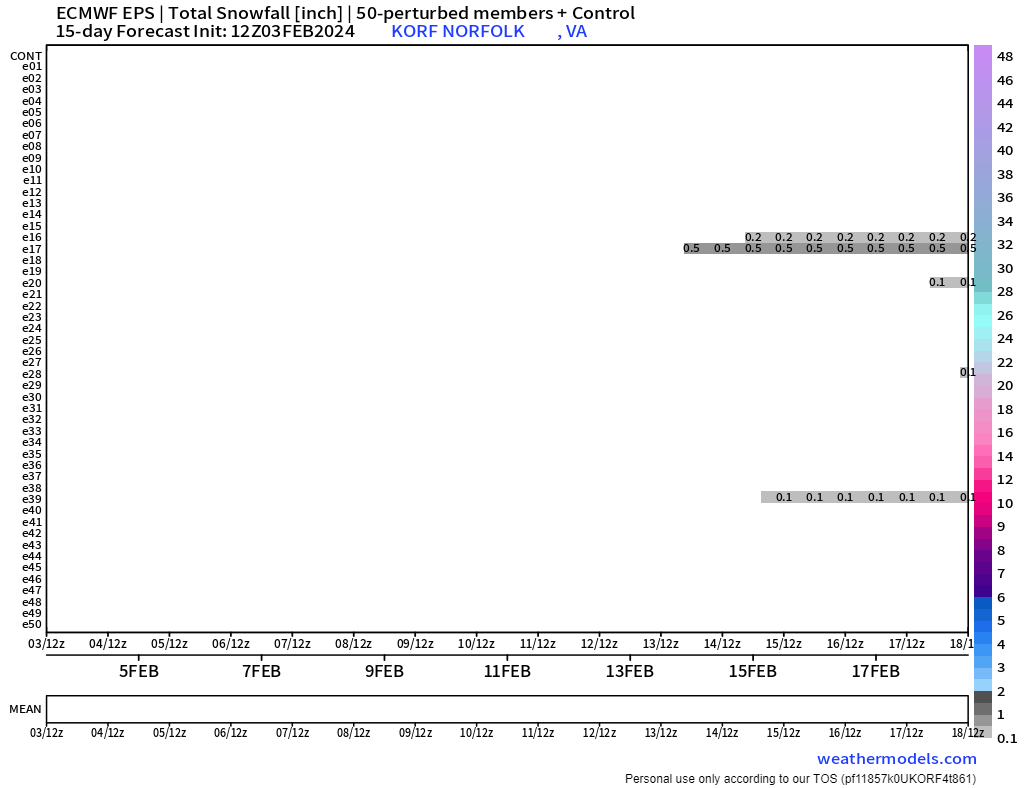
Nothing notable, in terms of snowstorms at least, on the 12z EPS either.
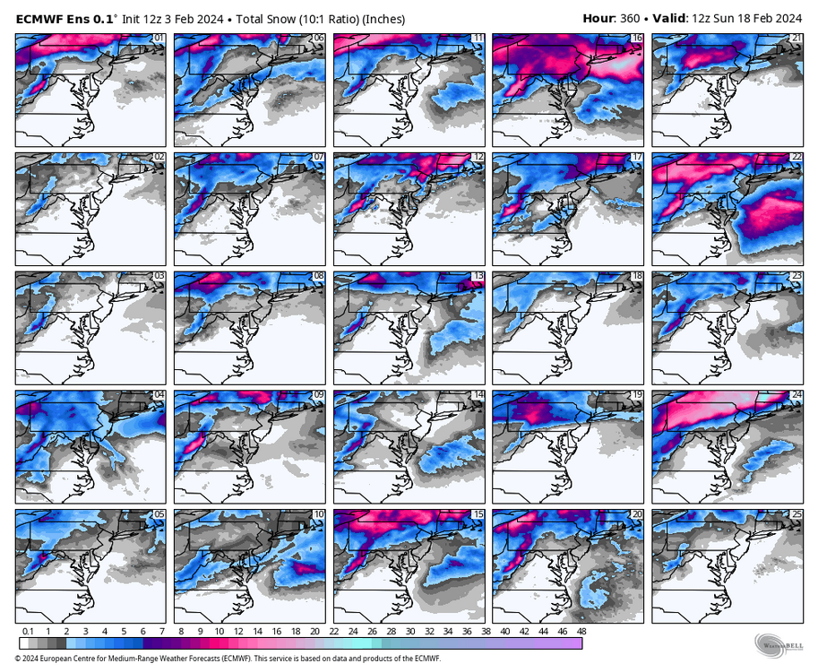
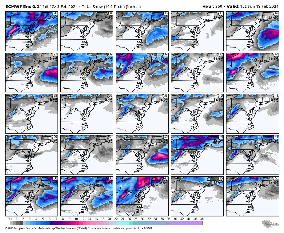
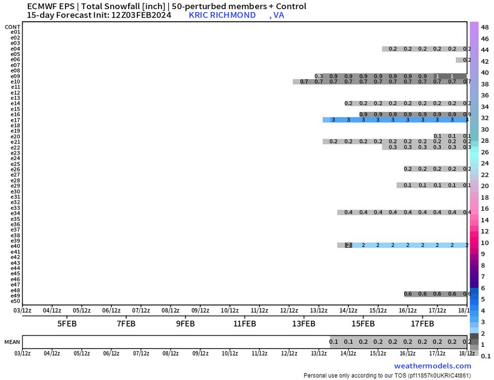
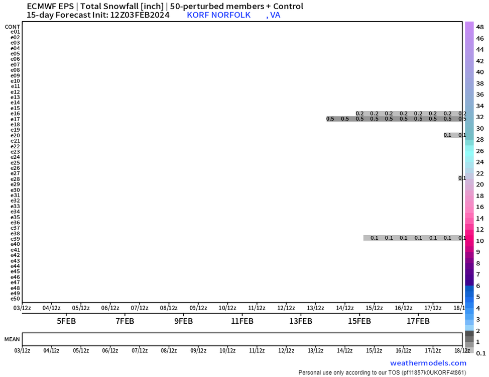
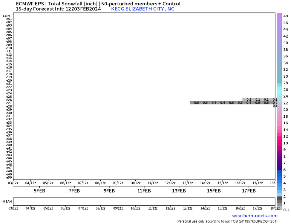
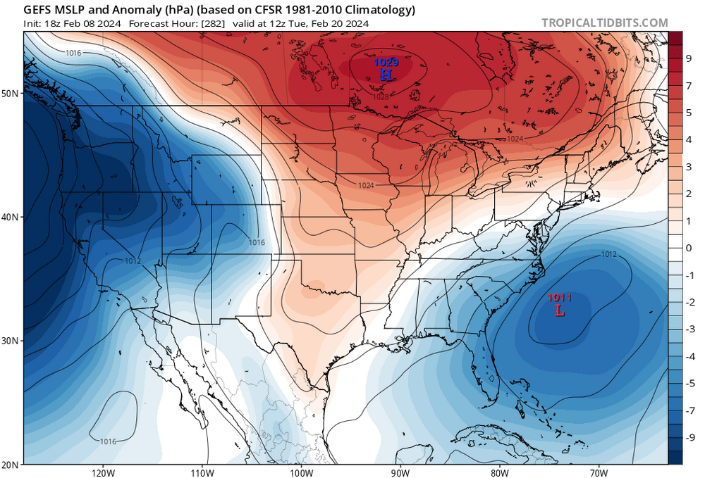
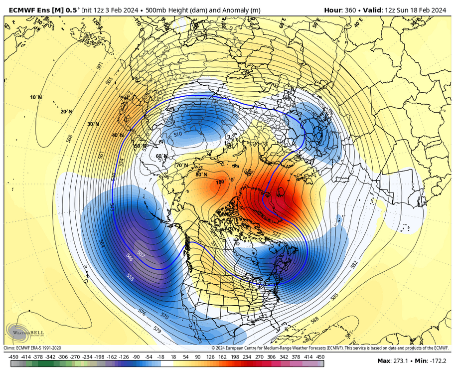
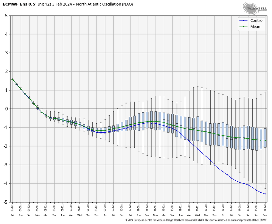
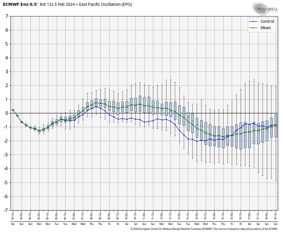
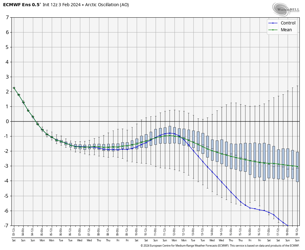
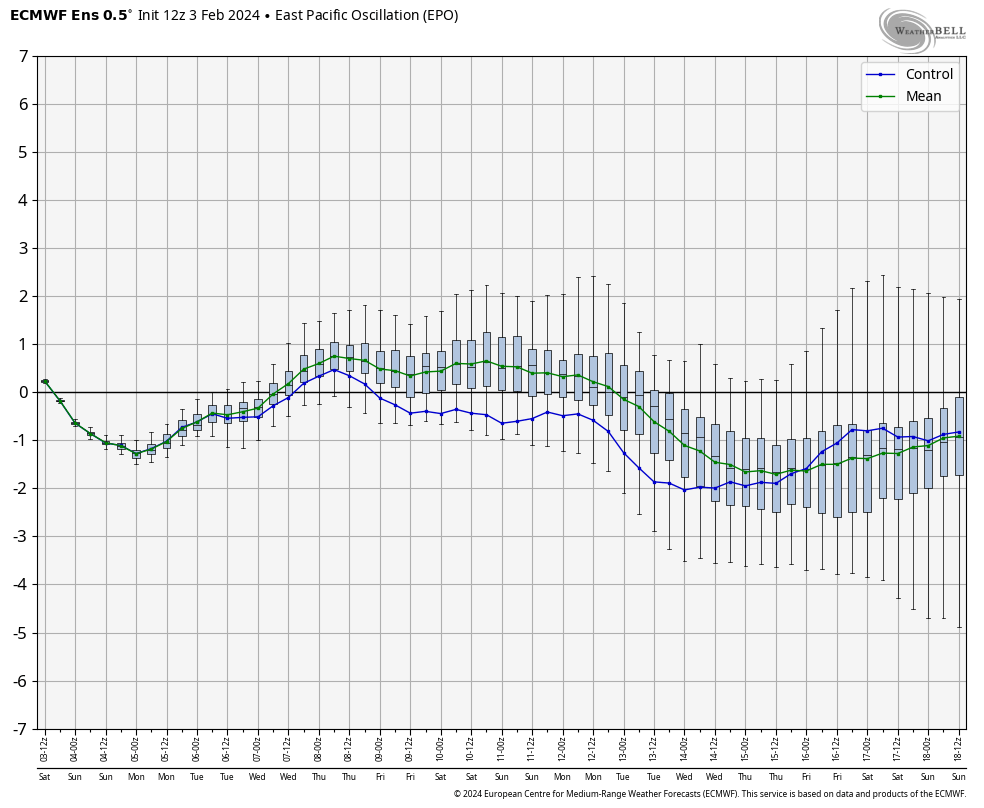
At the end of the run, we still have nice -NAO, -AO, and -EPO, a western ridge, and a split flow. There is also a nice vortex of SE Canada and lower highs in the 50/50 region, so it's hard to see why this "look" won't translate to a storm at some point, especially when all the teleconnections are where we want them to be.

I think there will be a ton of tracking starting a week from now and hopefully we cash in by President’s Day and beyond!
-
1
-
-
10 minutes ago, RIC Airport said:
@ldub23why do you keep posting the 384hr GFS and using that as justification to inject negativity into the thread? I've told you numerous times, both publicly and privately about why this isn't a best practice and you keep doing it.
The STJ has been producing all winter, hence the record rainfall we've seen since the week before Thanksgiving. The STJ isn't the issue. There are other mechanisms to learn about before making such declaration.
I also don't think people are "buying in", many of us have been at this long enough to know how things work. Personally, if I didn't want to see what the models showed a week or two in advance, I wouldn't be a part of this community and would either look at the forecast on my phone app or simply look out the window every day to see how the weather is. But, that isn't fun.
100% @RIC Airport! Pattern changes and fantasy clown maps 16 days away have virtually nothing to do with each other.
-
2 hours ago, RVAman said:
We apparently don't matter to the Mid Atlantic in the main forum, that's why we are here.
Lol I don’t get offended by that kind of stuff. Too many other things more important in life.


Richmond Metro/Hampton Roads Area Discussion
in Mid Atlantic
Posted
Probably too soon to say though. Surface maps not good but 7+ days out are virtually meaningless.