Buddy1987
-
Posts
4,511 -
Joined
-
Last visited
Content Type
Profiles
Blogs
Forums
American Weather
Media Demo
Store
Gallery
Everything posted by Buddy1987
-
Lmao.. idk what you use but I downloaded radar scope in my App Store and have had it for a good couple years. Every radar I see from Greenville to Knoxville even down to Atlanta all has a “good” look. Let’s just hope for the best man. I’m sure your temps are much more behaved. I’m 47/19 so am going to waste some precip for awhile.
-
Radar looks surprisingly good. Really hoping GFS can score a coup for a lot of us
-
You guys at least have the opportunity for having moisture thrown back your way. I have to pray this almost takes more of an east northeast trajectory otherwise we’re toast down here. And by the looks of the mesos don’t have the warm and fuzzies about over performing.
-
I was thinking the same thing. Pushed its poker chips all in on a nut flush
-
Good luck up that way. I feel a dud coming down in my neck of the woods. Starting off in the low 40s and the main piece of precip is going to traverse WV.
-
@clskinsfangot a nice strip showing up to a 1/2” qpf around the Blue Ridge there and then up into NW VA

-
This is the one I was alerting everyone to yesterday with me traveling and specifically watching the time period because of flights etc.. been showing on accuweather no joke for like over a month.
-
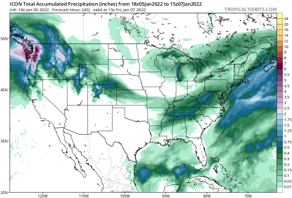
12z Icon has a nice area of mod-heavy snow that traverses southern/central va at hours 39-42 and then up into the DC crew at hr 45. Low goes from GSO to VA Beach.
-
Ehh now that I look again I was a little too focused on my specific area. I can see where up 81 gets shafted.
-
Icon still a quick hitting strike. Just a smidge south of 18z but precip evolution looks the same
-
Someone can correct me if I’m wrong but Nam looks better at 31 wrt GL low and energy out in the Plains/west
-
At this point 3” would make me ecstatic. Let’s hope 0z can give us all some goods.
-
Yea even up this way in ROA it’s a 50/50 shot right now imo to get 2-3”. I could easily see a lot of the precip go into WV. Has a tendency to do that a lot around here. If we can get some spacing it may be able to dig a little more and tap into some more moisture.
-
ICON still looks great at 18z. Maybe just a tick north and a little quicker than 12z
-
I got it out to 51 right now and yes you are right more moisture for sure.
-
Nice blend between RGEM, CMC and ICON for the win region wide
-
I forgot what option you offered me yesterday but there is that scenario for southern portion of forum
-
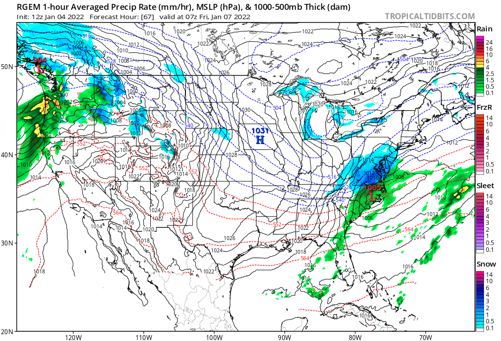
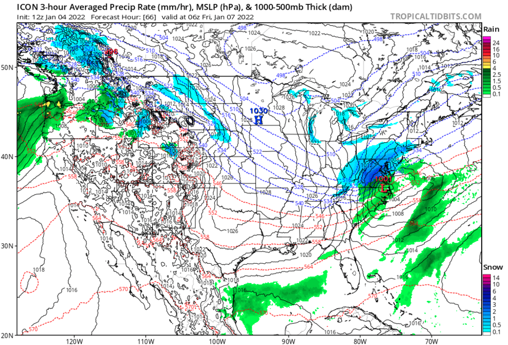
Then at 67

-
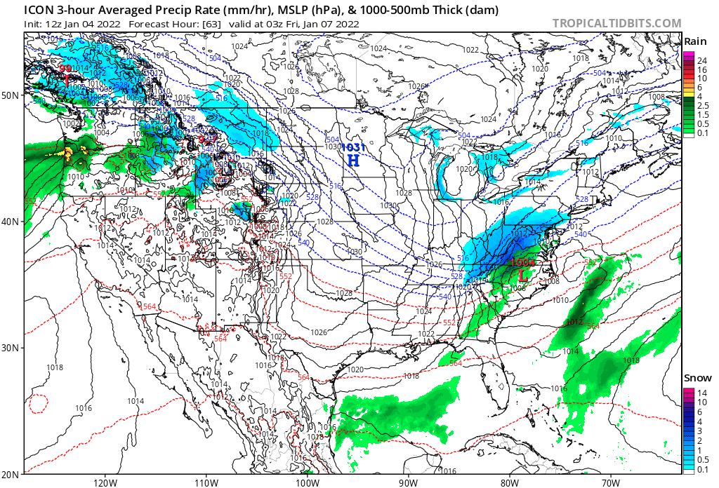
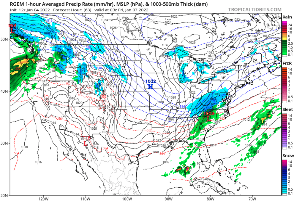
RGEM @63
-
Very similar evolution of last storm wrt LP placement
-
-

-
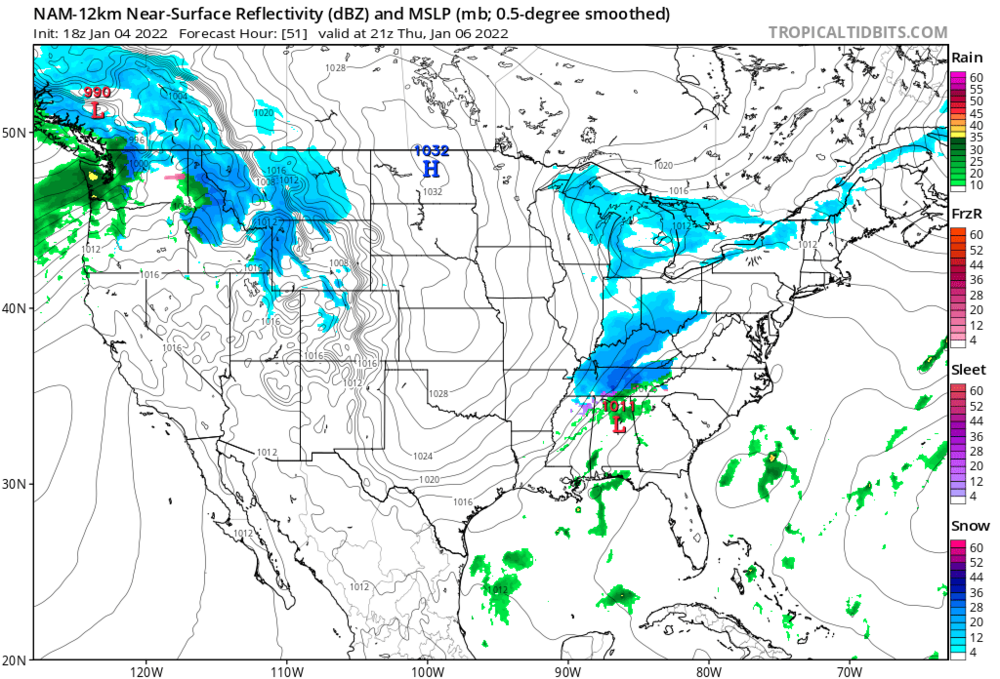
Yea Icon is a healthy a** storm for 81 corridor headed up toward the dc crew.
-
My kids school closed down for dry roads.. so there’s that too
-
Lmao and the NAM apparently broke as well been stuck at 36 forever