

Buddy1987
-
Posts
4,511 -
Joined
-
Last visited
Content Type
Profiles
Blogs
Forums
American Weather
Media Demo
Store
Gallery
Everything posted by Buddy1987
-
Afreakingmen
-
Man hard not to haha. Trying to stay humble tho so the weather gods don’t punish
-
@Cheeznado or @ILMRoss at 72 has the HP really shifted that far west or is that just more or less a nuance or meso type high the model is picking up comparing it to 6z?
-
At 60 the confluence is noticeable compared to last run that is what I have my eye on. If anything shortwave may be just a little slower this go around rather than going the wrong way.
-
Not sure I like it so far at 54. More of a neutral type tilt with shortwave but again confluence is a little better in New England so there's that. Need GFS to trend more southeast and I don't think it wants to do that. This is all strictly based off 500 map
-
So pretty much a wash here thus far at 42 and I say this because Plains energy is a tick north and west of 6z but confluence in New England is better.
-
Somewhat concerning because RGEM is used for CAD events, similar to Nam. Still far out in meso land so hopefully it will correct
-
3 hour increments starting at 72 ICON goes from SAV to CHS to MYR to Outer Banks and then is curling in to Chesterfield VA area (west of VA beach) by hr 90. Been pretty steady but to Buckeyes point there is a trend there as well.
-
ICON at 54 is a little southeast of its 6z position but is closed and stronger compared to 12z Nam. Also by 78 Icon MUCH quicker than NAM projection.
-
Icon sure taking it’s time to come out this morning
-
Yea GFS has been the one hauling a** the entire time. Kinda out there on its own in that regard from everything else I’ve seen
-
@psuhoffman would highly approve of this
-
Delayed delayed delayed been a growing trend. Would suck to get winter weather at night time it’s ok to weenie tag this
-
Actually imo not so much after the upgrade that occurred awhile back. It’s not the NAM I used to know where itd paint 3-4” or qpf only to cut it in half
-
-
Based on the presentation at 54 this looks to be pretty far south comparing it to 6z. Now I say that and then by the end of the run who knows with how the low behaves as it turns north
-
42 hrs 500 continues to look better with energy in the Plains
-
LOL man Colm Feore is a creepy dude.
-
Nam trying to go full Mark Wahlburg Perfect Storm into Cape Cod with a 972 beast prior to our event
-
Random thing I’m noticing at 36. Nam is trying go Perfect Storm into Cape Cod. 972 right off the coast. That would be something
-
12z Nam at 26 looks a little flatter and not as stout as 6z. Let’s see where this thing goes
-
Rise and shine, storm trackers! Two of our shortwaves of interest are now onshore, including the primary system which is making landfall in WA/OR this morning. 12z RAOBs should have the northern wave well-sampled, and should have a solid first look at the second wave. Twitter · 42 mins ago Jack Sillin (@JackSillin) · Twitter https://twitter.com/JackSillin Rise and shine, storm trackers! Two of our shortwaves of interest are now onshore, including the primary system which is making landfall in WA/OR this morning. 12z RAOBs should have the northern wave well-sampled, and should have a solid first look at the second wave. Twitter · 42 mins ago
-
Jack Sillin (@JackSillin) · Twitter https://twitter.com/JackSillin 12z RAOBS coming in with higher heights than 00z GFS across the W US, though less near the shortwave entering WA/OR compared to the downstream ridge. Also note lower ON heights. To me this suggests we might see today's guidance slow the storm down a bit and possibly wobble SE. Twitter · 19 mins ago
-
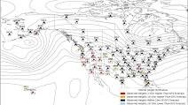
If you look at the 500 map on any website you desire, you will want to look at two pieces really. The energy that’s diving out of MN/Dakotas as the main piece of energy is around the gulf coast (models seem to be pretty set on this now) and then the confluence up above New England. The energy over New England basically squashes the heights and allows the system to be more south rather than turning due north and northwestward. Once that energy dives it’s a matter of timing. You have the euro that’s super aggressive with it and then you have some of the other solutions namely the GEFS that thinks it happens later and also allows the storm to take more of an east/northeasterly direction because of factors listed above The other factors is the NAO domain. Had that been a little further to the west than it is the storm would never have a chance to take a storm track like you’re seeing on some of these model runs. Now that makes some happy and others not so much. I can tell you WNC/SVA guys love this look and it’s classic major onslaught of heavy snow, as the flow comes out of the south southeast and piles up copious amounts of moisture along the blue ridge.
-
Euro in my opinion continues to struggle with low pressure placement, as the system becomes occluded and stacked, it is having a hard time depicting where to ultimately place the “L” I think this gets smoothed out within the next 24 hours and would expect to see it jump southeast some more in line with other guidance. Time will tell but that’s what my gut is telling me. There’s a lot going on in the atmosphere between the confluence to our north and the energy diving down forcing the low to feel it and get tugged back to the west/northwest. I think by tomorrow mornings 6z runs we should def have a pretty clear understanding as to what is going to happen.


