wx2fish
-
Posts
2,624 -
Joined
-
Last visited
Content Type
Profiles
Blogs
Forums
American Weather
Media Demo
Store
Gallery
Everything posted by wx2fish
-
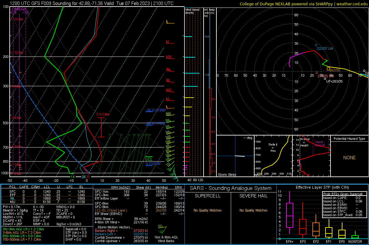
Paint peeler with a few flakes mixing in
-
Problem today is its really inverted aloft. No chance of mixing those 850s

-
Just the difference between Concord and my Uncles house un Andover can be crazy sometimes. Seems like it never melts all winter in that area.
-
Struggling to mix out even down here, so it's gonna be a while
-
0z nam trying for the BOS -10
-
They snuck a pk54kt in there too just before 0z
-
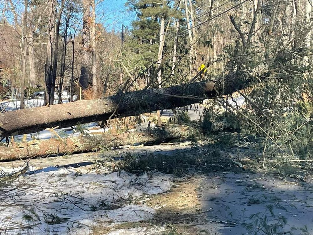
I hate pines
-
I just checked the eversouce map because I lost power too. Seems like alot small outages at the moment. A pine took down a pole a couple houses up from me. Not a huge deal because I have a genny, but I don't think it'll be out for too long.
-
Alot of -20 to -25s popping up around Jackman now
-
Just a short 30 min drive to the big city of Colebrook haha
-
Been steadily dropping since about 1pm, coincided with some big gusts that managed to take out my power
-
Yeah, even if the coop just caught a good 10 year period, it has to average considerably more than the First CT Lake coops ~150". From being up there snowmobiling there's always quite a bit more snow east/north of the First Lake down to Diamond Pond.
-
They don't have much for records but pretty sure they average over 200". There was a coop there for like 10 years
-
Lots of -10s showing up from northern ME back through NNH/NVT. Pretty solid for noon.
-
Feel like Sat aft will struggle with the high overheard. It's possible the high could happen pretty late, possibly at night if we cloud up.
-
Noticed the same here earlier. Drop a couple, stabilize, drop a couple
-
Locally looks like we pulled a T at the local coops in Feb 2012
-
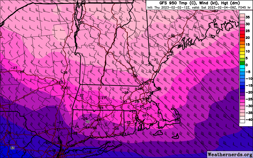
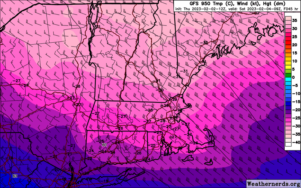
18z gfs pushed that -30c @950 line to about lwm
-
That's impressive. Makes you wonder how one of the sites up north like First Lake hasn't popped off a -50F or lower with good rad conditions. Several lows in the -40s at the coop.
-
Don't have euro, but gfs isn't far off those. Actually colder in NH.
-
Euro looked a tad colder vs 0z. Boston pushing-10F at 12z Sat
-
It's still kinda weenie range, but the hrrr gets MHT below 0F by noon, and Boston by 6pm
-
12z gfs is 28F at MHT at 06z, but 2F by 18z. Would be one of the colder afternoons I can remember yet a high in the upper 20s
-
Yeah timing kinda screws the highs, even though Friday is real cold.
-
Soundings seem centered up around 850, opposed to a little lower a couple days ago. Little deeper mixing to moderate a bit. Friday does look dam cold, 6z gfs is sub 5F after 12z at MHT. Ruined by a midnight high in the 20s though.