wxman
-
Posts
866 -
Joined
-
Last visited
Content Type
Profiles
Blogs
Forums
American Weather
Media Demo
Store
Gallery
Everything posted by wxman
-
Pretty consistent bumps west. If this continues we are looking at an all time great.
-
2.2" new snow. temp 27.9
-
pixie dust flakes have commenced. 33.8
-
At this point just need to hope the euro has a handle on this and adjusts west over the next 48 hours. It's possible.
-
How many times in the last 100 years has Cape Hatteras recorded 6" or more of snow? Would think that is also quite rare.
-
That's what I keep telling my wife!
-
Cue the reasons why it can't possibly cut...or come WAY north..........
-
By Thursday it could be congrats Pittsburgh, and probably will be............
-
12.1" yesterday. 30.5" on the season.
-
Ended up with 12.1" here with wild drifts to boot. Temp 17.2. 30.5" on the season. On to the next one!
-
10" down. light sleet/snow. 10.2 degrees.
-
9.5" on the ground. Light snow mixed with sleet. Temp 10.
-
8.75" down. Heavy snow. 9.3 degrees.
-
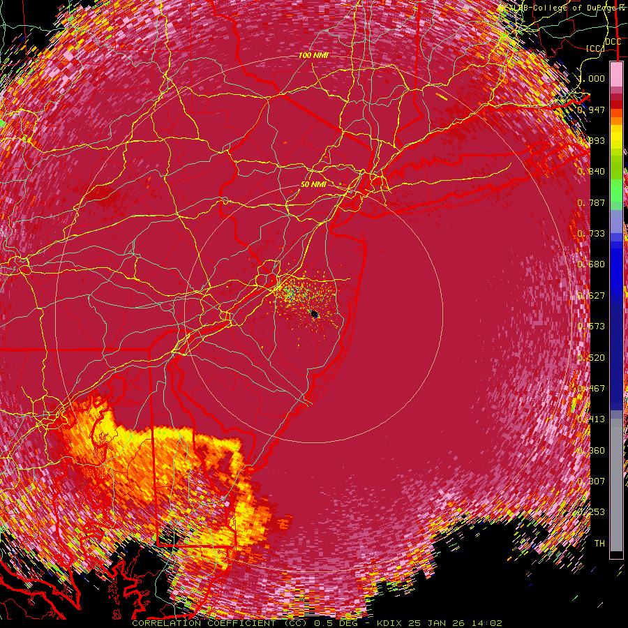
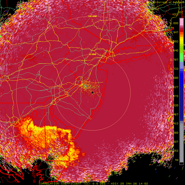
CC radar looks like the parting of the red sea down in far south jersey lol
-
6" down. Heavy snow. 9 degrees.
-
5" down. Heavy snow. 8.8 degrees.
-
Sleet line south of cape may.
-
4" down with moderate/heavy snow. 9.0 degrees.
-
3" down with moderate snow. 8.6 degrees.
-
snow has commenced here. pixie dust. temp 11.7
-
Essentially all snow like it was at 12z.
-
not running on pivotal. Maps?
-
The Rap is a foot plus forum wide. Hoping and praying LOL
-
Ahh, memories: National Weather Service Mount Holly NJ 318 AM EST Wed Dec 16 2020 NJZ001-007>010-PAZ054-055-060>062-101-103-105-162300- /O.CON.KPHI.WS.W.0001.201216T1700Z-201217T1500Z/ Sussex-Warren-Morris-Hunterdon-Somerset-Carbon-Monroe-Berks- Lehigh-Northampton-Western Chester-Western Montgomery-Upper Bucks- Including the cities of Newton, Washington, Morristown, Flemington, Somerville, Jim Thorpe, Stroudsburg, Reading, Allentown, Bethlehem, Easton, Honey Brook, Oxford, Collegeville, Pottstown, Chalfont, and Perkasie 318 AM EST Wed Dec 16 2020 ...WINTER STORM WARNING REMAINS IN EFFECT FROM NOON TODAY TO 10 AM EST THURSDAY... * WHAT...Heavy snow expected. Total snow accumulations of 12 to 20 inches. Winds gusting as high as 35 mph. * WHERE...Portions of northern and northwest New Jersey and east central, northeast and southeast Pennsylvania. * WHEN...From noon today to 10 AM EST Thursday. * IMPACTS...Travel could be very difficult to impossible. The hazardous conditions could impact the evening commute tonight and the morning commute on Thursday. Heavy snow and gusty winds could result in power outages. * ADDITIONAL DETAILS...Snow will move in from southwest to northeast this afternoon and early evening. The snow could become heavy at times tonight before ending Thursday morning. PRECAUTIONARY/PREPAREDNESS ACTIONS... If you must travel, keep an extra flashlight, food, and water in your vehicle in case of an emergency. The latest road conditions for the state you are calling from can be obtained by calling 5 1 1. && $$
-
Desperate times call for desperate measures!