VABILLUPS1
-
Posts
183 -
Joined
-
Last visited
Content Type
Profiles
Blogs
Forums
American Weather
Media Demo
Store
Gallery
Everything posted by VABILLUPS1
-
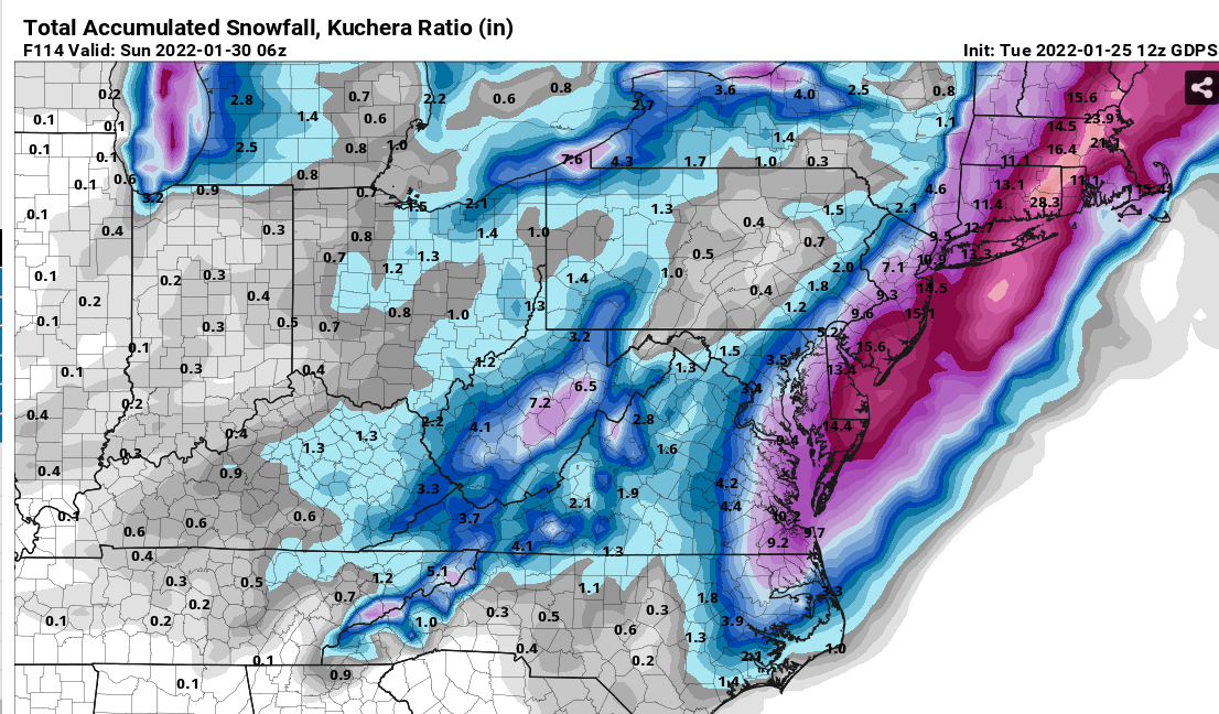
Potential 1/28-1/30 2022 winter storm
VABILLUPS1 replied to Prismshine Productions's topic in Southeastern States
12-26-10, let's do it again
-
About 7" IMBY - Va. Beach. GDPS/RGEM definitely the winner on this one. Was rock steady while most of the other models wavered back and forth. Great event.
-
Best rates of the night in Va. Beach now. I think we'll easily make 6" here, maybe a bit more.
-
Va Beach - nice. Probably close to 2" now with hours to go. Been 4 years since we had one like this.

-
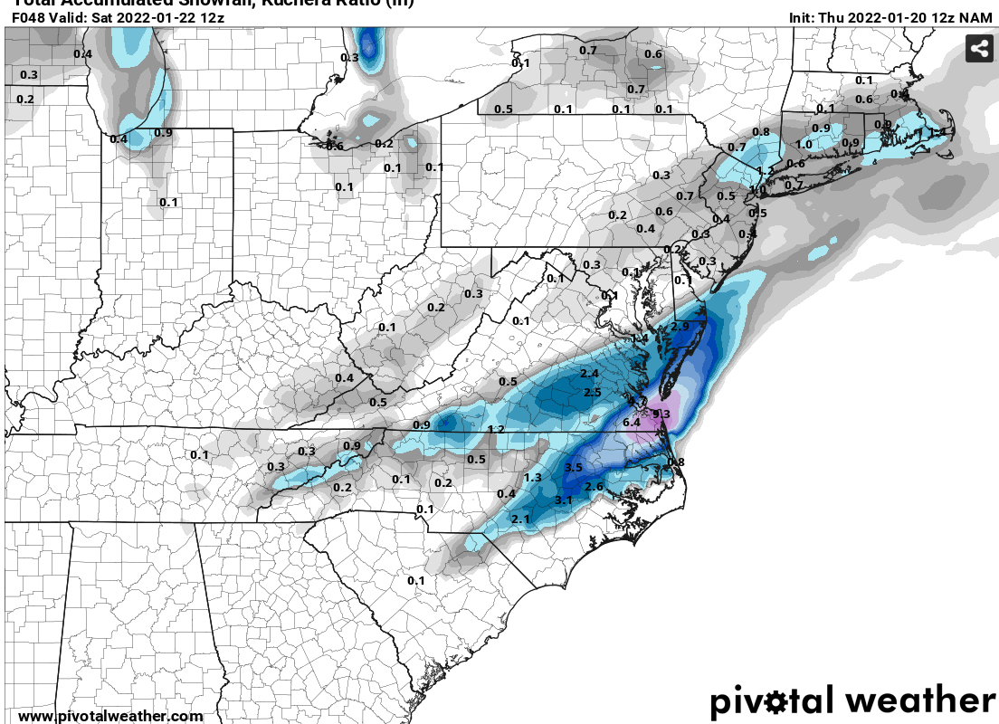
January 20-22 “bring the mojo” winter storm threat
VABILLUPS1 replied to lilj4425's topic in Southeastern States
Welcome back NAM
-
January 20-22 “bring the mojo” winter storm threat
VABILLUPS1 replied to lilj4425's topic in Southeastern States
Well if there’s any question we’re going to find out about these models in these next couple of days. NAM-GFS vs RGEM/CMC/ECMWF/ICON/UK -
January 20-22 “bring the mojo” winter storm threat
VABILLUPS1 replied to lilj4425's topic in Southeastern States
I'm stunned - I have no idea what's going to happen. NAM-GFS are out, ICON/RGEM holding steady. I'll just wait and see at this point. -
Jan 21 - 22 Weekend SE VA and Eastern Shore Snow
VABILLUPS1 replied to stormtracker's topic in Mid Atlantic
This is a total wow. I have never seen a system fall apart this fast and this close to the event. Whoever is programming these models needs to study this one. My goodness. -
January 20-22 “bring the mojo” winter storm threat
VABILLUPS1 replied to lilj4425's topic in Southeastern States
Man, all I can say looking at the NAM, the RGEM and the GFS I'm glad I'm not making this forecast. Huge differences in all these models. NAM = 15 inches, RGEM = 8 inches, GFS = 3 inches for my location. -
January 20-22 “bring the mojo” winter storm threat
VABILLUPS1 replied to lilj4425's topic in Southeastern States
About 30 hours continuous snow on the 12z NAM for SE Virginia from around midnight Friday to Saturday morning - model now combines the FROPA snow and the 2nd wave. Close to an all-timer if it verifies.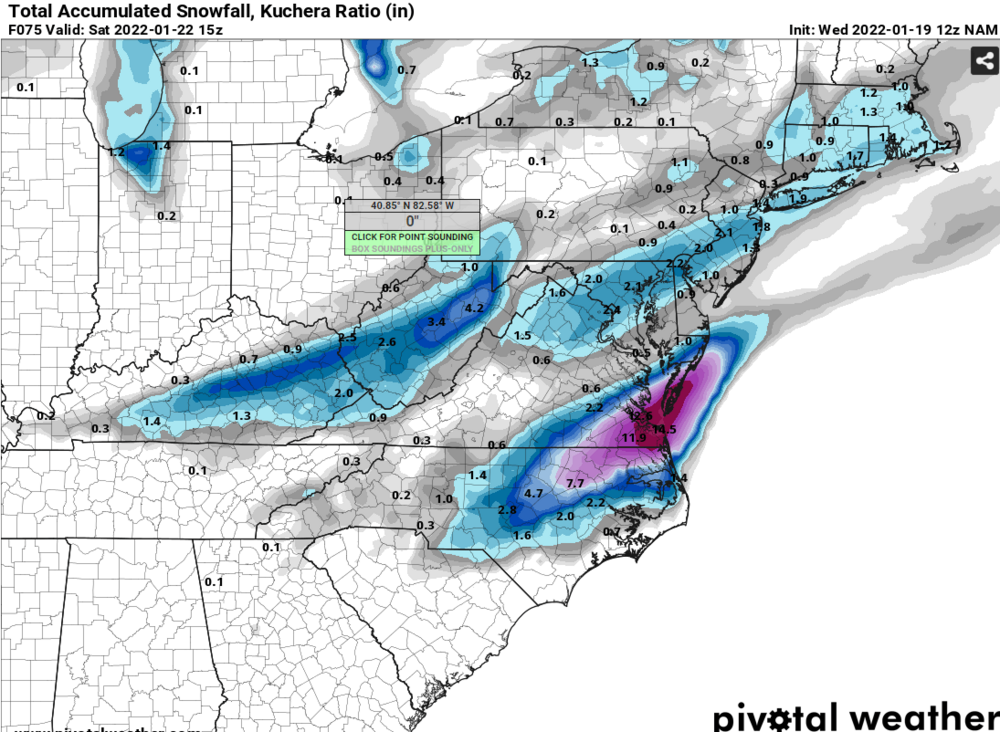
-
January 20-22 “bring the mojo” winter storm threat
VABILLUPS1 replied to lilj4425's topic in Southeastern States
12z NAM - two words for SE Virginia - GOOD GOD -
We got get one every once in a while. I think you folks will do well too even if the system stays this flat. These things tend to get wetter as we get closer to the event and you guys are going to be so cold you will have 15-20:1 ratios.
-
January 20-22 “bring the mojo” winter storm threat
VABILLUPS1 replied to lilj4425's topic in Southeastern States
I'm under that 21 in Va. Beach so, yeah, nice run. I'll sign for a quarter of that right now. -
Mid to Long Range Discussion ~ 2022
VABILLUPS1 replied to buckeyefan1's topic in Southeastern States
0z GFS, CMC and UKMET all with the classic weak southern slider. Very common in a Nina. Inside of 5 days now - we'll see if it holds up. -
Keep hope alive:

-
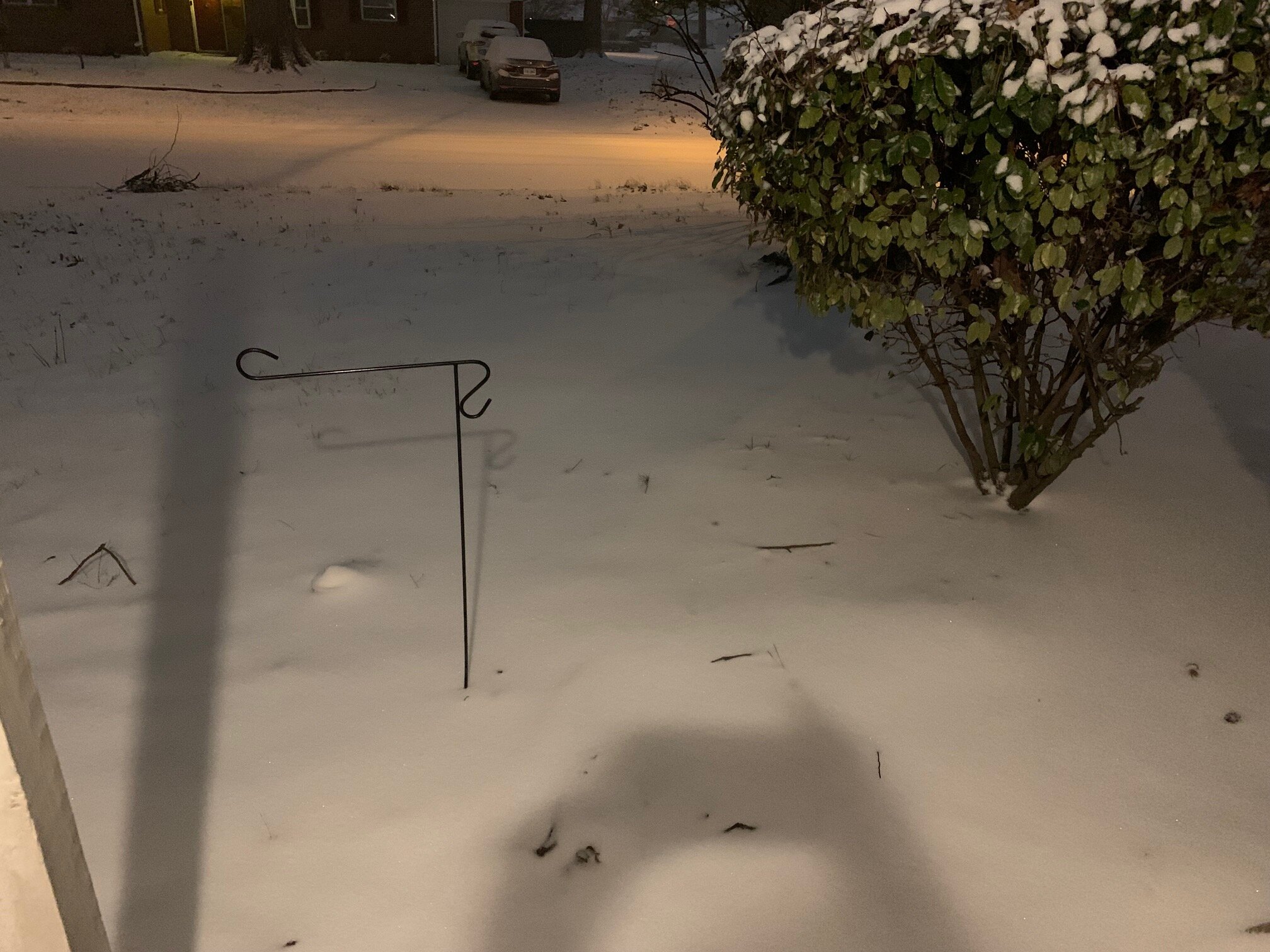
Interesting bay enhanced snow showers later tonight Southside HR. NAM has it going through noon tomorrow.
-
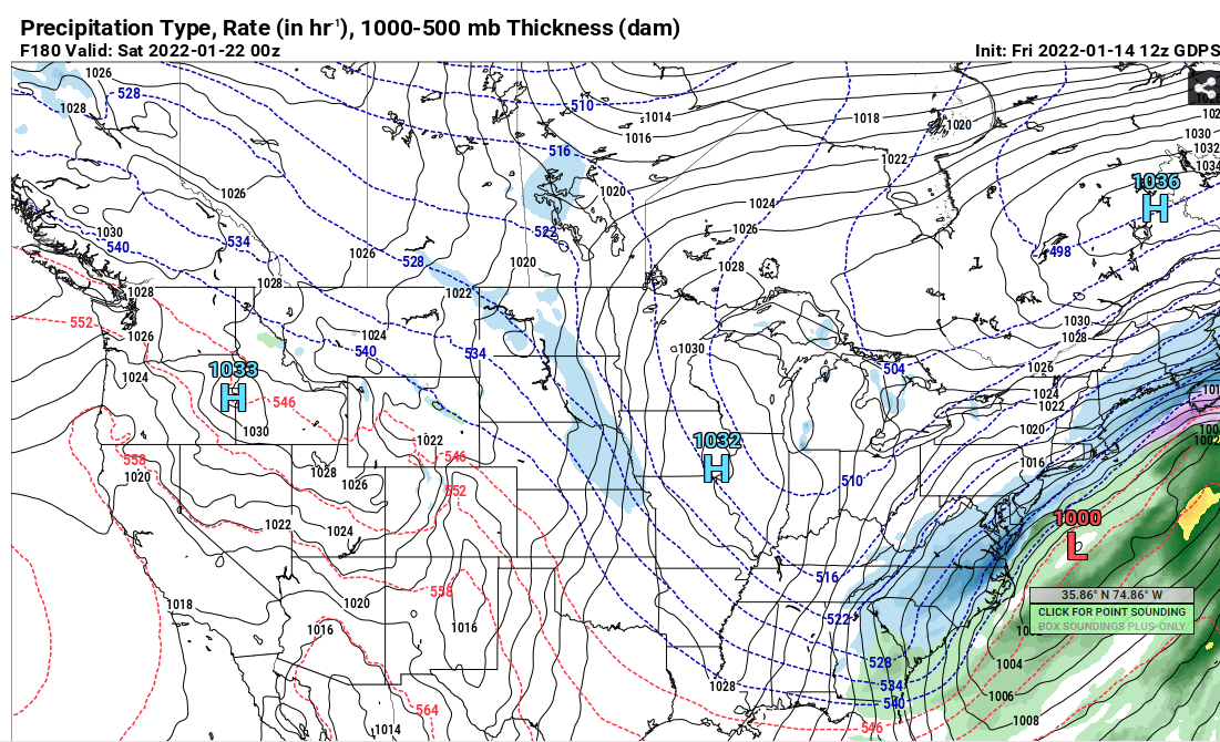
12z Jan 14 Euro at ORF 1/20 - 1p - 63F 1/20 - 7p - 28F 1/21 - 7a - 13F I've lived here my whole life and I thought and I had seen everything possible other than a Cat. 3 hurricane but I have never seen a 50 degree temp change in 18 hours. Will be interesting to see if it verifies.
-
Gonna be right on the edge in HR metro. Key will be how long it takes for the changeover from rain or rain/snow mix to all snow. Certainly looks like a couple of inches at least but could be a lot more if that changeover occurs quick enough. Somewhere around N.News to Suffolk or Wakefield area is going to jackpot with 6+.
-
18z CMC jumps on board. Much higher QPF right on the coast - P-types not out yet but certainly a good bit of snow in there.
-
12z Euro just went HAM - 6"+ for most of southside HR and NE NC but super sharp cut-off. Peninsula only 1-3" nothing for RIC but getting closer.