VABILLUPS1
-
Posts
183 -
Joined
-
Last visited
Content Type
Profiles
Blogs
Forums
American Weather
Media Demo
Store
Gallery
Everything posted by VABILLUPS1
-
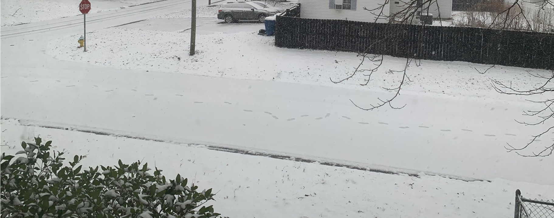
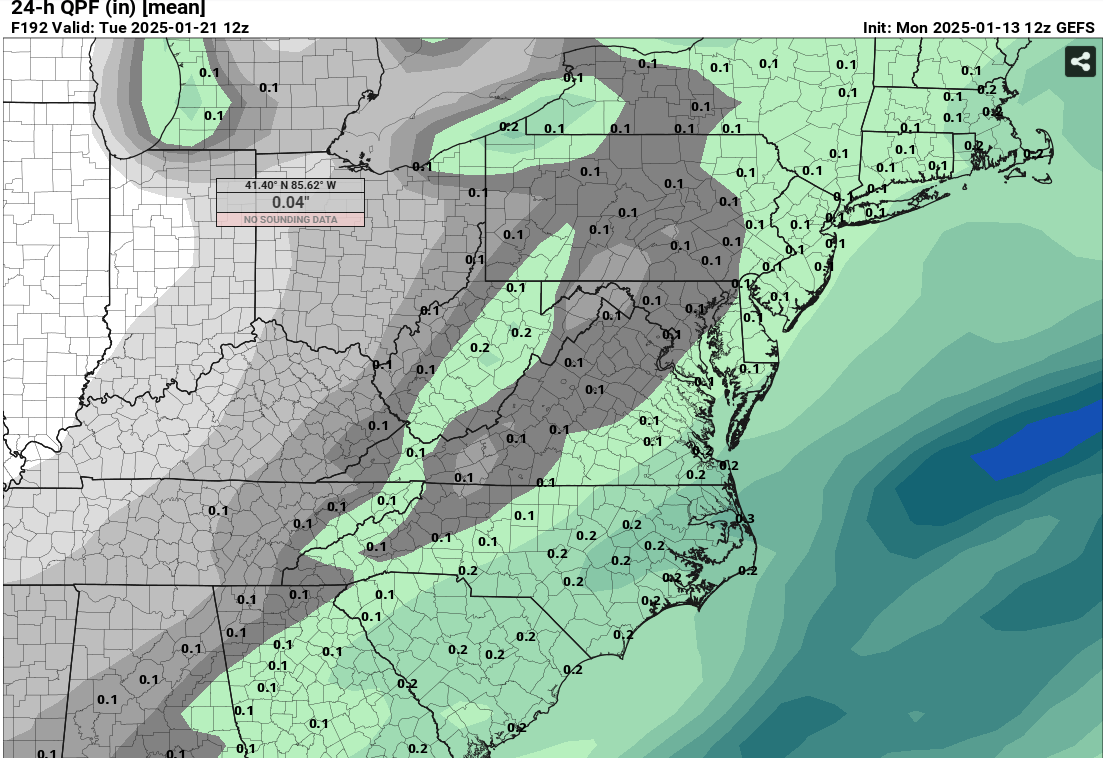
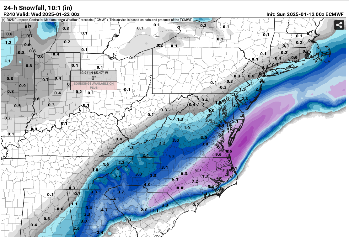
9.0" Va Beach - 23452
-
February 19-20 Major Winter Storm Threat
VABILLUPS1 replied to NorthHillsWx's topic in Southeastern States
Va Beach 23452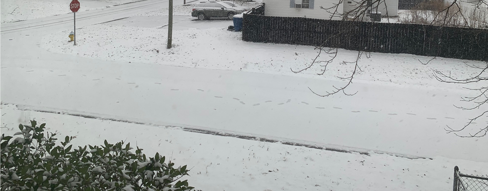
-

-
-
-
-
-
-
-
-
Everyone says the la nina causes the ever present southeast ridge that has obliterated this winter but is it possible it's the other way around? With the warming waters of the atlantic, is it possible we're in a feedback loop where the warm water promotes a ridge which then promotes further warming of the waters and sets up the pattern which leads to la nina?
-
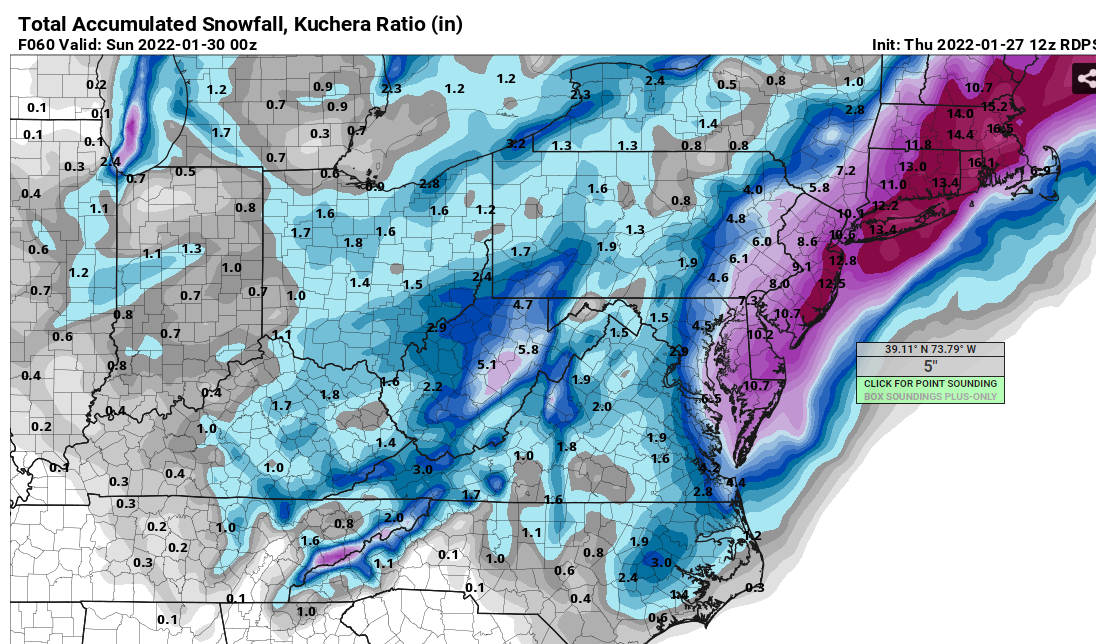
Potential 1/28-1/30 2022 winter storm
VABILLUPS1 replied to Prismshine Productions's topic in Southeastern States
Ripping pretty good in Va Beach now - 32F. Probably about an inch down. Let’s see if we can get this band to pivot and hold in here as the coastal strengthens. -
Potential 1/28-1/30 2022 winter storm
VABILLUPS1 replied to Prismshine Productions's topic in Southeastern States
Mod snow - Va Beach 32F. Maybe a half-inch down, street just starting to go snow covered now. -
Potential 1/28-1/30 2022 winter storm
VABILLUPS1 replied to Prismshine Productions's topic in Southeastern States
Mod snow Va. Beach - 33F -
Potential 1/28-1/30 2022 winter storm
VABILLUPS1 replied to Prismshine Productions's topic in Southeastern States
Snow mixing in - Va Beach 34F -
Potential 1/28-1/30 2022 winter storm
VABILLUPS1 replied to Prismshine Productions's topic in Southeastern States
Euro caves to the GFS again. It’s a new world -
Potential 1/28-1/30 2022 winter storm
VABILLUPS1 replied to Prismshine Productions's topic in Southeastern States
A little improvement on that run for the GFS but still out there on its own for the most part. We'll just have to bow down if it pegs this one. -
Potential 1/28-1/30 2022 winter storm
VABILLUPS1 replied to Prismshine Productions's topic in Southeastern States
Rock steady RGEM - it will win again.
-
Potential 1/28-1/30 2022 winter storm
VABILLUPS1 replied to Prismshine Productions's topic in Southeastern States
Man, GFS and NAM not even on the same planet. Epic model battle. -
Potential 1/28-1/30 2022 winter storm
VABILLUPS1 replied to Prismshine Productions's topic in Southeastern States
Three words for old-timer snow fans in SE Virginia- Blizzard of ‘80. That’s what the NAM is showing. The downside? It’s the NAM. Real interested to see what the RGEM shows tonight. If that jumps on board we may have something historic here. -
January 28-29, 2022 Miller abcdefu Storm Threat
VABILLUPS1 replied to WxUSAF's topic in Mid Atlantic
Remember it was Wednesday 18z NAM that lost the storm last week and eventually brought it back so it will probably be the same this week to some degree but I think the SC to Maine blizzard idea is off the board. Not just because of the NAM but all the guidance today. The thing just gets going too late for anybody south of NJ/NYC to really cash in. -
January 28-29, 2022 Miller abcdefu Storm Threat
VABILLUPS1 replied to WxUSAF's topic in Mid Atlantic
What is wrong with the Euro? I mean, has the atmosphere changed or something. -
Potential 1/28-1/30 2022 winter storm
VABILLUPS1 replied to Prismshine Productions's topic in Southeastern States
The Canadians never lost it -
Potential 1/28-1/30 2022 winter storm
VABILLUPS1 replied to Prismshine Productions's topic in Southeastern States
The Canadian has cancelled the big event. Just some light snows on the coast, gets going too late. I'd love to toss it but the Canadian models really handled last week the best so we'll see. -
January 28-29, 2022 Miller abcdefu Storm Threat
VABILLUPS1 replied to WxUSAF's topic in Mid Atlantic
Looks great but I have to wonder if the Euro is overdoing the trough the way it was about this time last week with the last storm.