
frostfern
-
Posts
1,984 -
Joined
-
Last visited
Content Type
Profiles
Blogs
Forums
American Weather
Media Demo
Store
Gallery
Posts posted by frostfern
-
-
32 minutes ago, Solidsting said:
hmm im getting vibes of the 1998 southern great lakes derecho. i hope the setup holds true for the overnight hours.
The thermodynamic setting is similar but the shear doesn't look quite as good extending to south and east. Derecho's can sometimes be CAPE-driven towards the end of their life-cycle though. The MCS can generate it's own shear via a rear-inflow jet. I'm worried if there's strong dry rear-inflow jet it could re-intensify coming in off the lake like in 1998. Sometimes a very cold Lake Michigan marine layer causes an air-hockey table effect. The rear-inflow can accelerate as it glides over the smooth surface of the marine inversion. It then crashes to the ground when it reaches the shore.
-
 2
2
-
-
Lake breeze micro-cell on the southeast side of GRR just produced a nice tropical downpour. Only heard one soft rumble so far though. I would like to hear more thunder, but cells are just getting started and are still a bit low topped.
-
On 5/15/2020 at 1:45 PM, madwx said:
the latest NAM has 500-1000 J/KG of ML CAPE over Wisconsin and Michigan early Sunday morning and has it lasting into the afternoon in Michigan. Previous runs had the low going from the Quad Cities to Toledo, the new run has it going from La Crosse to Detroit.
The CAMS are showing northern end of the line now just west of Chicago making it all the way up to GRR. I don't see it producing much lighting as whatever CAPE there is is tall and skinny, but the rain is going to be a problem as instead of moving east the line is supposed to just kind of slowly pivot around the low similar to a tropical rain band. 3-4" rain totals are not needed.
-
 1
1
-
-
1 hour ago, madwx said:
GFS and NAM are trending north with this weekends storm system, more in line with the Euro. Too bad the timing isn't great for the western lakes, otherwise we could have some good storm chances.
Does the instability actually reach Wisconsin and Michigan? Older runs just looked like a general rain.
-
4 hours ago, wisconsinwx said:
If I remember correctly, the first 2/3s of October featured mostly 50s and 60s, and I can't think it'd have been much different in GRR.
I just remember it being kind of cloudy compared to normal. Or maybe I just couldn't enjoy the nice ones.
-
1 hour ago, weatherbo said:
.62" of rain and then fog with a high of 52 today... felt warm
For the first time this spring I heard the peepers this evening.
Five weeks until the summer solstice and there's still snow hanging around. I love the north but a warm spring isn't too much to ask for from time to time, is it?

Based off the latest ECMWF, you may hit the first 80 before me. Maybe not right on the water, but inland certainly. Dumb blocking pattern means the first torch will hit places north and west while areas further south and east have cool northeasterly winds. Western Michigan might eek some mid 70s since we're the farthest from Lake Huron. I'm ready for 80, but I won't complain if it can at least be sunny. Just praying the cutoff doesn't retrograde any more than currently shown. I feel bad for Ohio people though. Really annoying pattern after already dealing with cold blasts the past two weeks.
-
On 5/13/2020 at 4:55 PM, wisconsinwx said:
That's what your fall is for (October specifically sees a lot of days like today). Here it's been quite windy today but despite temps in the upper 50s and the stiff breeze I did not need a jacket to golf today due to wall to wall sunshine.
Didn't get many of them last fall either though. It went from warm and wet to cold and wet. Summer humidity lingered late then winter came early. The transition was pretty abrupt and not very sunny... a lot like spring.
-
1
-
-
Today feels legitimately warm with full sunshine and light winds even though it's not even 60. Only nice thing about having a horribly cold early May is 60 degrees still feels somewhat good (so long as the sun is out and it isn't too windy). Would be nice to live in a place that gets a solid month or two of this kind of weather rather than just a day or two in transition.
-
1
-
-
On 5/7/2020 at 10:47 PM, mississaugasnow said:
I loved the humidity when I was in Thailand haha. I was in Phoenix last summer and didnt really enjoy the heat much. But I also love that feeling of the tropics. Off topic but I was able to sneak in a quick Asia trip in January before covid. Landed in Bangkok January 5th and hung around Thailand for a few weeks before going to Dubai and finally Paris/London. Looking back on 2020 in a few decades it will be weird to say the wife and I did a world tour right when the world pandemic was beginning.
I've never been to the Asian tropics. Costa Rica is kind of interesting with gap-wind patterns and micro-climates.
-
On 5/6/2020 at 11:09 AM, madwx said:
blowtorch means death ridge, lets get an active pattern with thunderstorms and mild temps
A death ridge in May sometimes means severe storms up north. May 1998 was hot and stormy in Michigan. WSW as opposed to SSW upper flow is usually better for the Upper Midwest. You need a good westerly component off the rockies in the 850-500 hPa layer to get steeper mid-level lapse rates. Otherwise the best instability is confined to the plains despite good dewpoints (most of May-June 2018). North-South meandering jet is bad whether it's a ridge or a trough. Somewhat zonal but displaced north is the best for anywhere north of I-80.
-
2
-
-
22 hours ago, LansingWeather said:
So lets go for a June snow thread?

I think we'd need a major volcanic eruption for that to happen. With the reduced air traffic due to the pandemic, low temperatures on clear nights might be a degree or two colder than otherwise in high-air-traffic regions though... like anywhere in a 300 mile radius of Chicago. Who would have thought air-traffic contrail pollution can protect fruit growers. Of course only passenger flights are affected right now, so it might not be quite as extreme an effect as after 9/11 when all planes were grounded for a short time.
-
1
-
-
22 hours ago, michsnowfreak said:
Even May of 2018 was preceded by a very cold April. One thing I have noticed the past decade, with a few certain exceptions, is that it seems that the leaves are falling a bit later in the fall and opening up a bit later in the Spring. Not by much, but the little things I used to always use were Halloween as the date when most of the trees were all bare and May 1st is when everything used to be very green with all the new lime green leaves having recently opened. Now, while we still peak in color in late October, we have the last of the color straggling on until mid November. Likewise, the buds start in April but May has been beginning with basically bare landscape, with rapidly blossoming during the first and sometimes second week of May (ongoing as we speak the last 2 days).
Only years I remember green maple leaves on May 1st are 2010 and 2012. Most years they're open but still have that early-spring reddish hue. This year they were mostly not open at all until the brief warmth hit last Saturday. If you have a lot of Norway maples around you might see more green as those will open early and green. Alder trees also leaf very early and are light green right away. I noticed the early flowers have hung on forever this year. Things have been really spaced out since there was some early warmth followed by cold.
-
1
-
-
On 5/1/2020 at 1:12 PM, Angrysummons said:
UKMET with a much more seasonal solution. Wavelengths are moving fast. This isn't January(but idiots like the GFS can believe so).
I want to murder the GFS. Next weekend is a horror show on all the models though. Just please let it be the end after that. Thunder weenies are going to suicide if this dumb pattern persists.
-
 1
1
-
2
-
-
19 minutes ago, janetjanet998 said:
it has been literally been raining for a day straight....24 hours of obs at PIA
looks like another 1 hour or so
widespread 2-4 inches down
It's all virga so far up here. Only felt a sprinkle or two.
-
On 4/22/2020 at 10:09 PM, zinski1990 said:
Be nice if this Spring was like 2018. Crap cool/cold April followed by sudden extreme pattern change last day of April into May with 70s 80s and 90s rest of the way. Remember Indy that year had 3rd coldest April on record followed by warmest May ever.
Up here in Michigan May 2018 kinda crap. Stuck on the north side of the warm front with constant rain for the first half of the month. Only south of I-80 saw the sun. Overnight lows were mild enough for things to start growing, but it didn't really get nice until the end, and at that point it was summer. Summer started early, but there was no pleasant spring with sunshine and temps in the 70s. Went straight from rain and 50s early to 80s and 90s late. Not that I wouldn't take 80s and humidity over cloudy and 40s and 50s.
-
1
-
-
10 hours ago, hoosierwx said:
On the bad news front all of these assymptamatic cases and maybe even mild cases may be able to get it again this fall. Nothing is known for sure yet but just based on other coronavirus infections the severity of the disease may be tied to immune response down the road. 2 to 3 years in severe cases and 2 to 3 months possibly in mild or assymptomatic cases.
Sent from my SAMSUNG-SM-G935A using Tapatalk
What is "mild" anyways? I had one of the worst fevers in my life back in early March, but since I was only bedridden for 3 days and never felt so bad I might die if I don't go to the hospital I couldn't get tested. For COVID-19 it wasn't that bad, but I'm having a lot of trouble believing it was something else because I'm 40 and haven't had influenza since childhood. The symptoms were either influenza or a short COVID-19 case. A positive antibody test would make me feel better. It's still worth it even if false positives are possible. Whatever it was my wife got it exactly a week after me. Both my parents were exposed to us before I realized it might not have been influenza, so I was nervous for a while. My father has heart disease.
-
5 hours ago, weatherbo said:
I still have some of last weeks snow that fell on top of 20 inches of glacier pack. Yesterday’s high was 28, tonight 22. Average high is 51 ( pre lake breeze of course).
I noticed the snowpack in the zone southeast of James Bay has continued to increase over the past month. That might have something to do with this stubborn Eastern US trough pattern. The spring melt has failed to reach the 50th parallel anywhere east of Winnipeg. Zone between 45 and 50 has lost some snowpack, but it's stopped as of now and won't resume for several days. We really need a good torch to knock back the glaciers of Ontario and Quebec. Lengthening days and higher sun angle does no good when it all gets reflected off snow. The Canadian prairies now being snow free and warm only seems to amplify the annoying NW flow and eastern Great Lakes digging.
-
1
-
 1
1
-
-
4 hours ago, Stebo said:
After the March we just had it is more like March 8753rd.

Every month has been some variation of March or November for the past 5 months.
-
1
-
-
11 minutes ago, Torchageddon said:
I haven't been checking the long range much but the 500 mb pattern didn't look much different from the stuff I was seeing in Jan. I still am solid on 2014 being the worst year in modern times for all aspects. If it weren't for some sunny weather early this month than this April would've been neck and neck with June 2015 for worst weather month. I don't feel bad for complaining about this because with rona this is the worst case senario for people's well-being in this region. I was pissed as soon as my fears were realized that the mental health crisis was going to be exaserbated with this ****.
Some ON posters may know of the UW Waterloo weather station contest to predict when we reach 20C for the first time annually. I can't believe this, but its nearly certain that this will be the 3rd year in a row where it will be in May! Before 2018 it was decades (70s?) since the first reading of 20 happened in May. With 108 years of data there were never 3 Mays in a row.
I'm sitting at -1C with chill at -8C. A LES shower gave some whispy snow snakes on the road not long ago.
I think the new semi-permanent northeast Pacific SST warm anomaly has slowed the polar jet and increased the amplification of the climatological Rocky Mountain ridge + Hudson Bay trough. The northern hemisphere has warmed overall, but climatological northwest flow has become more amplified over the eastern North America. This will definitely cause cold springs as long as the north winds are coming off lingering Canadian snowpack.
-
2
-
-
9 hours ago, Torchageddon said:
With how the climate has been behaving in recent years near the Lakes and what is taking place now it sealed it for me that my goal is now to simply leave, meteorology and weather is my main passion so to save it. Walking outside in mid-April feeling like your face is numb and in pain, yeah.
Today's high is 0ºC with a wind chill of -9ºC for most of the day. That would be in the all-timers for the worst late April day since it will be overcast with flurries. I'm trying to remember an April that was this terrible. I saw on the 00z Euro the same nightmare and on the 240 hr frame (May 1) I smiled in horror.
Is it time I pony up some of my quarantine stimulus check money to watch the 384 hr Euro? Or will that just make me more depressed? I don't understand why the weather gods have to conspire to make 2020 even more hell-year than it already is. Just need a little hope please. I suppose it could be worse. My neighborhood didn't get flattened by a tornado. I mean, I feel bad complaining about the weather of all things but I just need something to look forward to after rona-hell.
-
1
-
-
On 4/18/2020 at 7:29 AM, Baum said:
Fixed that for anywhere east of Lake Michigan and north of I-80. Also, "winter" = London-style. Cold and damp but no real snow.

-
2
-
-
1 hour ago, CheeselandSkies said:
@madwx @Geoboy645 Here's hoping for a few rumbles this evening, am I right?
There will probably be some thunder over there. The freezing level is real low so graupel will almost certainly make it to the ground. Stronger updrafts may have some small hard hail too. I don't think there will be any thunder in my area but still could see some graupel and gusty winds. This setup reminds me of mountain weather. Dry atmosphere with steep lapse rates and low freezing level.
-
At temperatures between 0C and -40C you can have either water droplets, snow/ice crystals, or both. It all depends on the type of aerosols present along with the temperature and humidity. At temperatures below freezing the ice crystals are generally much larger than the liquid droplets, so they will slowly fall and separate from the part of the cloud that is liquid droplets.
-
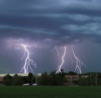
I just found out the cell I barely got out of the way of did drop 2" hail in Plainwell, Michigan. Looks like I high-tailed north just in time. I did run into a solid line of 60+ dbs in the dark driving north, but the hail thankfully didn't get bigger than dime size.
June 2-3 Severe Weather
in Lakes/Ohio Valley
Posted
The line looks kind of stung out in an E-W orientation. It's not the best orientation for shear / cold-pool interaction. The storms seem further east than what was in the models too.