
frostfern
-
Posts
1,984 -
Joined
-
Last visited
Content Type
Profiles
Blogs
Forums
American Weather
Media Demo
Store
Gallery
Posts posted by frostfern
-
-
5 hours ago, purduewx80 said:
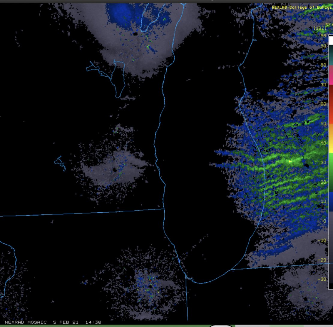
Kinda hard to see on the composite, but the TMKE terminal Doppler reveals that industry in WI is contributing to the heavier lake effect bands affecting areas near and NW of GRR this morning.

I was wondering why I've been stuck between bands most of the day. It's like there's been a hole over the SE side of Grand Rapids. Some could be due to being close to the radar source, but I can confirm the GRR hole is at least partially real as accumulations have been pretty nonexistent so far IMBY. It's finally starting to fill in now. Still nothing too heavy so far.
-
Total IMBY is for the synoptic event is right around 6". I think about 3 fell in the WAA event, then there was a "warm sector lull" as the center of the low passed nearby, then the cold front swung through with an additional burst that added up another 3". It was pretty wet and heavy shoveling. Definitely more synaptic than lake effect. Also a lot of accumulation on tree branches, signs, etc... despite 40 mph+ wind gusts last night. Think it's frozen on.
Lake effect has underpeformed. Just very light mood flakes. Kinda positioned between bands all day. Less than an inch so far. Might pick up in intensity or at least fill in some this evening though.
-
 1
1
-
-
Went up to 33 degrees with some drizzle in the past hour. Now a it's ripping snow again. Nice lake-enhanced burst moving inland. Roof dripping has stopped now so I assume the temperature is also dropping.
-
Another intense convective band rotating through here now. Really coming down.
-
Getting much bigger flakes now. First hour had a lot of pellets mixed in. Intensity is variable. Seems very convective.
-
Very heavy wet snow coming through with this first band. Seems convective... like mountain snow you get out west. Pellets mixed in with the flakes at times. You can hear it making a "shhhhhh" sound against the windshield.
-
1
-
-
15 hours ago, A-L-E-K said:
clipper trains are zzzzz unless you already have 1'+ otg which we do so bring it
Clippers often bring some of the highest impact weather of winter IMBY. Don't get any lake enhancement with southern stream storms but often do with the clippers especially if they are associated with a re-enforcing arctic surge. Totals usually aren't over 6", but it often comes down fast and with wind and low visibility. Spreads the wealth inland much better than typical lake-effect too.
-
2
-
-
21 hours ago, BuffaloWeather said:
Lake effect snow off of Erie is the wettest of the great lakes. Our ratios are usually 1:15 to 1:20. I think it has to do with being the southern most lake and higher lake temps on average for events. A lot has to do with the flow of the wind. NW wind is usually higher ratio snow due to colder conditions. I get hit with W/SW wind which is usually not as cold resulting in lower ratios.
Snow from a single dominant band may have updrafts strong enough to cause significant riming of flakes. Places in northern and western Michigan don't get those kinds of bands most of the time. It's typically persistent light snows from weaker bands with some orographic enhancement added in the slightly higher areas up north.
Also, immediate GRR area gets a lot of nickle-and-dime 2-3" snowfalls that add up to more when measured over days than if the same liquid were to fall in a single 24 hour period. The relationship between depth and liquid content isn't linear. Seems more logorithmic to me with fluffy snow as the bottom layers compress under the weight of new snow added on top, especially when you get over 6". This biases smaller snowfalls to higher ratios than big ones.
-
1
-
-
1 hour ago, WestMichigan said:
If only the GFS would verify. Nearly 3' IMBY. However the Euro says no way. Give me less than 12". Either way, definitely looking to double my YTD snowfall and maybe more.
Lake effect is always weird in terms of measurement. Very high winds can cut down on the fluff factor, as can a low DGZ causing more plate-dominant snow. Think you'd need 25:1 ratio at least to get three feet out of any model output. Lake effect is always better than 10:1, but you need temps in the mid 20s and wind under 15 mph to get the crazy 20:1 ratio dendrite-dominant feather-fluff. Even then it doesn't really feel like as much as the official measurement because when it gets deeper than 6" it settles fast under it's own weight even within 6-12 hours of falling.
-
1 hour ago, Chicago Storm said:

.How much of that in SW Michigan is post-frontal lake-enhanced snow? WAA stuff will be dense, but behind the front I'm assuming 10:1 is on the low end.
-
I'm hoping for a quick front-end snow, followed by dry slot, then a heavy west-flow lake effect event behind the occluded front as the system pivots away to the north.
-
Haven't had a good clipper-train / lake-effect pattern in a long time. Hopefully this pans out. GFS almost looks too cold for good accumulations though. Would prefer the DGZ rise above 5000 feet with waves coming across the lake. I remember Jan 28-31 2018 had decent small accumulations with waves that added up to over a foot of snowpack despite a very low DGZ a lot of the time.
-
1
-
-
About 3" total here. It came down good for brief period late last night. Just lacked duration due to lack of back-end deformation snows being all to the southwest. It's added on top of 4" remaining from the last system so there's finally a decent snowpack. Hopefully we get some more to add to it.
-
1
-
-
I'm hopeful for a good WSW flow lake-effect pattern. Frequent waves rotating around a nice arctic lobe would be nice. Still a lot of uncertainty though.
-
4 hours ago, HighTechEE said:
Serious virga over the SW Ohio area now, hope it doesn't turn into Thunder Virga!

Here it just went from virga and flurries to pouring snow. I think the dewpoint jumped up 10 degrees in 20 minutes. Went from 16 degrees to 26 degrees. It's a plate-dominant snow with mostly smaller flakes, so not accumulating super fast. Definitely reducing visibility though, especially since the wind is picking up.
-
Well, the snow finally started reaching the ground here. Had a solid 2 hours of virga and flurries.
-
5 minutes ago, Hoosier said:
I went out to get a head start on some shoveling and measured 2.5" about 40 minutes ago. It is ripping so probably topping 3" now. The snow is kind of a sugary consistency but with some density. Could make a snowball in my hand but it's not that great for packing. Not overly wet at all.
Something I've noticed is that the ratio can depend as much on wind and crystal structure as temperature. Dendrite-dominate lake effect that falls straight down in light wind can be much higher ratio at 30 degrees than wind-blown plate-dominant synoptic snows at 27 degrees. I have seen 14:1 ratio with massive aggregate flakes even with a temperature of 30, provided there isn't a lot of wind and the depth is only a few inches. Of course, once you get a depth of more than 4 inches, even dendrite-dominant large-aggregate snowpack will compress quickly to a 10:1 ratio if the temperature is anywhere near freezing. It's usually under 4 inch snowfalls that can have a lot of variability based on crystal structure and wind. Once you get a lot of depth there's more compression due to weight and so the ratio's become more purely temperature dependent.
-
3
-
-
18 minutes ago, Gino27 said:
Battled virga for about 45 mins but am snow now!
Still dealing with "heavy virga" overhead here. Getting some pixie flurries with composite 25 dbz overhead.
-
7 minutes ago, zinski1990 said:
Still never experienced that. Even when I was younger living in The UP don't remember it
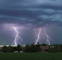
Thunder-sleet seems to be a more common phenomenon. Had quite a lot of lighting with ice storms in Feb 2019.
-
Just now, mimillman said:
Gotta appreciate the road accums
Have to live somewhere with a north-facing hill then. Weird how it often makes a difference even after dark.
-
1
-
-
2 minutes ago, mimillman said:
Dry air in the heart of the city causing issues again. Roads are wet with puddles so will need solid rates and big flakes to overcome that if anything is to stick. Visibility has improved and I can see the south loop buildings from my place which are about 1.5 miles away
LOL. Since when do we care about accumulation on salted roads. I assume most of us are not the age where we are praying to get days off school.
-
Just now, sbnwx85 said:
Heavy virga here.
Had a virga band sitting overhead all afternoon here. Mix of virga and filtered sunshine.
-
 1
1
-
-
20 minutes ago, madwx said:
It's not really a dryness thing here, its more just a slower progression northward of the forcing for precip. Getting reports of drizzle on the SW side of Madison so we just need the forcing to arrive(probably in an hour or so) and well be golden.
It's definitely dry here at 28/18. Was hoping to add at least a little to the snowpack. It looks like the backside deformation zone will be closer to you later tonight into tomorrow morning. Here the front end is all we're going to get as the upper low is forecast to fizzle as the energy transfers to the mid-atlantic. I'll be surprised if I eek 2 inches from this. You'll probably do a little better as you'll at least have a decaying deformation band overhead for a little bit of time.
-
Just now, SchaumburgStormer said:
Hoping to ride this side of the sleet line for as long as possible
Hopefully adiabatic cooling can force the line back south if the lift intensifies.
-
1
-
Feb 3rd - 5th Potential strong stm threat
in Lakes/Ohio Valley
Posted
It seems like the SE side has been stuck between bands most of the day.