WVsnowlover
-
Posts
690 -
Joined
-
Last visited
Content Type
Profiles
Blogs
Forums
American Weather
Media Demo
Store
Gallery
Everything posted by WVsnowlover
-
Driving home from Morgantown yesterday afternoon was fun coming through Garrett County. Near whiteout conditions at times. I will say I've never seen so many snow plows in my life. They were doing a phenomenal job.
-
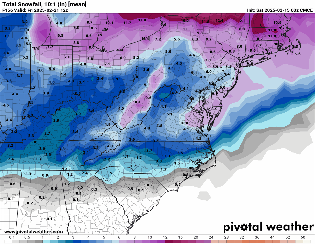
After all models were on board for a region wide big snow, the 12z CMC on Saturday was the first to make a major jump. That run took me from 20" to 4".
-
Oh well... I'm ready for Spring now

-
Compared to 12z
-
I laughed way harder at this than I should have lol
-
Almost a carbon copy of 12z. Good run, we take.
-
If it plays out like that I may have to chase this one and stay at the lake. Maybe do some fishing in the snow.
-
On my way to Morgantown and will be driving back tomorrow afternoon/evening. Should be a fun drive..
-
I agree. I will casually follow the smaller storms and don't invest much time/energy but anytime there's the chance of a big storm I become completely consumed with it. The week leading up to the 2010 and 2016 storms was so much fun. Every single model just nuked us over and over again. I know we all can't wait for something like that again to happen.
-
It's really remarkable how consistently that's been the theme this winter.
-
Ji says hello
-
Definitely agree with that.

-
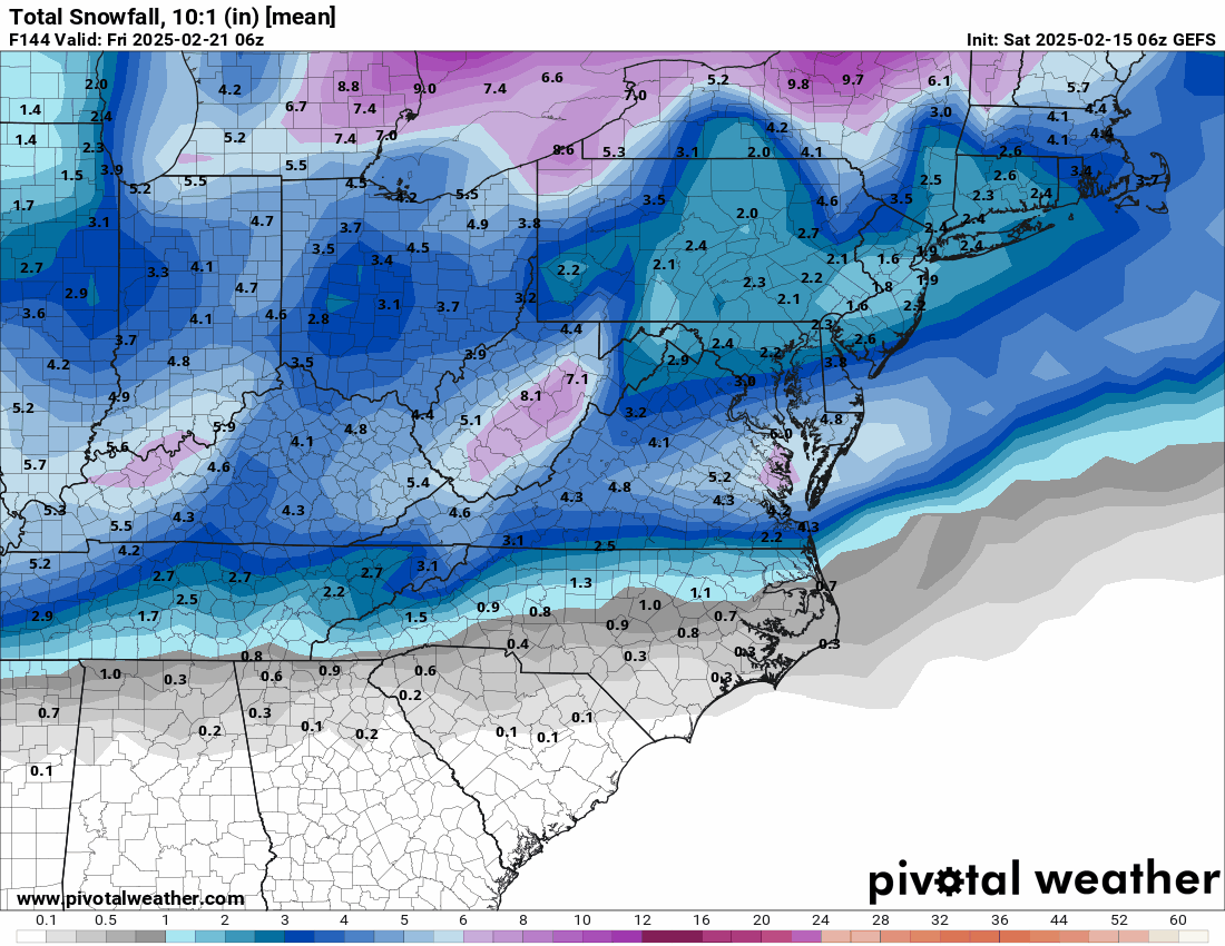
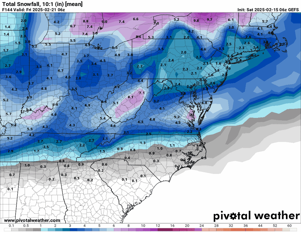
Snow mean on the past three EPS runs aren't exactly trending in our favor fwiw.

-
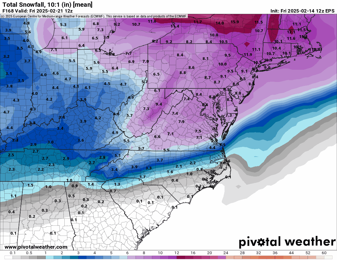
This Euro run is definitely still acceptable as advertised, but not exactly what I hoped to see after what the 12z CMC showed. I imagine the NYC forum is pretty entertaining right now.

-
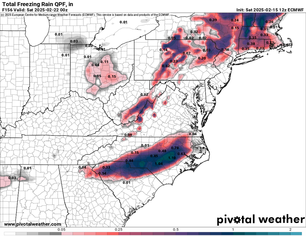
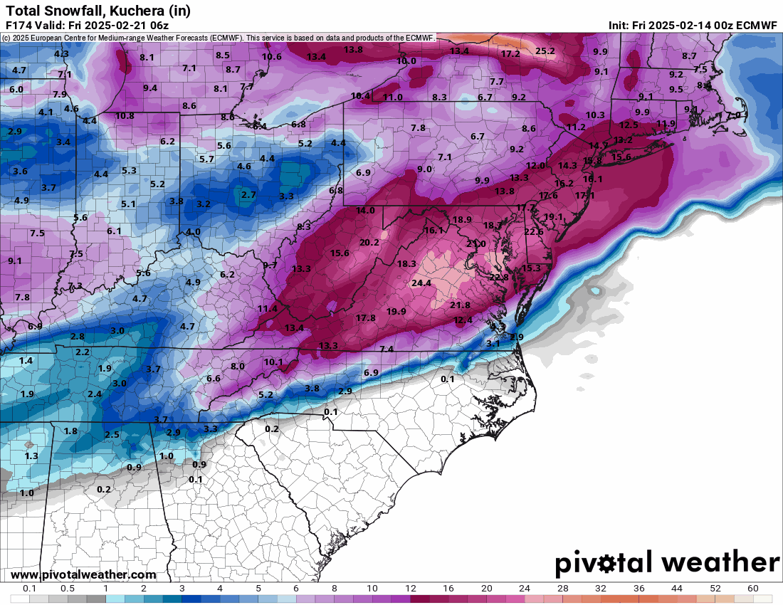
Euro advertising a historic ice storm for central NC
-
Bob Chill approves
-
You're right. They look to get into some decent lake effect snow early in the week.
-
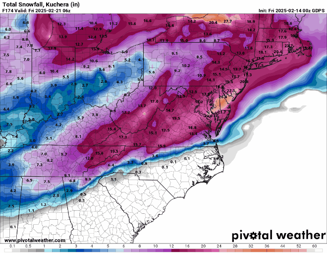
50" totals in upstate NY lol
.thumb.png.142042860796e27647bd9c66218556db.png)
-
-
This is gonna be good. Fuck the CMC lol
-
Was hoping to see a big jump in the snow mean on the GEFS to support the OP, but it was relatively unchanged.
-
Hopefully this was just a blip and it's not catching onto something early. The previous three runs had been fantastic. I lost 16" of digital snow on that run.
-
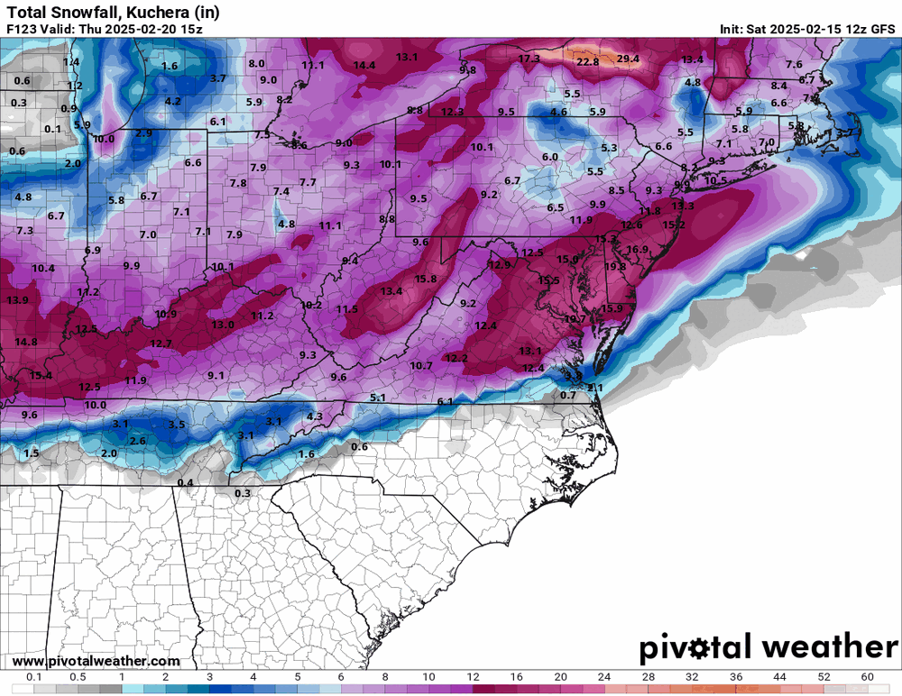
Would only be an advisory-level event for many in the forum, as depicted.
-
There's going to be a lot of breath holding until the 12z Euro rolls out after that run
-
Well the Canadians sure know how to kill a good vibe


.png.2171b98a507b4dc88c3d6ef296ec397c.png)