jm1220
-
Posts
26,307 -
Joined
-
Last visited
Content Type
Profiles
Blogs
Forums
American Weather
Media Demo
Store
Gallery
Everything posted by jm1220
-
Seems to love that initial front end thump but it seemed more amped to me. Low looked to get close to Cape May. That's enough usually to change the city on east over. But it would be after most of the precip fell already.
-
I highly doubt we get 25" of snow but its the new GFS version and hopefully onto something.
-
It's been extremely consistent the last 4 runs or so. Hope it and the NAM are onto it.
-
The RGEM deepens the trough more and strengthens the low early which causes it to be more of a coast hugger for a time and also bring in warm air around from the east. It backed away from this a little this run from 12z but hopefully that continues and the trough can be more progressive.
-
It was an improvement over 12z, all that really matters to me. I don’t see 35” of snow happening in Baltimore but who knows.
-
Right, it's one possible outcome. The ugly GGEM/UK for many are another.
-
Absolutely annihilated by that death WAA band. Holy smokes.
- 2,424 replies
-
- 1
-

-
- heavy snow
- ice pellets
- (and 3 more)
-
NAM is fine for all of us, not noticing much change really other than like was said-a little colder.
-
The Euro did dig more and has the stalled/tucked kind of solution where warm air can wrap around from the east. So we don't want that continuing especially east of NYC.
-
This isn't a miller A. It's a miller B transferring storm.
-
If you follow what the pattern supports people shouldn't be flipping out. I was always more worried about yet another situation here where we worry about mixing/dryslot vs suppressed. Not saying the mixing will really happen but too suppressed is off the table at this point. This'll be a big test for the new GFS, it's been the most bullish by far for NYC. But even these amped models seem to end up delivering a good amount for places away from the twin forks so I'll take it.
- 2,424 replies
-
- 1
-
-
- heavy snow
- ice pellets
- (and 3 more)
-
The new UKMET looks a lot like the GGEM to me, so it's not on its own.
-
Yeah it seemed to me like it stalled out and started occluding so soon and far south that it wrapped warm/dry air around from the east which screws it for eastern areas.
-
GFS v16 still looks amazing for places south of I-84. Might have ticked south a little from 6z?
-
The competing mesolows chasing convection are frequently wrong and are a function of the meso models overdoing the convection. I guess technically they can work out but I've yet to see it actually happen.
-
Odd and to me seems like an outlier. It ends up fine especially near the city but it might be in clueless mode again. This model can't get retired soon enough.
-
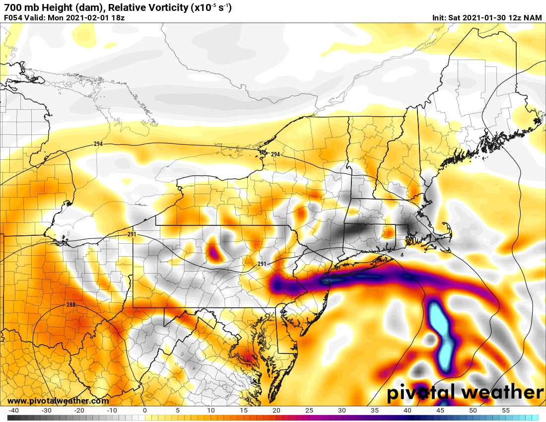
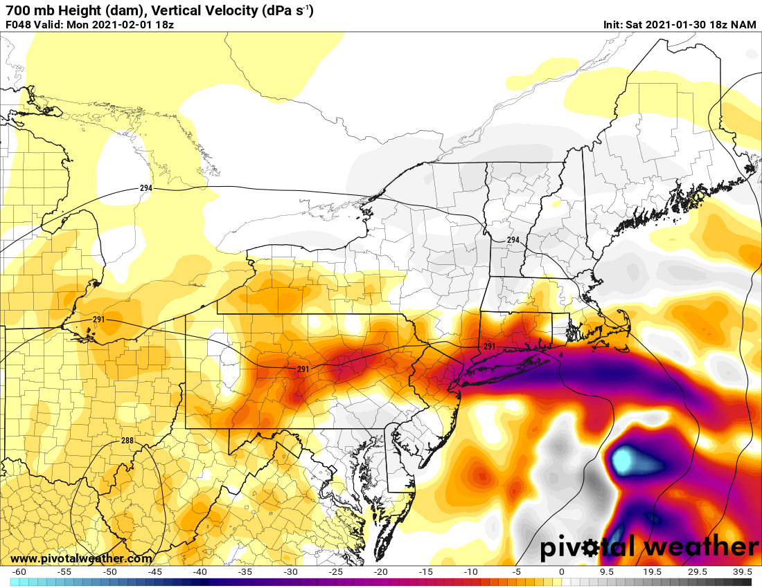
NAM supports a crazy snow band that would drop much of our snow here over a 6-8 hour period or so on Mon afternoon. This is for 18z Mon Inland gets there in the end but it's lighter snow over a longer duration.
-
The GFS v16 went even more berserk at 6z for everyone except the far northern areas and even they would have a nice event in the end. Has over 2" liquid as snow for NYC and Long Island, 1" up to about I-84.
-
Hopefully not tucked like this at least. The elongated nature of this can help it really dump somewhere but it also brings in warm air just as much on the easterly flow. Just have to hope those mid level low tracks stay SE of us.
-
It may not be so bad up there. It’ll be a slower event than here but it may pile up in the end to not too dissimilar amounts.
-
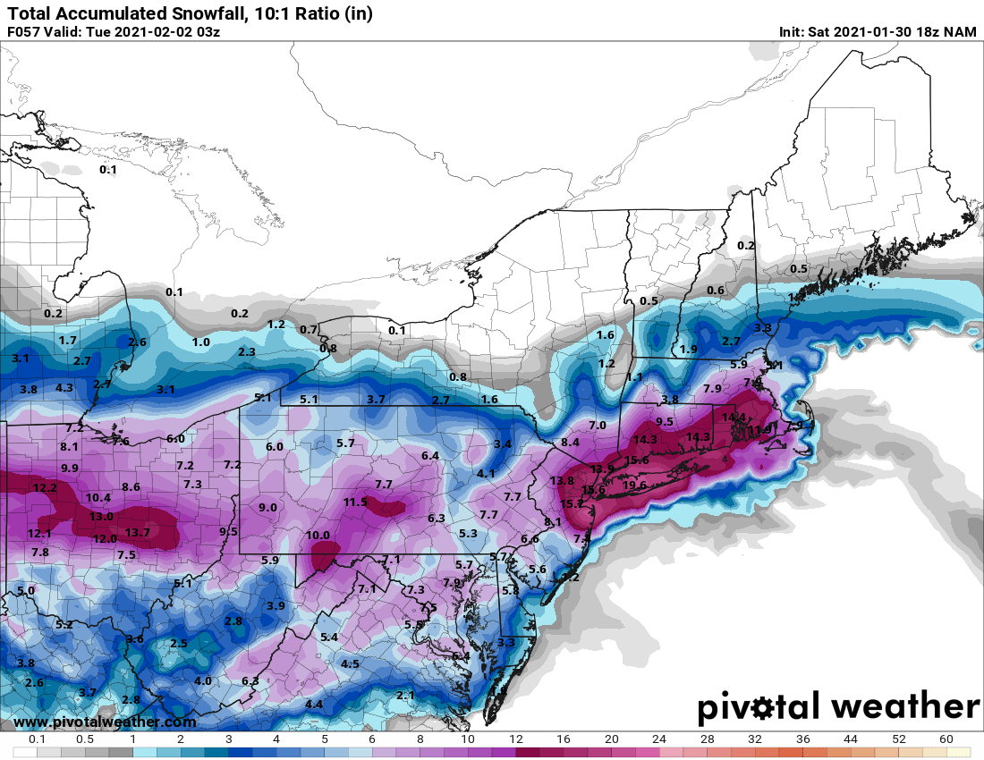
Maybe this storm can really do it-the 12” totals at Central Park and State College. Looks like this is an I-80 bullseye at this point. And in a moderate Nina no less.
.png.f581467f0a0df89793801639ac643c12.png)
.png.eb872d6bc4a91b34689fe3a3407f5b48.png)