

It's Always Sunny
-
Posts
1,946 -
Joined
-
Last visited
Content Type
Profiles
Blogs
Forums
American Weather
Media Demo
Store
Gallery
Posts posted by It's Always Sunny
-
-
4 minutes ago, OrdIowPitMsp said:
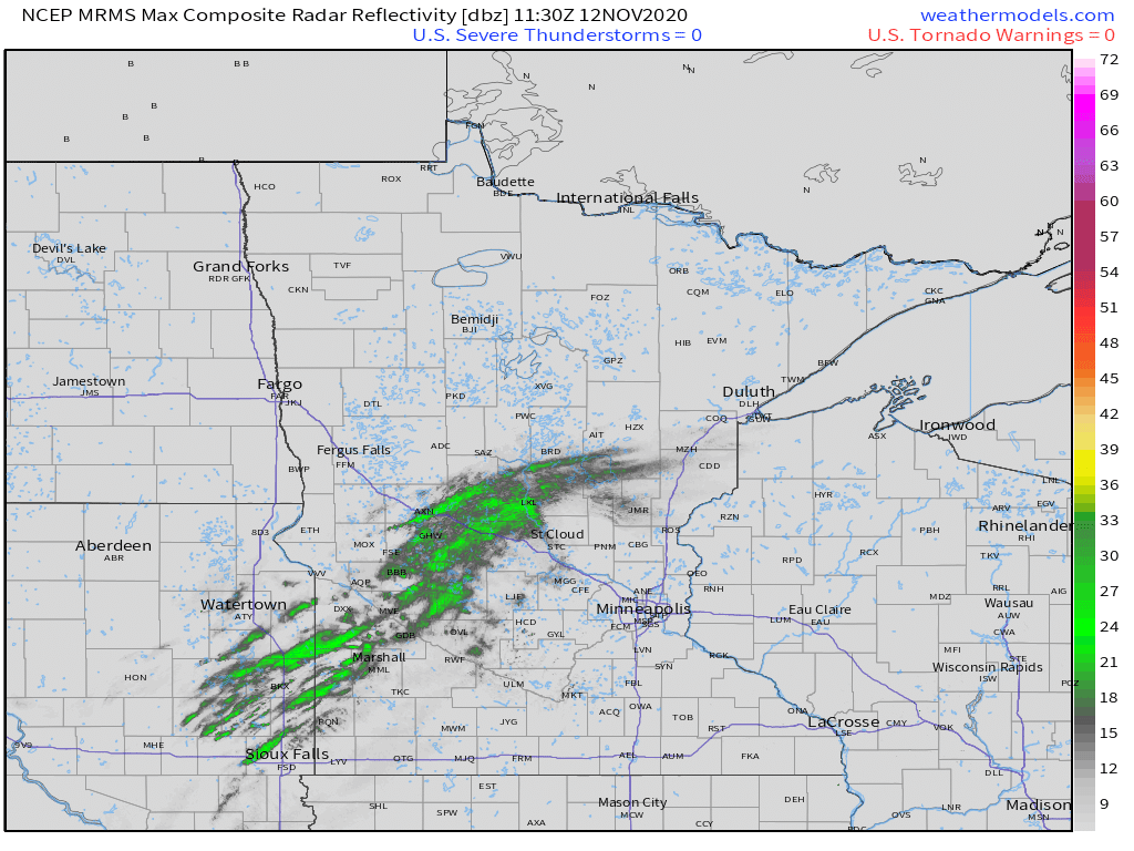
Radars got that squall line look to it. Should be some impressive rates here later on this morning.
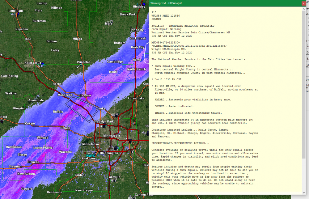
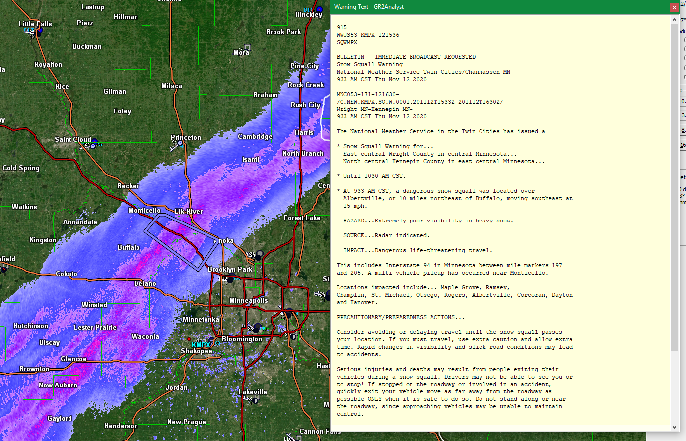
Snow squall warning currently out for parts of Wright/Hennepin counties. +SN on the way!
-
MSP could pick up a quick inch, maybe even two later this morning and afternoon with what (I think?) is an anafront (could be off on that). I think a brief period of moderate snow is in the cards.
-
18 minutes ago, OrdIowPitMsp said:
HRRR did a fairly good job at depicted where the mix line would setup. (Right over the heart of the metro)
Agreed, and it had it linger for several hours as well before getting shunted north and east. Cute pup btw!
-
 2
2
-
-
11 minutes ago, OrdIowPitMsp said:
Yep, finished with 5.5” officially which sets a new daily record for the date (5.0 in 1896) and brings our seasonal total up to 14.8”
We had a few hours of +SN and the pivot worked out for us. Oh what could have been if we hadn’t had the ice earlier...
Nice! That mid-level dry slot hung on once the warm nose eroded which allowed FZRA to continue into early evening. I don't recall the GFS having that but I think hi-res models did. MSP METAR had 0.23 liquid reported during that mixed precip phase so it's fair to assume that would've been around another 2-3 inches had that been snow.
-
10 hours ago, OrdIowPitMsp said:
Stacking nicely atm but this will end in my neck of the woods sooner then later. Airport will probably end up 3-4” while west metro and areas closer to Duluth see 6-8”
Looks like MSP got around 6". Personally I'm surprised given how much wintry mix they got earlier in the day. Banding did work considering MSP got ~0.2" more liquid than models had.
-
45 minutes ago, OrdIowPitMsp said:
Yikes hopefully things cool off a bit more. Was worried we’d be on the eastern edge. Getting some sleet and snow mix right now. Actually becoming mostly snow as I type this.
Yeah it may teeter-tot a bit before it flips to all snow (hopefully) around 1-2pm CT. National Weather Service has it flipping to all FZRA at 2pm through 6pm but I'm just not seeing it.
-
Pesky warm nose probably going to chip into what was once looking like decent snowfall for MSP:

-
38 minutes ago, CoastalWx said:
Make cheating great again for the Sox.
I'm okay with bringing him back. Red Sox needed some good news in 2020. I think he's a good manager despite the cheating scandal. It's like A-Rod using roids. Dude didn't need em he was good already just made a dumb decision.
-
2 minutes ago, Damage In Tolland said:
Its in Charlton. They’ve grown from a small barn in Brimfield 8 years ago to the largest brewery in the country and possibly globally. The place on the cape sounds like opening for summer 21
Well depending on the status of Covid I'll have to check out their location on the Cape next summer. The plan is to be up there in June for a week to see family . I've heard the microbrewery scene has really taken off over the past 3-4 years or so.
-
6 minutes ago, Damage In Tolland said:
I've heard this is a popular brewery up in MA. Near Sturbridge village? Now on the Cape?
-
10 minutes ago, CoastalWx said:
I am the same way. I can't do the IPAs any more.
You nursing Organic Michelob Ultras now?
-
Just now, Typhoon Tip said:
yeah there was one I think that was it - I'll go google it... anyway, cross Cuba there is interesting - the topography at that expanse of the island is flat-ish...
Probably why it barely weakens it once it moves back into open water is my guess.
-
Carol.
Timing is going to be of the essence with this storm. Mid-level trough coming in from the west and Bermuda high building west it'll be fun to see how this plays out.
-
On 10/14/2020 at 10:08 AM, aggiegeog said:
The main excitement for this winter will be how low can we get the temps. Its a great set up for a few short lived but severe cold shots. Can we get into the single digits with sub 0 for western N TX? It will likely be dry though. Hopefully we can get a couple NW flow high ratio surprises though. Beautiful weather after today though. Maybe some showers with each front then highs in the 60s with lows in the 40s post fronts. i do like seeing the rapid succession of the fronts, if that continues into winter maybe we wont see the big warmups between fronts. This is a winter where we could see some 90s in Feb though.
I enjoy the rapid succession of the fronts as well mainly because it's a rinse & repeat pattern when moisture pools up here in N TX; a good way to reset. I enjoy the warm temperatures though so I probably won't be saying this a couple months from now, haha. From a meteorological standpoint they're fun to anticipate because if they don't bring something as simple as strong N/NW winds and a 10-30F temperature drop in a matter of hours they bring the chance of thunderstorms (potentially severe) or some sort of wintry surprise.
When looking ahead at the long term pattern it's tough to pinpoint how often we'll see these, but as long as we have some sort of ridging in the Pacific we should be susceptible to these. Weekend should be good overall. Looks like a slight chance of thunderstorms late Sunday into Monday with another fropa but appears isolated and mainly east of DFW.
-
Just now, cptcatz said:
Euro showing a storm coming out of the central Atlantic but not the Caribbean storm?
Yeah some PVS induced LP I wouldn't put any stock in that solution right now. GFS solution is more realistic.
-
1
-
-
1 minute ago, CoastalWx said:
Georgey Pourgey...haha Nah, nothing to do with last two winters. I secretly have a bit of a good feeling...but there is no science in that..lol. Just maybe playing the odds a bit. I'm hoping we can end the stretch of black holes near Greenland for once. At least maybe have it average more neutral.
Can't resist this winter disco man I gotta get my fix somewhere! Haha. Don't miss the cold/snow one bit (unless it's a crippling blizzard) but I love forecasting it just as much as anyone else even though I'm in TX now lol. I feel good about this winter up there too I think at least an "average" winter is on tap.
-
1
-
-
I think being "quite cautious" is a fair assumption, especially since past couple winters for E MA have suckeddddd but most of you on here are smart enough to know that can all turn on a dime.
-
2
-
-
2010-2011 teleconnections are going to be pretty similar this year and I recall Lowell & Blue Hill (two stations I closely follow) did well that year.
EDIT: And when I say teleconnections I mean ENSO phase, QBO, PDO, AMO which I quickly looked up. I know there's more to it obviously but just quick glance that's what I'm gathering.
-
Guys are setting the bar low for this winter conversing whether you would take a 11-12 or 19-20 esque-winter lol.
-
-
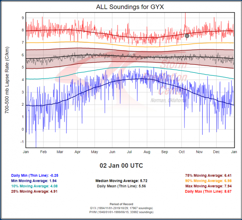
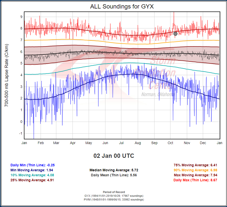
Those lapse rates...
-
Delta now a Cat 1
-
On 10/7/2020 at 5:57 PM, weatherwiz said:
I always forget but I am not sure if the distance requirement is the same for the classification of each type (serial, progressive, and hybrid). I think the criteria may be a bit more loose for serial derechos.
Yeah not so sure about the criteria. I've always used 240 miles as my benchmark. Another thing I noticed was dew points were only in the 50's with this serial derecho I wonder if that classifies it as a low dew point derecho. Does anyone know the threshold on that?
-
5 hours ago, weatherwiz said:
Forecast models are in agreement in very steep mid-level lapse rates associated with a plume of EML air will traverse the region on Saturday. During the afternoon yet another vigorous shortwave trough is set to eject into northern New England. This will be associated with yet another potent mid-level and low-level jet with a max passing right through northern/central New England. At the surface, temperatures should push well into the 60's to lower 70's across northern New England with mid-to-upper 70's across southern New England. There are some uncertainties regarding moisture return, however, dewpoints may push into the 50's or even lower 60's. This, combined with the very steep mid-level lapse rates should contribute to more than enough CAPE to fuel convective development. Strong heating should also promote very steep low-level lapse rates.
Given the above, the potential exists on Saturday for one or multiple squall lines to propagate through NY and northern/central New England. Given the signals for widespread damaging winds, a serial derecho is possible. There is also the potential for brief tornadoes with any initial discrete cells or embedded within the squall line.
I haven't looked at it in depth yet but looking at analogs there's nothing eye popping. Doesn't mean much though but it's always intriguing to see at least some similar event in the past.


November 2020 General Discussion
in Lakes/Ohio Valley
Posted
Buffalo, MN reporting 2.5". So cool!