

hawkeye_wx
-
Posts
5,944 -
Joined
-
Last visited
Content Type
Profiles
Blogs
Forums
American Weather
Media Demo
Store
Gallery
Posts posted by hawkeye_wx
-
-
Models have been flirting with an upper low digging down into the Ohio Valley next week, keeping our region a bit cool, but the GFS has lost that idea and the Euro is trending away from it. Tonight's GFS and Euro are blowtorching the plains in the extended, with a bit of summer attempting to spread east across the midwest.
-
It was a C here... better than Cyclone's winter, but still well south of the prevailing snowstorm track.
-
There might be a spin-up along the line just south of Cyclone. Cyclone is getting hit hard by heavy rain, hail, and wind.
-
69 mph wind gust at the Cedar Rapids airport, 70 mph in Hiawatha. I could hear the roaring wind coming. The line was weakening as it moved through, but we still managed to get about a 60 mph gust.
That's it for me today. Most of the action went around me.
-
The tornado signature is back on the cell that passed nw of Iowa City. It's approaching Mt. Vernon, east of Cedar Rapids.
-
The tornadic cell near Iowa City has inhaled the trailing storm, so the great-looking structure is fading.
-
Another severe storm has surged northeast and has nearly caught the tornadic cell in Iowa.
-
Iowa City is up next for the Iowa tornado.
It currently looks like all the cells will pass southeast and northwest of Cedar Rapids.
-
Ottumwa is under the gun from a rotating supercell.
-
DVN is most concerned with the lead wave tracking from south of KC to northern Illinois.
-
Hmmm..... The HRRR has mid 70s and storms forming east of Cedar Rapids. The 3k NAM has low 60s and storms forming near Des Moines.

-
The 12z HRRR has pushed nearly all of the action east of Cedar Rapids tomorrow. Northern Illinois looks like a fun spot.
-
 2
2
-
-
Now this is what I'm looking for... 60s and widespread thunderstorms. Time for the snowstorms to vamoose.
-
3
-
 1
1
-
 1
1
-
-
4 hours ago, cyclone77 said:
Picked up a brief period of freezing rain this morning with little warm air advection wing.
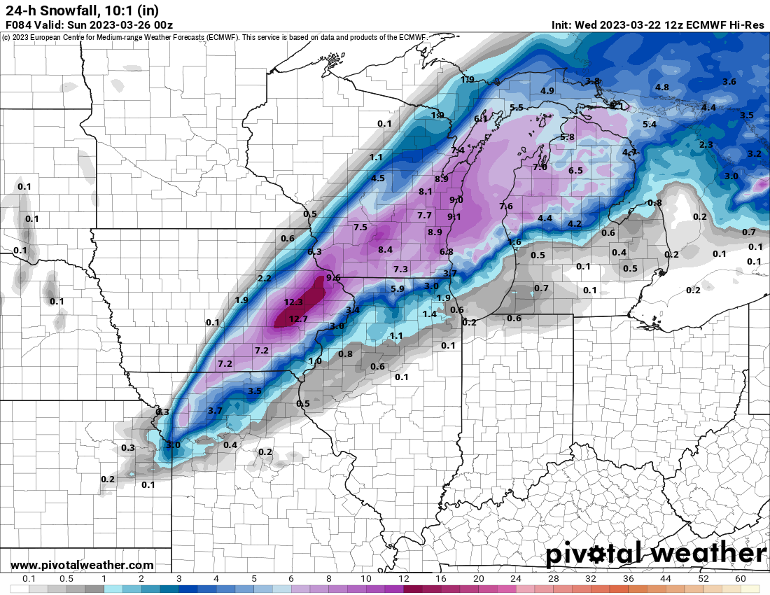
Some serious rippage out northwest of Des Moines. Carroll at 1/8 mile in heavy snow for a few obs now.
Up to 9 inches of snow has fallen in the western Iowa weenie band this morning. These late March systems are producing very heavy banding.
-
Jesus Christ..... 16 and 17 inch reports are coming in from nw Illinois. These locations must have received 4+"/hr rates.
-
3
-
-
Wow, 12.5 inches southeast of Dubuque!!!!
-
10" report now north of the Quad Cities.
-
5 minutes ago, madwx said:
Somewhere in eastern Dane county is going to get a foot out of this
Milwaukee NWS's snow map, last night, had Madison getting about 3 inches. Surprise!
-
 1
1
-
-
9 inches has fallen northwest of the Quad Cities. Iowa City got 4 inches. I did not get a flake.
-
Take all this shit to the banter thread.
The trend across all models this morning is to fade back east with the heavy snow band. Southeast Wisconsin looks like a pretty good spot.
-
1
-
1
-
-
A band of 2-4 inches of snow fell across northern Iowa overnight... definite over-performer.
-
3
-
-
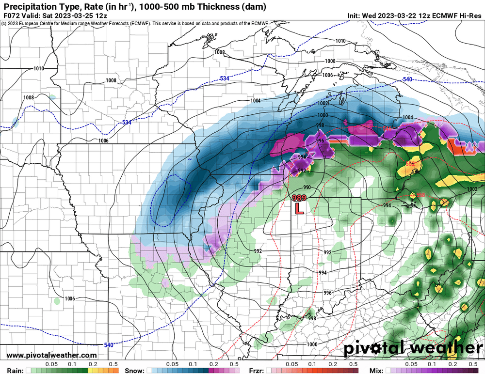
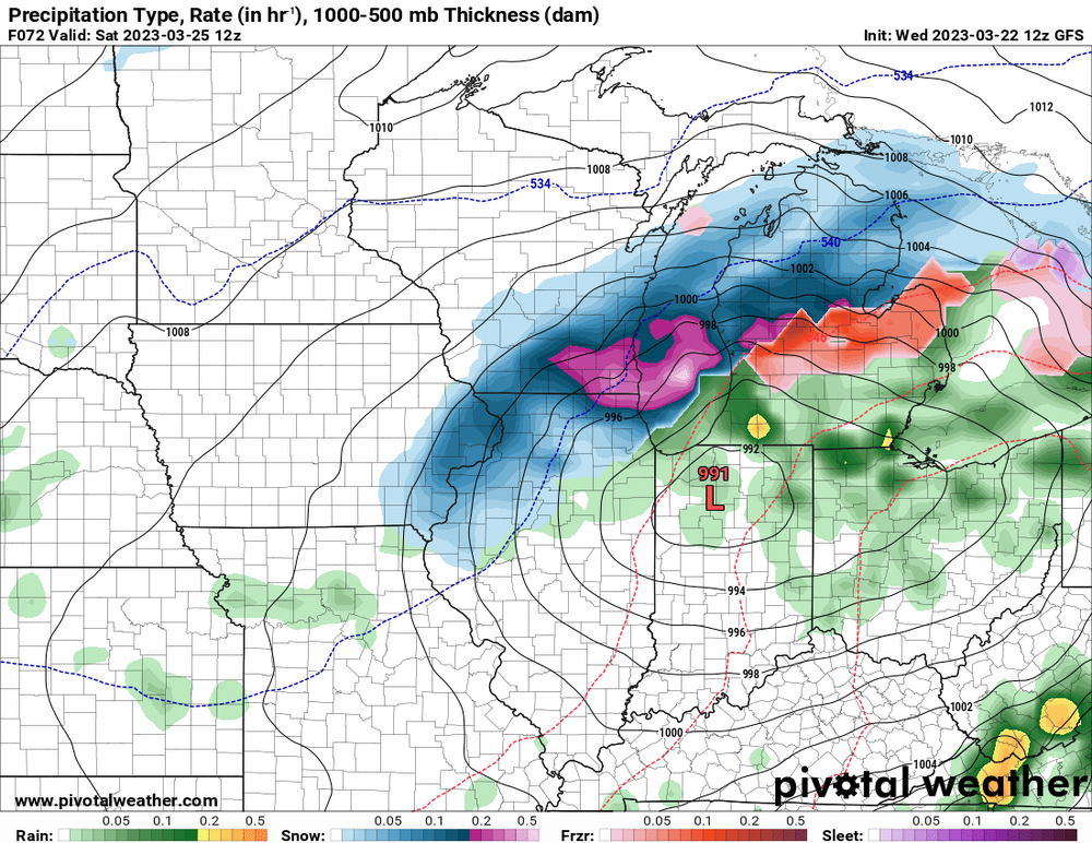
12z Euro
Of course, cut the snow totals in half due to lousy ratios and warm ground.

-
1
-
 2
2
-
-
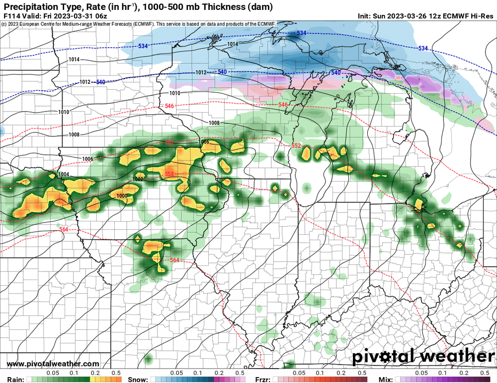
Most models are now showing a strengthening low cutting into the lakes Friday night into Saturday, with a burst of snow from southeast Iowa into Wisconsin.
-
2
-
-
Today I received 0.20" of rain, followed by 0.7" of snow. The northwest wind is currently howling. The wind chill should be close to zero by morning.


Severe Weather 4-4-23 and 4-5-23
in Lakes/Ohio Valley
Posted
An elevated hailer is approaching Cedar Rapids this morning, currently warned for 1" hail.