Met1985
-
Posts
16,564 -
Joined
-
Last visited
Content Type
Profiles
Blogs
Forums
American Weather
Media Demo
Store
Gallery
Everything posted by Met1985
-
it's looking more and more likely we see a pretty good cool coming towards the end of the month.
- 310 replies
-
- 3
-

-
- late freeze
- warm
- (and 3 more)
-
Had a cold crisp low of 45 this morning. Was a bit cool but definitely enjoyed it.
-
I vote on starting one at the first of October. Especially after this very nice period we are going to torch for awhile.
- 310 replies
-
- 3
-
-
- late freeze
- warm
- (and 3 more)
-
49 this morning. Feels amazing!
- 310 replies
-
- 3
-
-
- late freeze
- warm
- (and 3 more)
-
Temp down to 60 so far. A beautiful evening.
-
You just screwed us on a drier month...
- 310 replies
-
- 1
-
-
- late freeze
- warm
- (and 3 more)
-
Flash flood watches hoisted up for all of WNC.
-
Still looks like we may see some significant rainfall here in WNC from the now current hurricane in Louisiana. Also after the beginning of the week we will see a significant cool down with highs in the 70 and possibly 60 with lows in the 40s and 50s.
-
Yeah they are but small movements either way will make a big difference for us.
-
Yeah I have been seeing we might have some winds of 40 to 50 mph.
-
The overnight and morning model runs brings more moisture into SW NC from the hurricane this coming week. Looks like anywhere from 2 to 4 inches could be a scenario.
-
Looks like we will see a glancing blow from the hurricane coming in at this time. We will see some rain but at this time I do not expect any flooding. Also looks like we will see a brief cool down before we bake again.
- 310 replies
-
- 3
-
-
- late freeze
- warm
- (and 3 more)
-
Yeah seems like things may be trending towards a very wet scenario for us.
- 310 replies
-
- 2
-

-
- late freeze
- warm
- (and 3 more)
-
99l needs to be payed close attention for this region over the next week.
-
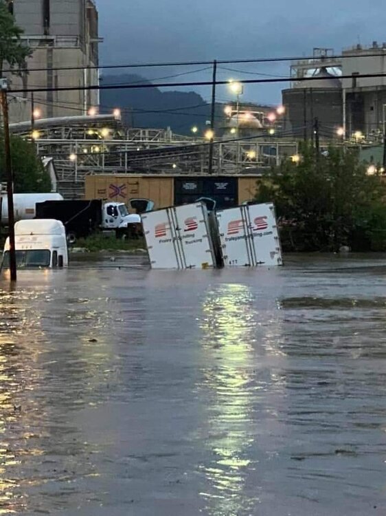
Yeah we had some very heavy rainfall here in Haywood again yesterday. Lot's of street flooding from that cell also. It's hampering the recovery here also.
-
So far 4 deceased have been found here in Haywood because of the flood. Also they have upped the number of missing people to 35 now here in Haywood. Truly this is extremely saddening and devastating. I've never seen anything like this even during 2004.
- 310 replies
-
- 4
-
-
- late freeze
- warm
- (and 3 more)
-
Yeah this may be the community but I heard that some 40 people were cut off because the road was washed away in Candler.
-
They have set up emergency shelters and are going to announce we are a disaster area on the state and federal level so we can get the adequate help we need around the county.
-
Yeah up in the bethel Cruso area. The river has all but destroyed 276 along the river. Several communities are being difficult to get to because bridges have been washed out.
-
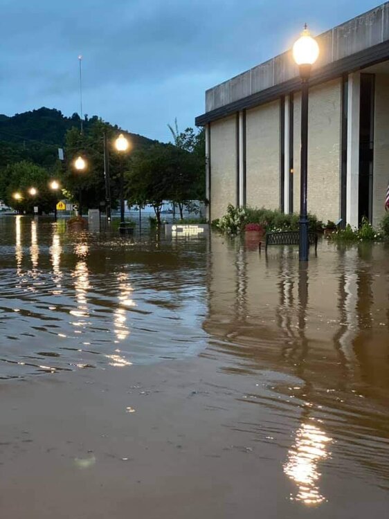
Amazing storm totals for around the area. You can see were that line ran for the heaviest rainfall totals.
-
Yeah this is taking its toll on a lot of families. Again several families have lost absolutely everything.
-
Yeah he made a post earlier saying they got everything out I believe. Yes the water rose swift and fast through here. This really is unbelievable and heartbreaking for so many. Today has been crazy.
- 310 replies
-
- 1
-

-
- late freeze
- warm
- (and 3 more)
-
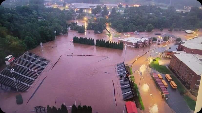
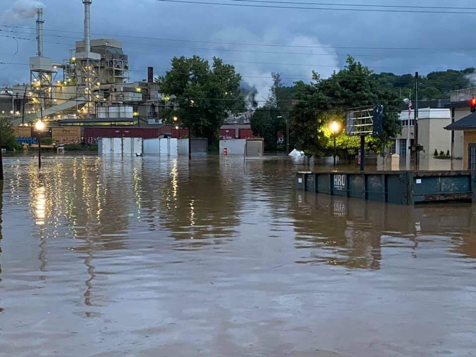
Downtown Canton and the Pisgah football stadium.
- 310 replies
-
- 3
-
-
-
- late freeze
- warm
- (and 3 more)
-
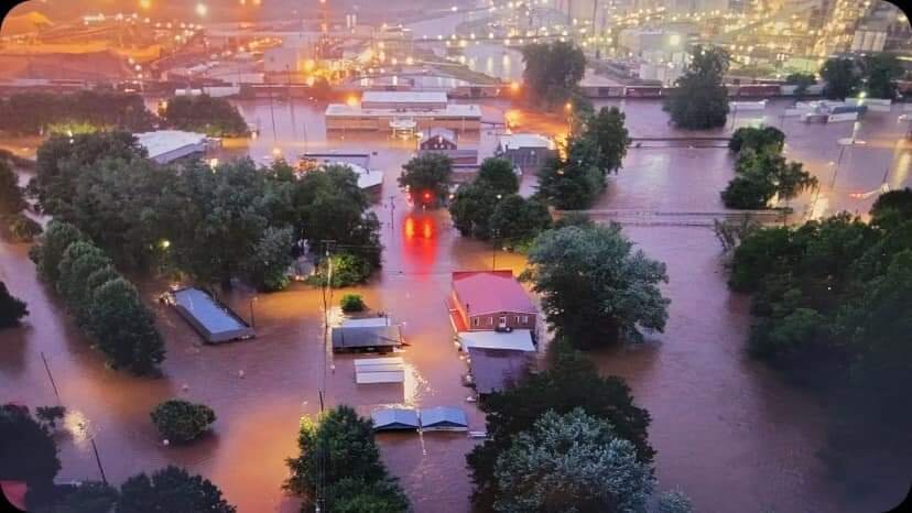
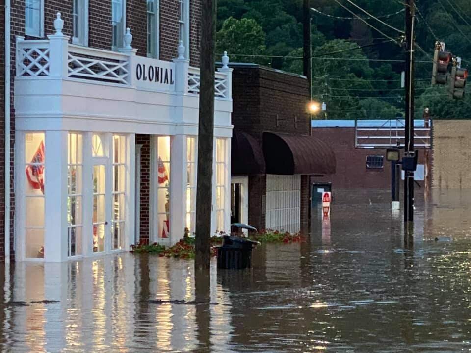
Downtown Canton before dusk. Its much worse currently.
- 310 replies
-
- 5
-
-
-
- late freeze
- warm
- (and 3 more)
-
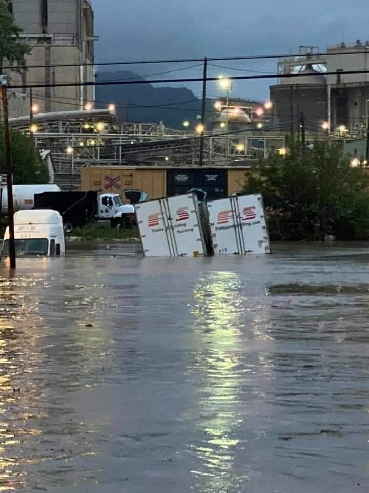
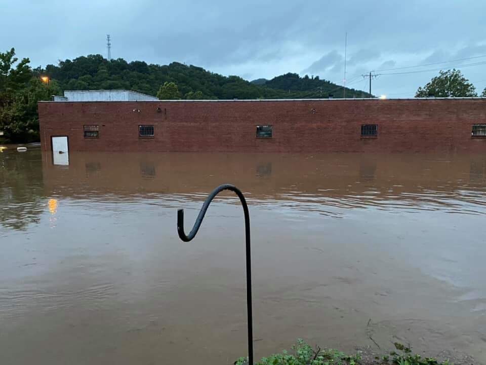
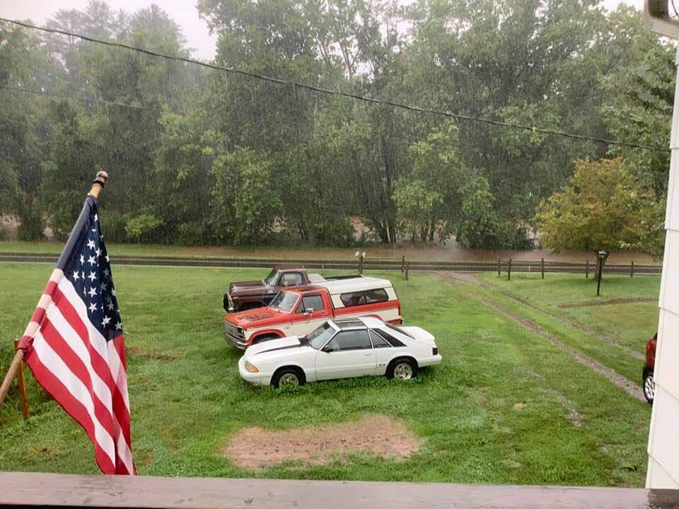
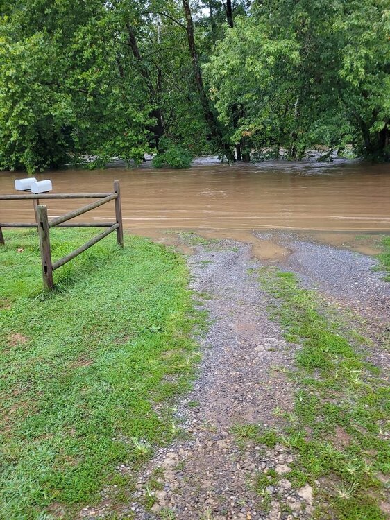
The river has overtaken the road in downtown Clyde. The top pic was a few hours ago. Bottom is current pic.
- 310 replies
-
- 2
-
-
- late freeze
- warm
- (and 3 more)