

NC_hailstorm
-
Posts
2,525 -
Joined
-
Last visited
Content Type
Profiles
Blogs
Forums
American Weather
Media Demo
Store
Gallery
Posts posted by NC_hailstorm
-
-
FV3 still bringing it,inside 10 days now.
Deep trough with a healthy storm coming up the coast at day 9-10.582dm height line all the way down in Miami,that's something you see in mid winter.
-
 2
2
-
-
100K still out of power in NC,good thing they had some sort of warning what was coming.
-
The FV3 has been adamant about bringing a pretty deep trough down in the longer range(after day 10) for about 4 or 5 runs in a row now.
Be a good test to see if this model is legit or just noise.if right it might go straight to winter for a bit.
Just something to observe.
-
4.10 today 1.18'' yesterday = 5.28'' for me,power back on now.
Terrible forecasting by local mets downplaying this wind threat,claiming no big wind and a rain event.Yep we got almost 400,000 in NC without power and it's still growing.
A 990low moving 23 mph with a decent cold front behind it is gonna cause some wind,come on people.HRRR showed the threat 24 hours ago and the only people discussing it was in here.
-
4
-
-
Easily over 40 mph here,maybe 45
Over 4'' here
-
3.86'' here heavy rain,wind getting stronger in the last 30 or so minutes around 30-35 mph gusts.
Lot of water everywhere
-
11 AM advisory for Michael
990 mb 35 miles SSE of CLT moving NE at 23 mph.
Actually the GFS and FV3 did pretty well on this,had this more west most of the way.Euro and Ukie were way too far east on this storm.
-
HRRR has 65kts gusts (74mph)pushing into SC at hour 36.Has 80kts(92mph)in S. central GA at hour 28.

-
Euro has it moving from Macon GA to Florence,SC in close to 12 hours,275 miles distance.Euro has a 983 low there at 84.
Basically you have a strong 983 low moving close to 25mph,someone better start tying things down if its right.
-
1
-
-
Euro moves this from Savannah to Wilmington in 9 hours.Considering its about 250-300 miles distance that thing has gotta be moving 25-30 mph.
Lots of forward speed.
-
Euro and Ukie still look real close but the Euro is slower by 12-24 hours.
Euro has a 977 low over Savannah at day 5,Ukie has a 970 low there 18 hours earlier moving NE.GFS looks way too west and looks like the outlier right now but we'll see.
Carry on.
-
Euro and Ukie are still on the coast with a much stronger storm,GFS slowly getting there.

-
0z GFS shifting east from 18z run,993 low just SW of CLT at 108.If this thing has any forward speed as forecasted some gusty winds are possible in my opinion.

-
Euro and Ukie look pretty close at day 5-6,Florida big bend,SE GA,SC,and NC the track.Euro is more inland and is slower by 12-24 hours.
It also pulls the heights/trof down in the upper SE by day 6,7,Ukie has 578dm at day 6,Euro has 573dm at day 7.
Hopefully no more 594dm death ridge this year.
-
Euro has a weaker system at day 7 in S.Alabama (1003mb) but it does pull NE helping to lower heights and eventually getting a trof n the E coast by day 9-10.
Ukie has a 997 low in C Mississippi at day 6.
-
Ukie has something coming into SE Louisiana at day 5-6,Euro also had something on the 0z run earlier but coming in slower.Maybe a strong tropical storm looks to me.
This could help flip the pattern a little quicker getting the heights down in the SE,we'll see.
-
On 9/29/2018 at 9:31 AM, NCSNOW said:
I hope this is the last week we have to report on the world famous "NC_hailstorm" 594 death ridge. If its on its way out after this week,its going out with a bang. October thru March are undoubtedly the best 6 month stretch of weather for most of us when compared to the other 6 month stretch. So lets hope we dont loose more than 1 week of it to a summer hangover that doesnt want to go away. Amazed to see the hot weather grasses around here still flush. The crab and bermuda usually are in warp speed mode toward dormancy by now.
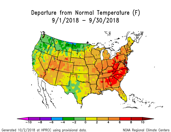
This is what happens when you get the 591dm-594dm death ridge parked over you for 30 days.And this is why I always keep my eyes open for it in the summer,it also directs any hurricanes this way as well..Hot month no doubt but July and August both ran 0+2 with much lower heights and more rain chances.
Sorry to say but I think we got at least 8-10 more days of it,very stubborn to move lately.
-
 1
1
-
-
Well the Euro and FV3 look pretty close at day 9-10 but hoping this isn't another false start though.
Strong heights north of Alaska moving over the arctic to go along with a decent Aleutian low,if that's right things will eventually shuffle but it might take a while.
-
Maybe the light at the end of the tunnel today,Euro has lower heights,trough setting up over the east at day 8 lasting through day 10.591dm death ridge hangs tough through day 7 before it gets here though.
The trough trended a bit stronger today vs yesterday so we'll see.
-
2
-
 1
1
-
-
Little over 4'' here so far,HRRR has the back edge coming through in 4-5 hours so another inch or so is possible.No 12''-15''as was hyped but there's a good bit of water standing,people still getting around the area ok for now.
Carry on.
-
30 minutes ago, Wow said:
3k NAM looks like it actually increased over NW NC?

vs.

Think I was looking at 12km but yeah you're right.
-
The 18z NAM continues to cut these rainfall totals in NW NC,3''-5'' across there on this run with a big cutoff just SE of CLT where 9'' plus are.Might be a bit light but we'll see.
Carry on.
-
10 minutes ago, knowledgeispwr said:
Does this include the Triad region?
10 minutes ago, knowledgeispwr said:Does this include the Triad region?
GFS has your area right on 6'',higher totals to the southwest
-
1
-
-
GFS cut back on the totals for people in the W.Piedmont/foothills on this last run.The NAM looks similar and is a bit less.
It brings heavy rain in around hour 38 and lasts to about hour 56,with lighter rain on either end for a bit so it pours for at least 18 hours.
Solid 4''-8'' looks ok right now with isolated 10'' lollipops possible.


Mid to Long Term Discussion 2018
in Southeastern States
Posted
Euro and EPS going with the deep trough the FV3 has been showing for a week,starting day 6-7.Don't know about a storm mixed signals on that.
582 dm line in the Miami area again,someone better go chop a load of firewood soon.