
Kay
-
Posts
2,313 -
Joined
Content Type
Profiles
Blogs
Forums
American Weather
Media Demo
Store
Gallery
Everything posted by Kay
-
I find when dealing with the cold/dry blues, frozen bay water helps lol. You too are on the frozen bay water lookout crew
-
Low of 22. Always appreciate your tidal/ice obs. Hope to see more ice back sometime soon.
-
29 here by the bay with a brisk west wind. Sun not helping much, it is chilly
-
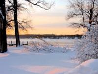
Nice! Love this vintage snow pic, and others like it. These girls look like real snow weenies, they have that crazed look of joy
-
I totally agree. I see you out there fighting the fight. My joke fell flat. It's an uphill battle, man, those are indeed the "loudest", as you say, and always draw the most attn. I haven't given up on this winter no f-in way.
-
I'll see you all later. Stone cold sober here. Just joking around. Wrong thread though!
-
I mean: He's kind of surly. But he really is a person who hates negativity. Get it? (and he seems to really hate complaining, and hopelessness about snow, He and I are really not that different
-
It's humor, @TSSN+ I'll get my coat.
-
I've come to realize Jenkins is the most relentlessly optimistic poster we have. Polices tf out of all negativity. Has declared war on the futility thread! a thread I forgot existed but am now reminded of thrice daily by Jenkins. Here I thought I was annoyed by complaining! Kryptonite to Jenkins. Beware, this is a world class hopeful, idealistic, anything-is-possible person, a pure soul, and surly about it!
-
Squalling here but not much frozen, a few flakes mixed in, poor rates. 44
-
This is still pinned. Idk it could be a generic hoping to see a squall thread
-
.80"
-
No. We have...big personalities that make it seem like that. Because everyone chats about what BPs say and think. By the numbers, I'll bet you actual money the majority in the forum are not "all or nothing", which is the expression you used.
-
It's really not the whole forum.
-
Makes sense.
-
Thank you. You seriously are as much a good sport as you are smart.
-
OK, I'll be the arsehole...bncho, is this all you and zero AI? You are obviously super bright and a quick learner, either way. And a good sport, so I hope you'll forgive my asking.
-
The upshot. The takeaway. The deal.
-
Iris, here. Gotta hand it to em I guess for being survivors. Annoying though, way too eager to LIVE
-
57. Getting some things done outside and it is noice.
-
It was these two for me. The first was amazing. I absolutely loved the sustained snopamine. Snow cover weenie through and through. The second event was impactful in terms of coastal flooding in the bay.
-
They were coming to mby
-
I don't have stats but feels like mby has struggled to reach forecast highs a lot this season. 41 now. Just noticed forecast high I saw this a.m. of 46 has been shaved back to 44.
-
A timeless question. Both can be annoying (and I have done both) but are fine, and normal weenie fare, in smaller doses. But. Factoring in post volume? imo the first is worse.
-
Great post, rational POV. Everyone needs to tattoo this on their brain


