Snowstorms
-
Posts
4,126 -
Joined
Content Type
Profiles
Blogs
Forums
American Weather
Media Demo
Store
Gallery
Everything posted by Snowstorms
-

11/8-11/10 First Snow and Lake Effect Event
Snowstorms replied to Geoboy645's topic in Lakes/Ohio Valley
3.9" fell on Sunday. The 2-3 day total is 5". I think we broke the daily record at YYZ. -
11/8-11/10 First Snow and Lake Effect Event
Snowstorms replied to Geoboy645's topic in Lakes/Ohio Valley
4" from this storm in Toronto. From the pictures, looked like a nice snow globe. Congrats to some of the Chicago peeps! -
Still have yet to visit Chicago
-
Really? That's interesting. Some of the locals I've talked to say they experience more ice than snow here. I'm closer to Fort Worth. I think 2" here shuts down the entire city lol. Maybe we'll great a freak storm like Houston did last winter.
-
Got an amazing job opportunity down here and I couldn't say no to it haha. Toronto kind of became unaffordable. But I'm going to miss winter storms. Might have to come to Michigan every now and then to experience some snow.
-
Going to miss out on the snow events this winter as I've moved to Texas now
-
You have to realize how incredibly localized lake effect snow is. Only those within a 10 mile radius of a lake effect band get snow and those outside that range are literally dry. And most of us in the Great Lakes don't live downwind of the lake effect snow regions or we live too far away because again, it is incredibly localized. And lake effect snow has only been heavy for those snow belt regions thanks to the warm great lakes (as a result of the constant warm winters/summers). Synoptically, we've been near average snow wise last 10 years but no historical winters. From the 1960s to the 1990s the AMO was negative. I think the AMO has a greater correlation to snowfall and temperatures in NYC than the Pacific pattern. And I believe it definitely played a role as to why we saw several cold winters in the late 70's through the late 80's in the east except from 1987-1993 which was heavily dominated by El Nino's and subsequent Pacific warmth. I agree and there is no doubt we've seen a trend towards a warmer climate and that's evident in the last 5-10 years with historically warm winters. And like I said earlier, it's been harder for the Great Lakes too. We've seen several storms in the last 10 years that were marginal at best (low ratio and wet snow). And that is unusual for our region. Ideally a slightly -PDO and -AMO are best for snowfall in the Great Lakes, New England, and NE whereas a +PDO is more ideal for snowfall for the Mid-Atl and further south. And that's evident in the 2000-2015, 1960-1977, and 1943-1949 period where either both or one of the oscillations aligned. We will have to see if the AMO will trend negative as it's been 30 years now and whether that has any impact or correlation to snowfall/temperatures in the east. The marine heatwave off the coast of Japan has certainly amplified the -PDO and polar jet than what you'd normally see in a La Nina pattern hence the lack of any phased storms. Again I refuse to consider it a norm and consider it a trend, for now. And we will have to see how the next 10 years play out before drawing any conclusions. Option 3 in your post would be viable in a slightly negative to neutral PDO phase. And a strong La Nina would certainly help shift us in that favor to cool down the oceans and we haven't seen one since 2010-11 (based on ONI).
-
The Great Lakes have NOT had historic snows in the last 7-10 years. There is a huge misconception here. Most of us in the Great Lakes have had near average snows and mostly due to nickel and dime events. Just because you see storms tracking into the Great Lakes doesn't equate to historic snows. Most of the storms have been rain thanks to the upper air pattern pumping warmth further north. In fact, most of us have seen historic warmth the last 5-7 years. Since 2018-19, only 2021-22 and this winter have finished either near average or below average temperature wise. And a 7 year sample in the grand scheme of things is nothing. Whether it's a trend or an anomaly we won't know until 10 years from now. To give you some context, 4 out of our top 6 least snowiest winters occurred between 2006-2016 in Toronto which includes 2006-07, 2009-10, 2011-12, and 2015-16. Of those, only 2009-10 was related to the storm track thanks to the strong -NAO block that suppressed every storm for us. But the others were a result of the upper air pattern flooding the area with warmth and the storm track being a byproduct where even nickel and dime events were rain. So am I going to single out that 10 year period and consider it a new normal? The 10 year period from 1996-2006 or the 10 year period from 2016-2025 were both near average snow for us. But I can skew the data for that particular 2006-2016 snowless period and consider that a trend/norm. And even in that 10 year period, we saw 3 historically snowy winters (2007-08, 2008-09, and 2013-14).
-
I think it depends where the cold is coming from? Extremely -AO/NAO or +PNA induced cold outbreaks drop the coldest temperatures across the Plains/Midwest. The block kept parts of New England and Quebec warmer than average this winter. Similar to 2009-10. Our coldest temperatures occur when the source region is Hudson Bay and Quebec. Thats more typical during weaker -NAO/AO blocks and -EPO blocks. Our coldest wind is from due N or NW and for most of this winter, especially at night, it was out of the SW or WSW. I think its the same logic for NYC and Boston too. I think Detroit too. So in all honesty, this winter was not cold. From Feb 4-Feb 22 we stayed below freezing, but the cold wasn't exceptional. We finished DJF at 25.3F. Our 91-20 normal is 25.3 and our 81-10 normal is 24.6. I agree with the clear nights part. Maybe the warm lakes kept creating lake effect clouds over our entire region?
-
YYZ got down to 3 last night. Colder than any low we saw in February.
-
2014-15 was a weak El Nino. I consider 2024-25 to be a cold neutral season and I'd lean heavy towards another neutral season next year given the current subsurface. Based on history, 2026-27 may likely be the next El Nino, possibly moderate, with potentially another weak-mod El Nino in 2027-28 similar to the late 60s/late 80s evolution. If current predictions hold, taking into account solar cycle progression, I'd argue for the next official La Nina to be 2028-29. Until then I don't think we'll see any La Nina's. And I'd argue against any super/strong El Nino until the next decade. There's never been a time where we've seen 2 strong/super El Nino's within a span of 5 years. The closest we got was 7 years (1965-66 and then 1972-73).
-
Got just under 2" of heavy wet snow this morning from the weak system that went through. Most of it melted as temperatures rose to 41 this afternoon. Snowpack down to 8" now. Might get 2" tomorrow with the clipper before temperatures crash Saturday. YYZ should be able to break the all time snowiest Feb on record (2008 with 30.2").
-
February 2025 was a crazy month for us. We got 31" in a week with a peak snow depth around 26". Some pictures I took last week after all the storms. The highest snowbanks and depth I've ever seen here. Would be nice to get a Illinois - Michigan-Ontario special next.
-
December finished above average for us with a mean temperature of 30.9F. Our average is 28F. So close to 3 degrees above average. January finished right at average. In terms of cold, this winter has been subpar. Our average Jan low is -10C (14F) and we only hit -10C a total of 11 times. For some perspective, we got below -10C, 21 times in January 2022.
-
Temps really overachieving today. Those SW winds are incredibly strong. Up to 45 now and really putting a dent on the monthly average and snowpack. DJF now looking to finish slightly above average, temperature wise.
-
We've now gone 51 days (since Jan 1) below 41F. The longest stretch since 1985. Although this cold hasn't been extreme, its been seasonably cold since January which is something we haven't seen in a long time so I am grateful for that. YYZ will likely finish DJF right on average. This stretch is almost as remarkable as the stretch from Jan 25 to March 2, 2015 where Toronto went 37 days below freezing in a row.
-
Another footage just came out. Saw this on reddit.
-
OBS-Nowcast Noon Saturday 2/15-Noon Monday 2/17
Snowstorms replied to wdrag's topic in New York City Metro
I doubt it. From what I saw, there was skid marks under the belly and near the engines suggesting it rolled over right when it landed? There's been blowing snow all day today. -
I went to go see it. Might be because of the slippery runway combined with strong winds. We got like 30" in the past 7 days and there's been a lot of blowing snow today with winds around 40mph.
-
OBS-Nowcast Noon Saturday 2/15-Noon Monday 2/17
Snowstorms replied to wdrag's topic in New York City Metro
I went to go see it shortly after it happened. We got like 30" in the past 7 days and there's been a lot of blowing snow today with winds around 40mph. From what I saw when I was there, it looked like it flipped over shortly after touching down suggesting a slippery runaway combined with strong winds. Glad everyone on board got out safe. -
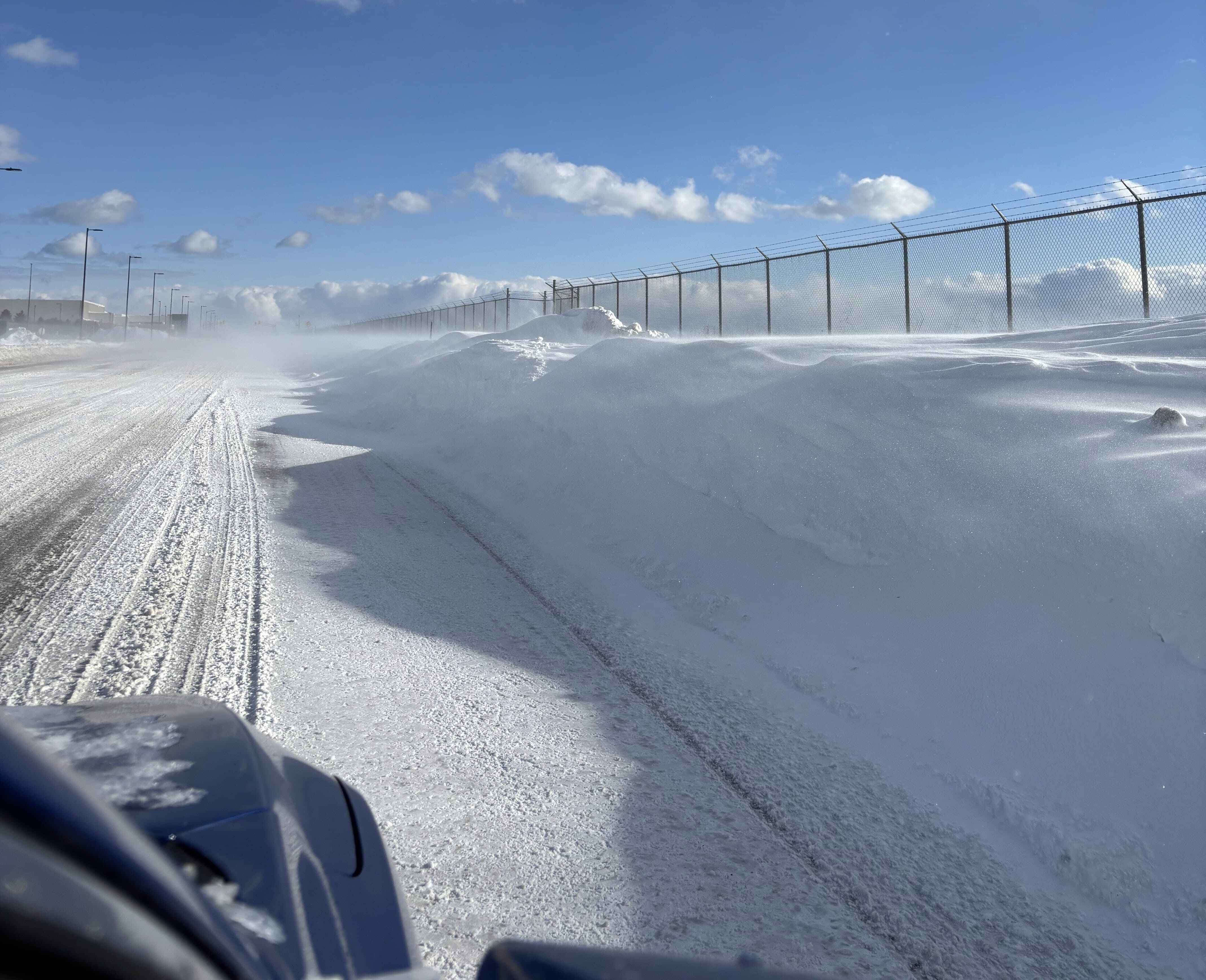
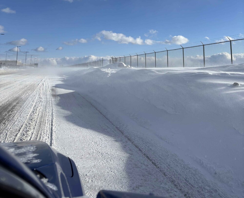
I drove to YYZ to check it out. There is a lot of blowing snow today thanks to the strong winds and the runway did look snow covered. The entire plane was flipped over and the fire crews were dowsing the plane when I was there. Looks like it flipped over almost right after it landed as it was right near where it would've touched down. I couldn't get a picture cause the snowbanks were too high to walk through and the blowing snow made it difficult. YYZ just opened up one of the other runways. Glad to know everyone is safe!
-
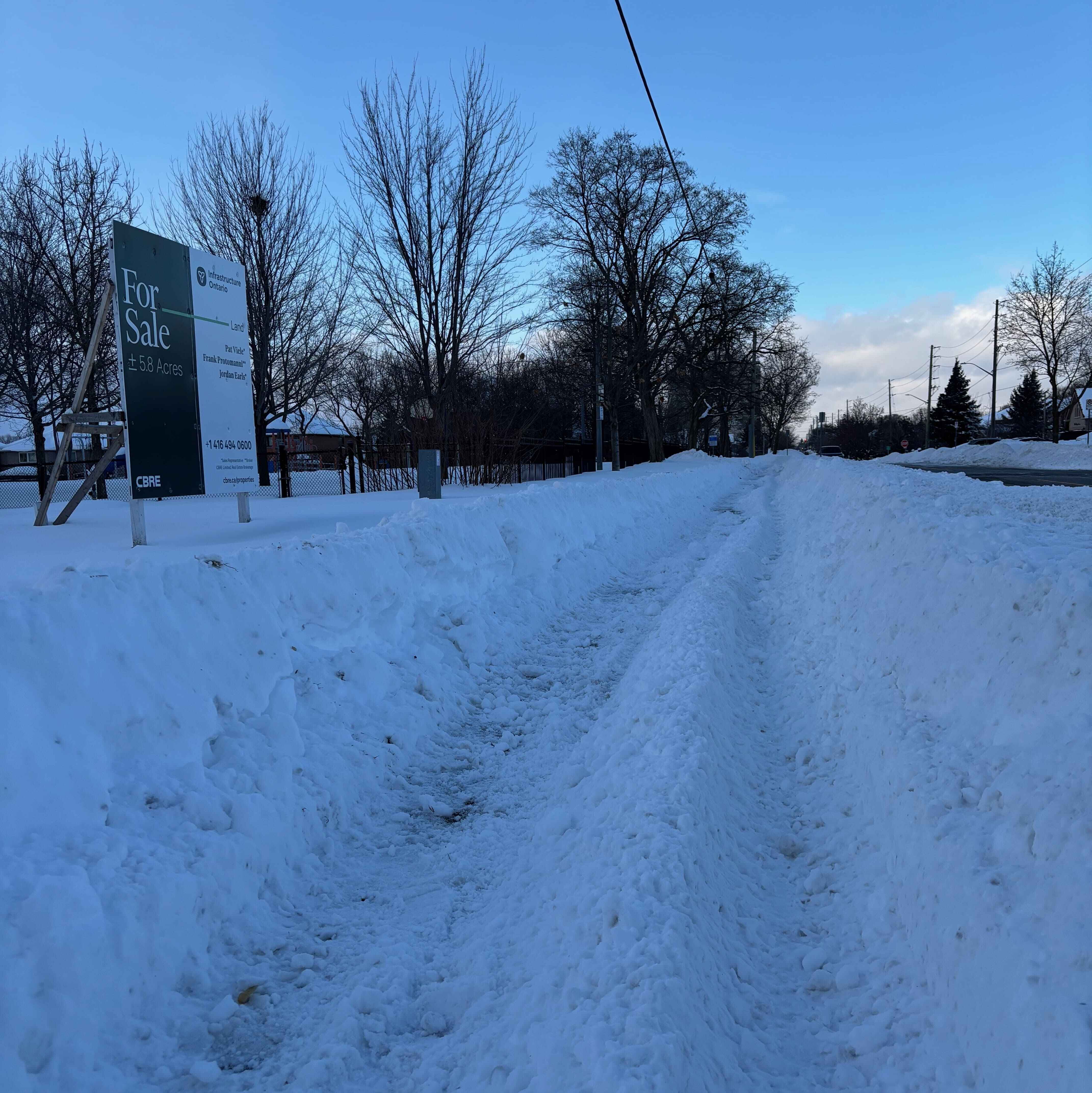
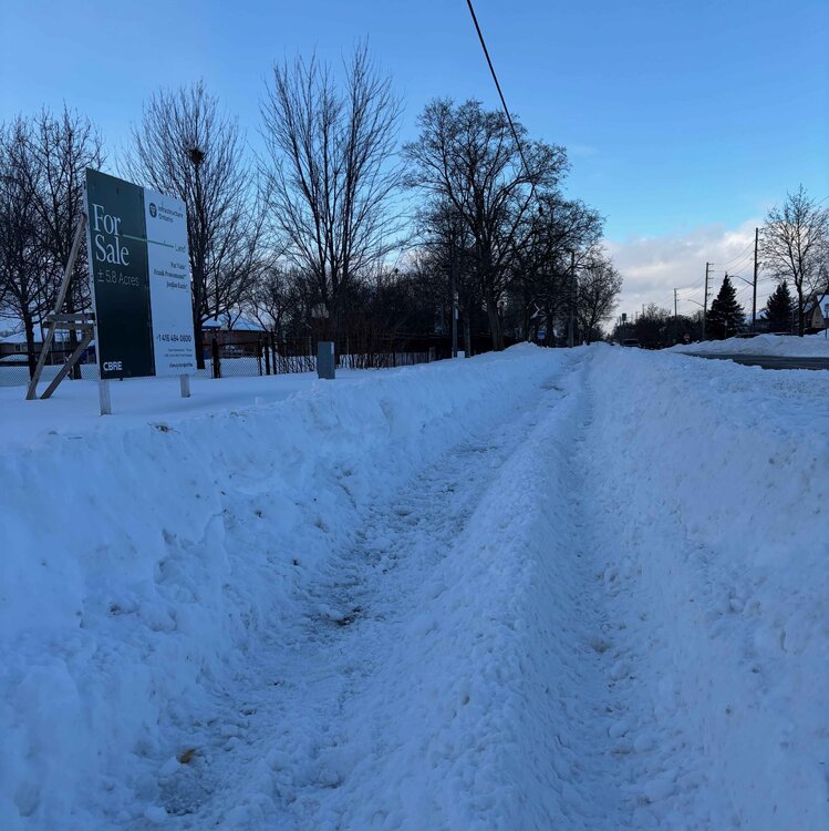
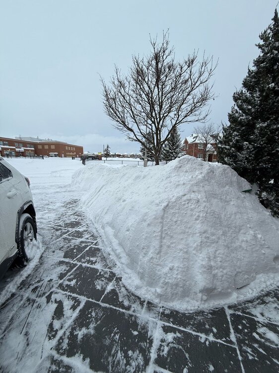
It is actually. The closest we've come in recent memory is 2014 where I had about 20" on the ground. Planning to go for a drive tomorrow when the roads clear up so will post more tomorrow. Here is my front driveway after shovelling.
-
With the storm winding down, my two day total is 11.5". My snow depth minus a little bit of compaction is now 26". Still waiting for the YYZ official numbers but it was at 10" as of 4pm.
- 711 replies
-
- 10
-

-
The GFS had this scenario a few days ago.
-
Not bad, won't complain. YYZ will likely finish with a 2 day total of 25cm (10"). Certainly not the 30-45cm (12-18") the models had for us the other day.