Hvward
-
Posts
3,522 -
Joined
-
Last visited
Content Type
Profiles
Blogs
Forums
American Weather
Media Demo
Store
Gallery
Everything posted by Hvward
-
Thanks for the kind words. On cue the 12z GFS shows what a real overunning event should look like here in WNC for next weekend.
-
Disappointing how this unfolded for all of us, that's for sure. Looking at the pattern ahead its easy to feel optimistic. We have found every way possible to miss in the past 4 years though, so it's hard to get too excited. Anyways glad I can post my thoughts here without a bunch of crazy. This is a good group of people!
-
Decent blob on the radar moving up from North GA. Snow reports showing down there so I bet many seem flakes from this.
-
Getting a nice little burst of snow at my house currently.
-
Not impressed with the 18z Nam 3km. Seems to keep firing precipitation through the early morning hours but it is just scattered. Still think we see a widespread 1"-3" from this but who knows. This is why the weather is so fun!
-
Yeah looks like our moisture is coming out of Louisiana so I would watch the radars down south through the day to see how much moisture develops. If ATL starts seeing snow around 8-10pm it's going to be game on big time.
-
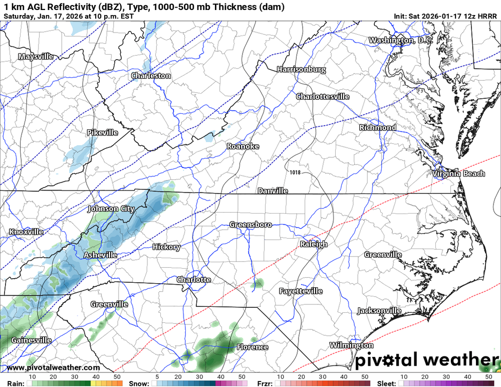
12Z HRRR has a nice strip of moisture developing over WNC tonight around 9-10pm. This seems to have some legs here. Perfect timing for snow to accumulate.
-
I think we are very much back in the ball game. Going to have to play a little catch up with my forecast but NAM 3km now showing a dusting for all and 1-3” for Haywood, Henderson, & Transylvania. These overrunning events are always poorly modeled, especially for WNC.
-
Woke up to heavy snow falling at my house. What a nice surprise.
-
WNC about to get Nam’ed on the 12z for Sunday.
-
Yeah I am about to pour a pitcher of beer and jump in the hot tub. Hopefully we switchover down here. Radar looks very juicy upstream for NWF. One of the better flows I have seen coming in on radar this year so let’s see if it verifies.
-
Should be a fun one tonight especially North of I-40. Models show a more real shot for Saturday into Sunday. Might be our best shot this season but I don't want to jinx it. Seems like every time I make a post about a storm in here it disappears lol. Looking at the 6z GFS and a phase 6 hours before would give a big time snowstorm to us on Saturday and into Sunday. Euro is also showing it. We just need that trough to steepen up just a bit and the moisture will flow into WNC. Anyways, stoked to see how some of you folks do tonight, hoping for a dusting -1" at my house while 2 miles away Craggy gets 4"-6".
-
Back to snow and cold finally today, and the pattern change is here. Wednesday night and into Thursday looks very interesting. We typically do pretty good with the ULL's here in WNC, but if we could get some Gulf interaction like the 0z GFS showed it could turn into a lot more. I am interested to see what the model have to say over the next 36 hours.
-
18z NAM 3km smokes the high elevations. As I said before this is also a good solution for getting those flakes into the valleys. 30mph winds and temps in the mid 20’s allow those flakes to push out much farther from the higher elevations.
-
12z NAM 3km is showing a hell of a Northwest flow tomorrow night. Winds gusting over 40mph for most and temps in the mid 20’s. That’s a good recipe for snow showers to break containment and make it even into the valleys.
-
Models starting to get a handle on Monday-Tuesday. It has my interest as well for sure. Could be 24 straight hours of snow. Looks like we have a weekend of model watching ahead!
-
38.8 here with a dewpoint of 25.3. Hoping for a surprise but not expecting much.
-
Just measured and I have around 3”. Best snow in the new house by far!
-
Looks like around an inch so far here. It’s so wind blown it’s hard to tell. Lots of people stuck on the interstate tonight… not a good situation.
-
Getting lots of reports of the roads getting pretty bad. Some people saying 40 is a solid sheet of ice.
-
Getting back to snow finally here at my house. Can’t say this is the first fire of the season but it might be the hottest! .
-
Just dropped to 39 here in Black Mountain.
-
Should be a fun on folks. 12z Nam 3km has my location getting 3” or so inches of snow and the higher parts of the neighborhood getting 5”-6” per the WeatherFront App. I have never been able to zoom in so close on a snowfall map so we will see how accurate that is. Anyways looking forward to our first chance of the year!
-
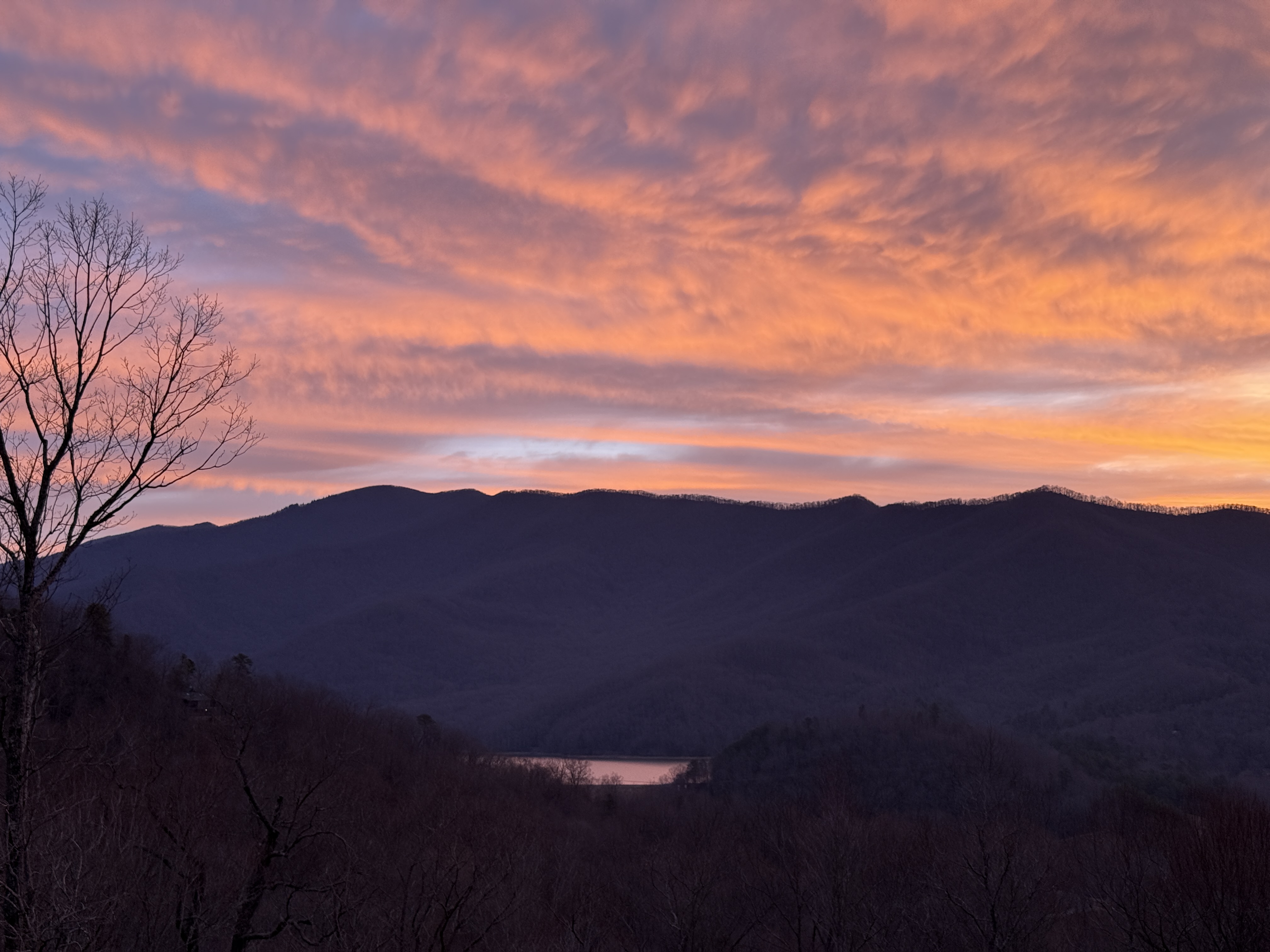
Beautiful shot! I am thinking someone is going to get hammered, but looking at winds it will be a bit more westerly flow. Usually someone gets popped who isn't expecting it. Hopefully it's my backyard! Good luck.
-
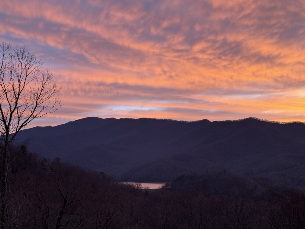
Beautiful sunrise this morning in Black Mountain.